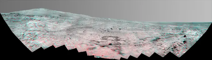
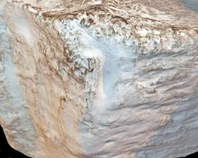
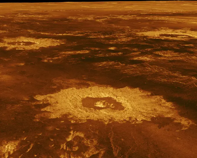
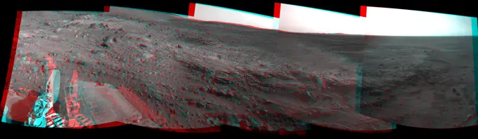
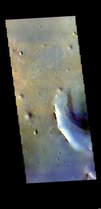
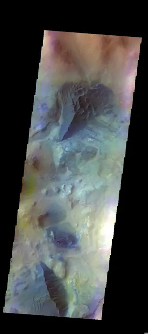
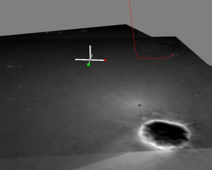
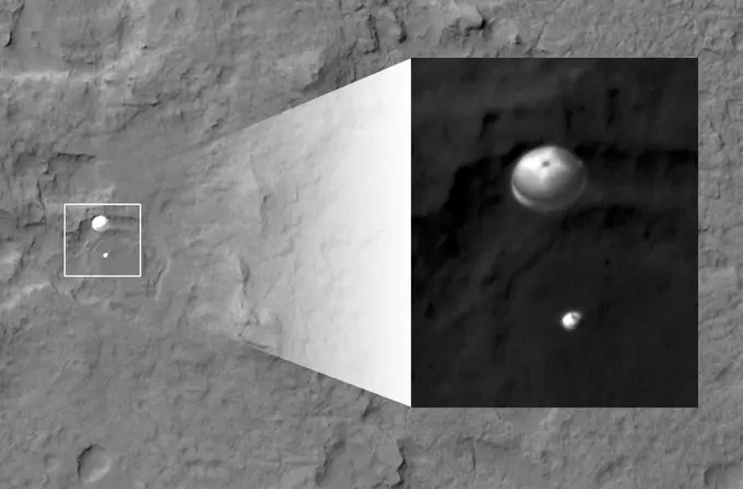
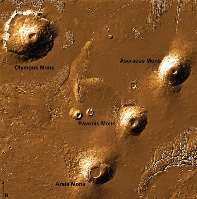
Mars Geological Features

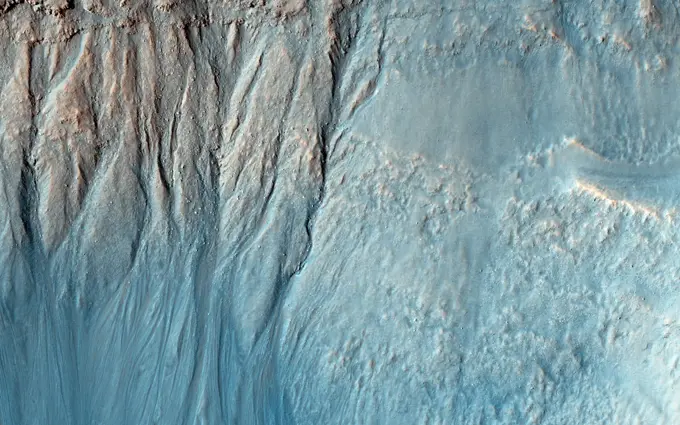
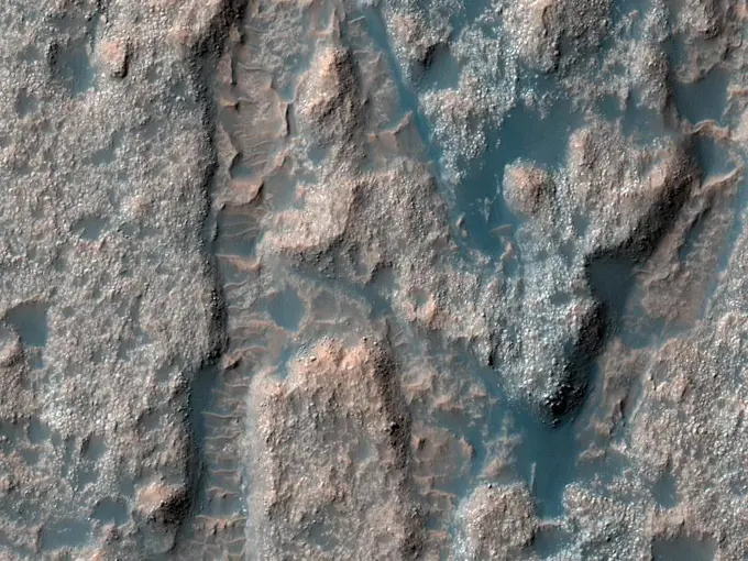
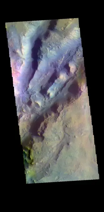
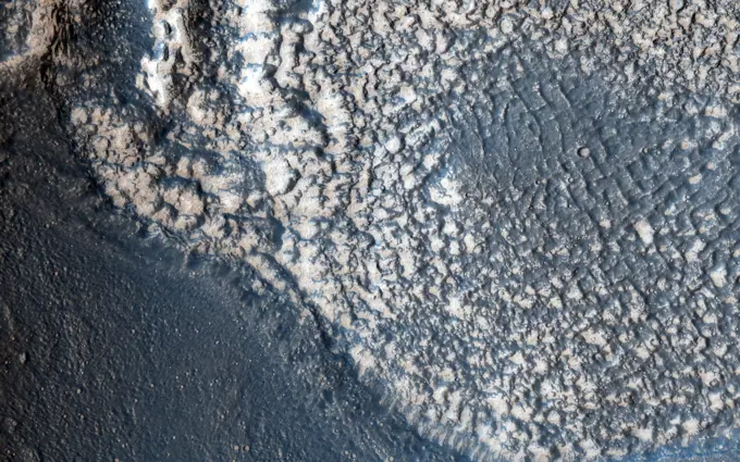
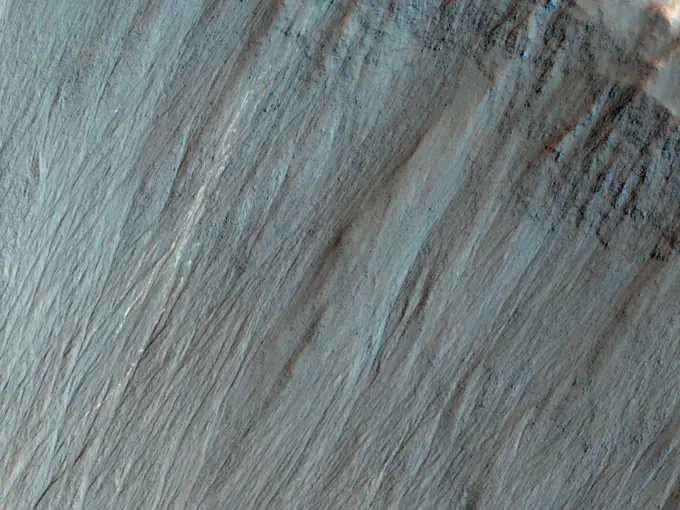
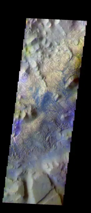
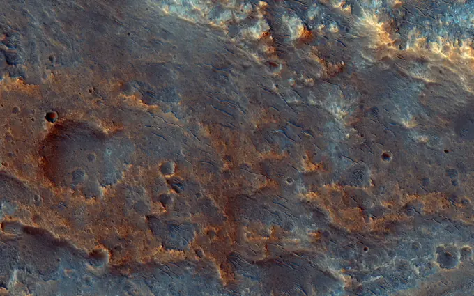
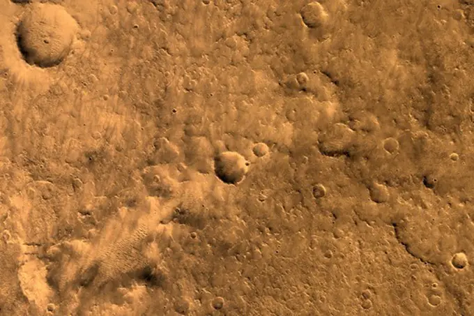
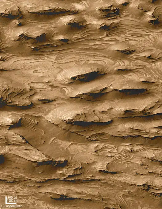
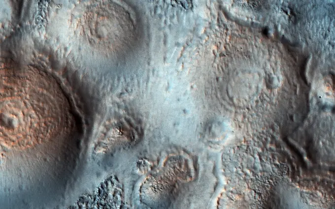
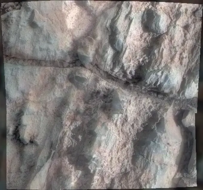
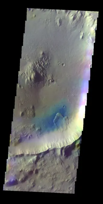
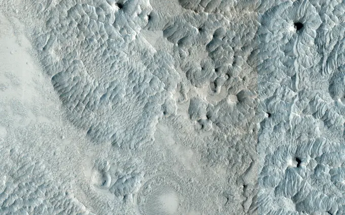
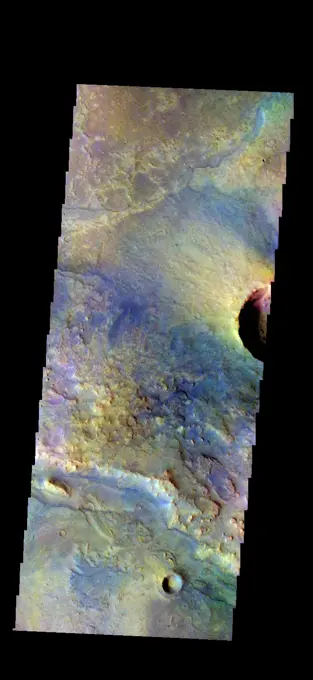
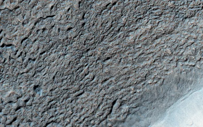
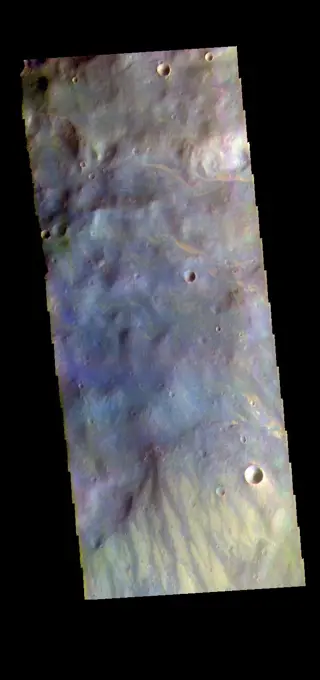
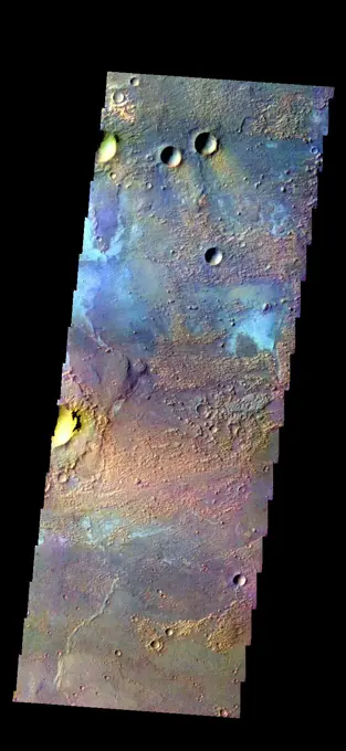
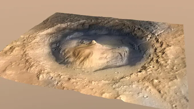
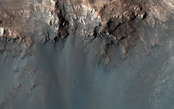
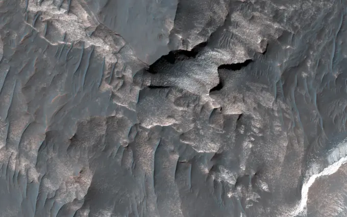
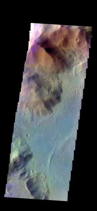
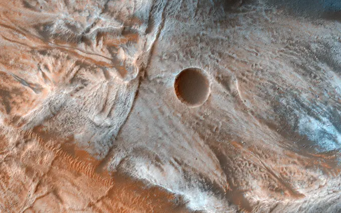
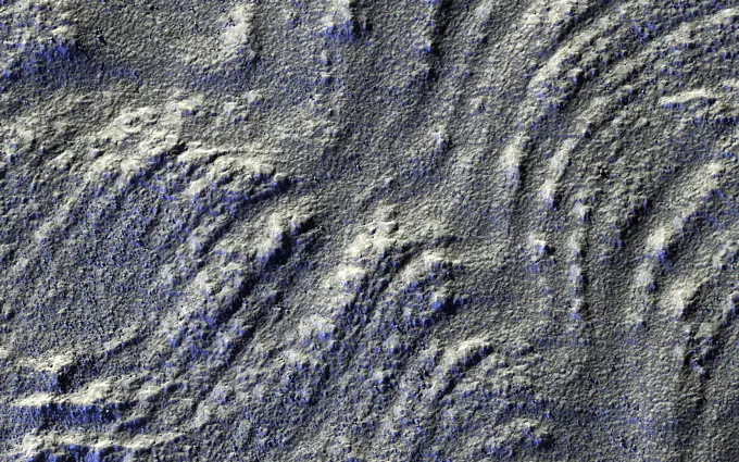
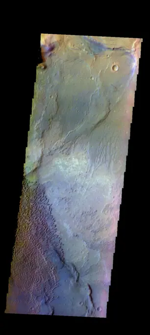
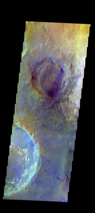
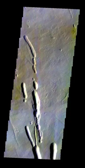
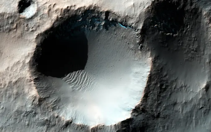
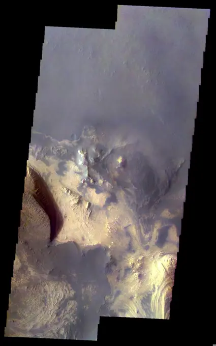
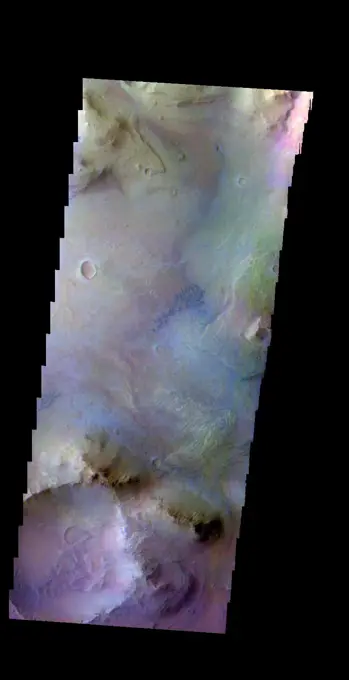
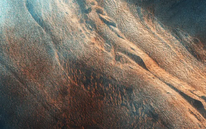
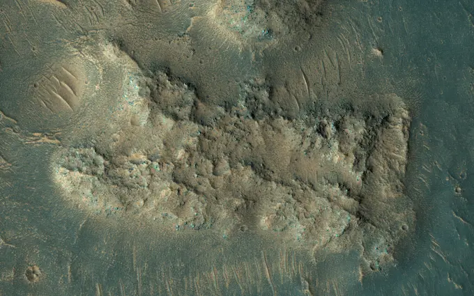
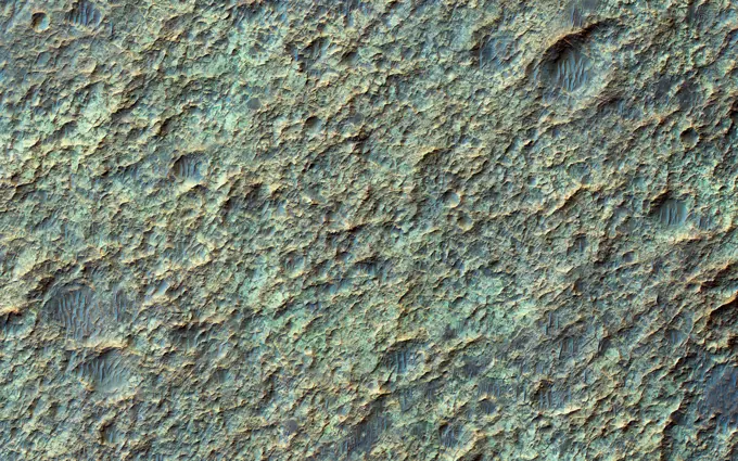
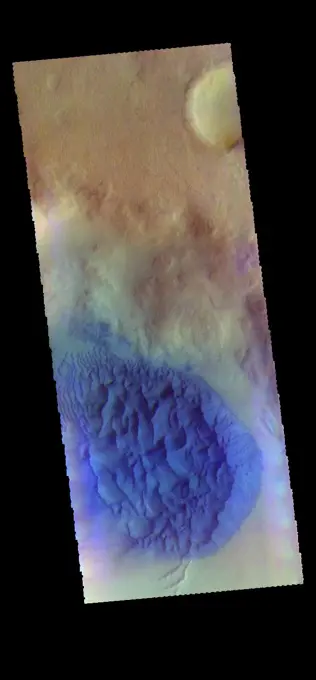
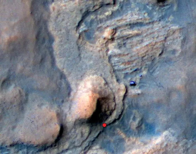
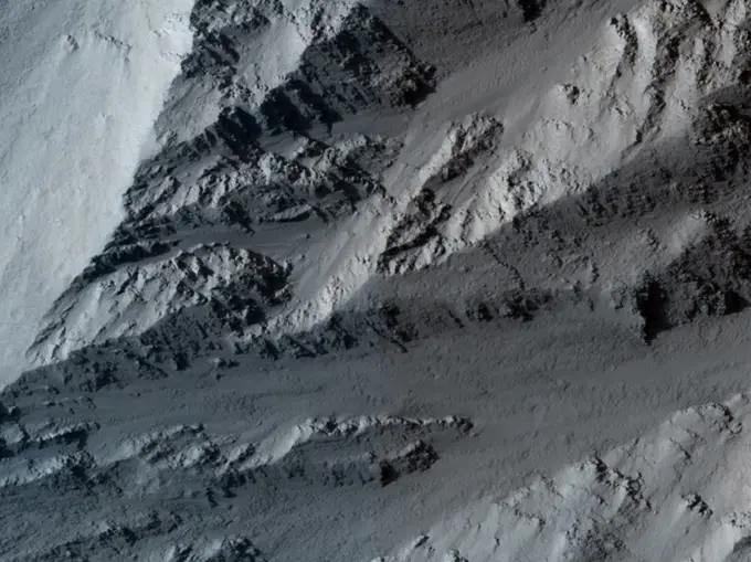
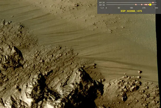
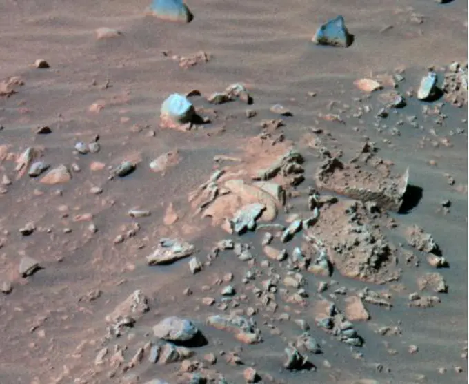
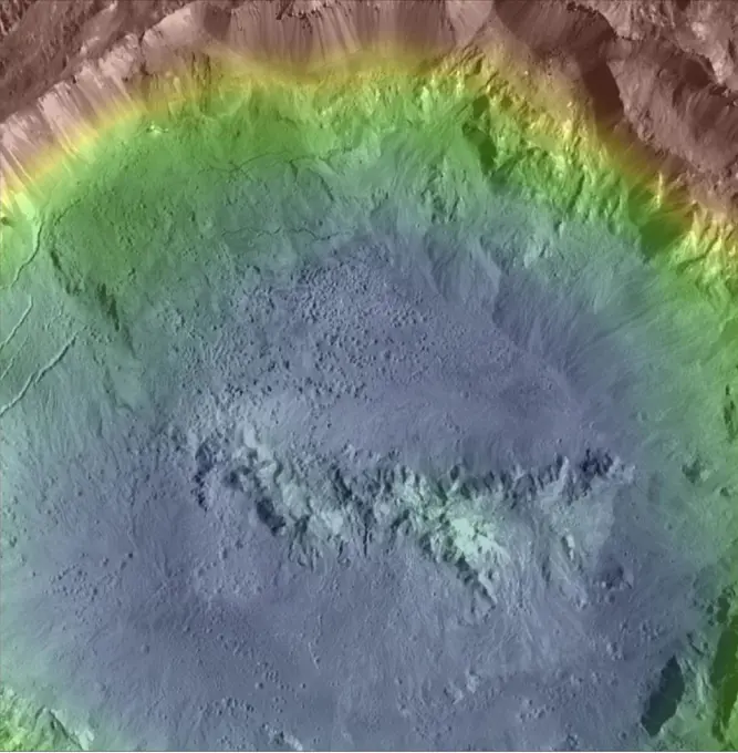
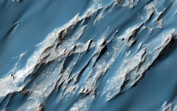
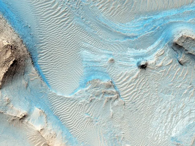
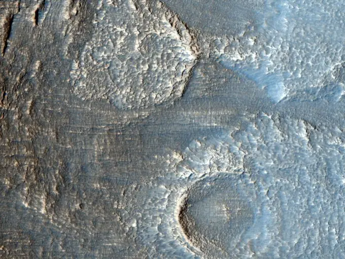
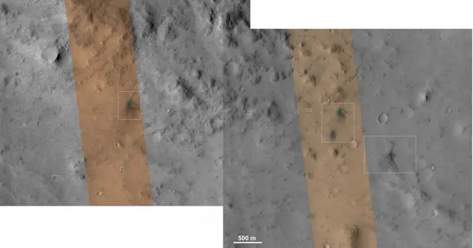
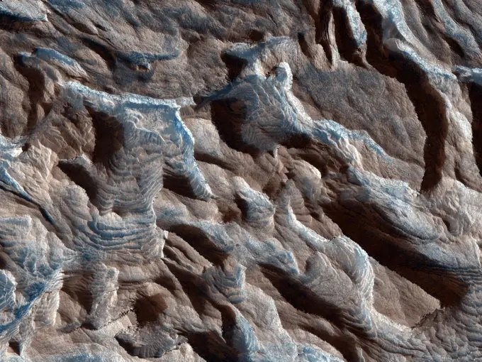
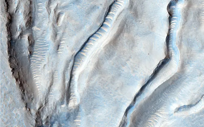
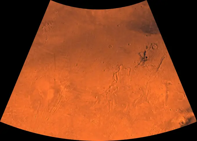
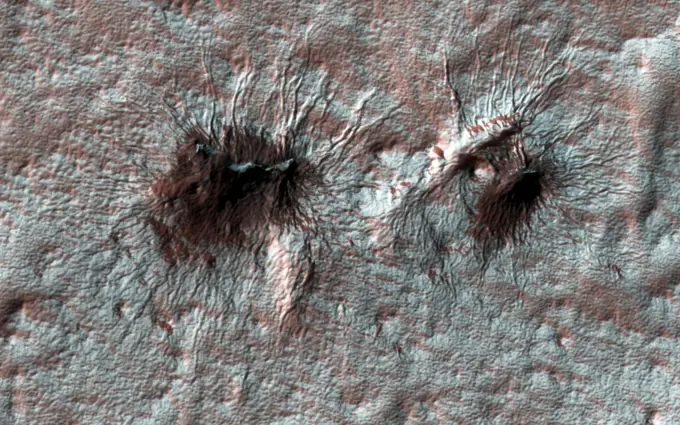
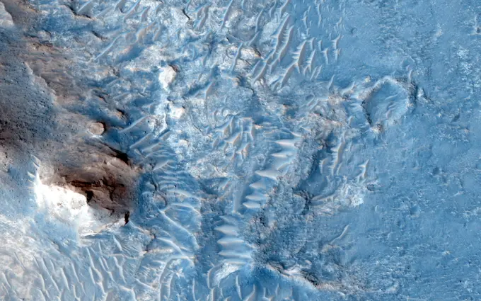
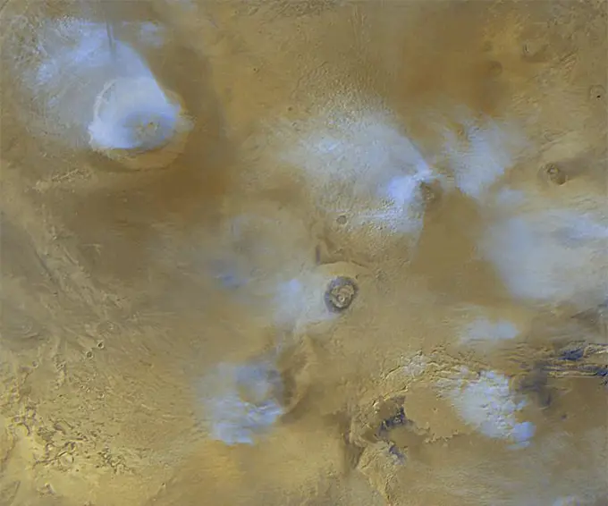
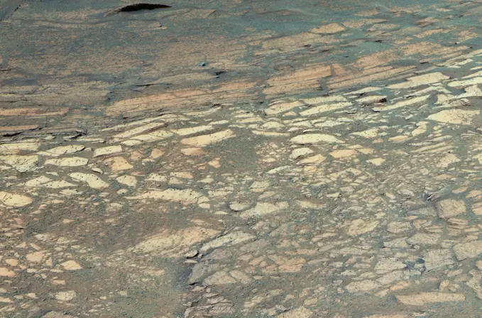
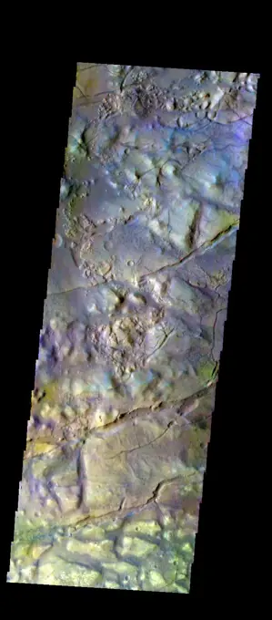
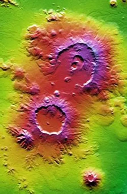
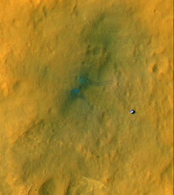
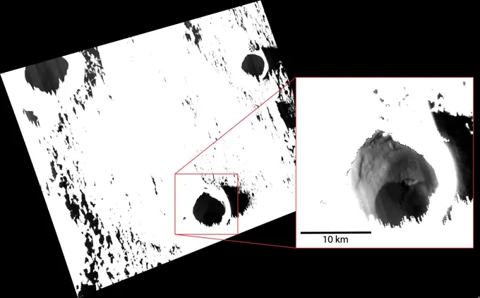
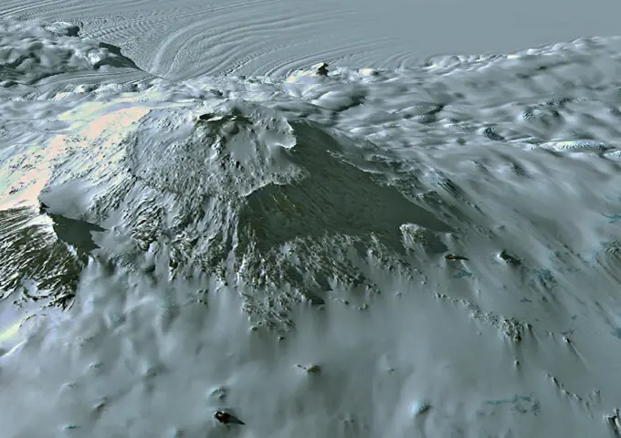
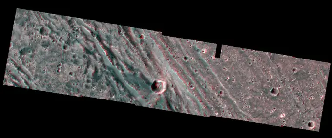
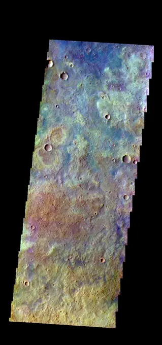
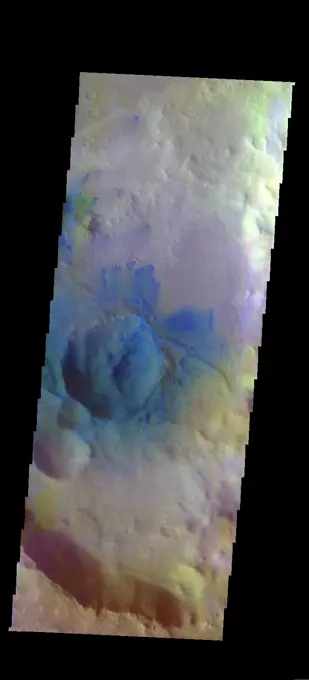
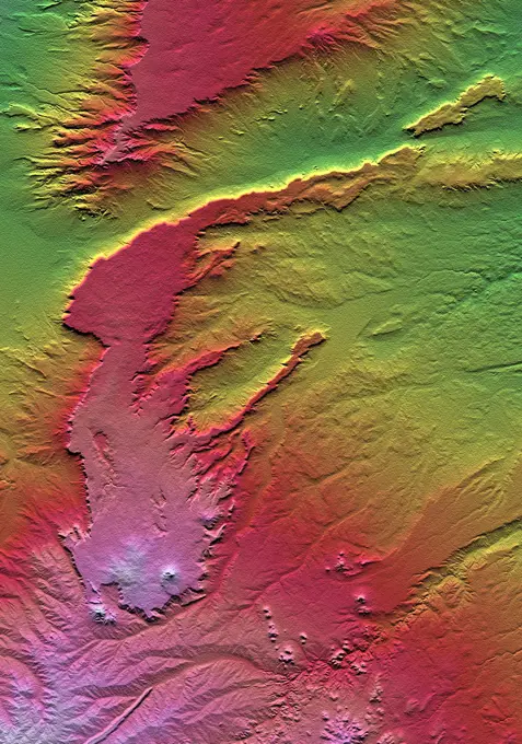
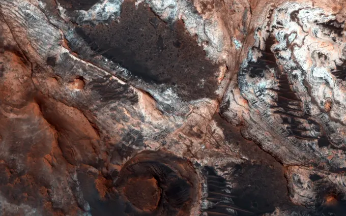
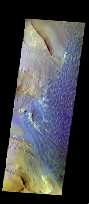
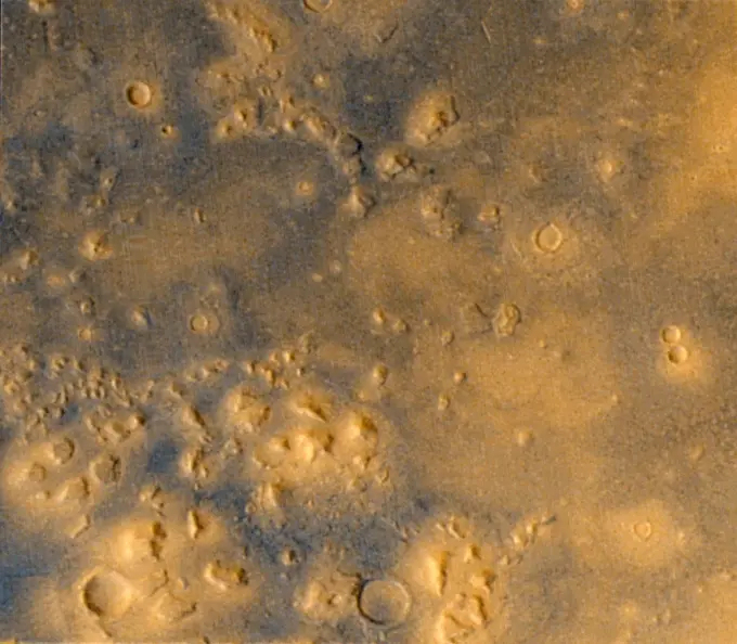
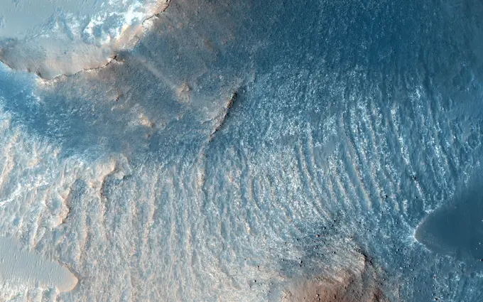
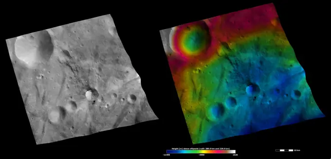
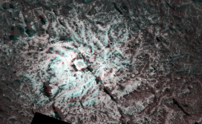
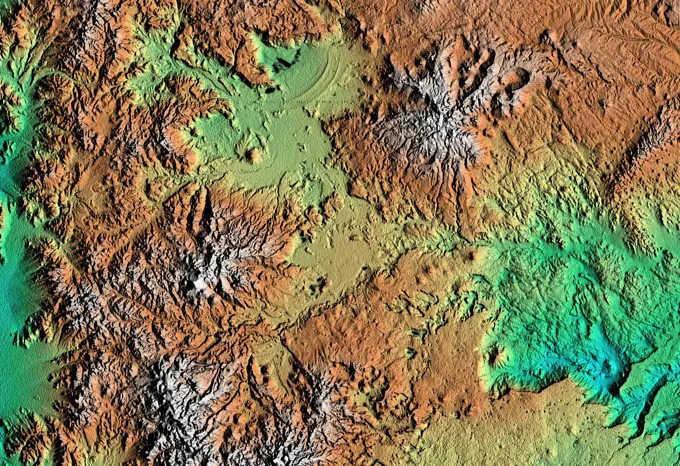
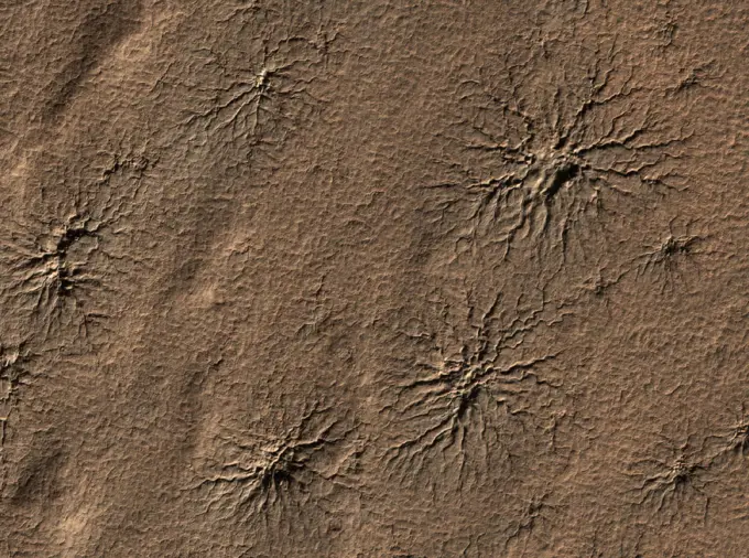
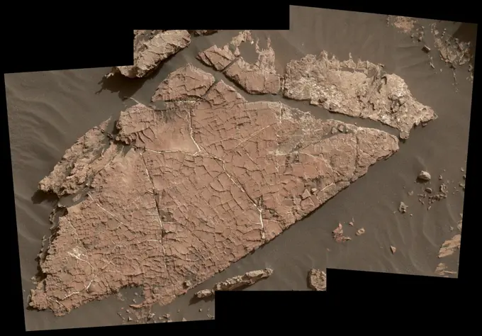
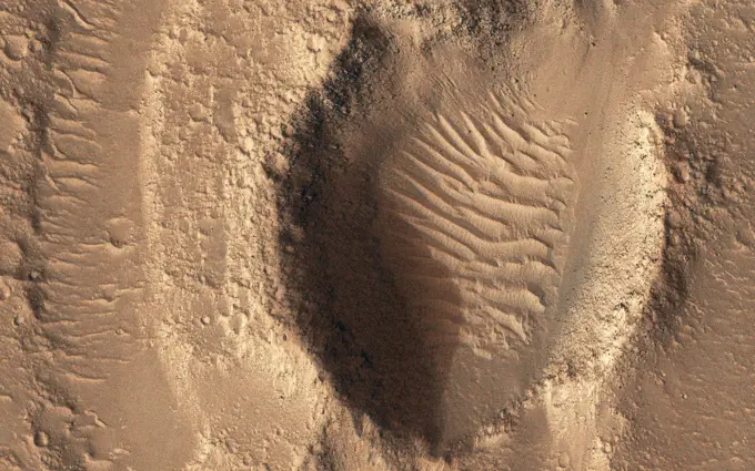
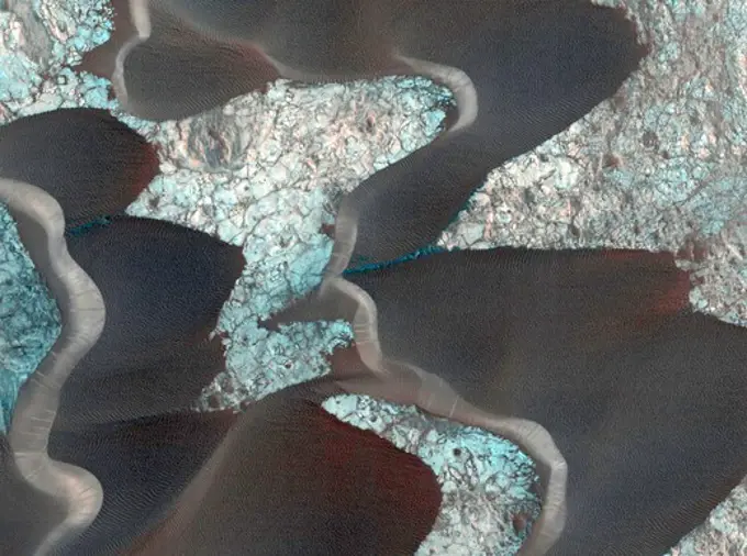
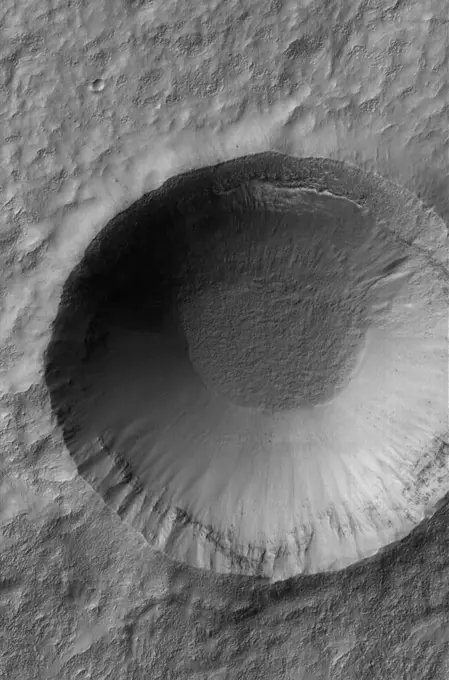
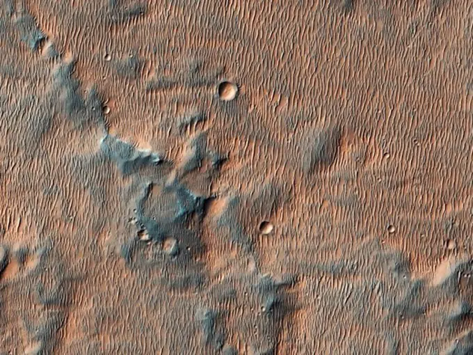
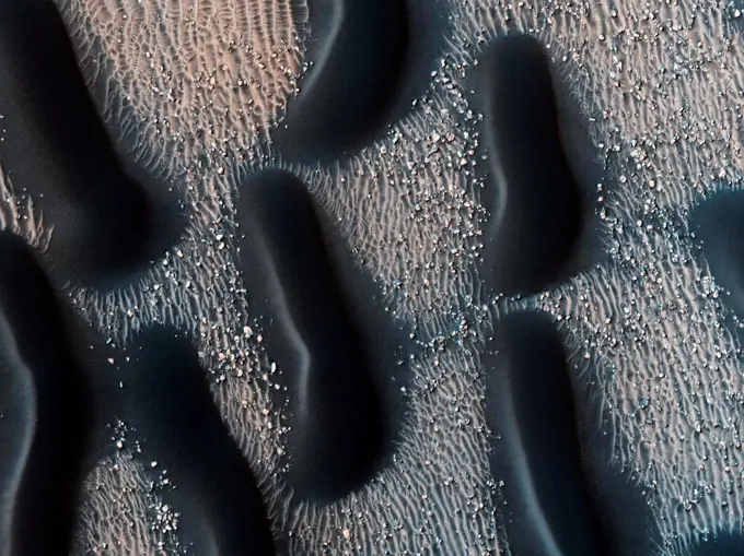
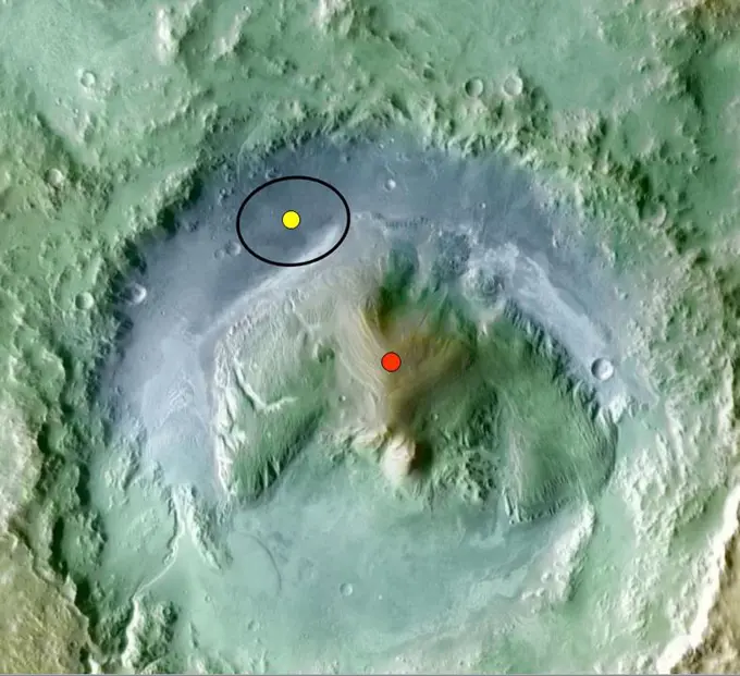
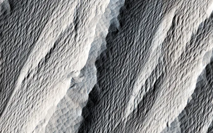
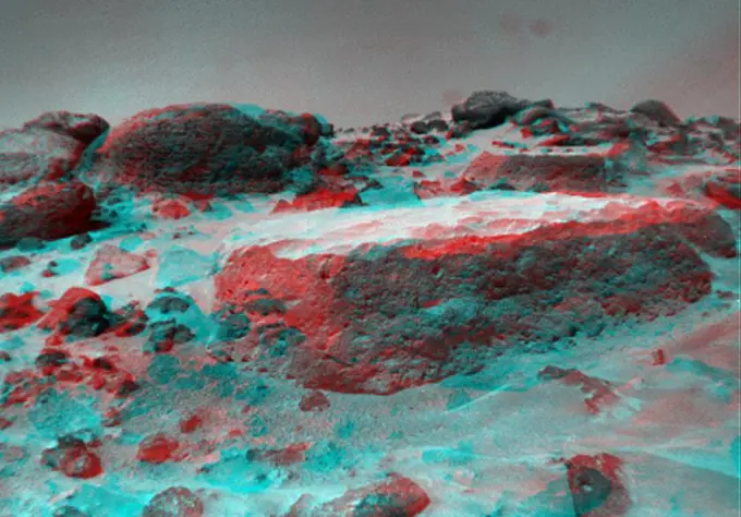
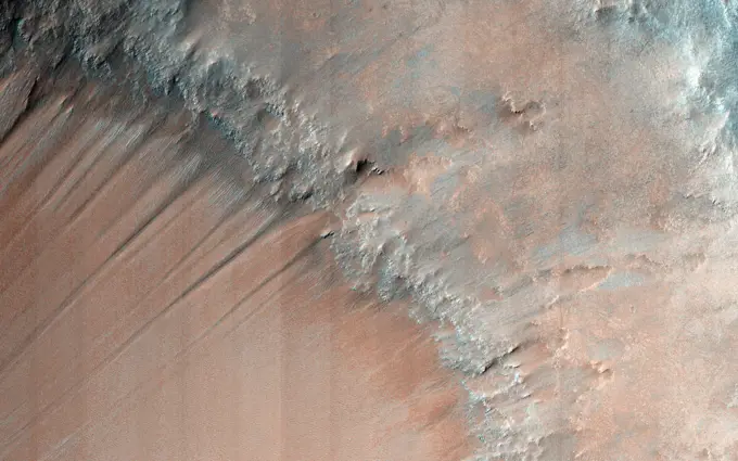
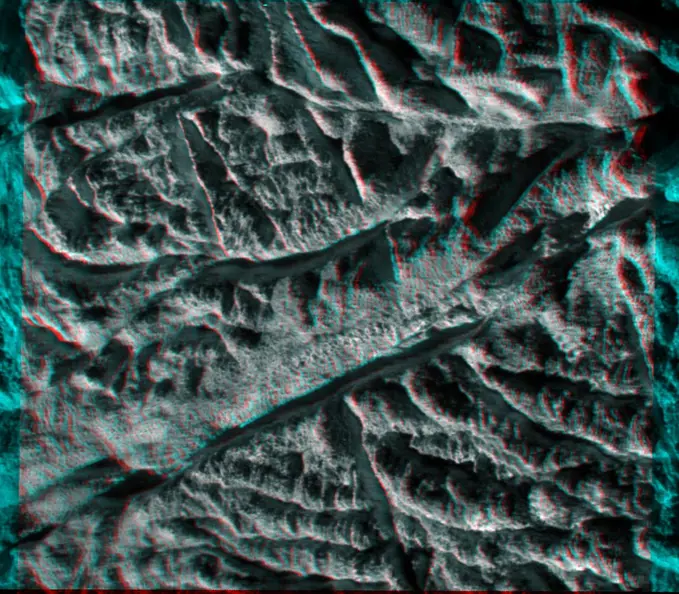
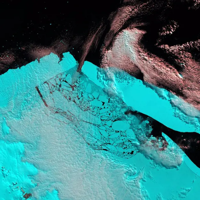
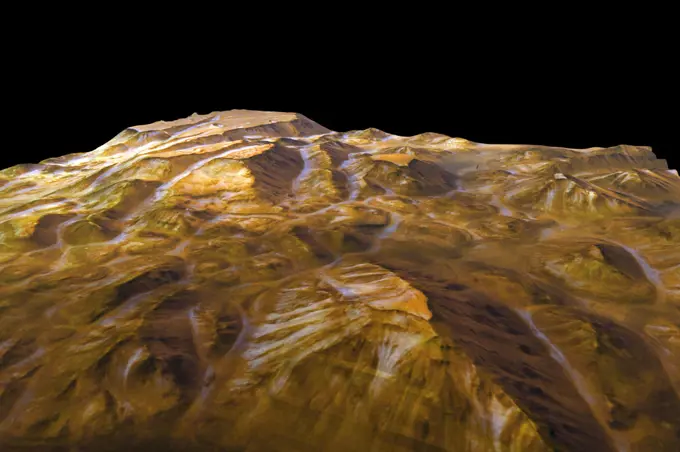
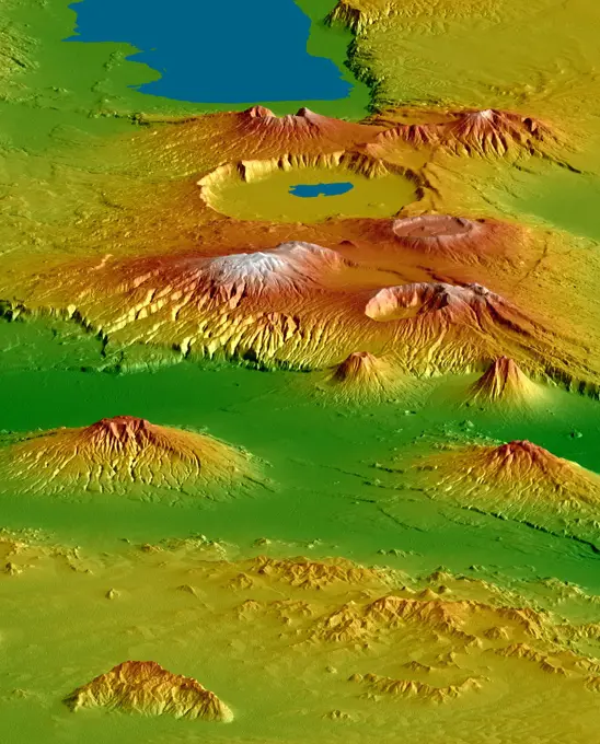
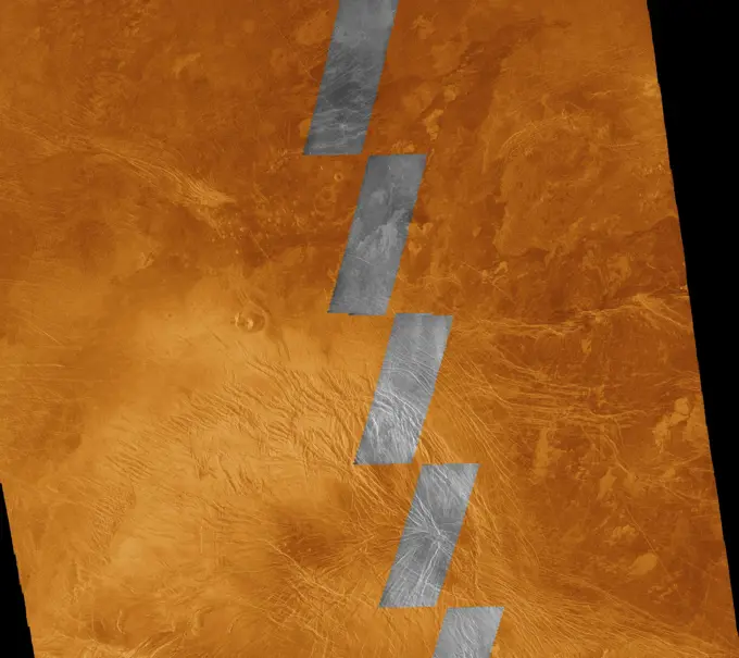
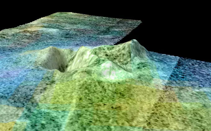
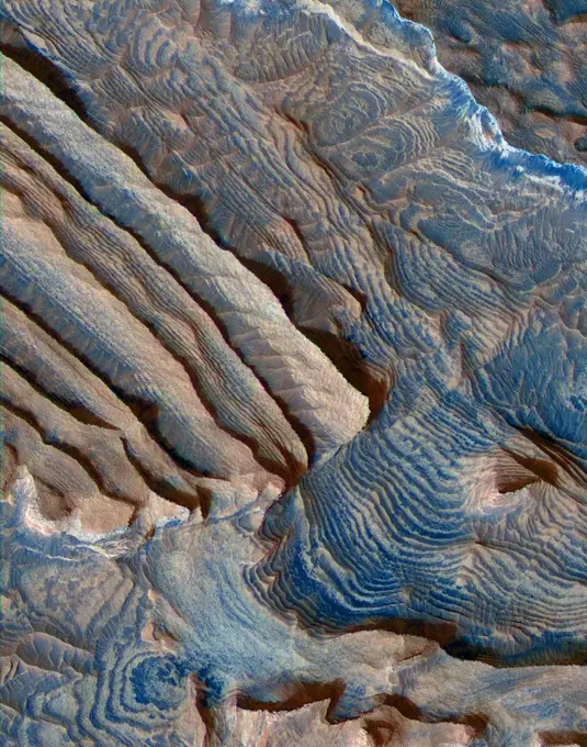
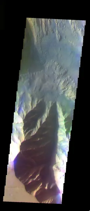
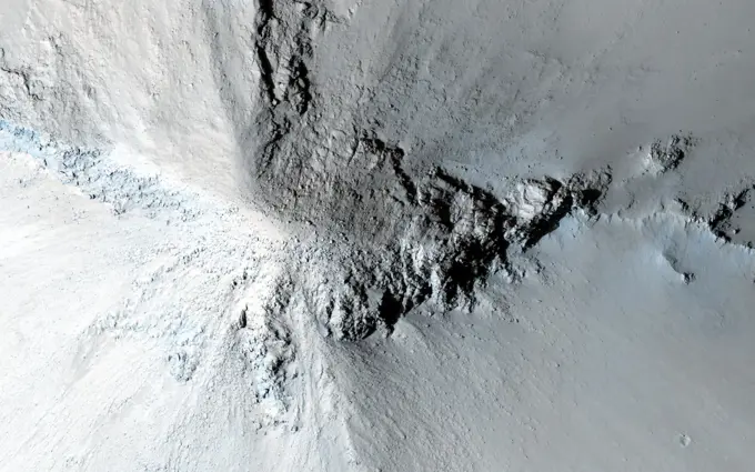
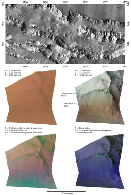
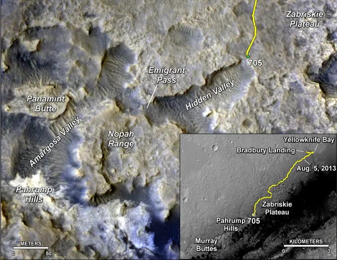
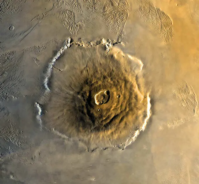
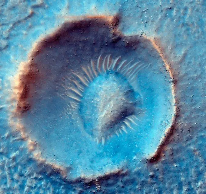
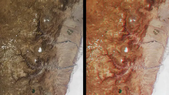
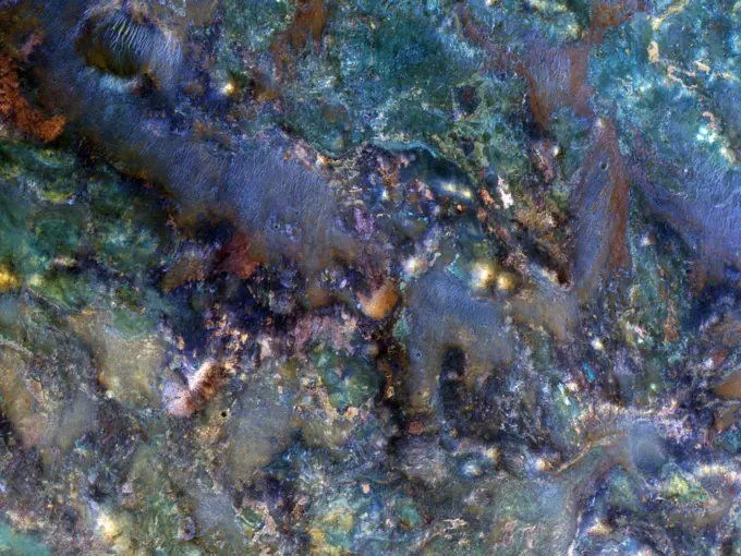
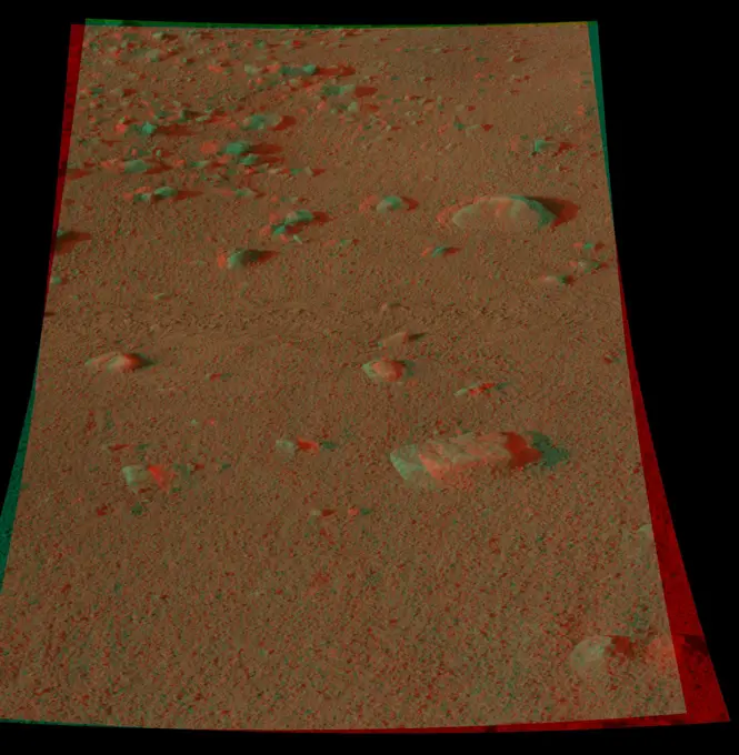
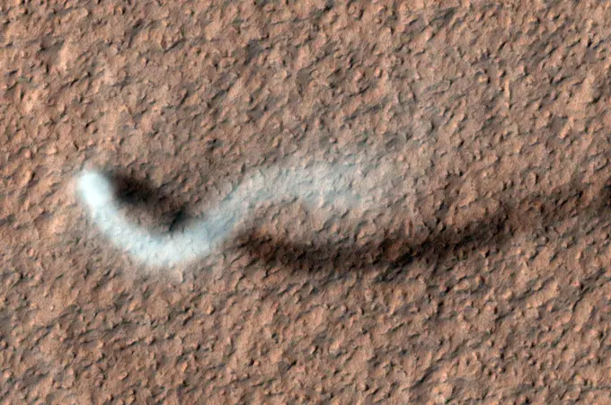
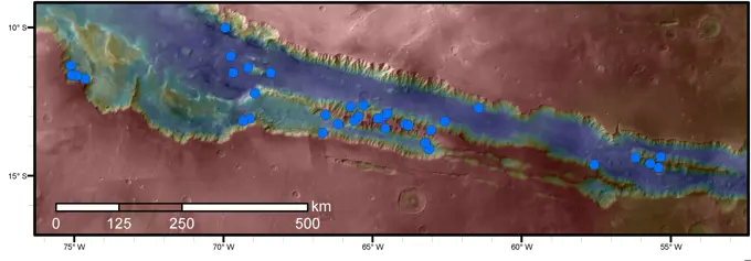
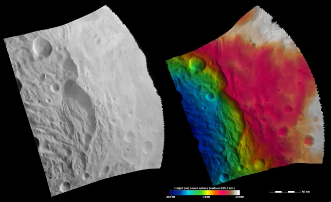
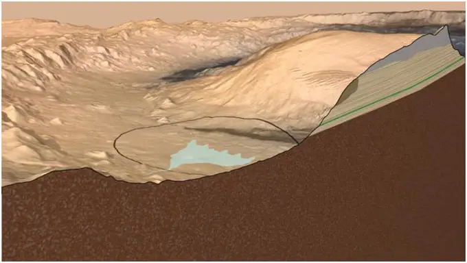
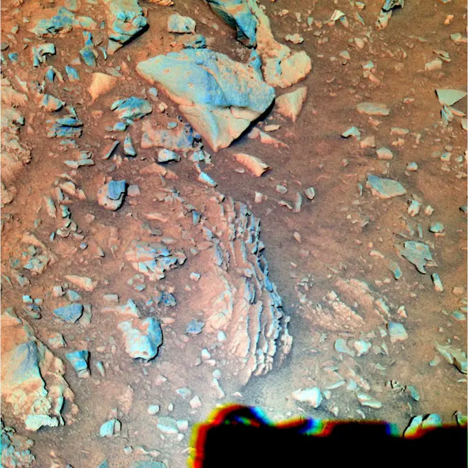
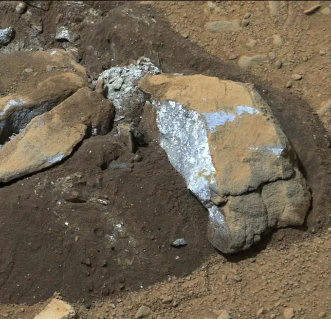
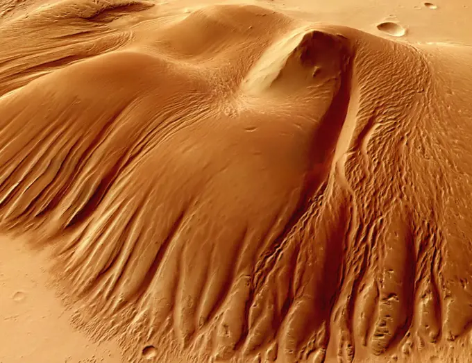
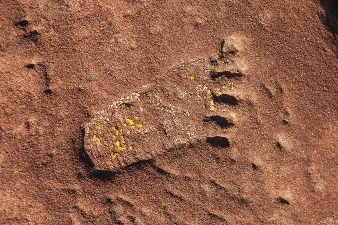
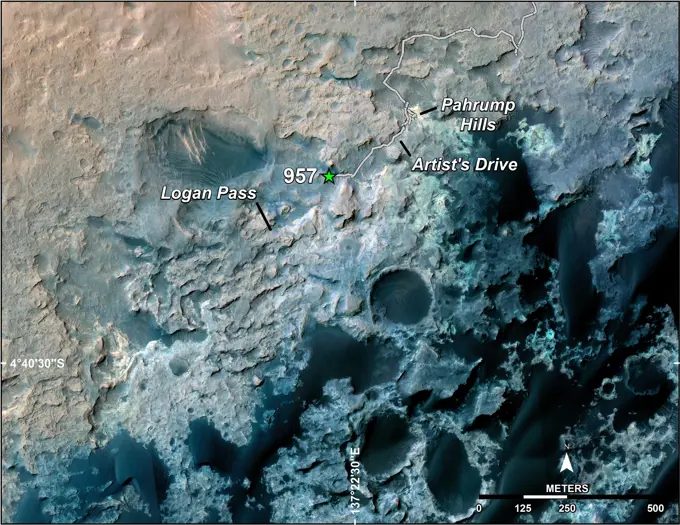
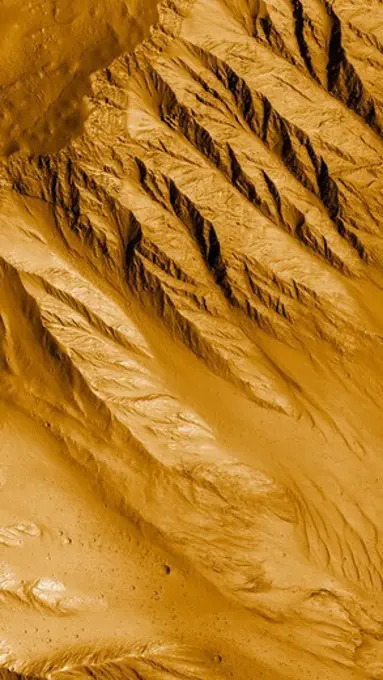
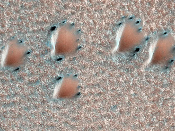
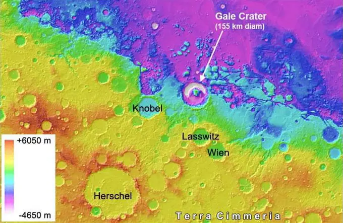
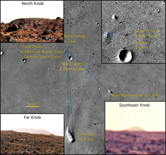
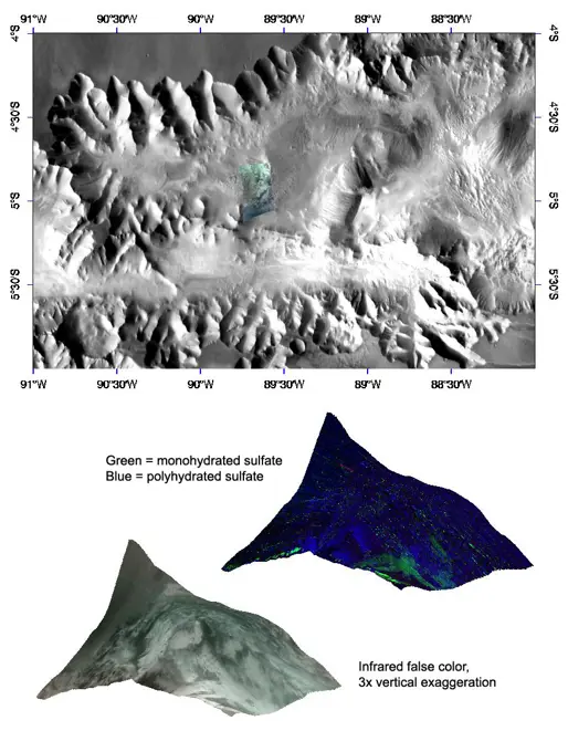
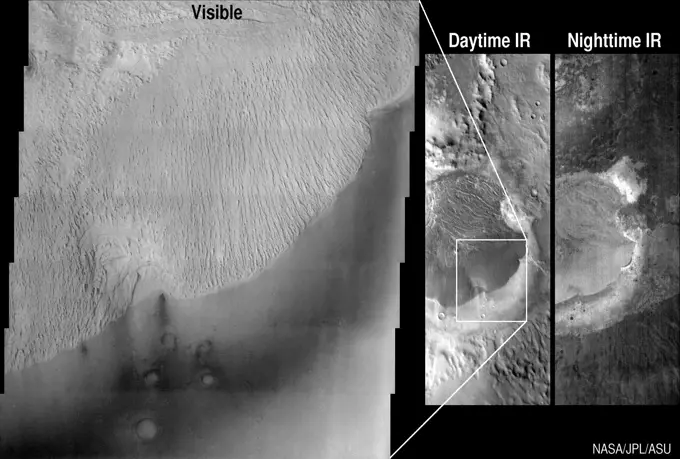
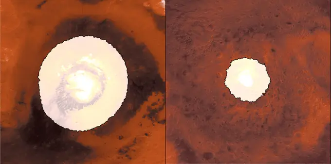
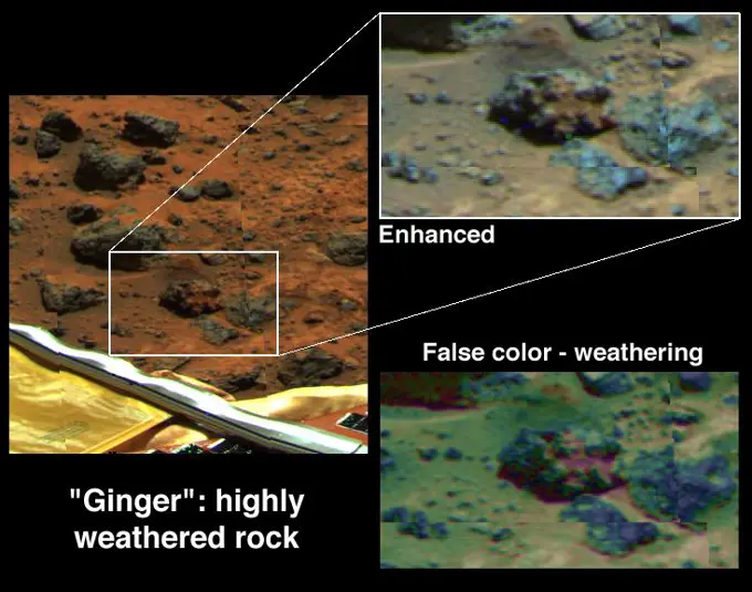
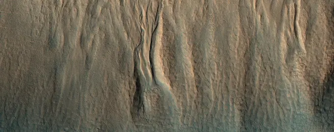
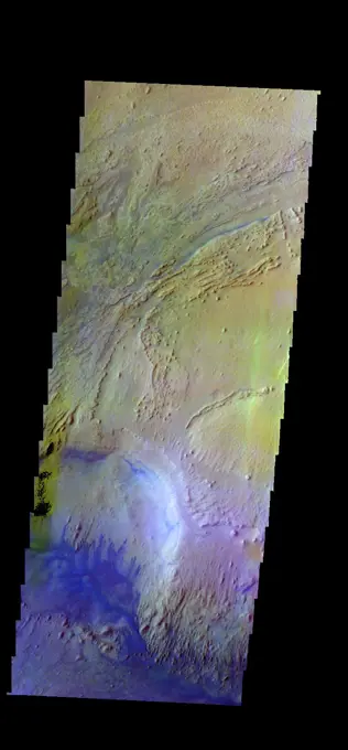
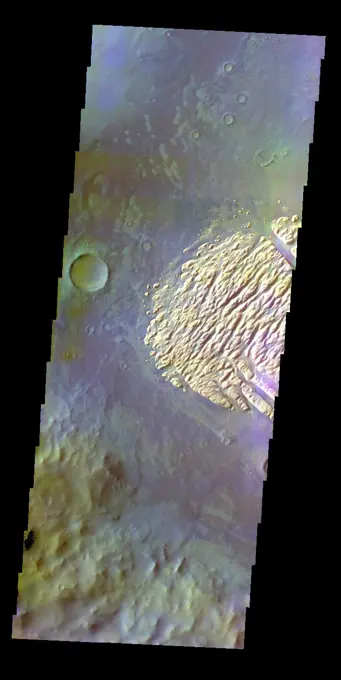
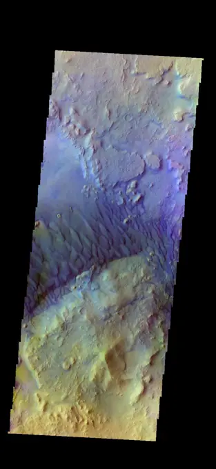
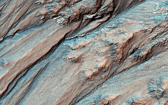
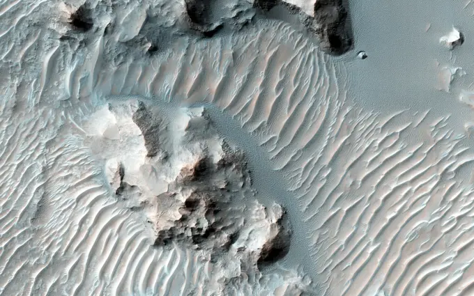
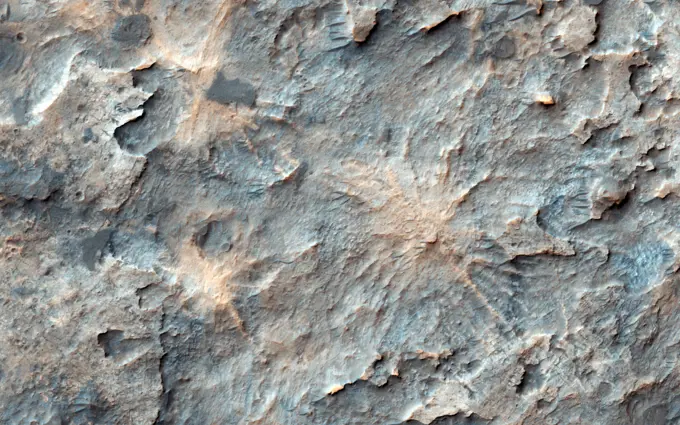
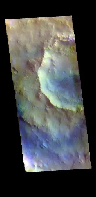
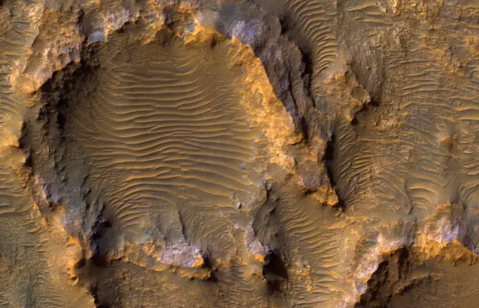
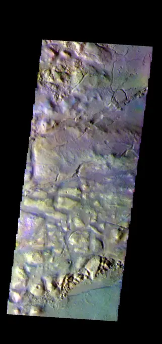
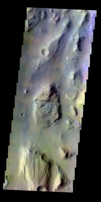
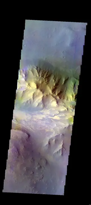
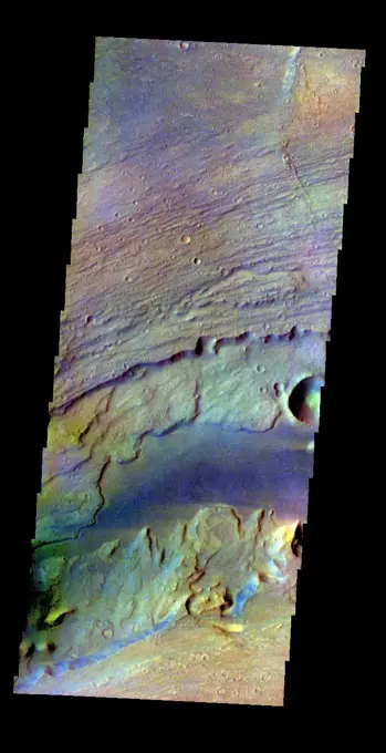
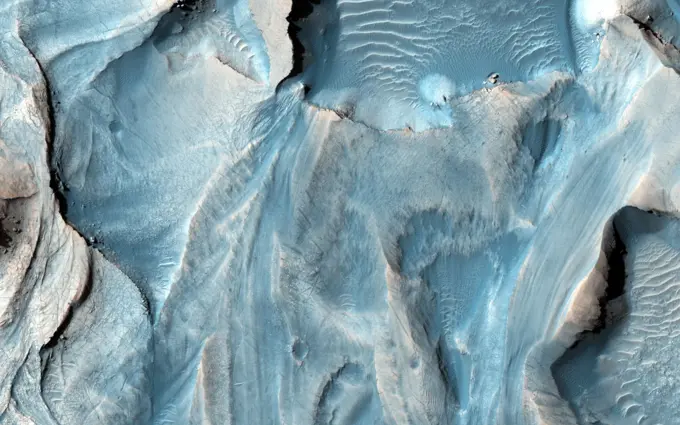
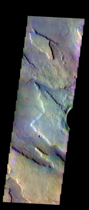
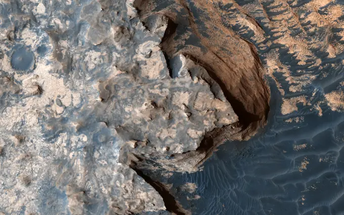
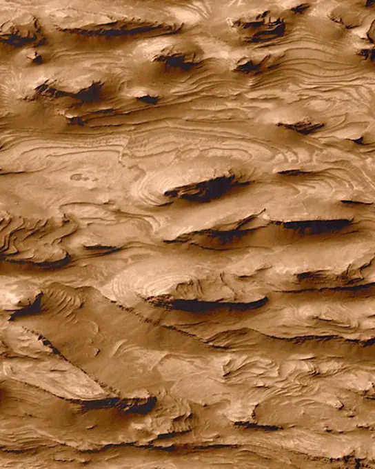
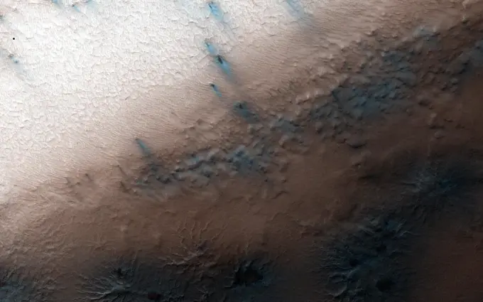
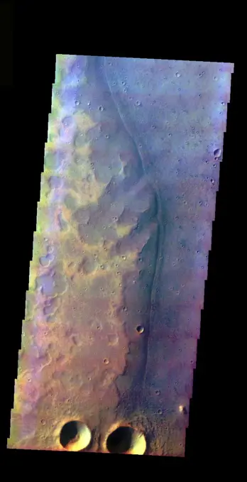
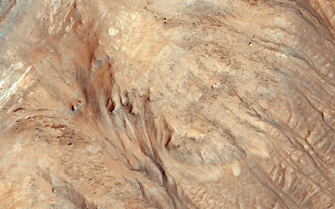
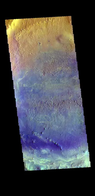
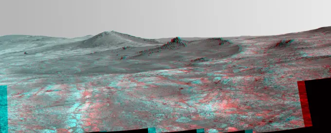
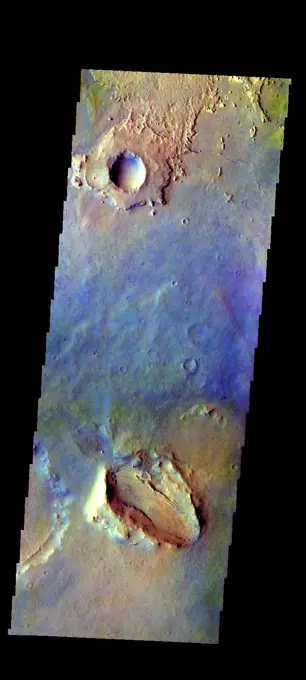
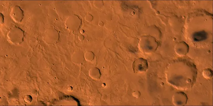
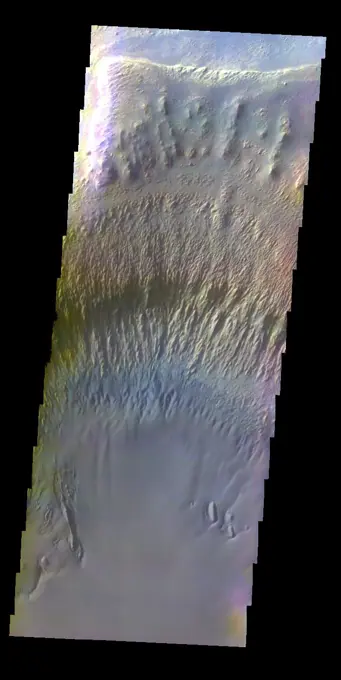
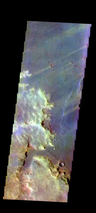
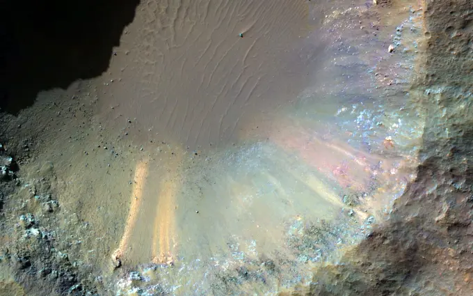
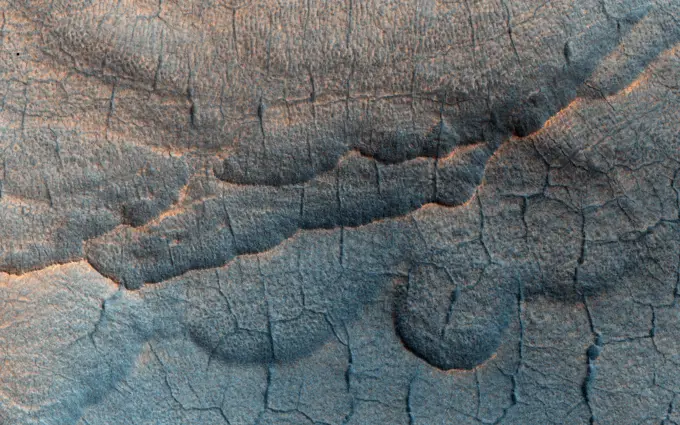
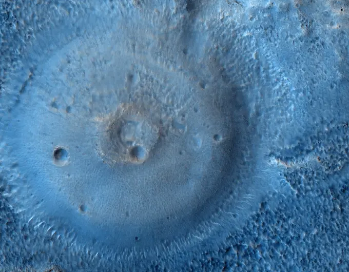
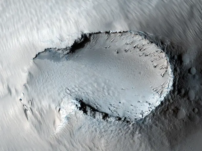
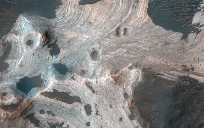
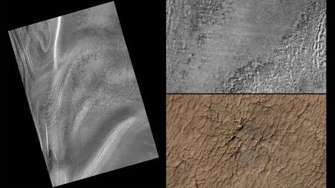
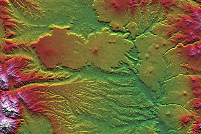
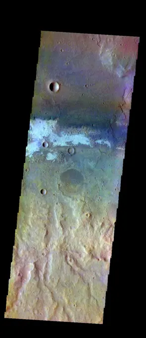
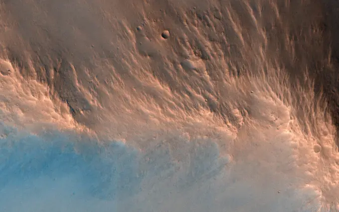
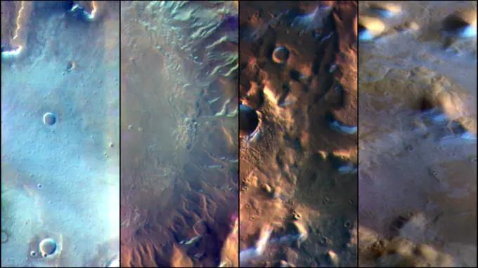
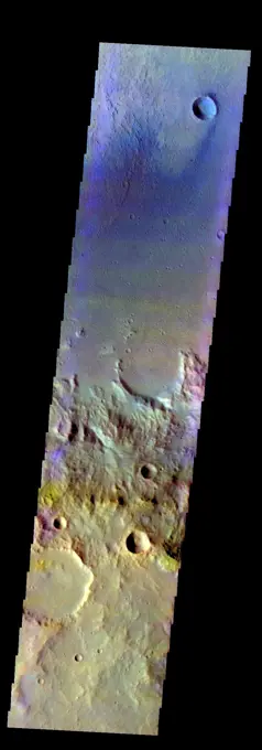
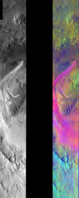
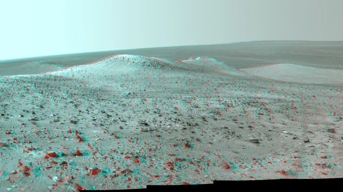
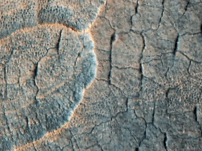
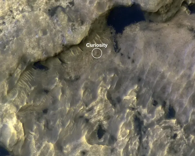
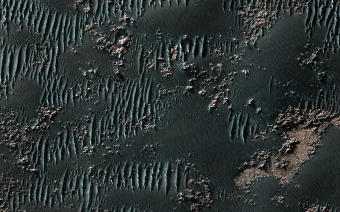
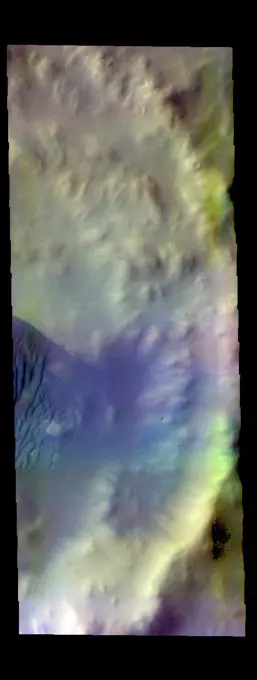
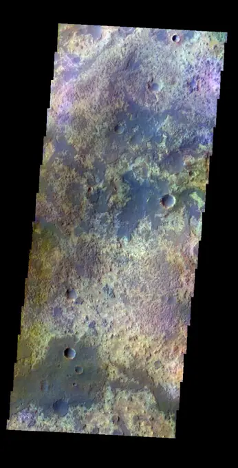
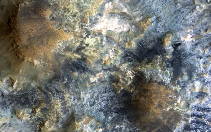
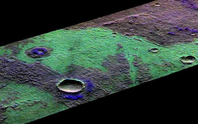
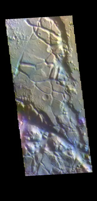
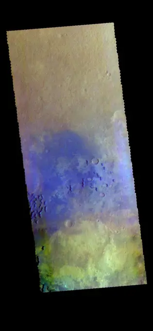
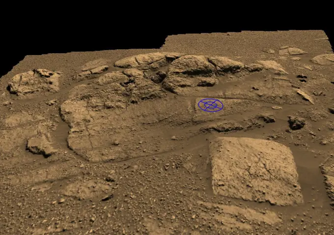
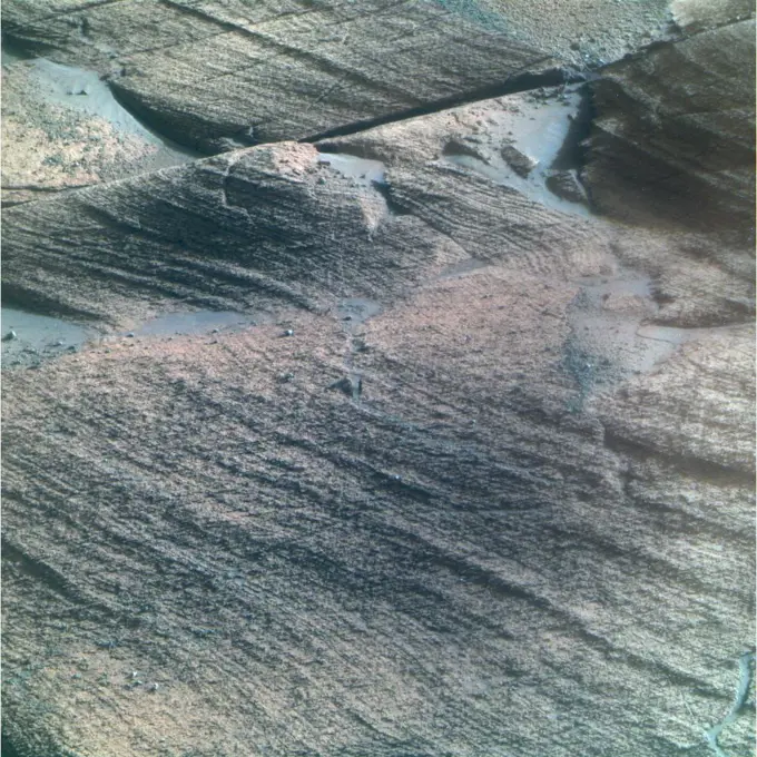
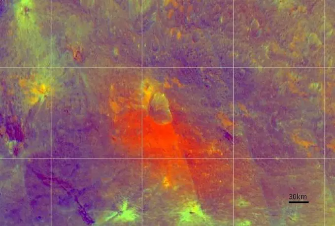
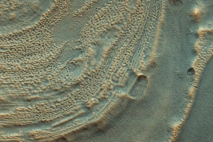
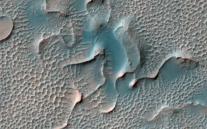
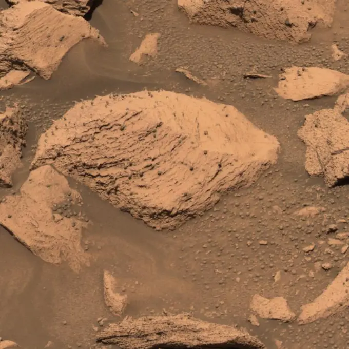
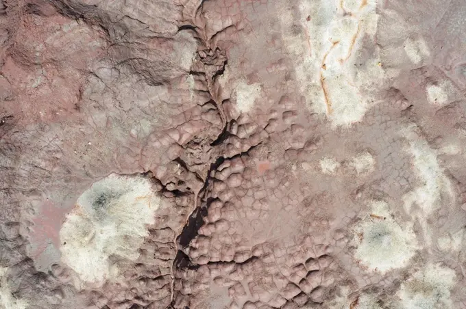
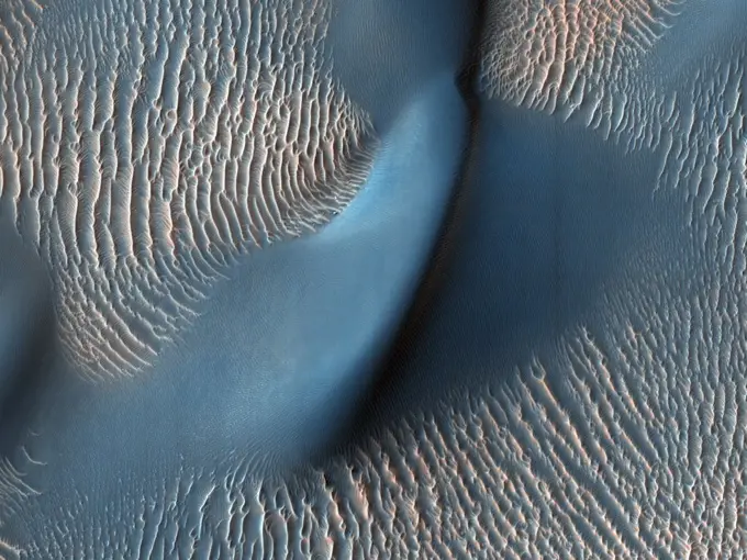
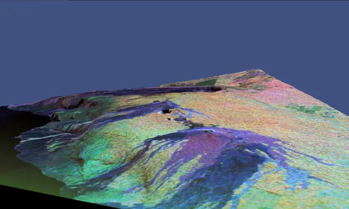
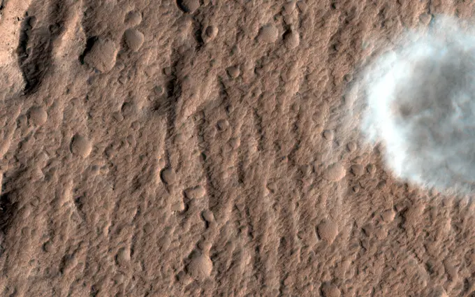
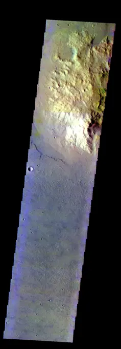
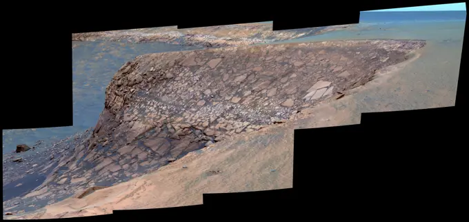
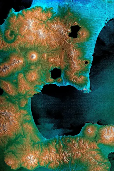
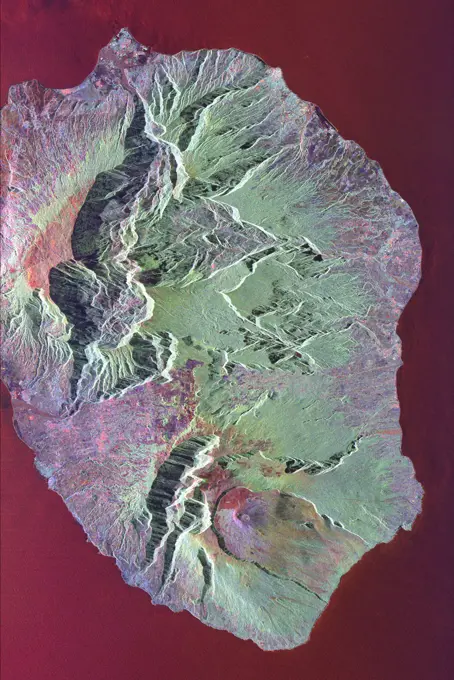
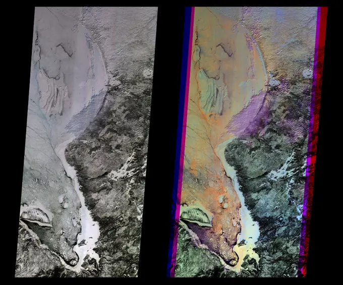
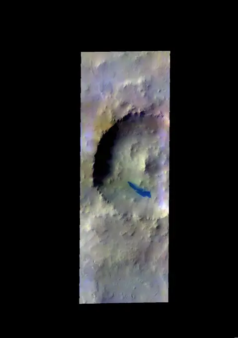
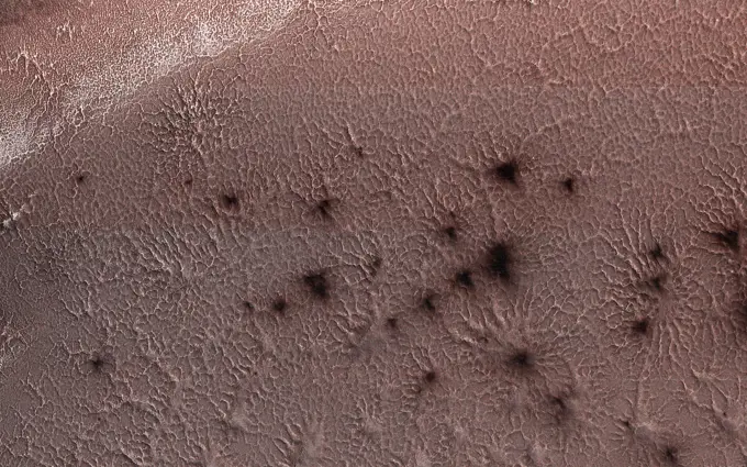
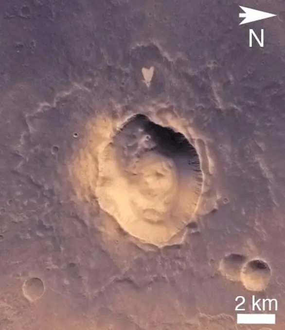
Aerial Mars images showcasing complex landforms and gullies, suggesting ancient water activity. Varied textures with rich colors depict diverse Martian landscapes.

HiRISE has been operating since 2006, and lately many of our observations of gullies are repeat images designed to study changes. However, we are also collecting data over gullies never before seen at this resolution, to study their morphology and allow us to look for changes in the future. This is the first HiRISE look at a cluster of gullies that appear modified or degradedthe gully fans have ripples and ridges that have formed since the last major gully activity, suggesting that they don't change very often, but we won't know for sure unless we look!

Assets in this Story

6145-45112134
Captured by NASA's Mars Reconnaissance Orbiter spacecraft, shown here are bizarre landforms in Gorgonum Basin. This basin may have contained an ancient lake, with channels draining into the lake from the sides.
6145-58971952
HiRISE has been operating since 2006, and lately many of our observations of gullies are repeat images designed to study changes. However, we are also collecting data over gullies never before seen at this resolution, to study their morphology and allow us to look for changes in the future. This is the first HiRISE look at a cluster of gullies that appear modified or degradedthe gully fans have ripples and ridges that have formed since the last major gully activity, suggesting that they don't change very often, but we won't know for sure unless we look!
6145-45089576
Gullies are commonly found in the southern mid-latitudes of Mars. In this image from NASA's Mars Reconnaissance Orbiter they start near top of a long ridge, and descend into an impact crater that lies at the bottom of the ridge.
6145-45118943
The THEMIS camera contains 5 filters. The data from different filters can be combined in multiple ways to create a false color image. This image from NASA's 2001 Mars Odyssey spacecraft shows part of the interior deposit of Firsoff Crater.
6145-44811017
This image from NASA's Mars Reconnaissance Orbiter shows a portion of the floor in Palos Crater on equatorial Mars. The floor appears bumpy with high-standing layered knobs; most of its terrain is weathering into meter-size (yard-size) polygonal blocks.
6145-45086453
The THEMIS VIS camera contains 5 filters. The data from different filters can be combined in multiple ways to create a false color image. This false color image from NASA's 2001 Mars Odyssey spacecraft shows part of the floor of Pollack Crater.
6145-44483608
The THEMIS VIS camera contains 5 filters. The data from different filters can be combined in multiple ways to create a false color image. These false color images may reveal subtle variations of the surface not easily identified in a single band image. The linear depressions in today's false color image are part of Nili Fossae. Nili Fossae is a collection of curved faults and down-dropped blocks of crust between the faults. The fossae, or graben, lie northeast of the large volcano Syrtis Major and northwest of the ancient impact basin Isidis Planitia. The troughs, which can be almost 500 meters (1,600 feet) deep , make concentric curves that follow the outline of Isidis Planitia. The graben likely formed as the crust sagged under the weight of lava flows filling the Isidis Planitia impact basin. The THEMIS VIS camera is capable of capturing color images of the Martian surface using five different color filters. In this mode of operation, the spatial resolution and coverage of the image
6145-45263619
This is a false color image of the dune field in the Arabia Terra crater. In this combination of bands, sand appears as a blue to dark blue color. In this image, the smaller areas of sand are easily visible and indicate the large amount of available material for creating dunes. Located in eastern Arabia is an unnamed crater, 120 kilometers (75 miles) across. The floor of this crater contains a large exposure of rocky material, a field of dark sand dunes, and numerous patches of what is probably fine-grain sand. The shape of the dunes indicate that prevailing winds have come from different directions over the years. The THEMIS VIS camera contains 5 filters. The data from different filters can be combined in multiple ways to create a false color image. These false color images may reveal subtle variations of the surface not easily identified in a single band image. The Odyssey spacecraft has spent over 15 years in orbit around Mars, circling the planet more than 71,000 times. It holds th
6145-45297965
This false color image shows part of the floor of Hale Crater and the elongate axis of the central peak mountains. Hale Crater is an example of an oblique impact crater. The mountain chain trends from the southeast towards the northwest, increasing in height towards the northwest. The incoming meteor struck the surface along this trend, forming an oval crater and displacing the impact energy forward to create the central mountain range. Hale Crater is 150 km x 125 km in diameter (93 miles x 77 miles) and is located near the northern part of Argye Plainitia. The THEMIS VIS camera contains 5 filters. The data from different filters can be combined in multiple ways to create a false color image. These false color images may reveal subtle variations of the surface not easily identified in a single band image. Orbit Number 66105 Latitude -35.5732 Longitude 323.646 Instrument VIS Captured 2016-11-07 23 04
6145-45089316
This image from NASA's Mars Reconnaissance Orbiter shows dark dunes in the western Medusae Fossae. This image shows no large dunes, but many of the dark sand patches cover slopes up to discrete layers.
6145-45264286
converted PNM file
6145-45299285
Scientists have come to realize that, just below the surface, about one third of Mars is covered in ice. We study this ice to learn about Mars' ancient climate and astronauts' future water supplies. Sometimes we see the buried ice because cliffs form like the one in this image. On the brownish, dusty cliff wall, the faint light-blue-colored ice shows through. Some of these cliffs change before our eyes and boulders of ice can tumble downhill. We take repeat images of these scenes to check for changes like this.
6145-45092574
This highly tectonized terrain (meaning it possesses many faults), as seen by NASA's Mars Reconnaissance Orbiter, has its low-lying areas filled with some form of younger material.
6145-54676711
Gully Activity in Triolet Crater. Gullies lying on the northeast slopes of Triolet Crater (about 11.6 km in diameter ), are located in the Southern Highlands just east of Gorgonum Chaos. Some gullies have eroded through resistant layers up to the crater rim. At the downslope are fans of debris that overlap with those of nearby gully systems, suggesting that there were multiple periods of gully activity in this region. Just south of the gullies is a large fracture that cuts through the crater rim. This fracture is part of the Sirenum Fossae system that slices across the region for over 1,000 kilometers from the northeast to the southwest. Because this fracture (or fossae ) cuts through the rim and ejecta blanket of Triolet Crater, this means that the crater is older than the fracture. This is known as a cross-cutting relationship and demonstrates a basic principle in geology known as the law of superposition. https //photojournal.jpl.nasa.gov/catalog/PIA25708
6145-44953080
This image from NASA's Mars Reconnaissance Orbiter shows a well-preserved impact crater. A closeup view highlights distinctive bright lines and spots on the steep slope on the north side.
6145-45102710
Schaeberle Crater is a large, heavily-infilled crater with many interesting features. This image NASA's Mars Reconnaissance Orbiter spacecraft shows a window into the crater fill deposit, showcasing eroding bedrock and aeolian landforms.
6145-44630883
Iani Chaos - Another View In False Color
6145-45260948
On Mars, NASA's Mars Reconnaissance Orbiter often sees inverted river channels preserved perched above the surrounding terrain because the sediment inside the river channel was stronger than its surroundings. This is common in the American Southwest in places where lava flowed down river channels and the surrounding sandstone subsequently eroded away leaving ridges in places that started as valleys. There's another example of high-standing columns protected by a strong cap rock, called hoodoos. Looking more closely at our image, we see what looks like a crater and its rays of ejecta, preserved and slightly higher than the surrounding terrain, possibly due to a similar process.
6145-45094162
The focus of this image from NASA's Mars Reconnaissance Orbiter is on the western end of a fan-shaped landform, located at the end point of a sinuous valley.
6145-45088849
The THEMIS VIS camera contains 5 filters. The data from different filters can be combined in multiple ways to create a false color image. This false color image from NASA's 2001 Mars Odyssey spacecraft shows part of Ares Vallis.
6145-45292469
The THEMIS VIS camera contains 5 filters. The data from different filters can be combined in multiple ways to create a false color image. These false color images may reveal subtle variations of the surface not easily identified in a single band image. Today's false color image shows two craters, one inside the other. These unnamed craters are located in Arabia Terra. Dunes are visible on the floor of the inner crater. Orbit Number 70157 Latitude 6.47569 Longitude 346.696 Instrument VIS Captured 2017-10-07 19 45
4389-1127
Meridiani Planum Seen by Mars Reconnaissance Orbiter
6145-45262284
This enhanced color image from NASA's Mars Reconnaissance Orbiter (MRO) shows eroded bedrock on the floor of a large ancient crater.
6145-44514253
Layered Outcrops of Far West Candor Chasma
6145-45134461
The THEMIS camera contains 5 filters. The data from different filters can be combined in multiple ways to create a false color image. This image from NASA's 2001 Mars Odyssey spacecraft shows part of Gorgonum Chaos.
6145-45263564
This image was acquired on May 15, 2018 by NASA's Mars Reconnaissance Orbiter. This observation shows relatively bright mounds scattered throughout darker and diverse surfaces in Chryse Planitia. These mounds are hundreds of meters in size. The largest of the mounds shows a central pit, similar to the collapsed craters found at the summit of some volcanoes on Earth. The origins of these pitted mounds or cratered cones are uncertain. They could be the result of the interaction of lava and water, or perhaps formed from the eruption of hot mud originating from beneath the surface. These features are very interesting to scientists who study Mars, especially to those involved in the ExoMars Trace Gas Orbiter mission. If these mounds are indeed mud-related, they may be one of the long sought after sources for transient methane on Mars. More information is available at
6145-45084103
The THEMIS VIS camera contains 5 filters. The data from different filters can be combined in multiple ways to create a false color image. This false color image from NASA's 2001 Mars Odyssey spacecraft shows part of of Eos Chasma.
6145-45122791
This mosaic combines four frames taken by the microscopic imager on Opportunity's robotic arm on Oct. 2, 2016 showing relatively bright outcropping of rock, dubbed 'Gasconade' on the western edge of Mars' Endeavour Crater.
6145-45126525
The THEMIS camera contains 5 filters. The data from different filters can be combined in multiple ways to create a false color image. This image from NASA's 2001 Mars Odyssey spacecraft shows part of Coprates Chasma.
6145-45298531
This false color image shows sand dunes on the floor of Sumgin Crater. The crater is located in Noachis Terra north of Argyre Planitia and is 85 km (53 miles) in diameter. Dark blue in this color combination typically means basaltic sands. The THEMIS VIS camera contains 5 filters. The data from different filters can be combined in multiple ways to create a false color image. These false color images may reveal subtle variations of the surface not easily identified in a single band image. Orbit Number 66517 Latitude -36.4993 Longitude 311.197 Instrument VIS Captured 2016-12-11 21 42
6145-45089087
The THEMIS VIS camera contains 5 filters. The data from different filters can be combined in multiple ways to create a false color image. This false color image from NASA's 2001 Mars Odyssey spacecraft shows an unnamed crater in Elysium Planitia.
6145-45084144
This image from NASA's Mars Reconnaissance Orbiter, approximately 1.5 x 3 kilometers, shows a sample of eroded Martian terrain in Arabia Terra.
6145-45085640
The THEMIS VIS camera contains 5 filters. The data from different filters can be combined in multiple ways to create a false color image. This false color image from NASA's 2001 Mars Odyssey spacecraft shows a portion of Kasei Vallis.
6145-44969873
This observation from NASA's Mars Reconnaissance Orbiter covers an outcrop of possible cyclic bedding within a crater in Arabia Terra.
6145-45114765
The THEMIS camera contains 5 filters. The data from different filters can be combined in multiple ways to create a false color image. This image from NASA's 2001 Mars Odyssey spacecraft shows part of the floor of Antoniadi Crater.
6145-44722180
This stereo, 180-degree panorama shows the southward vista from the location where Spirit is spending its third Martian winter inside Mars' Gusev Crater on July 2, 2008. 3D glasses are necessary to view this image.
1746-19665921
Chalk. When tiny organisms living in shallow seas die and sink to the bottom, their skeletons join together to make chalk.
6145-45097456
The THEMIS VIS camera contains 5 filters. The data from different filters can be combined in multiple many ways to create a false color image. This image from NASA's 2001 Mars Odyssey spacecraft shows the edge of the northwestern flank of Tyrrhenus Mons.
6145-45100554
This image from NASA's Mars Reconnaissance Orbiter spacecraft shows Solis Planum, a huge mound south of Valles Marineris. Like Earth's water table, Mars has an ice table.
6145-45258155
This image from NASA's Mars Reconnaissance Orbiter is reminiscent of the rugged and open terrain of a stark shore-line, perhaps of an island nation, such as the British Isles. A close-up in enhanced color produces a striking effect, giving the impression of a cloud-covered cliff edge with foamy waves crashing against it. The reality is that the surface of Mars is much dryer than our imaginations might want to suggest. This is only a tiny part of a much larger structure; an inverted crater -- a crater that has been infilled by material that is more resistant to erosion than the rocks around it -- surrounded by bluish basaltic dunes. The edge of these elevated light-toned deposits are degraded, irregular and cliff-forming. Dunes visible below the cliff, give the impression of an ocean surface, complete with foam capped waves crashing against the shore line, demonstrating the abstract similarity between the nature of a turbulent ocean and a Martian dune field. Meridiani Planum has an over
6145-45299266
The THEMIS VIS camera contains 5 filters. The data from different filters can be combined in multiple ways to create a false color image. These false color images may reveal subtle variations of the surface not easily identified in a single band image. Today's false color image shows part of Nectaris Fossae. The linear color variations at the bottom of the image are the fossae that dissect the topographic slope on the margin between Thaumasia Planum (top of image) and Noachis Terra (off the bottom of the image). The fossae may combine both fluvial and tectonic origins. Orbit Number 66854 Latitude -25.7521 Longitude 301.599 Instrument VIS Captured 2017-01-08 16 07
6145-45098981
This image from NASA's Mars Reconnaissance Orbiter shows a location on Mars associated with the best-selling novel and Hollywood movie, 'The Martian.' This area is in the Acidalia Planitia region.
4389-1559
Sediment Pattern Seen by Mars Global Surveyor
6145-45114740
The THEMIS camera contains 5 filters. The data from different filters can be combined in multiple ways to create a false color image. This image from NASA's 2001 Mars Odyssey spacecraft shows part of the plains of Terra Sirenum near Sirenum Fossae.
6145-45028929
Gale Crater, where the rover Curiosity of NASA's Mars Science Laboratory mission will land in August 2012, contains a mountain rising from the crater floor.
6145-45080064
At certain times in spring, fans take on a gray or blue appearance. This is the time in Inca City when this phenomenon happens, as seen in this image acquired by NASA's Mars Reconnaissance Orbiter.
6145-44631670
Acidalia Planitia Channel Margin
6145-58972033
Existing images of this impact crater show a couple of dark lineations on the equator-facing wall that resemble small recurring slope lineae (RSL). However, unlike typical RSL, these lines persist for several Mars years with only minor changes.
6145-45006818
NASA's Mars Reconnaissance Orbiter shows light-toned deposits along Coprates Chasma slopes.
6145-45092065
There are some interesting erosional signs in this observation from NASA's Mars Reconnaissance Orbiter, which will make for a good comparison with other intracrater fans and fluvial sedimentary landforms.
6145-45092878
Ravines (or very large gullies) are actively forming on Mars during the coldest times of year, when carbon dioxide frost aids mass wasting as seen by NASA's Mars Reconnaissance Orbiter.
6145-45297960
This false color image shows most of the floor of an unnamed crater in southern Arabia Terra. The wide variety of colors indicates a complex geologic history. Dark blue in this false color combination is typically basaltic sand. It appears that in addition to small sand dunes a scattering of sand also covers part of the crater floor. The THEMIS VIS camera contains 5 filters. The data from different filters can be combined in multiple ways to create a false color image. These false color images may reveal subtle variations of the surface not easily identified in a single band image. Orbit Number 64320 Latitude 5.45723 Longitude 356.407 Instrument VIS Captured 2016-06-13 22 19
6145-45112439
The THEMIS camera contains 5 filters. The data from different filters can be combined in multiple ways to create a false color image. This image from NASA's 2001 Mars Odyssey spacecraft shows part of Ausonia Montes.
6145-45092824
An elongated crater called 'Spirit of St. Louis,' with a rock spire in it, dominates this stereo view from the panoramic camera (Pancam) on NASA's Mars Exploration Rover Opportunity.
6145-45128723
Viscous, lobate flow features are commonly found at the bases of slopes in the mid-latitudes of Mars, and are often associated with gullies, as seen by NASA's Mars Reconnaissance Orbiter.
6145-45111871
The THEMIS camera contains 5 filters. The data from different filters can be combined in multiple ways to create a false color image. This image from NASA's 2001 Mars Odyssey spacecraft shows part of the plains in Arabia Terra.
6145-45112133
This image captured by NASA's Mars Reconnaissance Orbiter spacecraft has low-sun lighting that accentuates the many transverse ridges on this slope, extending from Euripus Mons (mountains).
6145-44565088
Fine Channel Networks
6145-45260194
This is a false color image of part of the Nili Patera dune field. High resolution imaging by other spacecraft has revealed that the dunes in this region are moving. Winds are blowing the dunes across a rough surface of regional volcanic lava flows. The paterae are calderas on the volcanic complex called Syrtis Major Planum. Dunes are found in both Nili and Meroe Paterae and in the region between the two calderas. The THEMIS VIS camera contains 5 filters. The data from different filters can be combined in multiple ways to create a false color image. These false color images may reveal subtle variations of the surface not easily identified in a single band image. The Odyssey spacecraft has spent over 15 years in orbit around Mars, circling the planet more than 69000 times. It holds the record for longest working spacecraft at Mars. THEMIS, the IR/VIS camera system, has collected data for the entire mission and provides images covering all seasons and lighting conditions. Over the years
6145-45086994
The THEMIS VIS camera contains 5 filters. The data from different filters can be combined in multiple ways to create a false color image. This false color image from NASA's 2001 Mars Odyssey spacecraft shows part of the interior of Ganges Chasma.
6145-45124243
The THEMIS camera contains 5 filters. The data from different filters can be combined in multiple ways to create a false color image. This image from NASA's 2001 Mars Odyssey spacecraft shows eroded craters in northern Meridiani Planum.
6145-45085423
The THEMIS VIS camera contains 5 filters. The data from different filters can be combined in multiple ways to create a false color image. This false color image from NASA's 2001 Mars Odyssey spacecraft shows the southern flank of Ascraeus Mons.
6145-45124259
The THEMIS camera contains 5 filters. The data from different filters can be combined in multiple ways to create a false color image. This image from NASA's 2001 Mars Odyssey spacecraft shows several wind streaks in Syrtis Major Planum.
6145-54684339
. Curiosity's Climb Attempt Leaves Tracks. NASA's Curiosity Mars rover left these tracks after trying multiple times to crest a slippery slope. This mosaic, made up of seven images that were stitched together after being sent back to Earth, was captured by the rover's Mastcam on June 13, 2023, the 3,858th Martian day, or sol, of the mission. The color has been adjusted to match lighting conditions as the human eye would see them on Earth. Curiosity struggled to climb a 23-degree slope that had slippery sand and wheel-size boulders. These three factors - the incline, the sand, and the large boulders - combined to make this Curiosity's toughest climb yet.
6145-45260167
This image from NASA's Mars Reconnaissance Orbiter shows one of millions of small (10s of meters in diameter) craters and their ejecta material that dot the Elysium Planitia region of Mars. The small craters were likely formed when high-speed blocks of rock were thrown out by a much larger impact (about 10-kilometers in diameter) and fell back to the ground. Some of these blocks may actually escape Mars, which is how we get samples in the form of meteorites that fall to Earth. Other ejected blocks have insufficient velocity, or the wrong trajectory, to escape the Red Planet. As such, when one of these high-speed blocks impacts the surface, it makes what is called a secondary crater. These secondaries can form dense chains or rays, which are radial to the crater that formed them.
6145-45110049
This image captured by NASA's Mars Reconnaissance Orbiter spacecraft shows several smaller craters that formed on the floor of Saheki Crater, an 85-kilometer diameter impact crater north of Hellas Basin.
4409-21503534
CUEVA DEL REGUERILLO. DETALLE DEL PANEL ANTERIOR. MADRID, ESPAÑA.
6145-45122130
The THEMIS camera contains 5 filters. The data from different filters can be combined in multiple ways to create a false color image. This image from NASA's 2001 Mars Odyssey spacecraft shows part of Ophir Chasma.
6145-45110048
This enhanced color image from NASA's Mars Reconnaissance Orbiter spacecraft shows several craters somewhere in the southern mid-latitudes of Mars.
6145-44650835
This two-image mosaic shows part of the floor of Melas Chasma
6145-45104966
The THEMIS camera contains 5 filters. The data from different filters can be combined in multiple ways to create a false color image. This image from NASA's 2001 Mars Odyssey spacecraft shows part of the floor of Coprates Chasma.
6145-45069309
The north end of this long image from NASA's Mars Reconnaissance Orbiter shows a lava surface in southern Elysium Planitia. Small cones are common on the extensive young flood lavas in this region.
6145-44968651
This observation captured by NASA's Mars Reconnaissance Orbiter shows a couple of landforms that may result from the loss of large amounts of ice from subsurface deposits: polygonal patterns of troughs and large scallop-shaped depressions.
6145-45083321
The THEMIS VIS camera contains 5 filters. The data from different filters can be combined in multiple ways to create a false color image. This false color image captured by NASA's 2001 Mars Odyssey spacecraft shows part of Hebes Chasma.
6145-44875394
This oblique view of the mound in Gale crater shows several different rock types of interest to the Mars Science Laboratory mission. The Mars Science Laboratory rover, Curiosity, will use its full instrument suite to study these minerals and how they form
6145-45056814
This May 12, 2014, view from NASA's Curiosity Mars Rover shows the rock target 'Windjana' and its immediate surroundings after inspection of the site by the rover by drilling and other activities.
6145-45264067
This image was acquired on May 13, 2018 by NASA's Mars Reconnaissance Orbiter. A hotspot for exploration on Mars centers on areas that were once, or are currently, next to a significant source of heat such as volcanoes. Martian volcanoes have not been active for the last couple million years, but beneath the shifting sands and dust of the Red Planet we find old lava flows frozen in time. These ancient lava flows may have provided a source of heat, along with liquid water or subsurface ice, to generate an environment conducive for the development of ancient life. Geological evidence for hot water interacting with rock is what we mean by hydrothermal sites with these conditions are very difficult to identify from orbit. One closeup view shows sand dunes scouring what appears to be a highly-cratered, old lava flow in the Tempe Terra region, located in the Northern Hemisphere. The flat, dark areas are basaltic in composition, a rock commonly found around active volcanoes, and the lighter-t
6145-45124504
The western Utopia Planitia in the Northern mid-latitudes of Mars is marked by a peculiar type of depression with scalloped edges and by a network of polygonal fractures as seen by NASA's Mars Reconnaissance Orbiter.
1746-19663340
Possible Mud Volcanoes on Mars: Is this a mud volcano on Mars If so, could it be dredging up Martian microbes This strange possibility has been suggested recently and seems to fit several recent observations of Mars. First of all, hills like this seem to better resemble mud volcanoes on Earth than lava volcanoes and impact craters on Mars. Next, the pictured dome has an unusually textured surface consistent with fractured ice. Infrared images from space indicate that hills like this cool more quickly than surrounding rock, consistent with a dried mud composition. The hills also reflect colours consistent with a composition that formed in the presence of water. Finally, unusual plumes of gas containing methane have been found on Mars with unknown origin. These gas plumes could conceivably have been liberated by mud volcanoes, were the initially warm mud to contain methane-producing microbes drifting in a previously unobservable underground lake. A candidate mud volcano over 100 meters
6145-45110358
This image from NASA's Mars Reconnaissance Orbiter spacecraft the valley networks on Mars are terrains eroded by flowing water billions of years ago. Where bedrock is well exposed, a variety of colors due to altered minerals and polygonal patterns.
6145-44835577
This image from NASA's Mars Reconnaissance Orbite is centered on a small cone on the side of one of Mars' giant shield volcanoes. The cone shows some layers of hard rock but most of it is made of relatively soft material.
6145-45133379
The THEMIS camera contains 5 filters. Data from different filters can be combined to create a false color image. This image from NASA's 2001 Mars Odyssey spacecraft shows a sand sheet with surface dune forms on an unnamed crater in Noachis Terrra.
6145-44493828
Much of Mars is covered by sand and dust but in some places stacks of sedimentary layers are visible. In this image, exquisite layering is revealed emerging from the sand in southern Holden Crater. Sequences like these offer a window into Mars' complicated geologic history. Holden Crater was once a candidate landing area for the Mars Science Laboratory, and is still an intriguing choice today.
6145-45053070
In this Mars Reconnaissance Orbiter view of the Curiosity rover mission's waypoint called 'the Kimberley,' the red dot indicates the location of a sandstone target, 'Windjana,' selected for close-up inspection.
6145-44911288
This stereo image from the Mast Camera (Mastcam) on NASA's Mars rover Curiosity shows a rock outcrop called 'Hottah,' cited as evidence for vigorous flow of water in a long-ago Martian stream. You need 3D glasses to view this image.
1746-19671098
This image covers the northern edge of the largest volcano in the solar system, Olympus Mons on Mars. Mars Reconnaissance Orbiter.
6145-45095922
This series of images from NASA's Mars Reconnaissance Orbiter successively zooms into 'spider' features, or channels carved in the surface in radial patterns, in the south polar region of Mars.
6145-44877243
This image comes from observations of Horowitz crater by the HiRISE camera onboard NASA's Mars Reconnaissance Orbiter. The features that extend down the slope during warm seasons are called recurring slope lineae.
6145-44529163
The interplay of volcanism, stream erosion and landslides is evident in this Shuttle Radar Topography Mission view of the eastern flank of the Andes Mountains, southeast of San Carlos de Bariloche, Argentina.
6145-44617110
Dirty Rotten Rocks
6145-45065419
Eridania Basin, located at the head of Ma'adim Vallis, has mounting geomorphic and spectral evidence that it may have been the site of an ancient inland sea. This image is from NASA's Mars Reconnaissance Orbiter.
6145-45258667
Haulani Crater (21 miles, 34 kilometers in diameter) is one of the youngest craters on Ceres, as evidenced by its sharp rims and bright, bluish material in enhanced color composite images from the framing camera on NASA's Dawn spacecraft. Haulani is also a good example of a polygonal crater. This high-resolution topography map of the crater's floor and northern rim displays a prime example of pitted terrains. Those features were likely formed through the rapid vaporization of subsurface water upon impact, and suggest that there is abundant water in Ceres' crust. Pitted terrains have also been found on Mars and Vesta. This topographic map was produced from the combination of images acquired under multiple illumination angles while the Dawn spacecraft was in its low-altitude mapping orbit, at a distance of about 240 miles (385 kilometers) above the surface. The colors represent elevations ranging from 1.3 miles (2.1 kilometers) below the surface to 0.75 miles (1.2 kilometers) above the s
6145-45111882
The THEMIS camera contains 5 filters. The data from different filters can be combined in multiple ways to create a false color image. This image from NASA's 2001 Mars Odyssey spacecraft shows part of the plains of Terra Sirenum.
6145-45126523
This image from NASA's Mars Reconnaissance Orbiter reveals an impact crater, nine kilometers in diameter, with a central peak. Impact craters of various sizes and ages can be found across the Martian surface.
6145-44982495
This image captured by NASA's Mars Reconnaissance Orbiter is of an ancient, approximately 3 billion year-old landslide shows two distinct surface albedos, which are proportions of reflected light.
6145-44649257
A Peek into 'Alamogordo Creek'
6145-44483904
Martian surface frost, made up largely of carbon dioxide, appears blueish-white in these images from the Thermal Emission Imaging System (THEMIS) camera aboard NASA's 2001 Odyssey orbiter. THEMIS takes images in both visible light perceptible to the human eye and heat-sensitive infrared.
6145-45134218
The THEMIS camera contains 5 filters. The data from different filters can be combined in multiple ways to create a false color image. This image from NASA's 2001 Mars Odyssey spacecraft shows part of the floor of Matara Crater.
6145-45121004
NASA's Mars Reconnaissance Orbiter captured this image of Nili Fossae, layered bedrock as horizontal striations in the light toned sediments in the floor of a canyon near Syrtis Major.
6145-44808417
This image taken by NASA's Mars Reconnaissance Orbiter covers part of a candidate landing site that appears to be a shallow depression with a deposit perhaps consisting of chlorides, like table salt.
6145-45094136
The THEMIS VIS camera contains 5 filters. Data from different filters can be combined in multiple ways to create a false color image. This image from NASA's 2001 Mars Odyssey spacecraft shows the floor and rim of an unnamed crater in Terra Cimmeria.
6145-44620179
Gale Crater in IR Color
6145-45110870
This enhanced color view from NASA's New Horizons spacecraft zooms in on the southeastern portion of Pluto's great ice plains, where at lower right the plains border rugged, dark highlands informally named Krun Macula.
6145-44549700
Three impact craters are displayed in this three-dimensional perspective view from NASA's Magellan spacecraft of the surface of Venus. The center of the image is located in the northwestern portion of Lavinia Planitia.
6145-44976287
This image, acquired by NASA's Terra spacecraft, is of Canyonlands National Park, Utah, a showcase of geology in the southwest desert of the United States.
6145-44811019
The terrain in this image from NASA's Mars Reconnaissance Orbiter lies in the Deuteronilus Mensae region along the highland-lowland dichotomy boundary in the northern hemisphere of Mars.
6145-45045178
This anaglyph from NASA's Dawn spacecraft shows degraded craters in asteroid Vesta's northern hemisphere. You need 3D glasses to view this image.
6145-44918217
These images from the NASA Mars Reconnaissance Orbiter show several impact scars on Mars made by pieces of the NASA Mars Science Laboratory spacecraft that the spacecraft shed just before entering the Martian atmosphere.
6145-44836321
This observation from NASA's Mars Reconnaissance Orbiter shows Becquerel Crater, one of several impact craters in Arabia Terra that have light-toned layered deposits along the crater floor. The layers appear to be only a few meters thick.
6145-45077579
This stereo vista from NASA's Mars Rover Opportunity shows 'Wdowiak Ridge,' from left foreground to center, as part of a northward look. You will need 3-D glasses to view this image.
6145-45006817
This image from NASA's Mars Reconnaissance Orbiter shows an unusual landform on the floor of Oxus Patera. Oxus Patera is an ancient, eroded depression in northern Arabia Terra.
4389-1131
Scallops and Polygons in the Utopia Planitia Seen by Mars Reconnaissance Orbiter
6145-44564549
Mars digital-image mosaic merged with color of the MC-3 quadrangle, Arcadia region of Mars. This image is from NASA's Viking Orbiter 1.
6145-45122786
Subtle variations in color look like brush strokes as the lightly frosted terrain reflects light on Mars as seen by NASA's Mars Reconnaissance Orbiter.
6145-44962657
In the area between Crommelin and Firsoff craters, NASA's Mars Reconnaissance Orbiter saw heavily cratered terrain with deposits that record Martian geologic history and stratigraphy.
6145-44506424
Regional View of the Tharsis Volcanoes
6145-44617114
'Tennessee' Clues
6145-45297983
This animation shows the position of NASA's Curiosity rover as it journeyed 1,106 feet (337 meters) through an area of Mount Sharp called the clay-bearing unit between May 31 and July 20, 2019. Each of these two images were taken by the HiRISE camera on NASA's Mars Reconnaissance Orbiter. The first image shows the rover, which appears as a gray speck, at a location called Woodland Bay (top center). The second shows Sandside Harbour (bottom center, near the dark sand patch). Look carefully and you can even see the rover's tracks arcing to the right of the second image. Animation available at
6145-45124256
The THEMIS camera contains 5 filters. The data from different filters can be combined in multiple ways to create a false color image. This image from NASA's 2001 Mars Odyssey spacecraft shows part of Gorgonum Chaos.
6145-45003150
This observation from NASA's Mars Reconnaissance Orbiter shows sand dunes in late Northern spring on Mars, mixed with rock outcrops on the floor of a large crater.
6145-44609678
The area known as the Afar Triangle is located at the northern end of the East Africa Rift, where it approaches the southeastern end of the Red Sea and the southwestern end of the Gulf of Aden.
6145-45292726
This image shows a close-up view of the rock target named Máaz from the SuperCam instrument on NASA's Perseverance Mars rover. It was taken by SuperCam's Remote Micro-Imager (RMI) on March 2, 2021 (the 12th Martian day, or sol, Perseverance's mission on Mars). Máaz means Mars in the Navajo language. Analysis of SuperCam data shows that Máaz has a basaltic composition. It is either an igneous rock or consists of fine grains of igneous material that were cemented together in a watery environment. The target was 10.4 feet (3.17 meters) from the rover. The image field of view is 2.3 inches (6.0 centimeters) in diameter. A key objective for Perseverance's mission on Mars is astrobiology, including the search for signs of ancient microbial life. The rover will characterize the planet's geology and past climate, pave the way for human exploration of the Red Planet, and be the first mission to collect and cache Martian rock and regolith (broken rock and dust). Subsequent NASA missions, in coop
6145-45111370
The THEMIS camera contains 5 filters. The data from different filters can be combined in multiple ways to create a false color image. This image from NASA's 2001 Mars Odyssey spacecraft shows some of the dunes on the floor of Wegener Crater.
6145-45088856
The THEMIS VIS camera contains 5 filters. The data from different filters can be combined in multiple ways to create a false color image. This false color image from NASA's 2001 Mars Odyssey spacecraft shows some of the plains of Arabia Terra.
1746-19671220
Tracks from the first drives of NASA's Curiosity rover are visible in this image captured by the HiRISE camera on NASA's Mars Reconnaissance Orbiter.
6145-45077859
Just as Planned!
6145-45115502
This image from NASA's Mars Reconnaissance Orbiter shows a candidate landing site in the Mawrth Vallis region for ESA's ExoMars rover, planned to launch in 2020.
6145-45264349
This 3D perspective view is a composite of both HiRISE and data from CRISM, another instrument onboard MRO. This view covers a small patch of ancient Martian real estate in Terra Sirenum. CRISM collects spectral data that can be used as a chemical fingerprint for the upper most surface. This information suggests that this small patch of surface is covered with salts (chlorides) represented in green and water-rich clays that appear in blue. CRISM colors can be added to high-resolution images to enhance our knowledge of these materials. They also match nicely with the surface features in our HiRISE image. For example, a fissure near the center of the image may be a a clue to the origin of the salts. The fissure may be a fracture where warm salt-laden water may have welled up, erupted and ponded on the surface. These waters then evaporated leaving the salt-rich deposits behind.
1899-34974
Erebus Volcano In 3D, Ross Island, Antarctica, True Colour Satellite Image. Erebus, Antarctica, true colour satellite image. 3D satellite view of Mount Erebus, the southern most active volcano located close to the South Pole on Ross Island. Image using LANDSAT data.
6145-44515077
Bright-Dark Terrain Boundary in stereo
6145-45118691
The THEMIS camera contains 5 filters. The data from different filters can be combined in multiple ways to create a false color image. This image from NASA's 2001 Mars Odyssey spacecraft shows part of the plains of Tyrrhena Terra.
6145-45100301
The THEMIS VIS camera contains 5 filters. Data from the filters can be used in many ways to create a false color image. This image from NASA's 2001 Mars Odyssey spacecraft shows small dunes and sand located in and around an unnamed crater in Arabia Terra.
6145-44528428
All of the major landforms relate to volcanism and/or erosion in this Shuttle Radar Topography Mission scene of Patagonia, near La Esperanza, Argentina.
6145-44620191
Lava Flows in IR Color
6145-45265671
Today's VIS image is located in Aram Chaos. Aram Chaos was initially formed by a large impact. Over time the crater interior was modified by several different processes, including liquid water. Located near Ares Vallis, a narrow channel links the Aram Chaos crater with Ares Vallis indicating a substantial amount of water was located in the crater. Chaos forms from erosion of the surface into mesa features. With time the valleys expand creating the jumble of hills seen in the image. The THEMIS VIS camera contains 5 filters. The data from different filters can be combined in multiple ways to create a false color image. These false color images may reveal subtle variations of the surface not easily identified in a single band image. Orbit Number 62100 Latitude 4.04973 Longitude 340.137 Instrument VIS Captured 2015-12-14 01 59
6145-44639099
Color Variation on Hyperion
6145-44811015
This image taken by NASA's Mars Reconnaissance Orbiter covers the northern edge of the largest volcano in the solar system, Olympus Mons on Mars; its margin is defined by a massive cliff many kilometers (several miles) tall.
6145-44967646
This observation from NASA's Mars Reconnaissance Orbiter shows a small portion of Mawrth Vallis, one of the many outflow channels feeding north into the Chryse Basin. This ancient valley once hosted flowing water.
6145-45299267
The THEMIS VIS camera contains 5 filters. The data from different filters can be combined in multiple ways to create a false color image. These false color images may reveal subtle variations of the surface not easily identified in a single band image. Today's false color image shows part of the floor of Kaiser Crater, including some of the sand dunes found there. In this false color combination dark blue often indicates basaltic sands. Orbit Number 66814 Latitude -46.2976 Longitude 19.611 Instrument VIS Captured 2017-01-05 08 55
6145-44565851
This anaglyph view of 'Souffle,' to the left of 'Yogi,' was produced by NASA's Mars Pathfinder's Imager camera. 3D glasses are necessary to identify surface detail.
6145-45260411
This is a false color image of Rabe Crater. In this combination of filters blue typically means basaltic sand. Rabe Crater is 108 km (67 miles) across. Craters of similar size often have flat floors. Rabe Crater has some areas of flat floor, but also has a large complex pit occupying a substantial part of the floor. The interior fill of the crater is thought to be layered sediments created by wind and or water action. The pit is eroded into this material. The eroded materials appear to have stayed within the crater forming a large sand sheet with surface dune forms as well as individual dunes where the crater floor is visible. The dunes also appear to be moving from the upper floor level into the pit. The THEMIS VIS camera contains 5 filters. The data from different filters can be combined in multiple ways to create a false color image. These false color images may reveal subtle variations of the surface not easily identified in a single band image. The Odyssey spacecraft has spent ove
6145-44504229
This image was taken by NASA's Mars Global Surveyor Cydonia region on Mars. 3D glasses are necessary to view this image.
6145-44609116
Plotting and Scheming
6145-45098450
A variety of diverse morphological features are present in this image located in the southeastern area of the Nili Fossae region and just northeast of Syrtis Major as seen by NASA's Mars Reconnaissance Orbiter spacecraft.
6145-44698041
Opportunity View of 'Lyell' Layer (False Color)
6145-44896826
These images from NASA's Dawn spacecraft are located in asteroid Vesta's Urbinia quadrangle, in Vesta's southern hemisphere.
6145-45299265
The Dawn spacecraft captured these stereo images of Occator Crater on the dwarf planet Ceres in 2018. Framing camera images were used to construct this anaglyph view (which requires red-blue stereo glasses for viewing) of part of the southeastern floor of the crater. This area is approximately 3 miles (5 kilometers) wide and is entirely within the large impact melt deposit formed there during the impact process. The low bright mounds and pits were probably formed by brine that moved to the surface to form surface vents and surface domes during freezing. The spatial resolution of the stereo images is about 11 feet (3.5 meters) per pixel. Occator crater, named after the Roman god of the agricultural practice of harrowing, is about 57 miles (92 kilometers) in diameter. The conclusion of Dawn's mission operations was Oct. 31, 2018, when the spacecraft depleted its hydrazine used for attitude control. This image was produced by Dr. Paul Schenk at the Lunar and Planetary Institute in Houston
6145-44502440
This topographic image acquired by NASA's Shuttle Radar Topography Mission (SRTM) from data collected on February 15, 2000, of Patagonia, Argentina shows a spectacular landscape formed by volcanoes, rivers, and wind.
6145-58969655
The High Resolution Imaging Science Experiment camera on NASA's Mars Reconnaissance Orbiter captured this image of spider-shaped features on Mars, carved by vaporizing dry ice.
6145-45125001
The network of cracks in this Martian rock slab called 'Old Soaker' may have formed from the drying of a mud layer more than 3 billion years ago. The view combines three images taken by NASA's Curiosity Mars rover on Dec. 31, 2016.
6145-58967101
This false-color image from NASA's Dawn spacecraft is of the of the giant asteroid Vesta. Scientists are studying image like these to better understand the different materials on the surface.
6145-44645845
This MOC image shows a 1.5 meters (~5 feet) per pixel view of a crater in the Terra Cimmeria region of Mars. Several gullies extend from near the top of the crater rim, downslope toward the floor of the crater
6145-45266897
This mosaic of images shows a boulder-sized rock called Strathdon, which is made up of many complex layers. NASA's Curiosity Mars rover took these images using its Mast Camera, or Mastcam, on July 9, 2019, the 2,461st Martian sol, or day, of the mission. The color in the image has been adjusted to approximate white balancing to resemble how the rocks and sand would appear under daytime lighting conditions on Earth.
1525-20468259
alien terrain with craters made in 3d software
6145-44484146
Hebrus Valles are a complex set of channels in the northern lowlands of Mars just to the west of the Elysium volcanic region. The channel segments to the north of this image display a variety of features, including streamlined forms and terracing that are suggestive of catastrophic flooding. However, this observation shows channels of uniform width suggesting more persistent flows eroding into and around two impact craters, each about two hundred meters in diameter. This complex geology may be the result of formation in volcanic terrains as fluid flows erode into basalt and interbedded ash or sediment layers. The channel system is thought to be early Amazonian in age (as far back as 3 billion years ago), which is younger than many of the other outflow channels on Mars.
6145-45262277
converted PNM file
4389-1105
Sand Dunes in Nili Patera Caldera Seen by Mars Reconnaissance Orbiter
6145-45104471
This image from the Radar instrument aboard NASA's Cassini spacecraft show the evolution of a transient feature in the large hydrocarbon sea named Ligeia Mare on Saturn's moon Titan.
6145-44891242
The Forgotten Cezanne
6145-44970965
This basin in Ceti Mensa, as seen by by NASA's Mars Reconnaissance Orbiter, exposes concentric rings in the sedimentary layers. Dark sand ripples and textures in the bedrock suggesting wind scouring are also apparent.
6145-45257629
During the morning of March 20, 2015, a total solar eclipse was visible from parts of Europe, and a partial solar eclipse from northern Africa and northern Asia. NASA's Terra satellite passed over the Arctic Ocean on March 20 at 10 45 UTC (6 45 a.m. EDT) and captured the eclipse's shadow over the clouds in the Arctic Ocean.
6145-44504505
The prominent linear feature straight down the center of this perspective view is California's famous San Andreas Fault. The image was created with data from NASA's Shuttle Radar Topography Mission (SRTM).
6145-44630055
Frosty Crater
4389-1123
Dunes in Holden Crater as Seen by Mars Reconnaissance Orbiter
6145-45265664
In this image many sand dunes are visible. They have an elongated crescent form and are called barchan dunes. They are formed by the continuous action of the wind, blowing in the same direction, giving this particular shape. The orientation of these dunes tell us that the prevailing wind blows from the right to the left (east to west). The wind is continuously moving sand grains up the longer dune slope, towards the top. The small ripples on the slope are caused by this movement. When the sand grains arrive at the top, they fall down the steeper and shorter slope, which as a consequence, has no ripples. It is this gradual sand movement that causes the dunes to slowly move over time.
6145-44542531
Sand dunes are found in many places on Mars. At most of these places the dunes are slowly moving, blown by the wind, just like on Earth. However, in this location in south Melas Chasma they appear to have turned to stone. The large dunes are slowly being eroded and disappearing, replaced by smaller structures of scalloped sand.
6145-44892776
These images from NASA's Dawn spacecraft are located in asteroid Vesta's Tuccia quadrangle, in Vesta's southern hemisphere.
6145-44745131
Periodic Layering in Becquerel Crater, Mars
6145-44758127
NASA's Mars Exploration Rover Spirit used its navigation camera to take the images that have been combined into this stereo, 180-degree view of the rover's surroundings on Feb. 17, 2009. 3D glasses are necessary to view this image.
6145-45266374
Today's false color image shows part of Endeavour Crater in Meridiani Planum. The MER Opportunity Rover drove along the rim of this crater, ending it's 15 year mission after losing contact during a global dust storm. The THEMIS VIS camera contains 5 filters. The data from different filters can be combined in multiple ways to create a false color image. These false color images may reveal subtle variations of the surface not easily identified in a single band image. Orbit Number 63135 Latitude -2.24737 Longitude 354.624 Instrument VIS Captured 2016-03-08 07 47
6145-45126505
The THEMIS camera contains 5 filters. Data from different filters can be combined in multiple ways to create a false color image. This image from NASA's 2001 Mars Odyssey spacecraft shows many areas of dunes and sand sheets with dune forms between hills.
6145-44900060
This imagery is being released in association with NASA's Mars Science Laboratory mission. This is a temporary caption to be replaced as soon as more information is available.
4413-184585
Dark Dune Fields of Proctor Crater on Mars
6145-44614688
Similar on the Inside (pre-grinding)
6145-58967609
Color coding in this image of Gale Crater on Mars represents differences in elevation. The vertical difference from a low point inside the landing ellipse for NASA's Mars Science Laboratory (yellow dot) to a high point on the mountain inside the crater.
1848-18515801
Extremely mineral-rich ground in the area of the Rio Tinto mines, aerial view, drone shot, Huelva province, Andalusia, Spain, Europe
6145-45118696
The distinctively fluted surface and elongated hills in Medusae Fossae are caused by wind erosion of a soft fine-grained rock, as seen by NASA's Mars Reconnaissance Orbiter.
1746-19663308
This image shows an area within Proctor Crater that has both dunes and ripples. The smaller, brighter ridges are ripples made of very fine sand. The larger, darker forms are dunes made of dust from dark volcanic rocks. This image was taken by the High Resolution Imaging Science Experiment (HI RISE) camera on NASAs Mars Reconnaissance Orbiter in February 2009.
6145-45292215
This annotated mosaic depicts a possible route the Mars 2020 Perseverance rover could take across Jezero Crater as it investigates several ancient environments that may have once been habitable. The route begins at the cliffs defining the base of a delta produced by a river as it flowed into a lake that once filled the crater. The path then traverses up and across the delta toward possible ancient shoreline deposits, and then climbs the 2,000-foot-high (610-meter-high) crater rim to explore the surrounding plains. About half of this traverse could be completed in Perseverance's prime mission (one Mars year, or two Earth years). For reference, the prominent crater near the center of the image is about 0.6 miles (1 kilometer) across. This mosaic is composed of multiple precisely aligned images from the Context Camera on the Mars Reconnaissance Orbiter and has a resolution of 20 meet (6 meters) per pixel.
6145-45098863
This image from NASA's Mars Reconnaissance Orbiter spacecraft shows a channel system flowing to the southwest toward the huge Hellas impact basin.
6145-45069856
NASA's Curiosity Mars rover used the Dust Removal Tool on its robotic arm to brush aside reddish, more-oxidized dust, revealing a gray patch of less-oxidized rock material at a target called 'Bonanza King,' visible from the rover's Mastcam.
6145-44565638
This anaglyph view of 'Flat Top,' due south of the lander, was produced by NASA's Mars Pathfinder's Imager camera. 3D glasses are necessary to identify surface detail.
6145-44572549
This is a three-dimensional perspective view of a false-color image of the eastern part of the Big Island of Hawaii.
6145-44504489
Highest Resolution of Lava Flows on Io
6145-45088327
The gullies observed in this image from NASA's Mars Reconnaissance Orbiter are within the valley wall of an ancient channel-Nirgal Vallis-a testament to flowing water in Mars' ancient past.
4389-1130
Crater in Southern Highlands  Seen by Mars Reconnaissance Orbiter
6145-44806860
This anaglyph from images captured by NASA's Cassini spacecraft shows a dramatic, 3-D view of one of the deep fractures nicknamed 'tiger stripes' on Saturn's moon Enceladus which are located near the moon's south pole, spray jets of water ice.
1746-21104313
In late 2004, scientists began watching for a collision between iceberg B15-A, which was once the largest floating object on Earth, and the Drygalski Ice Tongue, the 43-mile (70-kilometer) long floating end of the David Glacier in Antarctica
6145-44575137
This is an X-band black-and-white image of the forests east of the Baikal Forest in the Jablonowy Mountains of Russia. The image is centered at 52.5 degrees north latitude and 116 degrees east longitude near the mining town of Bukatschatscha.
6145-45080326
The descent of its comet lander Philae was captured by ESA's Rosetta spacecraft's main camera as the lander approached -- and then rebounded off -- the comet's surface.
1746-19663325
Valles Marineris Perspective from Mars Express
6145-45016160
This anaglyph image shows the topography of part of Vesta's equatorial region; this uneven topography is mostly due to large, ancient, rather degraded ruin eroded craters. You need 3D glasses to view this image.
6145-45127001
This image captured by NASA's Mars Reconnaissance Orbiter shows a portion of one of many dust devils on Mars.
6145-44892529
As of June 2012, the target landing area for NASA's Mars Science Laboratory mission is the ellipse marked on this image of Gale Crater. The ellipse is about 12 miles long and 4 miles wide (20 kilometers by 7 kilometers).
6145-44501689
Saturn's Moon Rhea
6145-44641222
NASA's Shuttle Radar Topography Mission (SRTM), flown aboard Space Shuttle Endeavour in February 2000, acquired elevation measurements for nearly all of Earth's landmass between 60N and 56S latitudes.
6145-45093136
The THEMIS VIS camera contains 5 filters. The data from different filters can be combined in multiple ways to create a false color image. This image from NASA's 2001 Mars Odyssey spacecraft shows a highland surrounded by the lava flows of Daedalia Planum.
6145-44546889
Venus - Comparison of Initial Magellan Radar Test and Data Acquired in 4/91
6145-44841544
This frame from a movie is based on data from NASA's Cassini spacecraft and shows a flyover of an area of Saturn's moon Titan known as Sotra Facula. Scientists believe Sotra is the best case for an ice volcano, or cryovolcano, region on Titan.
1746-19663838
Rhythmic bedding in sedimentary bedrock within Becquerel crater on Mars is suggested by the patterns in this image from the High Resolution Imaging Science Experiment (HiRISE) camera on NASAs Mars Reconnaissance Orbiter. Three dimensional analysis based on stereo pairs of images confirmed the regularity of repetition in the thickness of the beds. In the left half of this image, some of the rhythm is apparent as a series of bundles of about 10 individual layers per bundle. By corresponding to a known 10-to-one pattern in changes in the tilt of Mars rotation axis, this pattern suggests the periodicity in the rock layers results from cyclical changes in the planets tilt. Faulting apparent in the image suggests that the deposits are hardened rock, not softer material. Tilting of the layers in different ways and the surface topography made the three-dimensional analysis necessary for determining the thickness of layers.
6145-44664414
View of 'Cape Verde' from 'Cape St. Mary' in Late Morning (False Color)
6145-44631381
Hebes Chasma Wall
6145-44505581
The southeast part of the island of Hokkaido, Japan, is an area dominated by volcanoes and volcanic caldera. The active Usu Volcano is at the lower right edge of the circular Lake Toya-Ko and near the center of the image.
6145-45030213
This image shows rough ice in the southern part of Saturn's moon Enceladus. It was created using synthetic-aperture radar (SAR) data acquired by NASA's Cassini spacecraft on Nov. 6, 2011.
6145-45099254
The hills in the relatively-smooth region surrounding this image are flat topped erosional remnants or mesas with irregular or even polyhedral margins in this image from NASA's Mars Reconnaissance Orbiter spacecraft.
6145-44574377
This radar image shows the volcanic island of Reunion, about 700 km (434 miles) east of Madagascar in the southwest Indian Ocean. The southern half of the island is dominated by the active volcano, Piton de la Fournaise.
6145-44975168
New Higher Resolution Color of de Graft
6145-44916451
Running Up that Hill
6145-44927288
This image from NASA's Curiosity rover shows the great diversity of grains found on the surface of a Martian rock.
6145-44687223
This image of the northern wall of Coprates Chasma, in Valles Marineris, was taken by the Compact Reconnaissance Imaging Spectrometer for Mars (CRISM) on June 16, 2007.
6145-44504487
These multi-angle images of Hudson Bay and James Bay, Canada, taken 24 February 2000 from NASA's Terra spacecraft, come from the downward-looking (nadir) camera on the MISR instrument onboard NASA's Terra satellite.
4389-184
Rock Drilled by Mars Exploration Rover Opportunity, Mars
6145-45005951
This map shows the route driven and route planned for NASA's Curiosity Mars rover from before reaching 'Dingo Gap' in upper right, to the mission's next science waypoint, 'Kimberley' (formerly referred to as 'KMS-9'), lower left.
6145-44572550
This is a three-dimensional perspective of Mammoth Mountain, California. This view was constructed by overlaying a NASA Spaceborne Imaging Radar-C (SIR-C) radar image on a U.S. Geological Survey digital elevation map.
6145-44493025
NASA's EMIT Generates Image Cube of Surface Minerals in Northwest Nevada. The front panel of this image cube shows the true-color view of an area in northwest Nevada observed by NASA's Earth Surface Mineral Dust Source Investigation (EMIT) imaging spectrometer. The side panels depict the spectral fingerprint for every point in the image, which shows an area about 130 miles (209 kilometers) northeast of Lake Tahoe. The instrument works by measuring reflected solar energy from Earth across hundreds of wavelengths from the visible to the infrared range of the spectrum. The intensity of the reflected light varies by wavelength based on the material. Scientists are using these patterns, called spectral fingerprints, to identify surface minerals and pinpoint their locations on a map. The cube was among the first created by EMIT scientists as they confirmed that the instrument was collecting data accurately before the start of science operations. Analysis of the patterns indicate areas domina
6145-44502214
This perspective view acquired by NASA's Shuttle Radar Topography Mission (SRTM) from data collected on February 16, 2000 shows an area of Ventura County, California, including Simi Valley in the center of the image.
6145-52412950
Leaf Form In Limestone. 2nd View. Crater of Periodical Hot Lake and Leaf Formation and Limestone series. still image. Stereographs, Photographs. 1876. The Miriam and Ira D. Wallach Division of Art, Prints and Photographs: Photography Collection. Wyoming, Yellowstone National Park, National parks & reserves , Wyoming
6145-45067288
The main map shows landforms near NASA's Curiosity Mars rover as the rover's second anniversary of landing on Mars nears. The gold traverse line ends at Curiosity's position as of July 31, 2014 (Sol 705).
6145-44608308
Opportunity's Hole in One (Side View)
1746-28996721
Olympus Mons, the largest volcano in the solar system, is also known as Nix Olympica, Olympus Mons is a very large shield volcano on the planet Mars. By one measure, it has a height of nearly 22 km (13.6 mi).
4389-1107
Intra-Crater Deposits in Nilosyrtis Seen by Mars Reconnaissance Orbiter
6145-45114746
Ceres' lonely mountain Ahuna Mons is seen in this perspective view from NASA's Dawn spacecraft. The elevation has been exaggerated by a factor of two.
6145-44529437
Spectacular canyons of the central Andes, in the Peruvian department of Arequipa, are seen in this anaglyph from the MISR instrument aboard NASA's Terra spacecraft. 3D glasses are necessary to view this image.
6145-44899812
NASA's Curiosity rover and its parachute were spotted by NASA's Mars Reconnaissance Orbiter as Curiosity descended to the surface. The HiRISE camera captured this image of Curiosity while the orbiter was listening to transmissions from the rover.
6145-44941850
Breaking Mercury
6145-45019151
These composite images from NASA's Dawn spacecraft images show the spectacular spectral diversity of asteroid Vesta's surface.
6145-44528435
The motion of small clouds on Jupiter is used to determine wind direction (indicated with arrows) in this work by citizen scientists John Rogers and Gerald Eichstädt. Using multiple images to track the motion of clouds was enabled by the Juno spacecraft's slow departure from Jupiter's southern hemisphere on perijove pass 28, on July 25, 2020. Zonal winds are a well-known phenomenon on Jupiter, correlating with its familiar belts and zones. Within a latitudinal band there can be regional circulation, such as the South Temperate Belt (STB) Spectre shown in this image. The STB Spectre is cyclonic (winds rotating in clockwise direction), spread out in latitude but confined in longitude. This work is representative of an ongoing and fruitful collaboration of amateur astronomers with the Juno project. John Rogers analyzed cloud movement in three JunoCam images processed by citizen scientist Gerald Eichstädt to identify winds. Latitudinal belts and zones ( labeled with the conventions used by
6145-44980308
This view of Murray Ridge was generated from data from NASA's Mars Reconnaissance Rover and a digital topographic map generated from stereo HiRISE coverage.
1746-19671135
This image covers a region of Mars near Nili Fossae that contains some of the best exposures of ancient bedrock on Mars. MRO.
6145-44836082
Sinus Iridum
6145-44493023
Mars Dust Storm in Relation to InSight, Curiosity and Perseverance. The beige clouds seen in this flat global map of Mars are a continent-size dust storm captured on Sept. 29, 2022 by the Mars Color Imager (MARCI) camera aboard NASA's Mars Reconnaissance Orbiter (MRO). As MRO passes over the planet, MARCI takes linear images - essentially strips - of the planet's circumference each day. The images are then stitched together to create a daily global map of the planet, showing atmospheric features across the planet as seen at the same time of day (mid-afternoon). Comparison of daily maps show atmospheric changes over time. Besides providing unique scientific data, MARCI's global maps are useful for monitoring weather changes that could affect NASA's surface missions. The agency's Perseverance, Curiosity, and InSight missions are also labeled, showing the vast distances between them. NASA's Perseverance rover and Ingenuity helicopter, are located at the white dot farthest north, roughly 2
6145-44715700
Full-Circle Color Panorama of Phoenix Landing Site on Northern Mars, Polar Projection
6145-44713120
This colorglyph, acquired by NASA's Phoenix Lander's Surface Stereo Imager shows part of Phoenix's workplace and is informally called 'Wonderland.' 3D glasses are necessary to view this image.
6145-45045429
A towering dust devil casts a serpentine shadow over the Martian surface in this image from NASA's Mars Reconnaissance Orbiter. The scene is a late-spring afternoon in the Amazonis Planitia region of northern Mars.
6145-45111899
Blue dots on this map indicate sites of recurring slope lineae (RSL) in part of the Valles Marineris canyon network on Mars, from NASA's Mars Reconnaissance Orbiter..
6177-V53557756
6145-45021758
These images from NASA's Dawn spacecraft show part of the rim of asteroid Vesta's south polar basin, which is dominated by a large scarp (cliff) that runs vertically across the center of the images.
6145-58967653
This artist's impression Mars' Gale Crater depicts a cross section through the mountain in the middle of the crater, from a viewpoint looking toward the southeast. NASA's rover Curiosity will land in Gale Crater in August 2012.
6145-44624608
Layered Outcrops in Gusev Crater (False Color)
6145-44945316
The Mast Camera (Mastcam) on NASA's Mars rover Curiosity showed researchers interesting internal color in this rock called 'Sutton_Inlier,' which was broken by the rover driving over it.
1746-19663341
Mountain in the Nicholson crater. Perspective colour view of a 55 kilometre long and 37 kilometre wide massif in the middle of the Nicholson crater - detailed view. North is at the top. Nicholson is a crater on Mars centred at 0.1° N and 164.5° W. It is 62 miles wide (100 km), and located in the Memnonia quadrangle. Nicholson is a good marker for the equator as it sits almost directly on the Martian equator. It is named after Seth Barnes Nicholson, an American astronomer.
6145-44763350
Chaiten Volcano, Chile continues to erupt after first exploding in May 2008 following about 9,000 years of inactivity. This image from NASA's Terra spacecraft shows vegetation in red. You can clearly see the extent of the plume.
6145-58966438
The Musandam Peninsula is part of Oman, separated from the rest of the country by the United Arab Emirates. This image was acquired by NASA's Terra satellite on March 27, 2004.
1570R-21727151
Full frame shot of footprint on rock surface
6145-45101299
The THEMIS camera contains 5 filters. The data from different filters can be combined in multiple ways to create a false color image. This image captured by NASA's 2001 Mars Odyssey spacecraft shows an unnamed crater in Noachis Terra.
6145-45092327
A green star marks the location of NASA's Curiosity Mars rover after a drive on the mission's 957th Martian day, or sol, (April 16, 2015). The map covers an area about 1.25 miles (2 kilometers) wide.
1746-19671190
This cut-out from a color panorama image taken by NASA's Curiosity rover shows the effects of the descent stage's rocket engines blasting the ground.
4389-1095
Basal Scarp of Olympus Mons from Mars Reconnaissance Orbiter
6145-45262778
This image from NASA's Mars Reconnaissance Orbiter, acquired May 13, 2018 during winter at the South Pole of Mars, shows a carbon dioxide ice cap covering the region and as the sun returns in the spring, spiders begin to emerge from the landscape. But these aren't actual spiders. Called araneiform terrain, describes the spider-like radiating mounds that form when carbon dioxide ice below the surface heats up and releases. This is an active seasonal process not seen on Earth. Like dry ice on Earth, the carbon dioxide ice on Mars sublimates as it warms (changes from solid to gas) and the gas becomes trapped below the surface. Over time the trapped carbon dioxide gas builds in pressure and is eventually strong enough to break through the ice as a jet that erupts dust. The gas is released into the atmosphere and darker dust may be deposited around the vent or transported by winds to produce streaks. The loss of the sublimated carbon dioxide leaves behind these spider-like features etched i
6145-45257392
The main caldera of Bardarbunga volcano is tucked beneath Icelands largest glacier, Vatnajökull. Beginning in August, 2014, red-hot basaltic lava originating from Bardarbunga has been pouring from fissures just north of Vatnajökull, creating the massive Holuhraun lava field. As of January 6, 2015, the Holuhraun lava field had spread across more than 84 square kilometers (32 square miles), making it larger than the island of Manhattan. Holuhraun is Icelands largest basaltic lava flow since the Laki eruption in 1783-84, an event that killed 20 percent of the islands population. Scientists from the University of Icelands Institute of Earth Sciences have estimated the thickness of the lava field based on data from surveillance flights. On average, the eastern part was about 10 meters (33 feet) thick, the center was 12 meters, and the western part was 14 meters. Their preliminary analysis put the volume of lava at 1.1 cubic kilometers, enough for the eruption to be considered a flood ba
6145-44784493
This series of images spanning a period of 15 weeks shows a pair of fresh craters taken by NASA's Mars Reconnaissance Orbiter. Bright, bluish material apparent in the earliest images disappears by the later ones.
6145-44516377
These maps are global false-color topographic views of Mars at different orientations from NASA's Mars Orbiter Laser Altimeter (MOLA). The maps are orthographic projections that contain over 200,000,000 points and about 5,000,000 altimetric crossovers.
6145-45098754
This view, made using images taken by NASA's Dawn spacecraft, is a color-coded topographic map of Occator crater on Ceres. Blue is the lowest elevation, and brown is the highest.
1746-19663821
Shaded relief image derived from Mars Orbiter Laser Altimeter data, which flew on-board the Mars Global Surveyor. The image shows Olympus Mons and the three Tharsis Montes volcanoes: Arsia Mons, Pavonis Mons, and Ascraeus Mons from southwest to northeast.
6145-44575122
These are two false-color composites of Raco, Michigan, located at the eastern end of Michigan's upper peninsula, west of Sault Ste. Marie and south of Whitefish Bay on Lake Superior.
6145-45086452
This annotated image taken on Dec. 15, 2014 by NASA's Mars Reconnaissance Orbiter shows a bright feature interpreted as the United Kingdom's Beagle 2 Lander, which was never heard from after its expected Dec. 25, 2003, landing.
6145-45265892
NASA's InSight spacecraft and its recently deployed Wind and Thermal Shield were imaged on Mars on Feb. 4, 2019, by the HiRISE camera aboard NASA's Mars Reconnaissance Orbiter. On Feb. 2, 2019, InSight's robotic arm placed the special shield over its seismometer on the Martian surface to protect the instrument from wind and extreme temperatures. The green object in this image is the InSight lander; the white dot just below it is the shield, which is especially bright and reflective. The shield is a little less than 6 feet (1.8 meters) away from the lander. The dark circles on either side of the lander are its solar panels. The total width of the lander with both panels open is 19 feet, 8 inches (6 meters). The image also shows the darkened ground where InSight's retrorockets blew away lighter-colored dust as the lander touched down on Nov. 26, 2018. Scientists are interested in imaging this location over time to watch how quickly the lighter-colored Martian dust covers that darkened su
6145-45031335
This image from NASA's Mars Reconnaissance Orbiter depicts a scene from early spring in the northern hemisphere of Mars. These dunes are covered with a layer of seasonal carbon dioxide ice (dry ice).
6145-58958894
This wide-view picture of a heart-shaped feature in Arabia Terra on Mars was taken on May 23, 2010, by NASA's Mars Reconnaissance Orbiter. A small impact crater near the tip of the heart is responsible for the formation of the bright, heart-shaped feature
6145-44565853
'Yogi' is a meter-size rock about 5 meters northwest of NASA's Mars Pathfinder lander and was the second rock visited by the Sojourner Rover's alpha proton X-ray spectrometer (APXS) instrument. 3D glasses are necessary to identify surface detail.
6145-44967382
This color-coded topography map from NASA's Dawn mission shows the giant asteroid Vesta in an equirectangular projection at 32 pixels per degree, relative to an ellipsoid of 177 miles by 177 miles by 142 miles.
6145-44899266
Gale Crater on Mars, where NASA's Curiosity rover is set to land, belongs to a family of large, very old craters shown here on this elevation map. The data come from the Mars Orbiter Laser Altimeter instrument on NASA's Mars Global Surveyor.
6145-44839544
This image shows the nuclei of comets Tempel 1 and Hartley 2, as imaged by NASA's Deep Impact spacecraft, which continued as an extended mission known as EPOXI.
6145-44646638
Views of Titan from Different Altitudes
6145-44559132
Mars Pathfinder Landing Site
6145-44696402
Interior Layered Deposits in Tithonium Chasma Reveal Diverse Compositions
6145-44581735
These images from NASA's Mars Odyssey spacecraft show the Becquerel crater in different lights -- visible, daytime infrared and nighttime infrared.
6145-45128465
This map shows the two locations of a research campaign by NASA's Curiosity Mars rover mission to investigate active sand dunes inside Gale Crater on Mars.
6145-45264341
This animation shows a side-by-side comparison of CO2 ice at the north (left) and south (right) Martian poles over the course of a typical year (two Earth years). This simulation isn't based on photos; instead, the data used to create it came from two infrared instruments capable of studying the poles even when they're in complete darkness. As Mars enters fall and winter, reduced sunlight allows CO2 ice to grow, covering each pole. While ice at the north pole is fairly symmetrical, it's somewhat asymmetrical during its retreat from the south pole for reasons scientists still don't understand. Scientists are especially interested in studying how global dust events affect the growth and retreat of this polar ice. Mars' seasons are caused by a tilt in the planet, resulting in winter at one of the planet's poles while it's summer at the other. How do spacecraft observe the Martian surface in the polar night, when the Sun is below the horizon for weeks or even months, or in the spring, when
6145-44753098
Martian Moon Deimos in High Resolution
6145-44631913
This artist's concept of NASA's Mars Reconnaissance Orbiter highlights the spacecraft's radar capability.
5514-65776554
Supercomputer Vizualization of 1906 earthquake.
6145-44554964
Weathering of Rock Ginger
6145-52930718
A Map of Perseverance's Samples. Shown here is a representation of the 21 sample tubes (containing rock, regolith, atmosphere, and witness materials) that have been sealed to date by NASA's Perseverance Mars rover. Red dots indicate the locations where each sample was collected. Squares outlined in red show the texture of an area about 2 inches (5 centimeters) across on a particular rock sample after it was worn down by the rover's abrasion tool (with the exception of Observation Mountain, which is an image of the surface of a pile of regolith, or broken rock and dust). The one or two squares immediately to the right of each red-outlined square shows an image of the top of each sample tube after the sample was acquired. A key objective for Perseverance's mission on Mars is astrobiology, including the search for signs of ancient microbial life. The rover will characterize the planet's geology and past climate, pave the way for human exploration of the Red Planet, and be the first missio