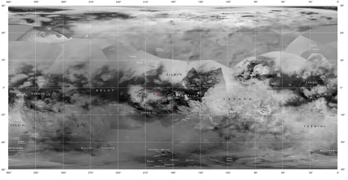
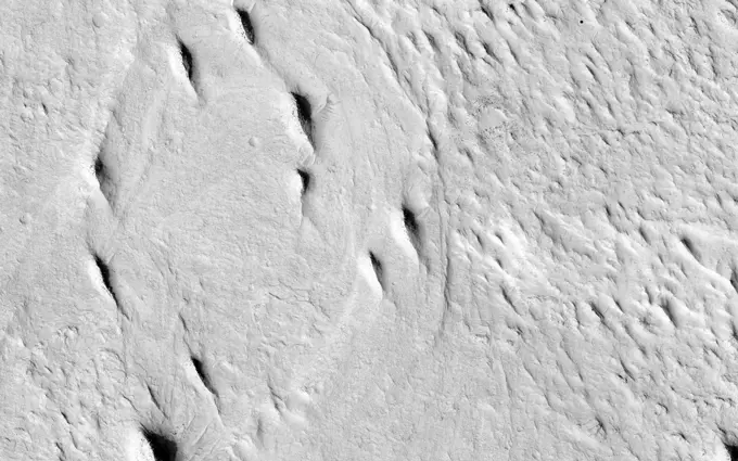
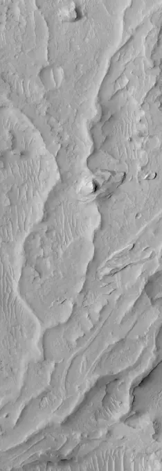
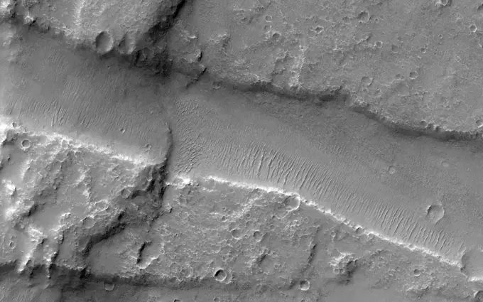
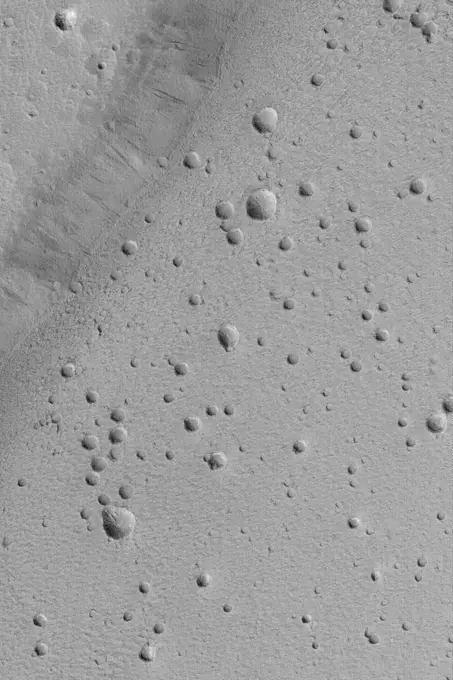
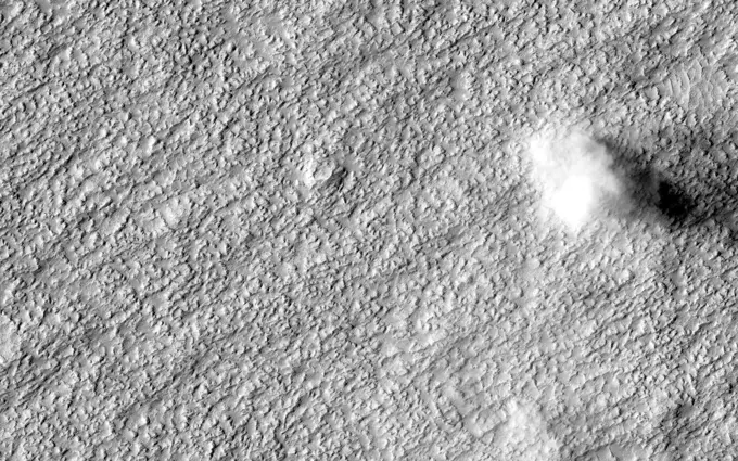
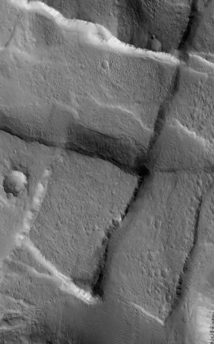
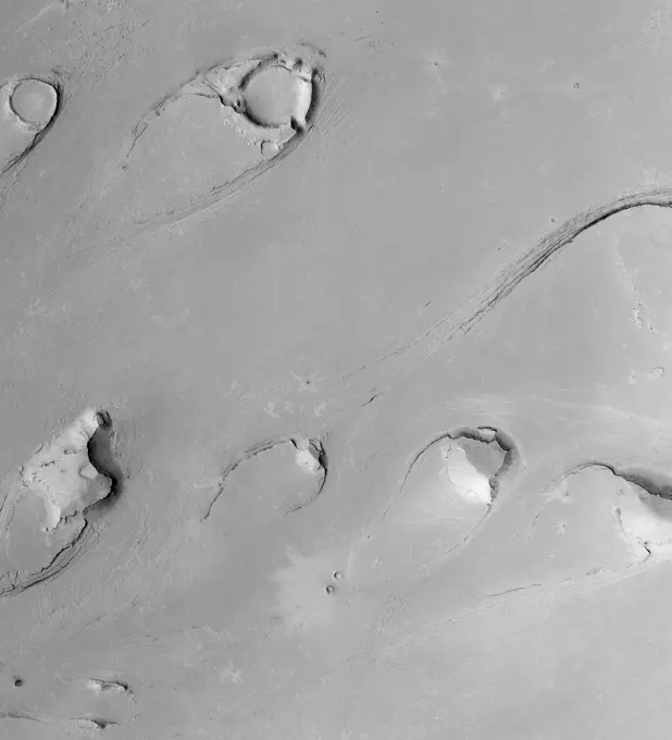
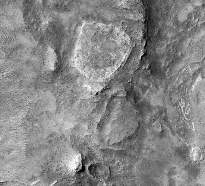
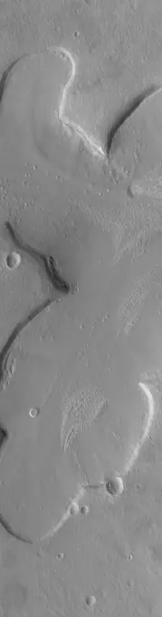
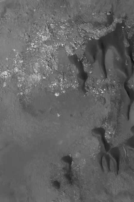
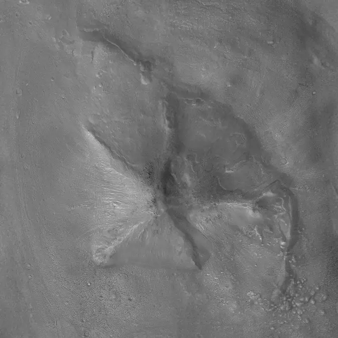
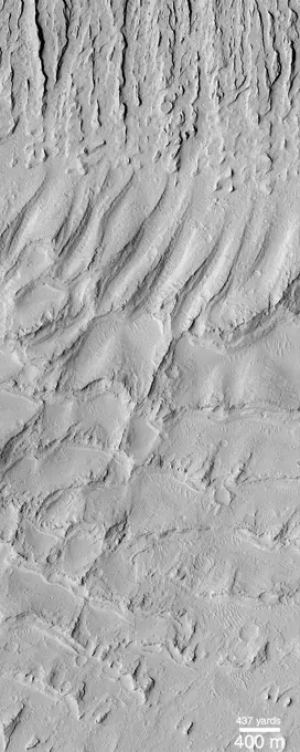
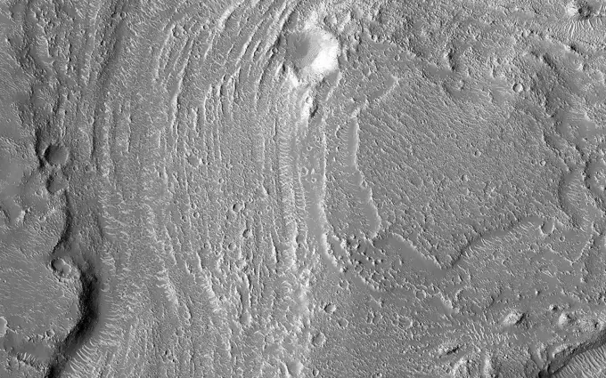
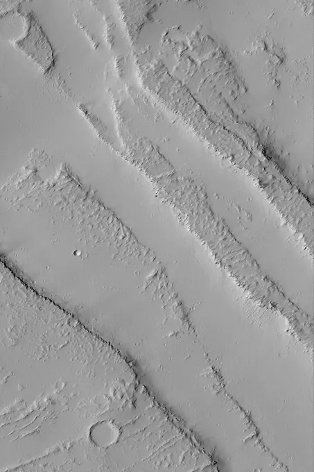
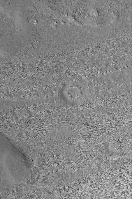
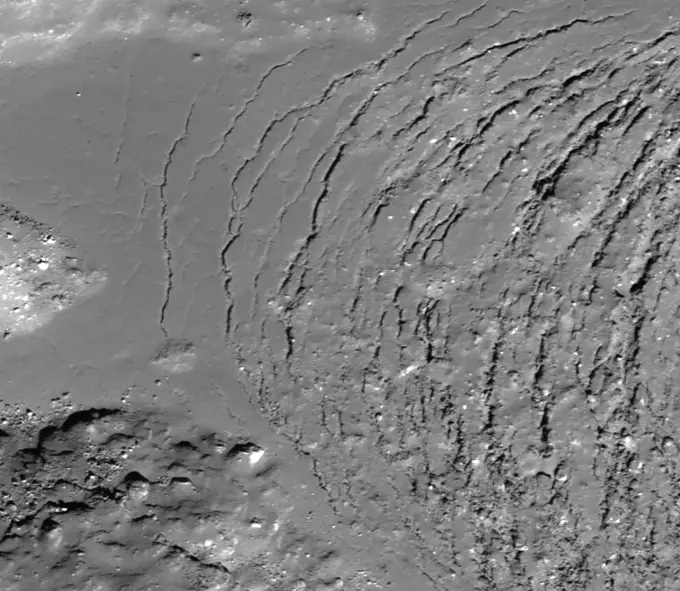
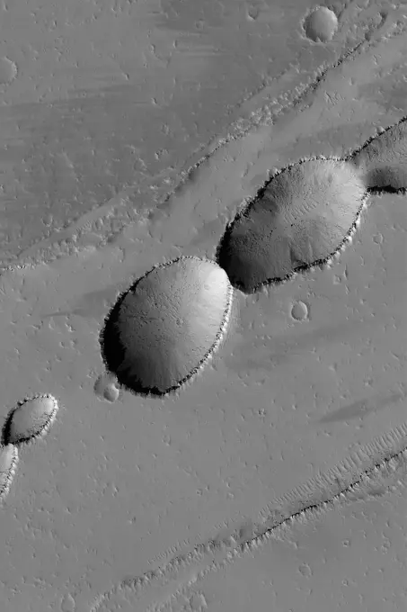
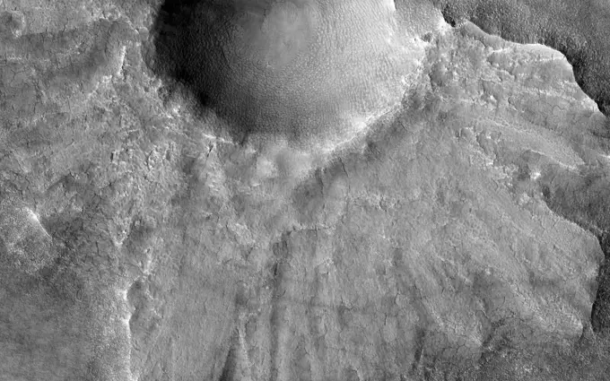
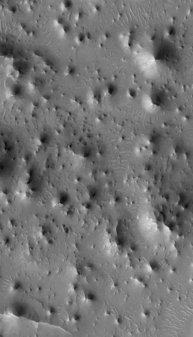
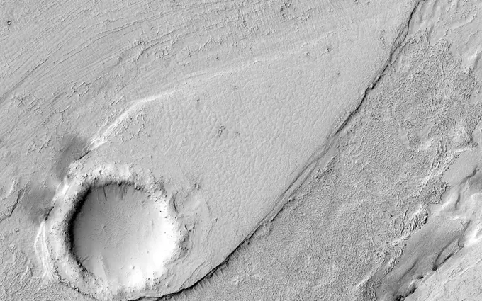
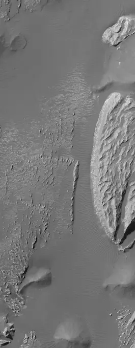
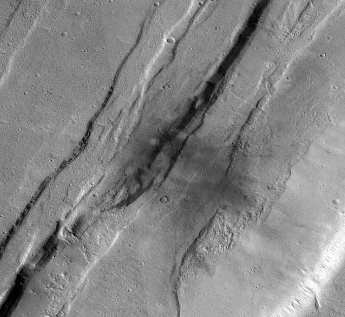
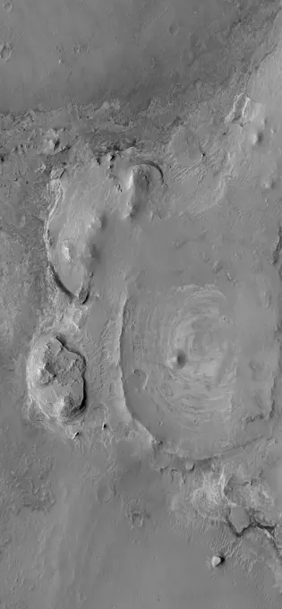
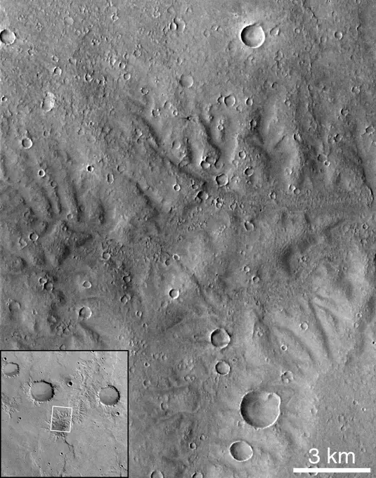
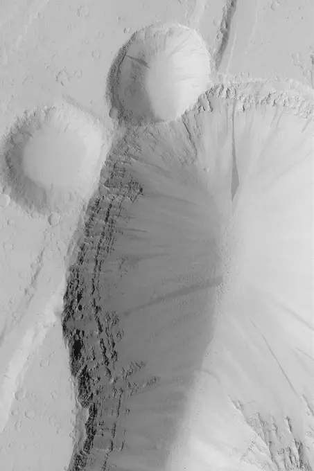
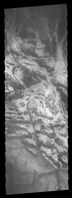
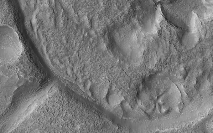
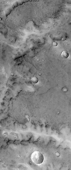
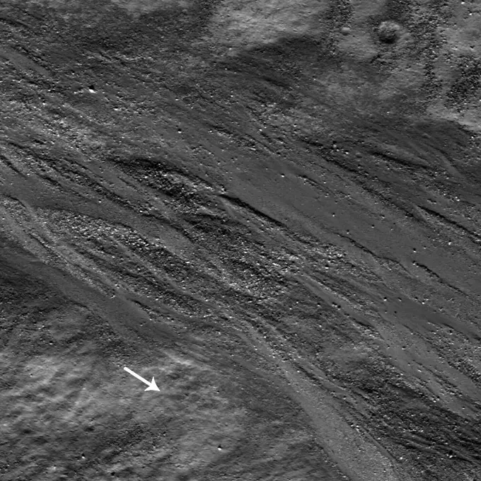
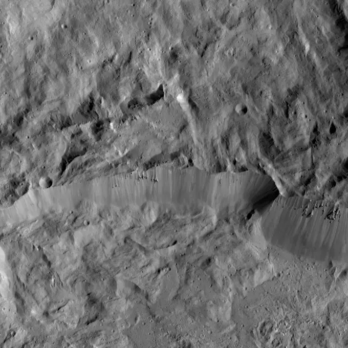
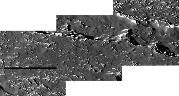
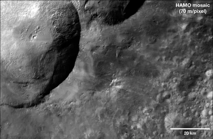
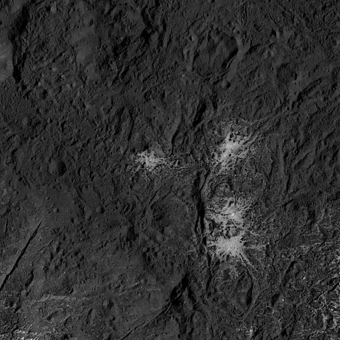
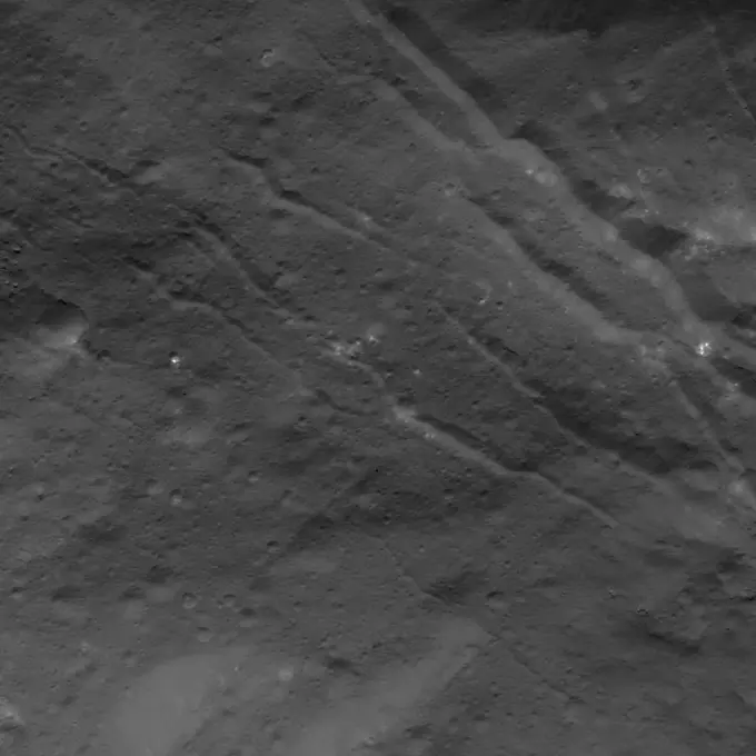
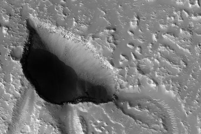
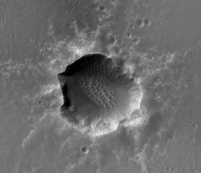
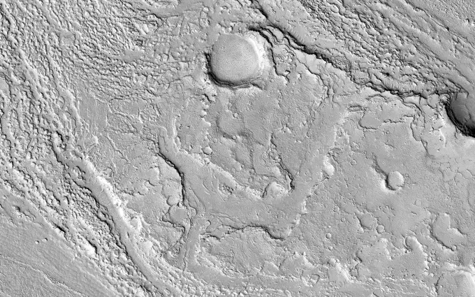
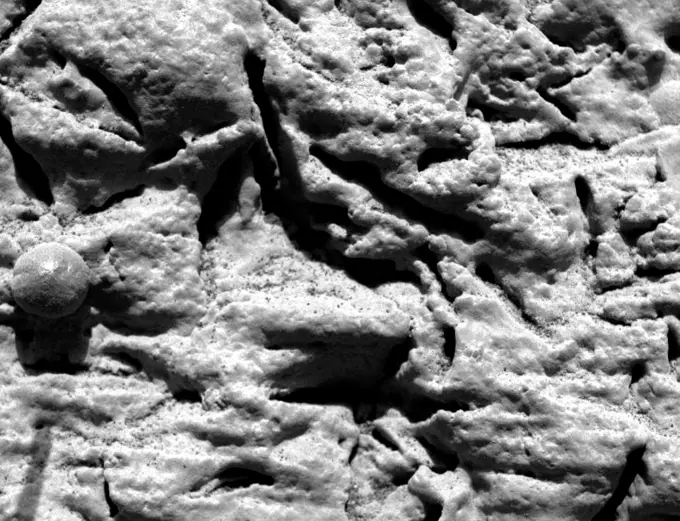
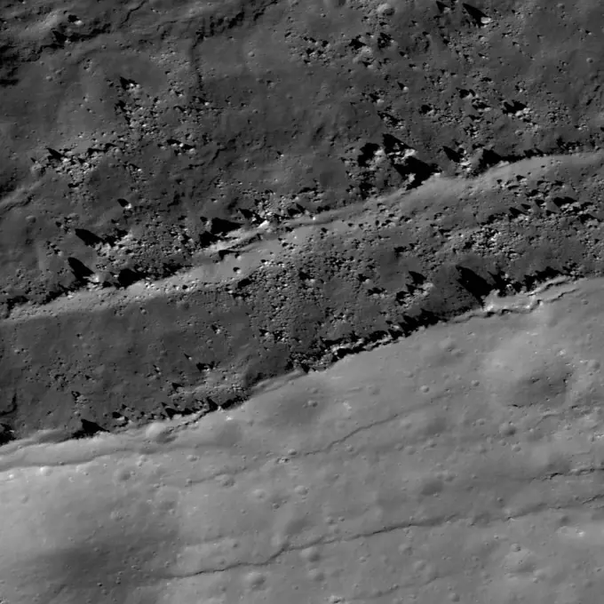
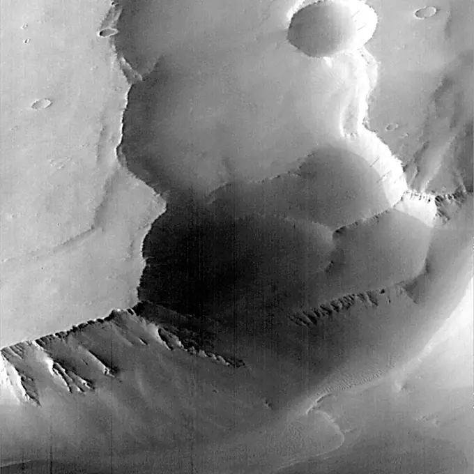
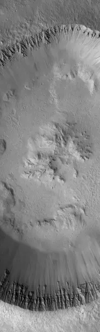
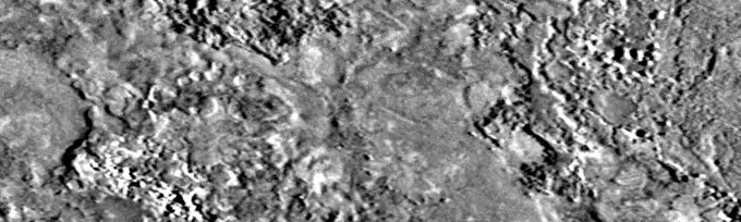
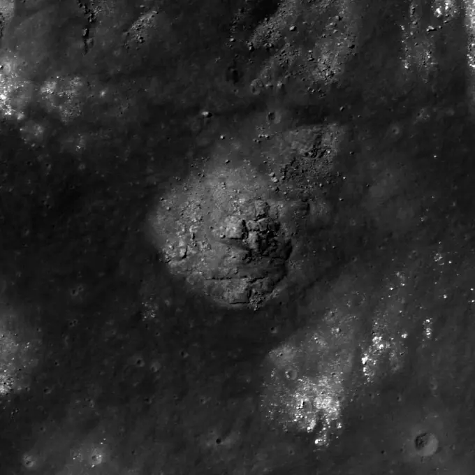
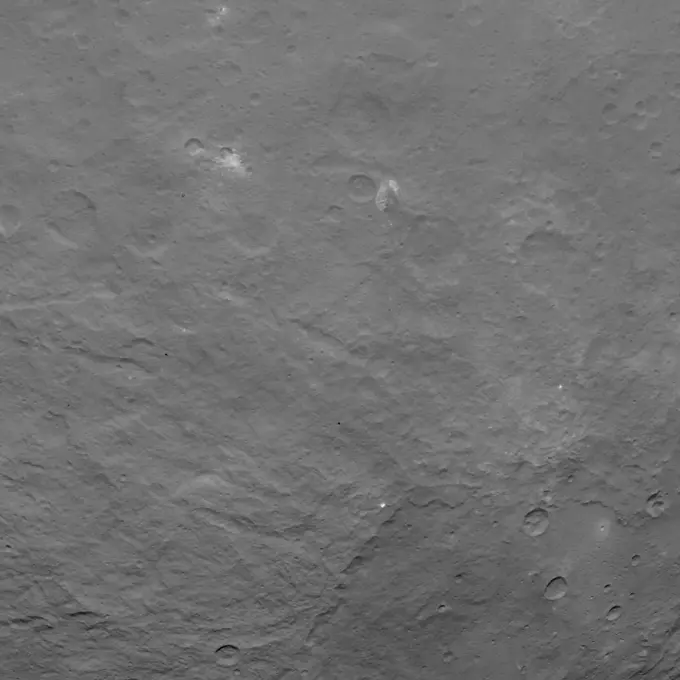
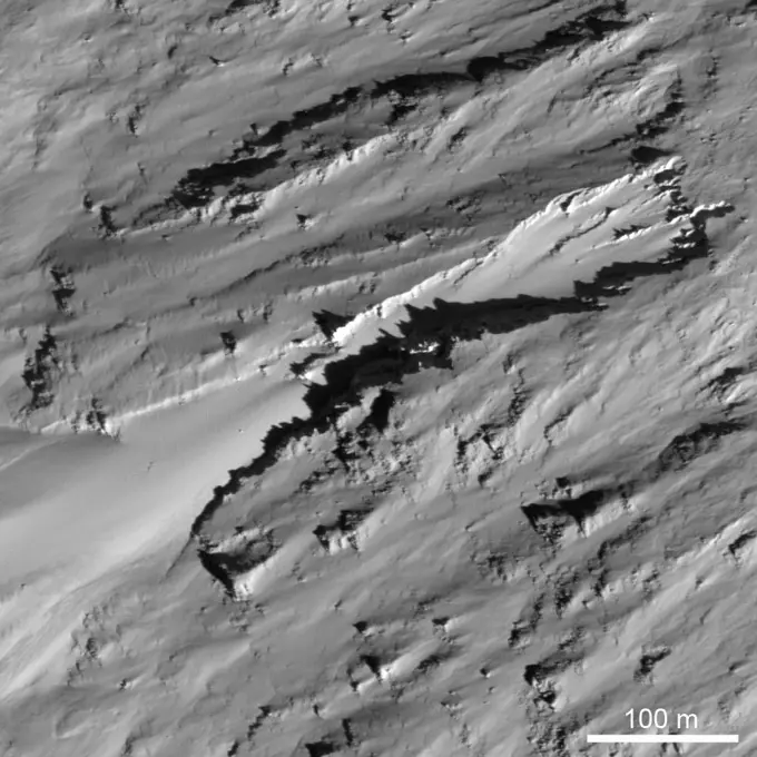
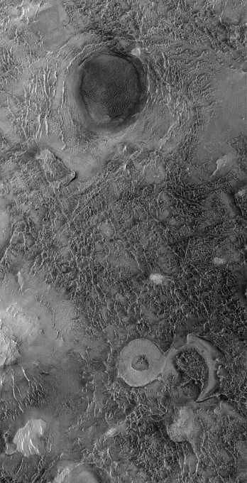
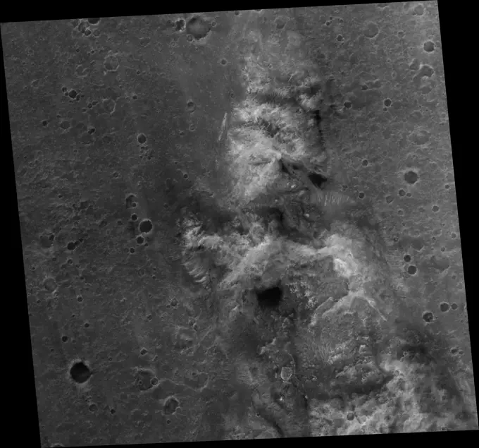
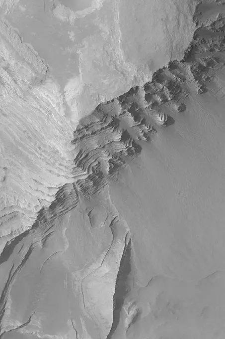
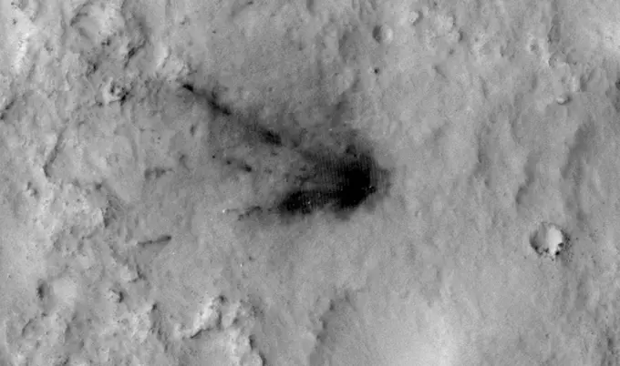
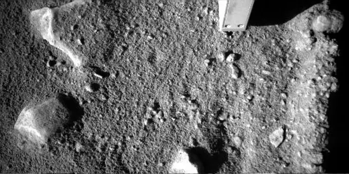
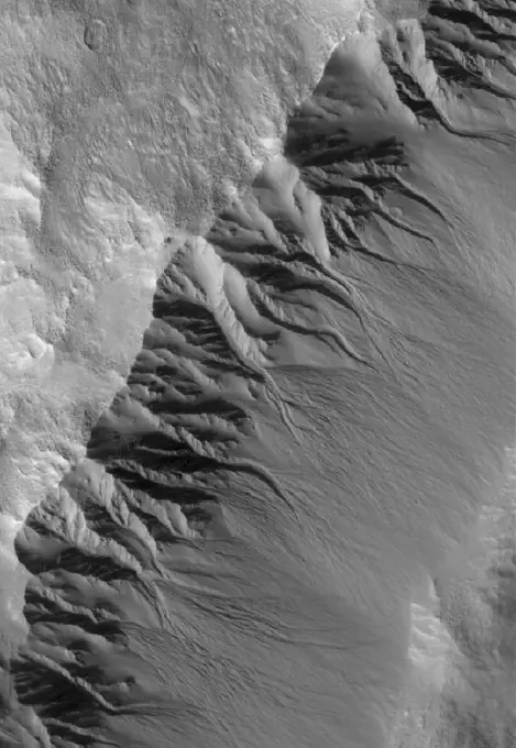
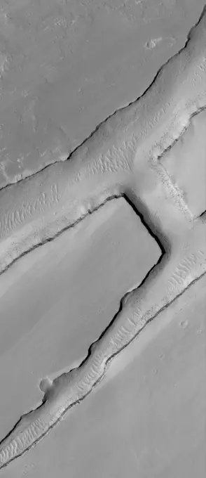
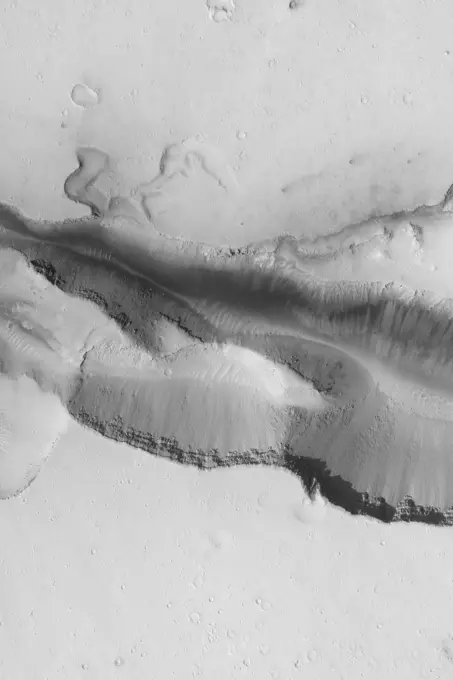
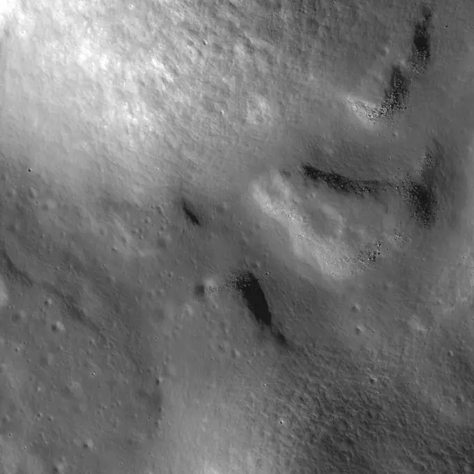
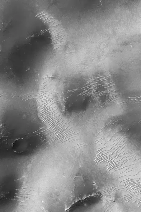
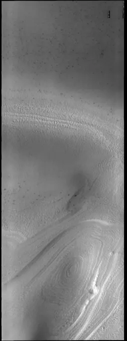
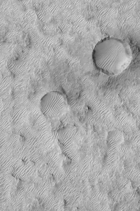
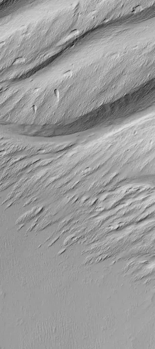
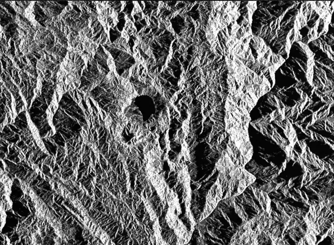
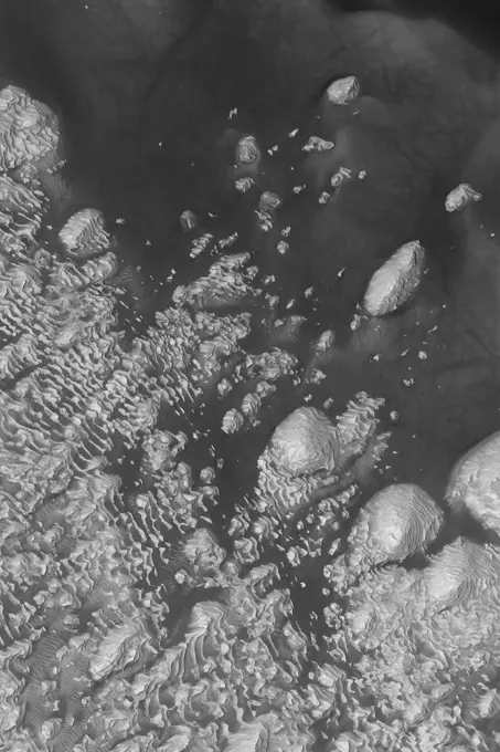
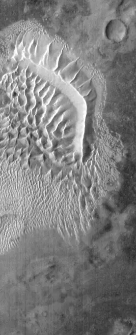
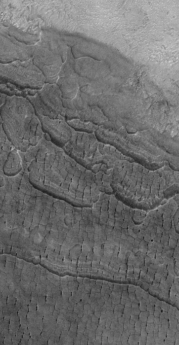
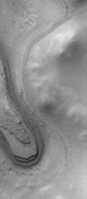
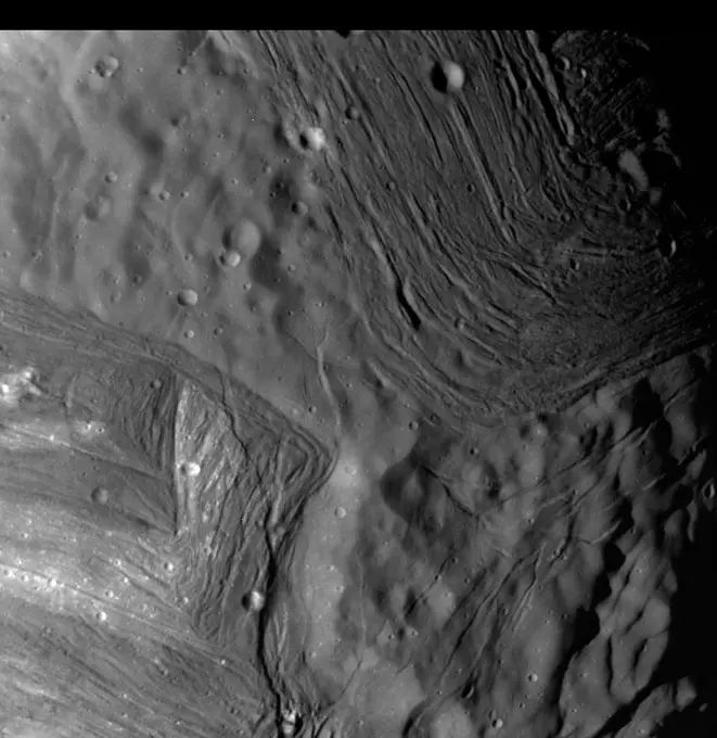
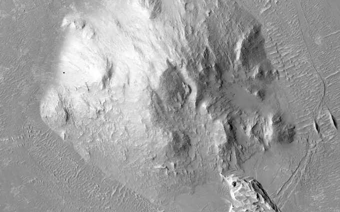
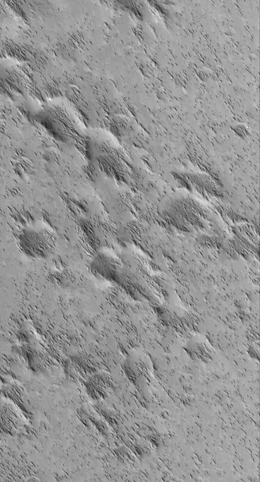
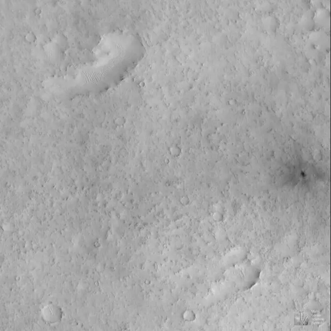
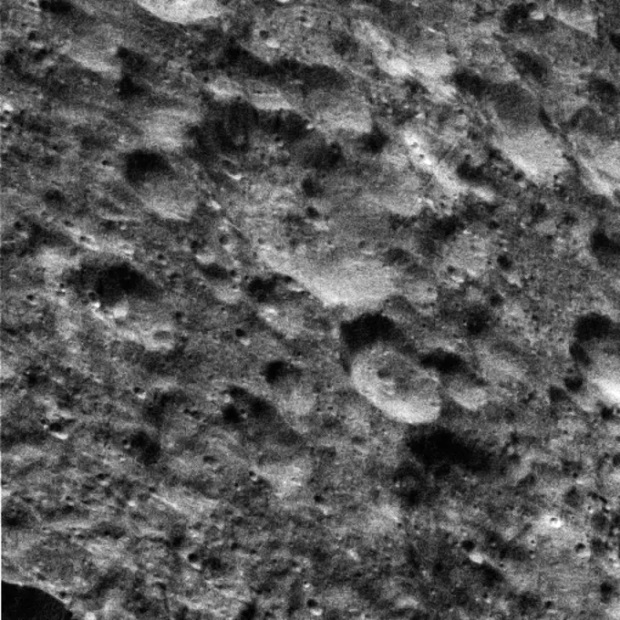
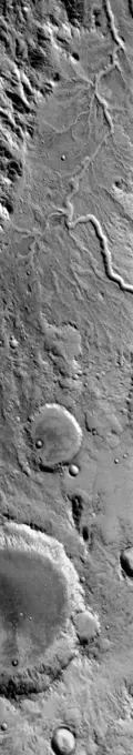
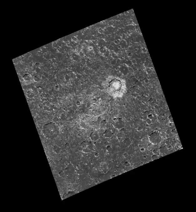
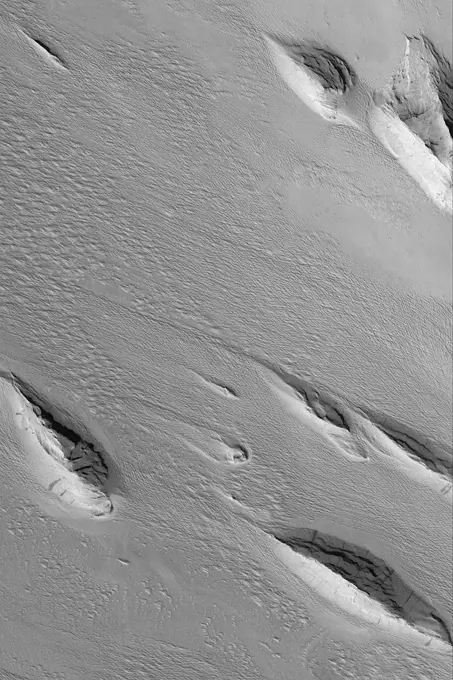
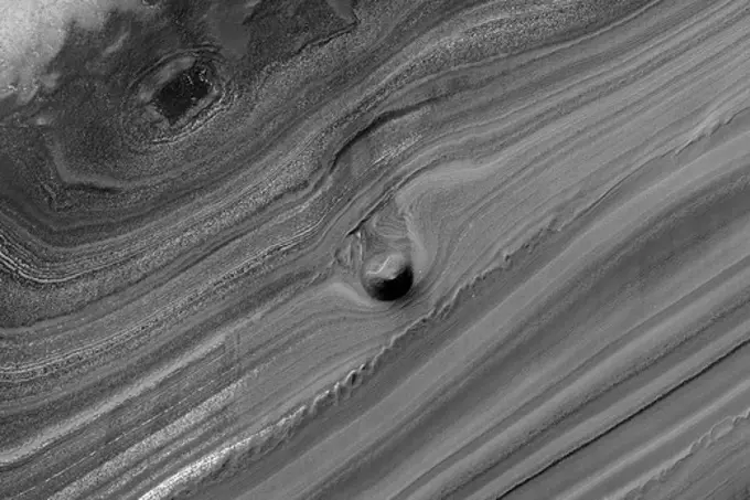
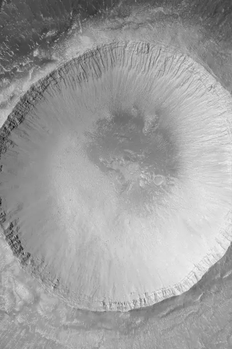
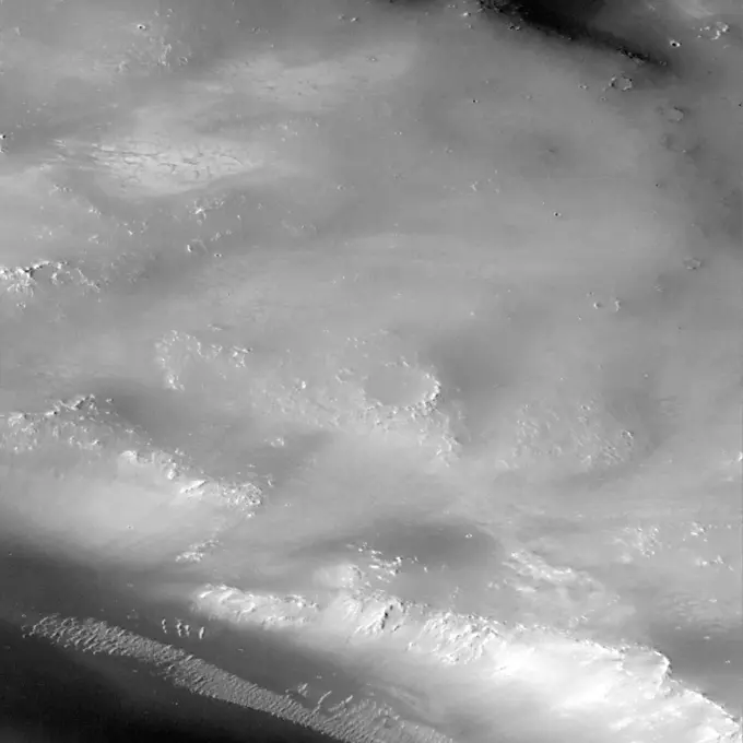
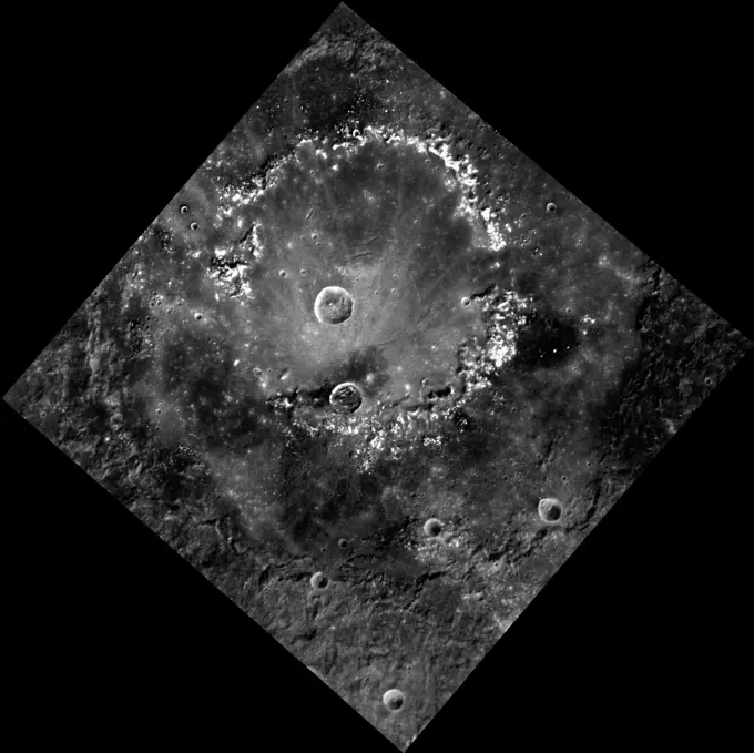
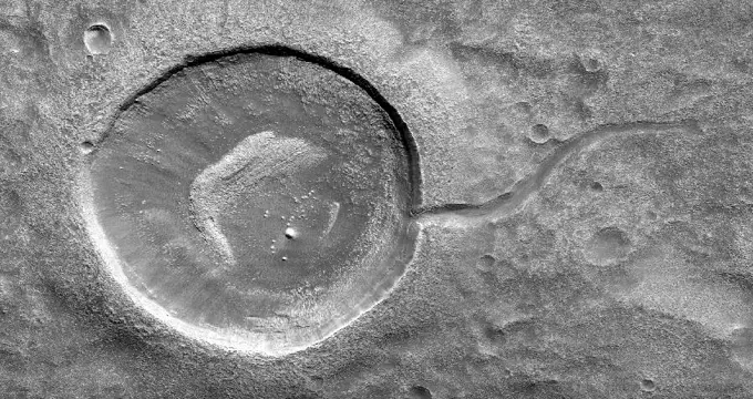
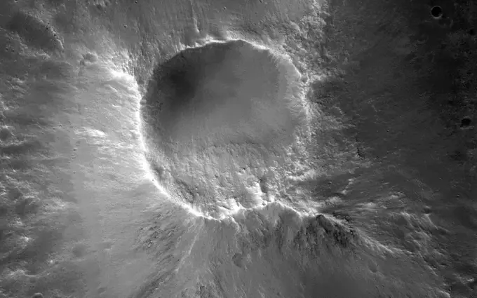
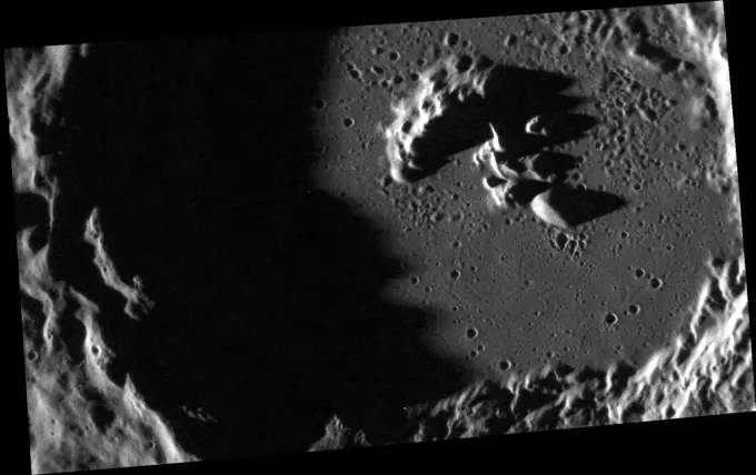
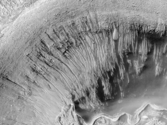
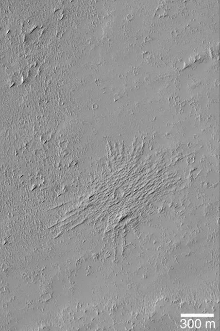
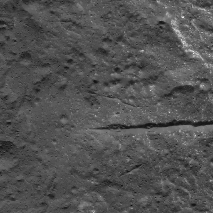
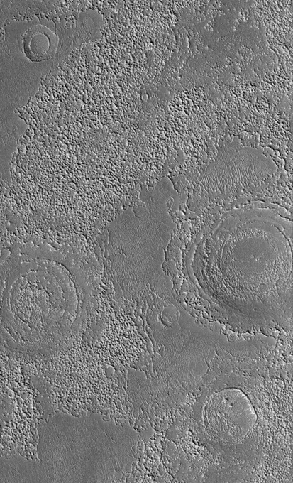
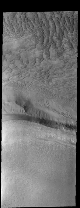
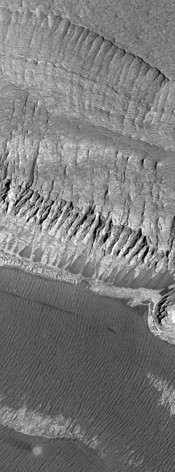
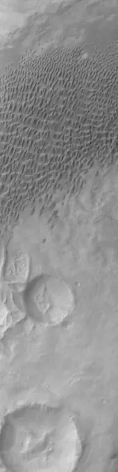
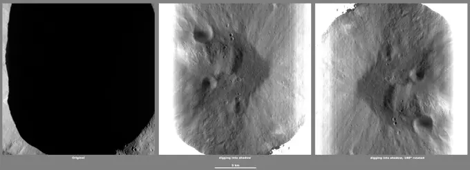
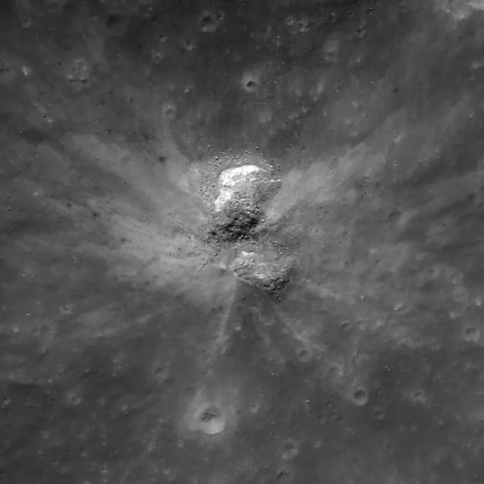
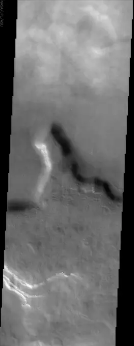
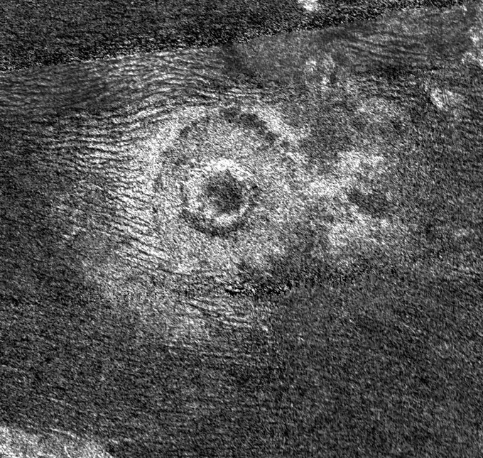
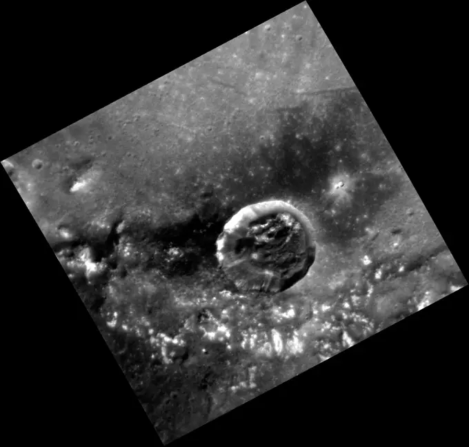
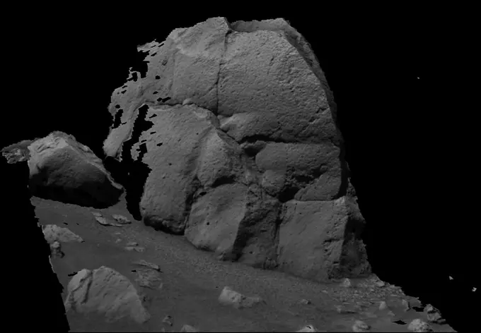
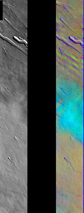
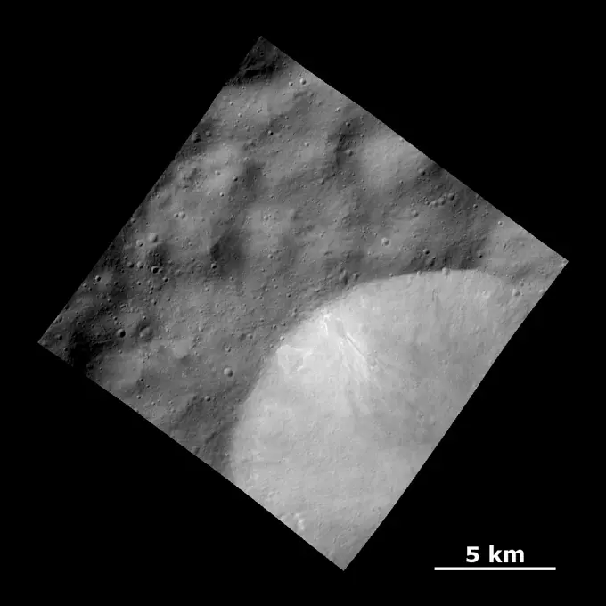
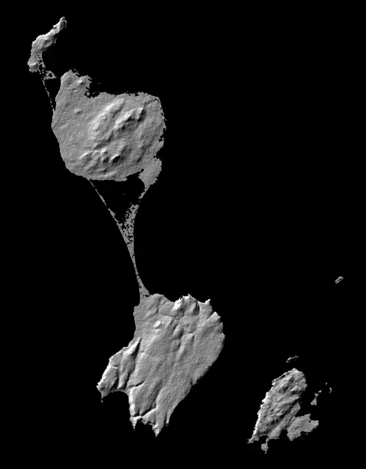
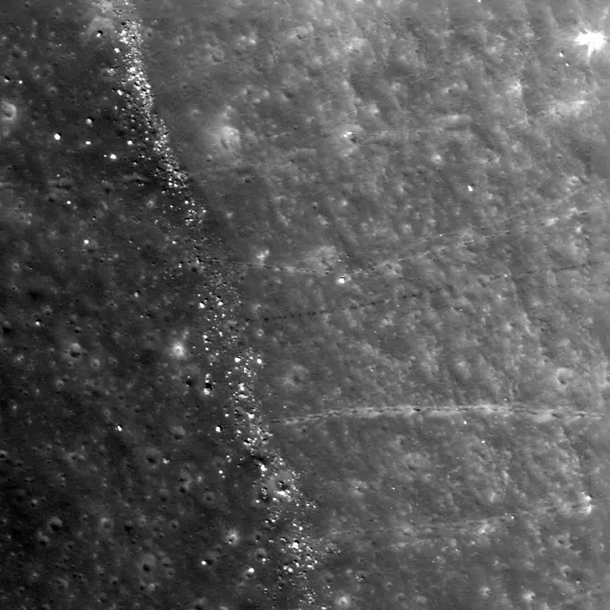
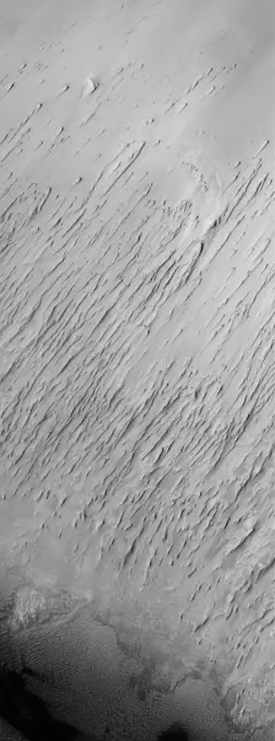
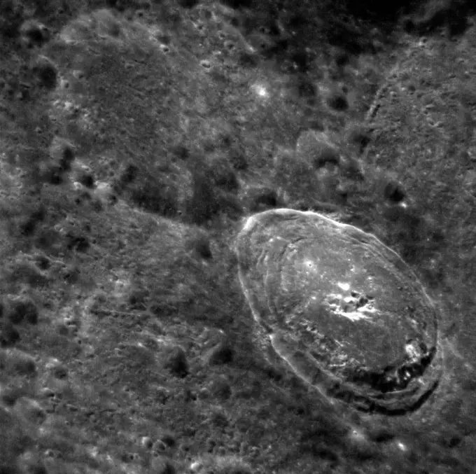
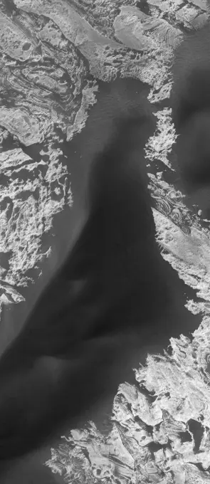
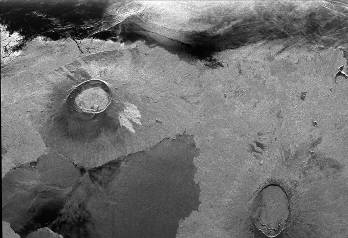
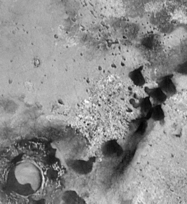
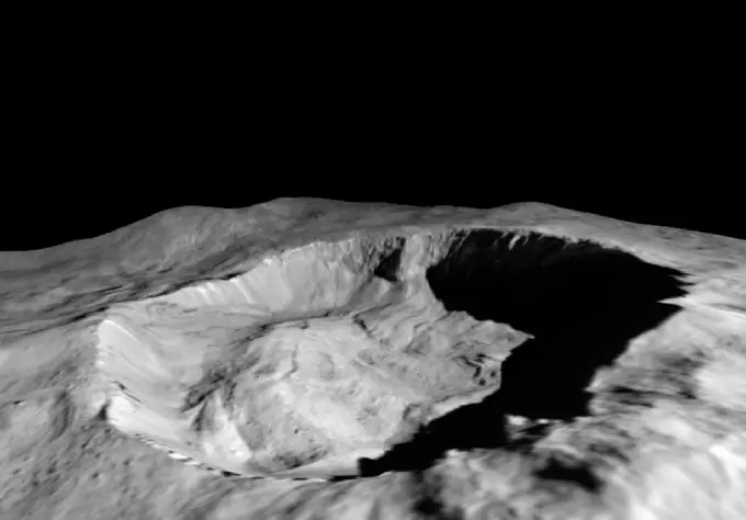
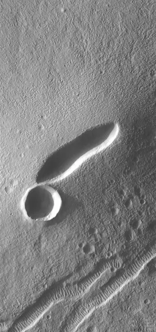
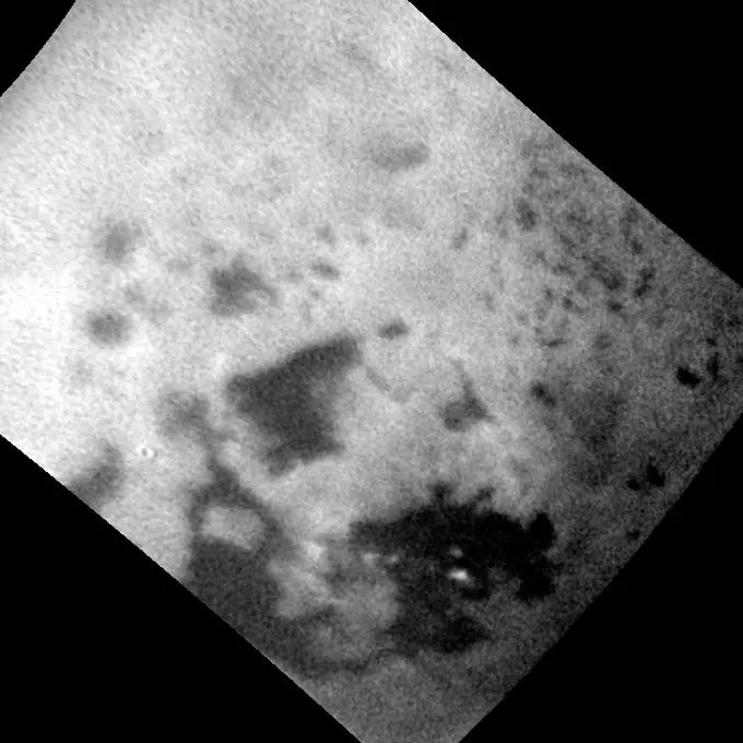
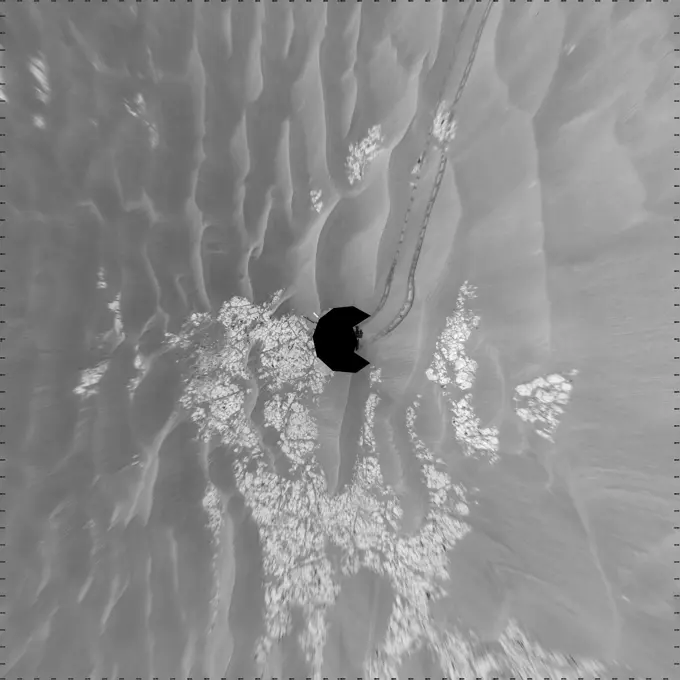
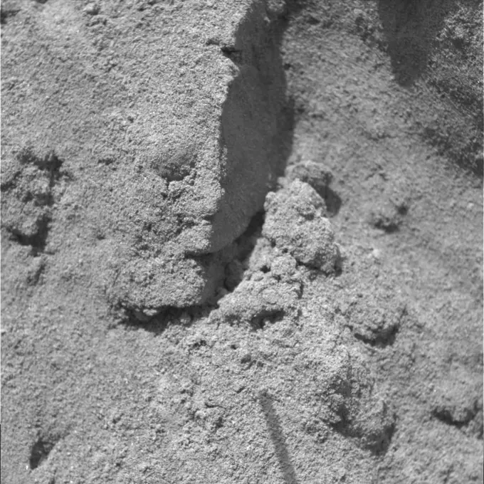
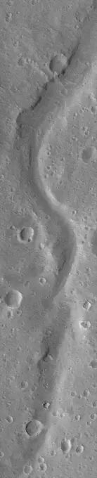
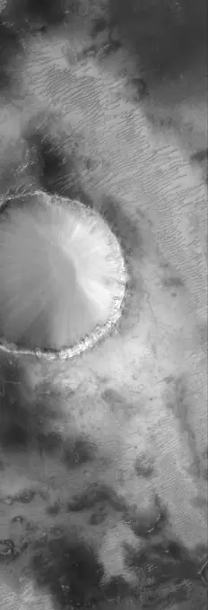
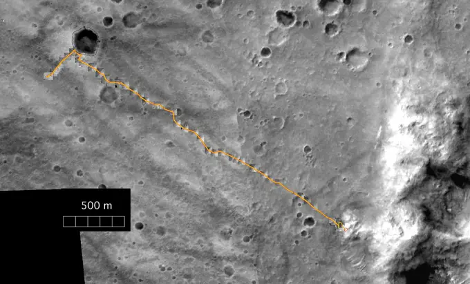
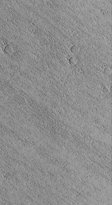
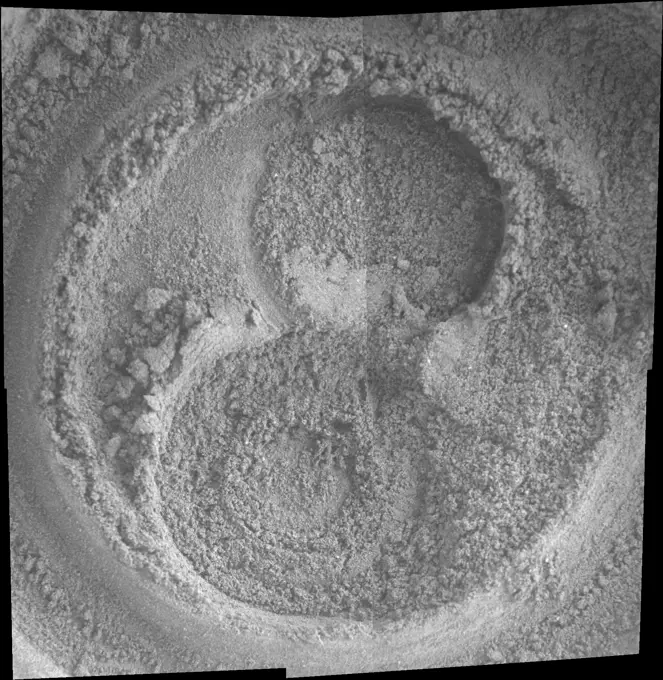
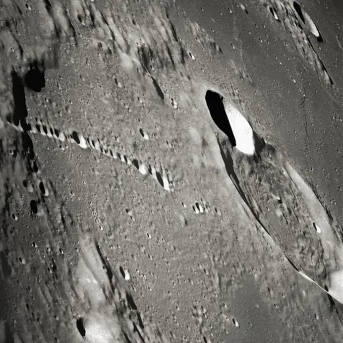
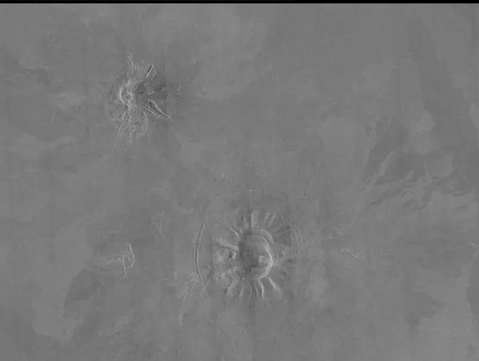
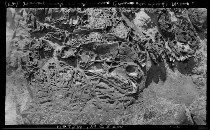
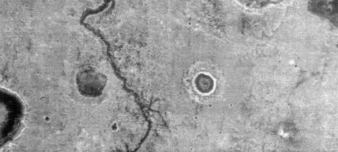
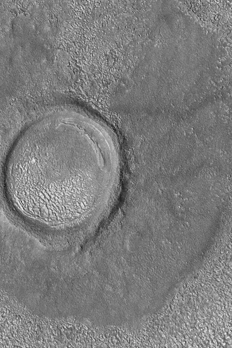
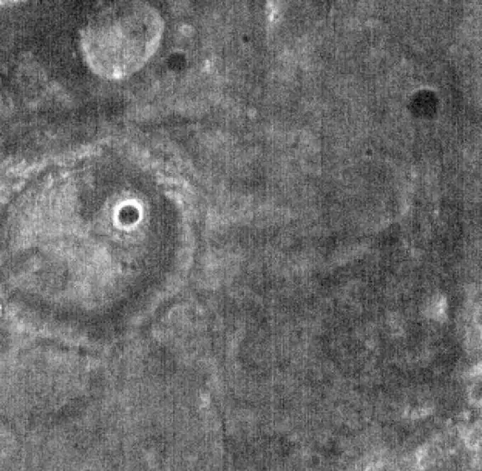
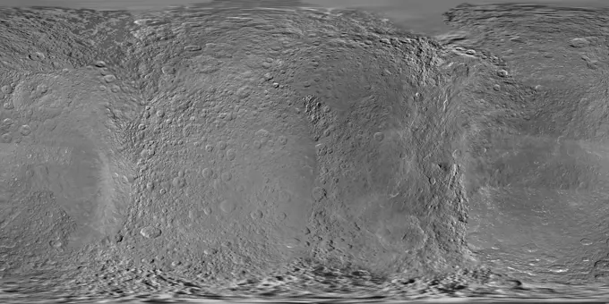
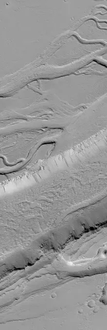
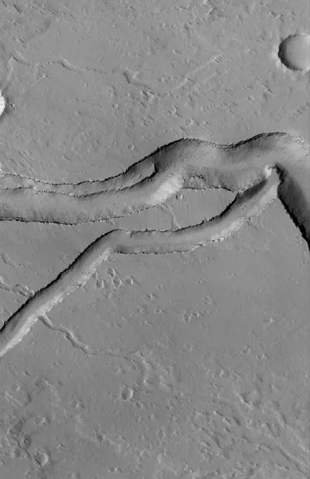
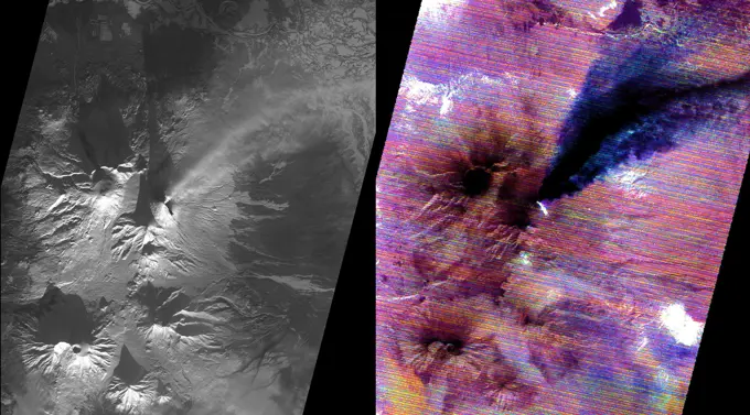
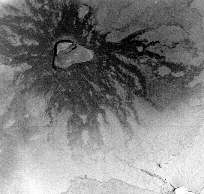
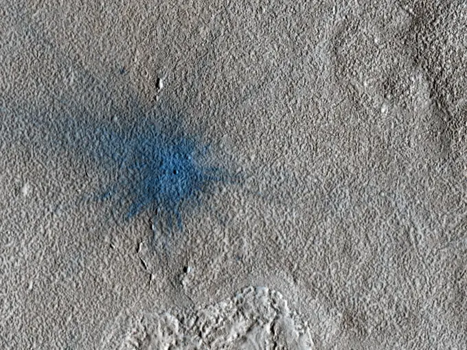
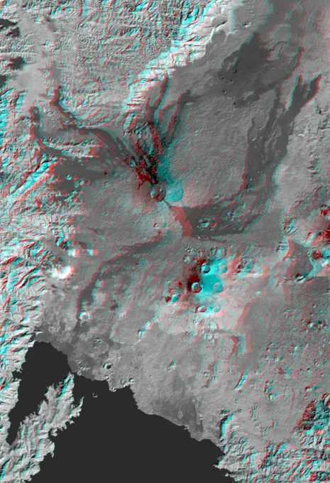
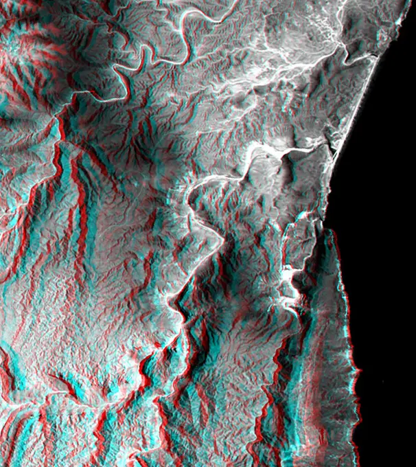
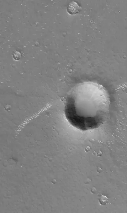
Martian Geological Features

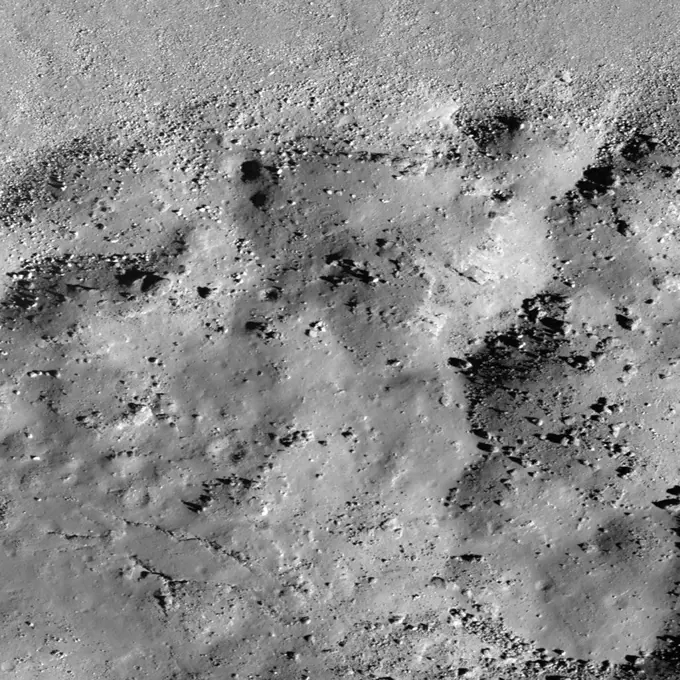
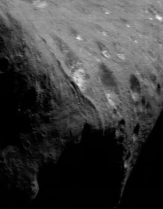
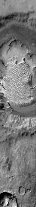
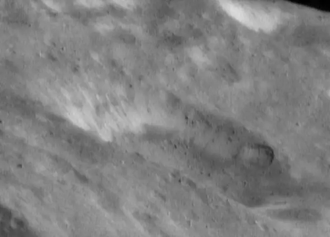
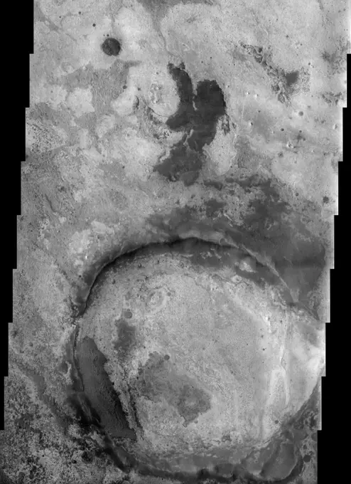
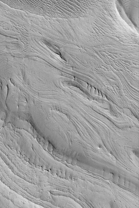
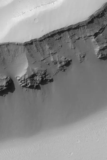
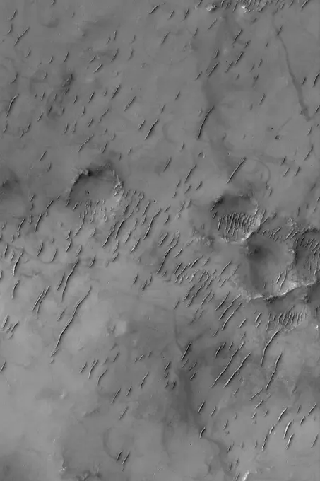
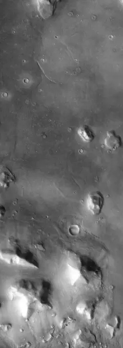
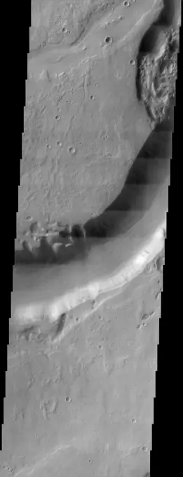
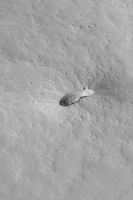
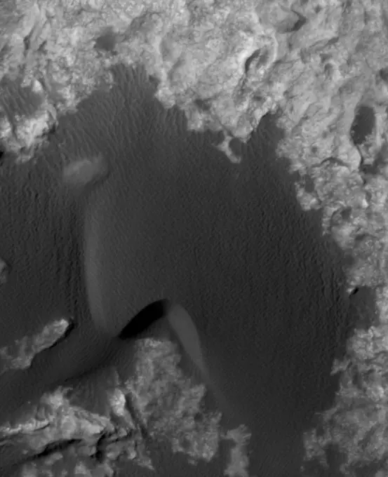
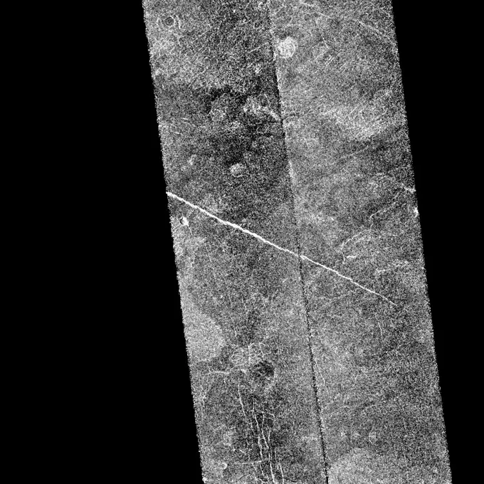
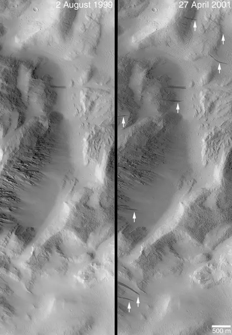
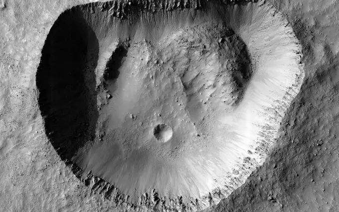
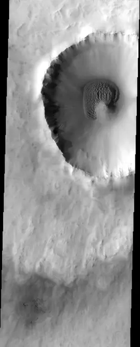
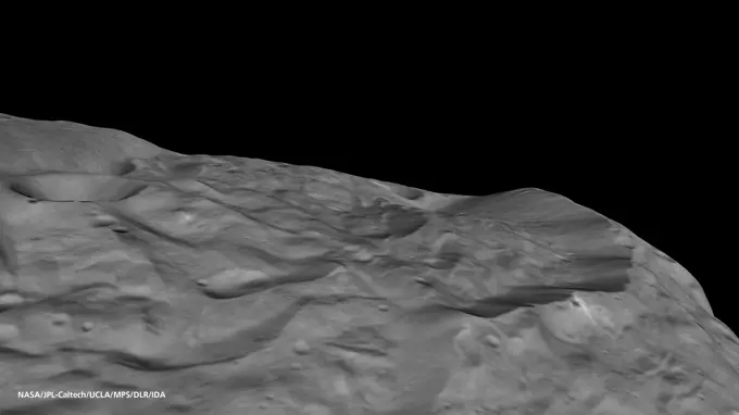
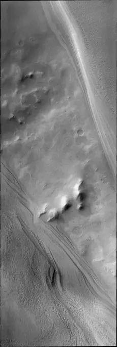
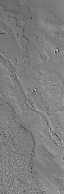
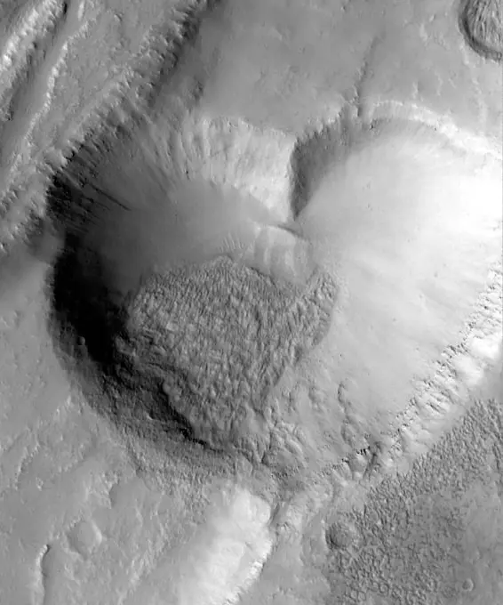
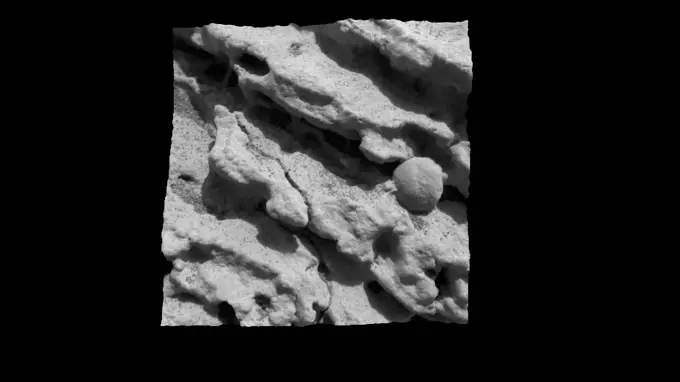
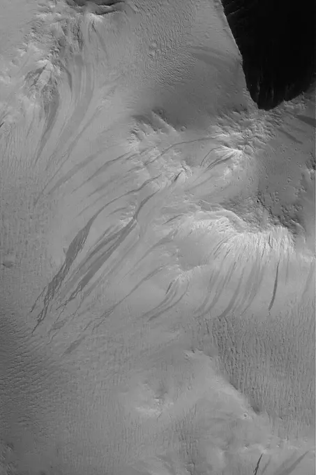
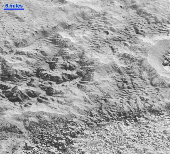
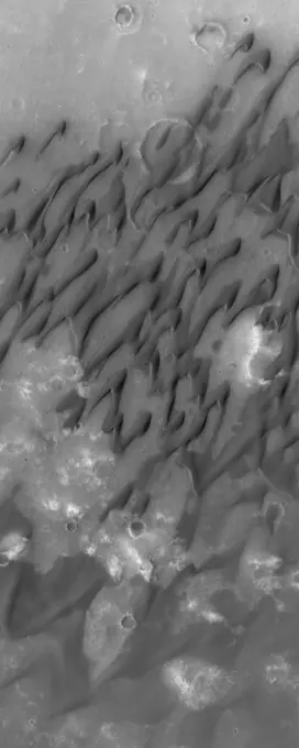
High-resolution images of Mars showing various geological formations, including craters, ridges, and the notable Valles Marineris canyon system.

Sirenum Troughs
Sirenum Troughs

Assets in this Story

6145-44838763
Kepler's Rim
6145-45100061
This image from NASA's Mars Reconnaissance Orbiter spacecraft contains interesting examples of crosscutting, sinuous and straight ridges. Both ridges may be ancient river deposits.
6145-44616058
Large Ripples in Cerberus
6145-44650525
This MOC image shows sinuous ridges and other landforms exposed by erosion in the Aeolis region of Mars
6145-45050526
Melas Chasma is part of the Valles Marineris canyon system, the largest canyon in the Solar System. This image was taken by NASA's Mars Reconnaissance Orbiter.
6145-44620223
Wind Erosion in Aeolis
6145-44602200
Ceraunius Caldera Floor
6145-45061735
The North Polar layered deposits (NPLD) are a stack of layers of ice and dust at the North Pole of Mars. The layers are thought to have been deposited over millions of years. This image is from NASA's Mars Reconnaissance Orbiter.
6145-44631396
Cross-Cutting Faults
6145-44629040
Sirenum Troughs
6145-44586009
Athabasca Vallis Streamlined Islands
6145-44595546
Yardangs and Exhumation
6145-45297175
During periods in Mars' history when the planet had greater axial tilt, shifts in atmospheric circulation may have favored the extensive accumulation of snow in some locations. Protonilus Mensae is just such a site of extensive glaciation. We can see a flow of material through the valleys between a complex of small mesas. Streamlines and flow fronts appear as subtle ridges. Some ridges appear perpendicular to the mesas indicating flow direction. Others appear concentric to the mesas and parallel to the valleys, where debris and now-underlying ice bunched up and moved down valley. Deflation of the ice has led to a rich collection of small-scale features. Polygonal patterns of fractures and fissures may be related to a combination of thermal contraction cycles and overall subsidence of the surface. Larger fractures may be glacial crevasses, caused by differential flow rates in the underlying ice. Other more complex patterns of swirled pits and hummocks may result from the continual loss
6145-44609012
THEMIS Images as Art #14
6145-44606492
Terby Sedimentary Rocks
6145-44639624
Double Impact
6145-44664415
Spirit's Winter Work Site
6145-44625349
Fretted Terrain Valleys
6145-44631349
Stokes Crater Dunes
6145-45256634
Images of the Cydonia region of Mars continue to be popular among visitors to the Mars Global Surveyor (MGS) Mars Orbiter Camera (MOC)web site. The two pictures (one annotated, the other not) are mosaics of two images from MGS MOC and one from the Mars Odyssey Thermal Emission Imaging System visible camera (THEMIS VIS). The mosaics highlight a Cydonia landform popularly known as the D&M Pyramid. It is located near 40.7°N, 9.6°W. Although it is not really shaped like a pyramid, the Cydonia landform is one of thousands of massifs, buttes, mesas, knobs, and blocks that mark the transition from the far northwestern Arabia Terra cratered highlands down to the northeastern Acidalia Planitia lowlands. Each block, whether shaped like a face, a pyramid, or simply a mesa, massif, or knob, is a remnant of the bedrock of northeastern Arabia that was left behind as erosion slowly degraded the terrain along this zone between the highlands and the lowlands. A few outcroppings of layers in this ancien
6145-44505033
Ancient Paleo-Dunes Battered by Impact Craters
6145-58971813
Granicus Valles form a low-lying complex of channel systems located west of the volcano Elysium Mons. They are one of several larger systems known as outflow channels because the water source is from the subsurface. In this case, Granicus Valles emanate from a series of fractures on the western flank of Elysium Mons. In this image, large, streamlined features and grooves have been carved by enormous water volumes into the floor of Granicus and point to the direction of flow towards the northwest. The floods of Granicus Valles are thought to have formed later in Mars history during the Amazonian epoch, several billion years ago.
6145-44602403
Dusty Troughs
6145-44624845
Degraded Crater
6145-44653733
This MOC image shows gullies a portion of a flood-carved canyon within the larger Kasei Valles system on Mars. This canyon is the result of the very last flood event that poured through the Kasei valleys, long ago
6145-44648189
Back by popular demand: THEMIS ART IMAGE #61 With an impact crater for an eye - this layer of material resembles a large fish
6145-44592361
Landslide in Kasei Valles
6145-44561752
Medusae Fossae #1
6145-44628821
Exhumed Flows
6145-44620748
West Olympica Fossae
6145-45105990
The trio of ridges on Titan known as Mithrim Montes is home to the hazy Saturnian moon's tallest peak. The mountain is located midway along the lower of the three ridges shown in this radar image from NASA's Cassini spacecraft.
6145-44637383
Wind Streak in Daedalia
6145-44647148
This MOC image shows a portion of the floor and wall of a trough in the Acheron Fossae region of Mars. Mass movements of dry dust, which appears to mantle much of the scene, have created the dark slope streaks on the wall of the trough
6145-44659189
This MOC image shows the patterned ground of the cold, martian northern plains. The circular features are the sites of buried impact craters
6145-44510855
Mars Boulders: On a Hill in Utopia Planitia
6145-44631677
East Candor Outcrops
1746-19670844
Frozen impact melt flows on the floor of Moore F, a farside highlands crater.
6145-44617839
Pits Near Rhabon Valles
6145-45066966
This image from NASA's Mars Reconnaissance Orbiter shows what is termed a pedestal crater, so-called because the level of the surface adjacent to the crater is elevated relative to the surface of the surrounding terrain.
6145-45116783
The Tharsis region of Mars is covered in vast lava flows, many with channels, as seen by NASA's Mars Reconnaissance Orbiter. Some channels, however, resemble features that may have been formed by water.
6145-44632702
Knobby Eastern Arabia
6145-45115504
This image from NASA's Mars Reconnaissance Orbiter shows a large field of sand dunes on Kaiser Crater. They are partially free of seasonal ice, with the contrast making it easy to see the ripples.
6145-44624853
Arsinoes Chaos Landforms
6145-44493286
Context Camera Views a Mars Impact Crater in Tempe Terra. This meteoroid impact crater on Mars was captured using the black-and-white Context Camera aboard NASA's Mars Reconnaissance Orbiter (MRO). The Context Camera took this image showing the impact, which occurred Sept. 18, 2021, in a region called Tempe Terra. The meteoroid struck the side of a graben - a depression created by faults. The impact crater left behind is roughly 427 feet (130 meters) across.
6145-44625633
Northern Meridiani Scene
6145-44886307
This image from NASA's Dawn spacecraft of asteroid Vesta shows two craters, one that has been named Canuleia and one that has been named Sossia.
6145-44572872
Dissected Terrain Near Parana Valles
6145-44602466
Pits and Layers
6145-44562023
Pwyll Crater on Europa
6145-44639113
This image of the polar region illustrates the effect of the sun on polar frost. The highstanding ridges have lost all their frost cover, while the lows shaded by the ridges still have a bright frost cover
6145-44506485
A Complex, Ridged Terrain in North Terra Cimmeria
6145-58971975
This crater is approximately 2.3 kilometers across and is located in northern Arabia Terra near where the cratered highlands meets the northern lowlands (called a dichotomy boundary ). Small craters with an exit channel, such as this one, are nicknamed pollywog craters, as they resemble tadpoles. The channel is consistent with flow *out of* the crater, rather than flow *into* the crater, because 1) the valleys do not cut down to the level of the interior crater floor, and 2) there are no deposits of material on the floor associated with the mouth of the valley. This small crater was probably once filled with an ice-covered lake that overflowed, forming the exit channel. Young craters with exit channels are intriguing because they record a relatively recent (during the Amazonian epoch) wet environment on Mars.
6145-44571259
Mars Water: Valley Networks
6145-44789629
High-albedo marks on the lunar surface left by a boulder bouncing down the northeast wall of farside highlands crater Moore F in this image captured by NASA's Lunar Reconnaissance Orbiter.
6145-45110856
This picture captured by NASA's Dawn spacecraft shows a portion of the northern rim of Occator Crater, which measures 57 miles (92 kilometers) across and 2.5 miles (4 kilometers) deep.
6145-44559172
Callisto Crater Chain Mosaic
6145-44881306
This mosaic from NASA's Dawn spacecraft shows dark material near a series of craters known as the 'snowman' on asteroid Vesta. That ejected material is a complex mixture of components.
6145-45264866
This image was obtained by NASA's Dawn spacecraft on July 24, 2018 from an altitude of about 89 miles (143 kilometers). NASA announced the conclusion of Dawn's mission operations was Oct. 31, 2018, when the spacecraft depleted its hydrazine. The center of this feature is located at about 18.5 degrees north latitude and 240.9 degrees east longitude, in the eastern part of Occator Crater. Occator Crater is named after the Roman agricultural deity of the harrowing, a helper of Ceres, the goddess of agriculture, grain crops, fertility and motherly relationships.
6145-45264884
This image was obtained by NASA's Dawn spacecraft on July 3, 2018 from an altitude of about 22 miles (35 kilometers). The center of this picture is located at about 14.4 degrees north latitude and 241.4 degrees east longitude.
6145-45125528
NASA's Mars Reconnaissance Orbiter captured this image of Hebrus Valles, located in the plains of the Northern lowlands, just west of the Elysium volcanic region.
6145-44804424
This image taken NASA's Lunar Reconnaissance Orbiter shows the wall of crater Van de Graaff C, where brighter material is exposed by more active processes associated with steeper slopes, recent small craters, and even individual rolling boulders.
6145-44841790
This image of Santa Maria Crater was taken by HiRISE camera on NASA's Mars Reconnaissance Orbiter where NASA's rover Opportunity approached Santa Maria Crater in December 2010.
6145-45265899
This image in Athabasca Valles shows lava flows originating from Elysium Mons to the northwest. A Context Camera image shows the lava flowed from the northwest to the southeast, diverting around obstacles as it settled. (The flow is outlined in blue with the flow direction shown in yellow, and the approximate location of the HiRISE image is represented by a white rectangle.) The lava appears to have flowed smoothly around obstructions, almost like water, forming streamlined islands. In the southern part of this image, a branch of the flow diverts around a small crater, and eventually rejoins the main part of the flow. Irregular-shaped ring structures appear on the northern end and are related to the volcanic activity that formed the flows. We also see a dense cluster of secondary craters that formed when material ejected from Corinto Crater (to the northwest) impacted the surface at high speed. At full-resolution, this terrain has the distinctive appearance of a field of numerous, smal
6145-44611267
'Blueberry' Layers Indicate Watery Origins
6145-44644065
Marte Vallis Textures
6145-44596383
Gullies in Terraced Crater Wall
1746-19670923
Fractured and slumping rim of Klute W crater.
6145-44557089
MGS Views of Labyrinthus Noctis
6145-44622761
Impact Crater
6145-44498270
Highest Resolution Image Ever Obtained of Io
6145-44838199
Gassendi A
6145-45094411
This image, taken on June 18, 2015 by NASA's Dawn spacecraft, shows dwarf planet Ceres from an altitude of 2,700 miles (4,400 kilometers) -- a mountain 3 miles (5 kilometers) high, surrounded by relatively smooth terrain, can be seen here.
6145-44839801
Erosional Trough on Crater Wall
6145-44628261
Antoniadi's Floor
6145-44639892
Spirit Rover on 'Husband Hill'
1746-19670909
Bottom of Laplace A crater cavity.
6145-44506446
Eros'North Pole
6145-44789074
The Thermal Emission Imaging System aboard NASA's Mars Odyssey captured this daytime infrared image of Rabe Crater shows the large dune field located within the crater. Note that the dunes are not confined to the lowest elevation depressions on the
6145-44506461
Rock Bands
6145-44592638
This image by NASA's Mars Odyssey illustrates the complex terrains within Terra Meridiani. This general region is one of the more complex on Mars, with a rich array of sedimentary, volcanic, and impact surfaces that span a wide range of Martian history.
6145-44602726
East Candor Layers
6145-44619142
Terra Sirenum Slope
6145-44620479
Ancient Bedforms
6145-44598233
Layers in Terby Crater
6145-45091634
This frame from a sequence of images shows a blast zone where the sky crane from NASA's Curiosity rover mission hit the ground after setting the rover down in August 2012. The images are from HiRISE on NASA's Mars Reconnaissance Orbiter.
6145-44731120
Phoenix's Probe Inserted in Martian Soil
6145-44632179
Gullied Crater Wall
6145-44648729
This MOC image shows a small portion of a dust-covered plain directly north of Labyrinthus Noctis which is cut by three linear troughs
6145-44600626
Cerberus Fossae Trough
6145-44796665
A bottleneck at the start of the lunar sinuous rille within Vallis Alpes formed several morphologic features including a lava pond, a breached dam, and an island in the rille in this image captured by NASA's Lunar Reconnaissance Orbiter.
6145-44625086
Sinus Sabaeus Scene
6145-45113979
Southern hemisphere spring has arrived at the south polar cap. The ice layers that make up the cap are easily seen in this image from NASA's 2001 Mars Odyssey spacecraft.
6145-44603584
Rippled Mars
6145-44650831
This MOC image shows a contact between a dust-covered plain and a dust-mantled, textured upland in the Memnonia Sulci region of Mars
6145-44572555
This is a radar image of a little known volcano in northern Colombia. The image was acquired on orbit 80 of space shuttle Endeavour on April 14, 1994, by NASA's Spaceborne Imaging Radar C/X-Band Synthetic Aperture Radar (SIR-C/X-SAR).
6145-44621962
Sedimentary Rocks of 8N, 7W
6145-44678070
Russell Crater - IR
6145-44658957
This MOC image shows cracked, layered plains-forming material in the western part of Utopia Planitia, Mars
6145-44597429
Tractus Catena Collapse Pits
6145-44497215
View of Miranda showing light and dark banded scarps near the boundary of the banded ovoid and a deep graben that bounds the ovoid in this region.
6145-44647680
This MOC image shows remnants of layered materials near the west rim of South Crater, Mars. The composition of these layered rocks is unknown -- are they the remains of sedimentary rocks or accumulations of dust and ice
6145-44546626
This image of Miranda, obtained by NASA's Voyager 2 on approach in 1986, shows an unusual 'chevron' figure and regions of distinctly differing terrain on the Uranian moon.
6145-44975852
This image captured by NASA's Mars Reconnaissance Orbiter shows a central peak that is surrounded by a ring-like graben feature and relatively flat terrain.
6145-44638522
Small Yardangs
6145-44576477
The so-called 'Face on Mars' can be seen slightly above center and to the right in this NASA Mars Odyssey image. This 3-km long knob was first imaged by NASA's Viking spacecraft in the 1970's and to some resembled a face carved into the rocks of Mars.
6145-44584845
This NASA Mars Odyssey image shows Dao Vallis, a large outflow channel that starts on the southeast flank of a large volcano called Hadriaca Patera and runs for 1,000 kilometers (about 620 miles) southwest into the Hellas impact basin.
6145-44598774
Small Volcano
6145-44626918
Layers and Exhuming Crater
6145-45100010
This is a frame from an animation that flips back and forth between views taken in 2010 and 2014 of a Martian sand dune at the edge of Mount Sharp, documenting dune activity.
6145-44980299
This image covers part of the Athabasca Valles flood lava plain, the youngest large lava flow on the surface of Mars as observed by NASA's Mars Reconnaissance Orbiter.
6145-45265133
Today's VIS image shows a small part of the south polar cap. The layering of the cap is easy to see. The layers record the seasonal deposition of dust and ice over the course of 1000's of years. This image was taken during summer at the pole. Orbit Number 74904 Latitude -85.4168 Longitude 184.015 Instrument VIS Captured 2018-11-02 20 21
6145-44606225
Approximate Location of Spirit
1746-19670843
A crater on the southwest rim of Metius B crater.
6145-44654556
This MOC image shows a flow knob of light-toned, layered rock exposed by erosion in the Iani Chaos region of Mars
6145-44603538
North Nilosyrtis Mesas
6145-44631389
Inverted Channels
6145-44640669
South Polar Terrain
6145-44593650
Lava Flow and Impact Crater
6145-44565343
Small, Fresh Impact Crater With Dark Ejecta
6145-45097706
This view from NASA's Cassini spacecraft shows terrain on Saturn's moon Dione that is entirely lit by reflected light from Saturn, called Saturnshine.
6145-44776962
This daytime infrared image shows a channel system draining from the highlands down to Isidis Planitia.
6145-44980300
Does this observation from NASA's Mars Reconnaissance Orbiter show a possible proto-pedestal crater This crater has a ring trough, but the inner circle around the crater does not appear significantly elevated.
6145-44562043
Mass Wasting in Craters near the South Pole of Callisto
6145-44546914
After traveling more than 1.5 billion kilometers (948 million miles), NASA's Magellan spacecraft was inserted into orbit around Venus on Aug. 10, 1990.
6145-44525018
Changes Over a Martian Year -- New Dark Slope Streaks in Lycus Sucli
6145-44494336
Most craters are round, because a high-velocity impact acts like a powerful explosion that expands in all directions. This crater is an exception because the northern rim is almost perfectly straight. One possibility is that there was a zone of joints or faults in the crust that existed before the impact. When the impact happened, the crater formed along the straight line of these faults. Something similar happened to Meteor Crater in Arizona. Our image doesn't show any faults, but they could be beneath the surface. Perhaps some sort of uneven collapse changed the shape of the crater. There are piles of material on the crater's floor, especially in the northwest and northeast corners. If those piles fell down from the rim, why did it happen there and not in other places This crater is near the size where larger craters start to show wall slumping and terraces, so this type of collapse could be occurring unevenly. Our image reveals the crisp detail of the crater rim, with individual bou
6177-V53557717
6145-44625342
Landforms in East Candor
6145-44663086
The sand dunes in this image surround the northwestern half of the central peak of this crater
6145-44619098
Medusae Sulci Yardangs
4389-1899
Mound on Mars
6145-44603540
Impact Crater
6145-44558123
Valley and Surrounding Terrain Adjacent to Schiaparelli Crater - High Resolution Image
6145-45010646
The south pole of the giant asteroid Vesta reveals cliffs that are several miles or kilometers high, deep grooves, and craters. This oblique view is from NASA's Dawn spacecraft.
6145-44868698
The surface beneath the south polar cap as seen by NASA's 2001 Mars Odyssey spacecraft at the highest latitude in Chasma Australe.
6145-44647693
This MOC image shows a portion of a dust-covered plain northwest of Jovis Tholus which is host to several overlapping, ancient lava flows and a channel containing streamlined features indicative of fluid flow
6145-44494602
From Mars, With Love
6145-44926638
Raditladi's Rings
6145-45016548
This image of asteroid Vesta, from NASA's Dawn spacecraft, calculated from a shape model, shows a tilted view of the topography of the south polar region. This perspective removes the overall curvature of Vesta, as if the giant asteroid were flat and not
6145-45263337
This image from NASA's Mars Reconnaissance Orbiter (MRO) shows an impact crater looking amusingly like a tadpole because of the valley that was carved by water that used to fill it. It is often difficult to differentiate between inlet and outlet channels, but water always flows downhill. In this particular case, we can infer that water is flowing outward because we have the necessary terrain-height information. When studying these images in detail, scientists can gain a better understanding of the strength of the flooding water that carved the channels, and better understand the history of water activity in this region of Mars.
6145-45086306
There are many knob formations is the southeastern Acidalia region of Mars. All show a hilltop crest except one which has a summit crater that resembles a cone volcano in this image captured by NASA's Mars Reconnaissance Orbiter.
6145-44902145
Inside a Crater
4389-1984
Crater Shows Evidence for Water
6145-44600106
Pedestal Crater and Yardangs
6145-44601398
Martian Gullies
6145-44568368
The Tyre multi-ring Structure on Europa
6145-45264882
This image was obtained by NASA's Dawn spacecraft on July 6, 2018 from an altitude of about 72 miles (116 kilometers). The center of this picture is located at about 44.1 degrees south latitude and 249.1 degrees east longitude.
6145-44637150
Filled/Eroded Craters
6145-44570174
Photographic Mosaic of Saturn
6145-45087783
This image from NASA's 2001 Mars Odyssey spacecraft contains the margin of the south polar cap (bottom half) and dunes in an unnamed crater (top half). Part of the crater is covered by ice, which may affect the winds creating these dunes.
6145-44606197
Gusev Crater
6145-44505830
Layers and a Dust Devil in Melas Chasma
1746-19671147
A large sandsheet with surface dune forms is shown in today's image of Aonia Terra.
6145-44898483
These images from NASA's Dawn spacecraft, located in asteroid Vesta's Caparronia quadrangle, in Vesta's northern hemisphere, demonstrate a special analytical technique, which results in shadowed areas of Vesta's surface becoming illuminated.
6145-44608355
A Sharp Look at Robert E
6145-44616283
Lycus Sulci Slope Streaks
6145-45100520
This highest-resolution image from NASA's New Horizons spacecraft shows how erosion and faulting has sculpted this portion of Pluto's icy crust into rugged badlands.
6145-44634272
Dunes of Herschel
1746-19670931
Small fresh crater in Palitzsch B, with a shape and ejecta pattern typical of an oblique impact.
6145-44576713
This image by NASA's Mars Odyssey spacecraft shows a region of northern Tempe Terra. Patchy water-ice clouds cover portions of the low-lying canyon at the top (north) of this image.
6145-44878901
Impact craters are rare on Titan. Until recently only seven had been identified definitely on Titan. Dunes, visible as dark lines on the left of the image, have been swept toward the crater by the winds of Titan.
6145-44899257
Compositional Medley
6145-44610476
'Humphrey' Like You've Never Seen It
6145-44620248
Ice Clouds in Color IR
6145-45039870
This image from NASA's Dawn spacecraft shows a relatively fresh crater with bright deposits exposed in the crater wall that streak downslope on the giant asteroid Vesta.
6145-44502174
This image acquired by NASA's Shuttle Radar Topography Mission (SRTM) from data collected on February 12, 2000 shows two islands, Miquelon and Saint Pierre, located south of Newfoundland, Canada.
6145-44504791
The anaglyph is helpful to see that the dark streaks really do occur on a slope in this image taken by NASA's Mars Global Surveyor 1999. 3D glasses are necessary to view this image.
6145-44648840
This MOC image shows a group of impact craters in Aonia Planum, Mars. Remarkably, two of the craters are approximately equal in size, however, they clearly differ in age
6145-58967510
This image from NASA's Dawn spacecraft shows craters with both sharp and smooth crater rims in asteroid Vesta's southern hemisphere. Detailed structure is seen more readily in the the image with a smaller view at right.
6145-44595283
Dunes and Dust Devil Tracks
6145-44903161
Looking Into the Dark
6145-44837120
Boulder Trails in Menelaus Crater
6145-44658972
This MOC image shows the contact between a group of yardangs, tapered ridges formed by the removal of relatively easily-eroded material (e.g., sedimentary rock) and a concentration of dark-toned windblown sand on the floor of a crater in Terra Sabaea
6145-58964739
Bek's Close Up
6145-44635866
Meridiani Rocks
6145-44646607
This MOC image shows dark sand dunes superposed on layered, light-toned outcrops -- interpreted to be sedimentary rocks -- in Melas Chasma. Melas Chasma is part of the enormous Valles Marineris trough system
6145-44549454
This is an image showing part of Isla Isabella in the western Galapagos Islands. It was taken by the L-band radar in HH polarization from the Spaceborne Imaging Radar C/X-Band Synthetic Aperture Radar on the 40th orbit of NASAs space shuttle Endeavour.
6145-44904752
This 360-degree vertical projection was assembled from images taken by the navigation camera on NASA's Mars Exporation Rover Opportunity shows terrain surrounding the position where the rover spent its 3,000th Martian day.
6145-44561758
Crommelin Crater #2
6145-45263027
This view from NASA's Dawn mission shows where ice has been detected in the northern wall of Ceres' Juling Crater, which is in almost permanent shadow. Dawn acquired the picture with its framing camera on Aug. 30, 2016, and it was processed with the help of NASA Ames Stereo Pipeline (ASP), to estimate the slope of the cliff.
6145-44567514
Small Volcano in Tempe Terra
6145-44606207
Mars Exploration Rover (MER-A) Spirit Landing Site
6145-44506163
Alba Patera Surface
6145-44617075
Crater Close-up on Phoebe
6145-44607549
Opportunity Rocks!
1746-19671088
This pair of THEMIS infrared images shows the so-called 'face on Mars' landform viewed during both the day and night.
6145-45069045
This frame from an animated sequence of NASA's Cassini images shows methane clouds moving above the large methane sea on Saturn's moon Titan known as Ligeia Mare.
6145-44752580
Opportunity's View on Sols 1803 and 1804 (Vertical)
6145-44777947
NASA's Mars Exploration Rover Opportunity used its microscopic imager to get this view of the surface of a rock called 'Block Island' during the 1,963rd Martian day, or sol, of the rover's mission on Mars (Aug. 1, 2009).
6145-44608848
The Trench Throws a Dirt Clod at Scientists
6145-44629339
Xanthe Valley
6145-44539739
Two of Guatemala's active volcanoes, Fuego (upper left) and Pacaya (lower right) were erupting when the ASTER nighttime thermal infrared image was acquired on March 5, 2021. Pacaya's most recent eruption began Wednesday, with several lava flows and ash eruptions; surrounding villages were ordered evacuated. Since mid-February, Fuego continued to produce sporadic emissions of ash from its active central crater. In the ASTER image, the hottest areas are white, and coldest are black. The image covers an area of 29.8 by 40.3 km, and is centered at 14.4 degrees north, 90.8 degrees west.
6145-44579605
This set of images from NASA's Mars Odyssey spacecraft shows the so-called 'face on Mars' landform located in the northern plains of Mars.
6145-44494875
South Polar Topography (MOLA)
824-57657959
Sappinia is an amoeba (a single-celled living organism), found in the environment. There are two known species of Sappinia: Sappinia diploidea and Sappinia pedata. This amoeba causes amoebic encephalitis, which is an infection of the brain. Worldwide, only one case of amoebic encephalitis due to Sappinia infection has been reported.
6145-44560977
Europa's Pwyll Crater
6145-44636664
Crater in Sabaeus
6145-44900321
Mozart's Composition
6145-44622606
Spirit's Travels During its First 238 Martian Days
6145-44628820
Eumenides Dorsum Yardangs
6145-45080057
This image was taken by the Philae lander of the European Space Agency's Rosetta mission when it was about 130 feet (40 meters) above the surface of comet 67P/Churyumov-Gerasimenko during descent to the surface on Nov. 12, 2014.
6145-44647150
This image shows two shallow, circular holes - one above and one below - that meet in the middle to form an indentation shaped like a figure eight in the Martian soil. The holes are within a larger circular area created by the rock abrasion tool
4389-250
Apollo 12 - A Strange String of Moon Craters
6145-44547181
Two unusual volcanic domes are shown in this full-resolution mosaic obtained by NASA's Magellan spacecraft.
6145-44576970
Galileo's Best View of Loki Volcano on Io
6145-58981659
Visit to Ward Island : Honeycomb gelatin silver negatives, black-and-white negatives
6145-44534125
This nighttime thermal infrared image, taken by NASA's Mars Odyssey spacecraft, shows differences in temperature that are due to differences in the abundance of rocks, sand and dust on the surface.
6145-44599042
North Mid-latitude Crater
6145-44628546
THEMIS Images as Art #46
6145-44629311
Ejecta Boulders
6145-44858873
This global digital map of Rhea was created using data taken during NASA's Cassini and Voyager spacecraft flybys. This map contains data from Cassini's Jan. 11, 2011, flyby of Rhea. Six Voyager images fill gaps in Cassini's coverage of the north pole.
6145-44639649
This global digital map of Saturn's moon Tethys was created using data taken during Cassini and Voyager spacecraft flybys. The map is an equidistant projection and has a scale of 293 meters (961 feet) per pixel
6145-44648750
This MOC image shows a wide, flat-floored trough flanked by several smaller, branching troughs in the Olympica Fossae region of Mars. Dark- and intermediate-toned slope streaks -- created by dry avalanches of dust -- occur on the trough walls
6145-44529926
Pine Island Glacier has undergone a steady loss of elevation with retreat of the grounding line in recent decades. NASA's Terra satellite acquired the scene on December 12, 2000.
6145-44957881
In Focus: Cahokia Vallis
6145-45047938
Berkel - Nearly Three Years Later
6145-44509035
Major Martian Volcanoes from MOLA - Arsia Mons
6145-44746191
Different wavelengths of light provide new information about the Orientale Basin region of the moon in a composite image taken by NASA's Moon Mineralogy Mapper, a guest instrument aboard the Indian Space Research Organization's Chandrayaan-1 spacecraft.
6145-44614670
Spirit's Travels
6145-58967725
These images from NASA's Dawn spacecraft show the ~20km diameter Numisia crater on asteroid Aster, after which Numisia quadrangle is named.
6145-44628815
Collapse Features
6145-45066993
This view from the OSIRIS instrument onboard ESA's Rosetta spacecraft shows the nucleus of comet 67P/Churyumov-Gerasimernko from a distance of 1,210 miles (1950 kilometers).
6145-44971559
NASA's Mars rover Curiosity left the 'Glenelg' area on July 4, 2013, on a 'rapid transit route' to the entry point for the mission's next major destination, the lower layers of Mount Sharp.
6145-58971960
Kamchatka, Russia hosts some of the most active volcanoes on earth. Among those is Kliuchevskoi stratovolcano, erupting almost constantly, and the tallest volcano in Kamchatka. In this snow-covered winter image (left), an eruption plume rising to 7.5 km, is streaming from the summit in a northeast direction. The thermal infrared image (right) reveals additional information the bright material on the east side of the summit is a hot, recent lava flow; the eruption plume is displayed in blue, revealing its composition as dominated by ice mixed with ash. The thermal data are noisy because of the very low signal from the cold scene. The data were acquired December 2, 2020, cover an area of 27 by 30 km, and are located at 56.1 degrees north, 160.7 degrees east.
1746-19671732
This picture of Io, Jupiter's innermost Galilean satellite, was taken by Voyager 1 on the morning of March 5, 1979, during the closest approach to this satellite.
4384-316
Scanning Electron Photomicrograph of Polio Virions
6145-44565854
Pathfinder Landing Site Observed by Mars Orbiter Camera
6145-44835530
This image from NASA's Mars Reconnaissance Orbiter shows an approximately 7-meter diameter fresh crater and dark ejecta blanket. These small impact craters continue to form on Mars, and are most easily recognized in areas covered by bright dust.
6145-44532826
This anaglyph, from NASA's Shuttle Radar Topography Mission, is of the Nyiragongo volcano in the Congo. 3D glasses are necessary to view this image.
6145-44502981
This anaglyph, from NASA's Shuttle Radar Topography Mission, is of the coastal area in southernmost Oman; the Arabian Sea is on the right. 3D glasses are necessary to view this image.
6145-44640691
Impact Crater
6145-45114416
This map of Titan from NASA's Cassini imaging coverage, shows the names of many (but not all) features on the Saturnian moon that have been approved by the International Astronomical Union.