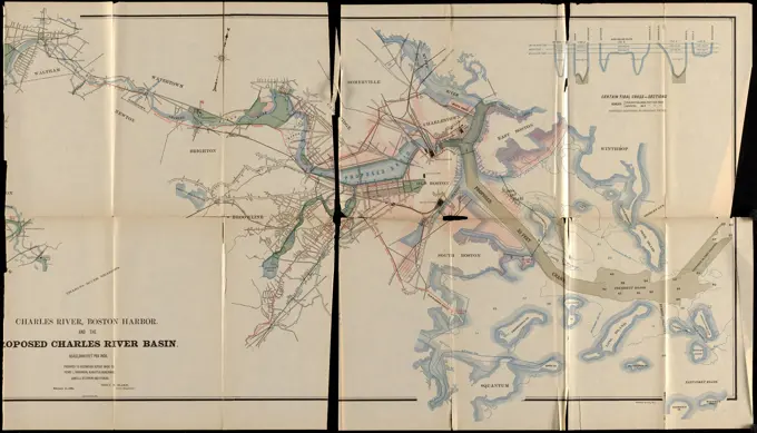
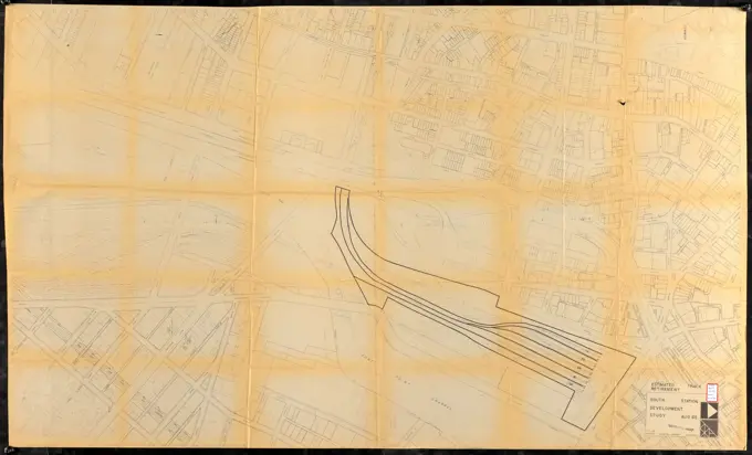
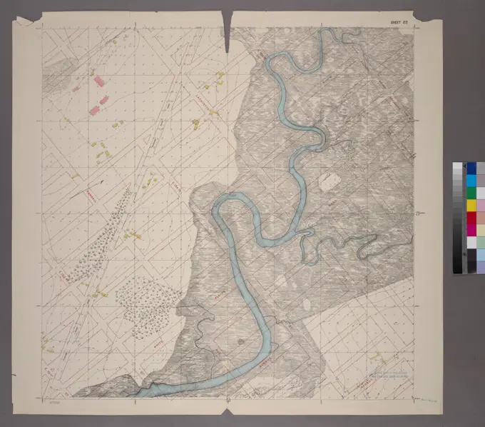
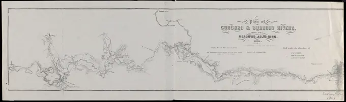
Historical Land Surveys

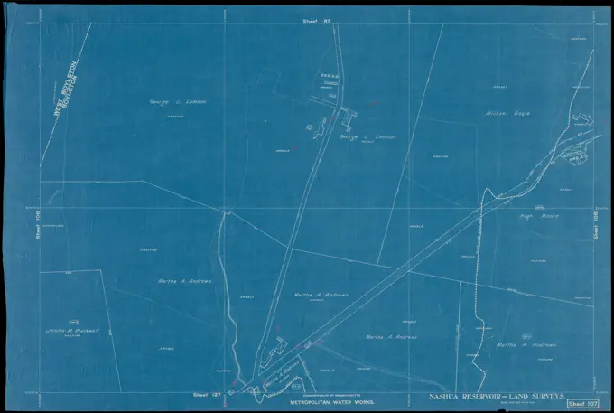
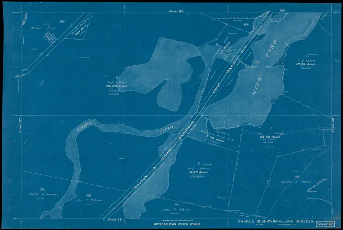
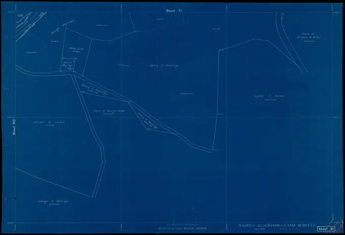
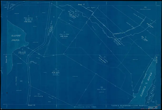
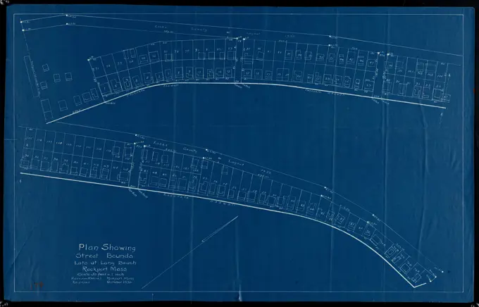
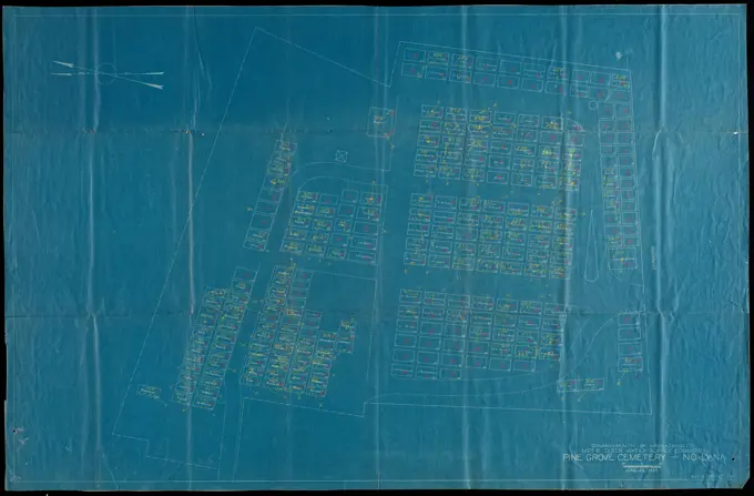
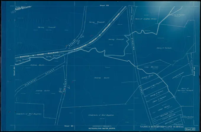
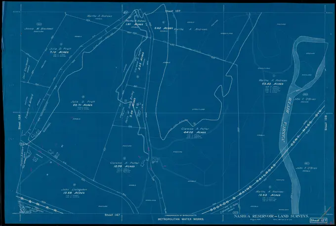
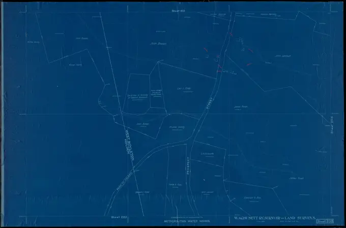
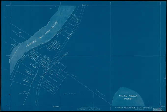
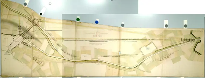
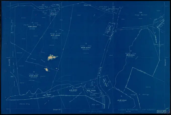
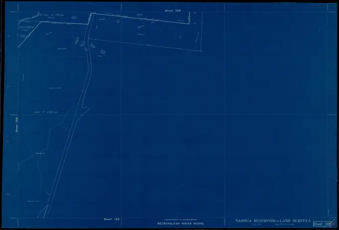
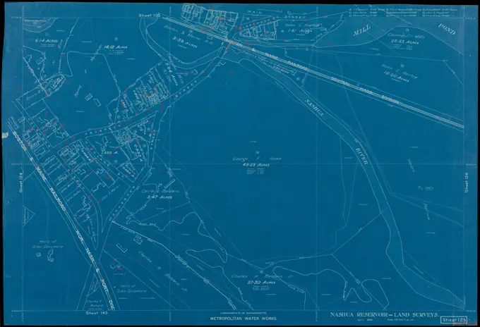
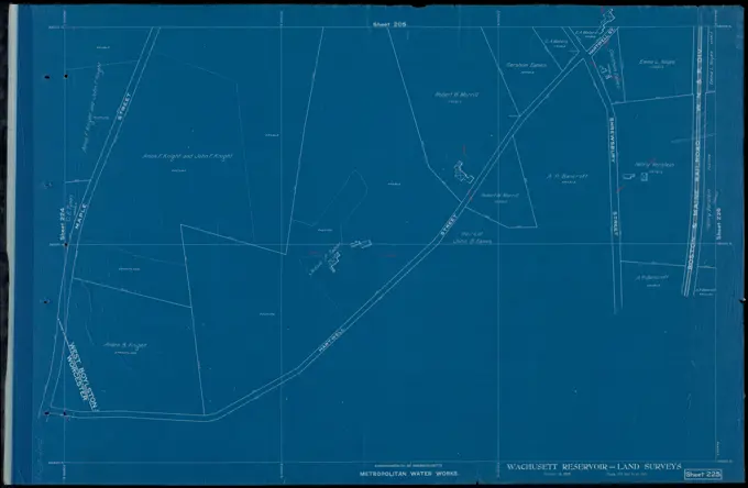
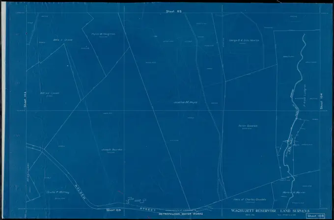
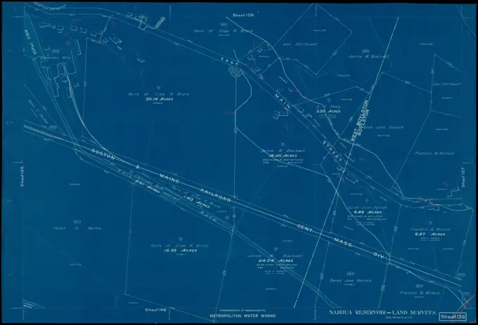
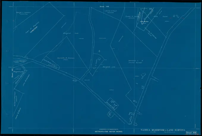
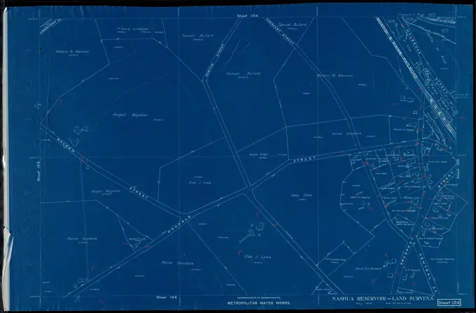
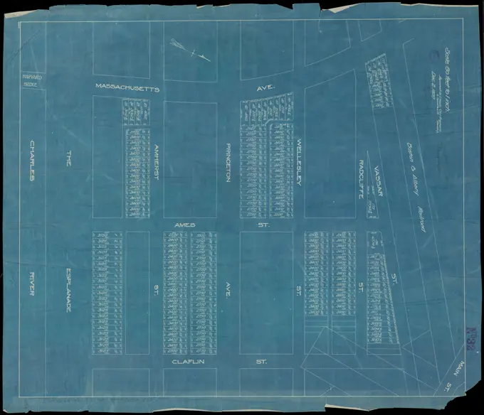
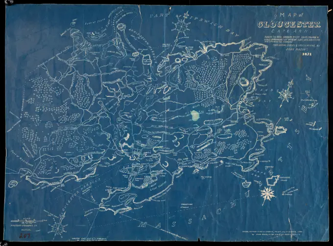
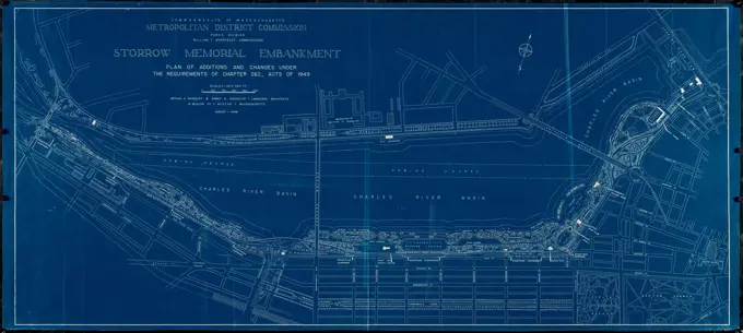
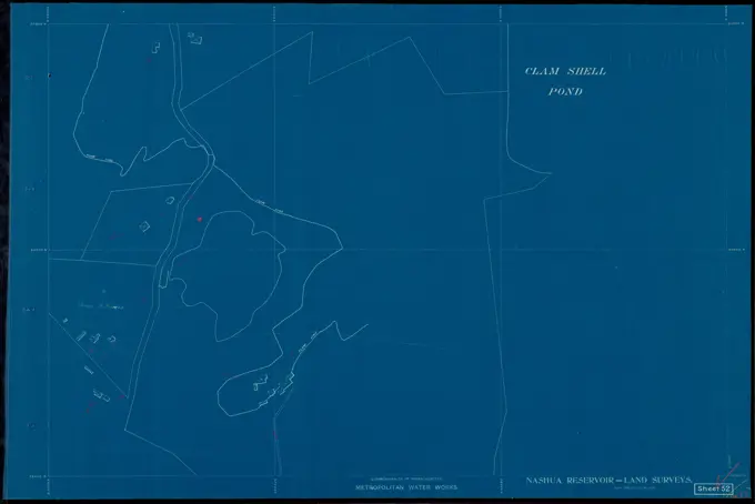
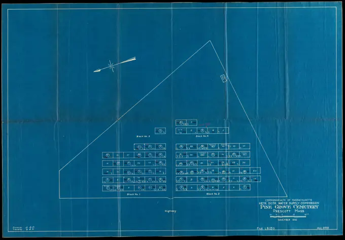
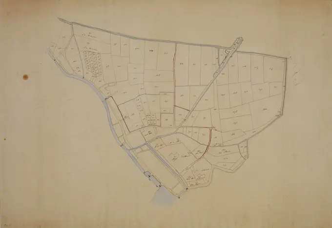
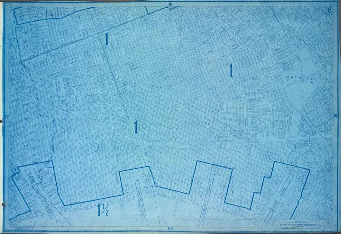
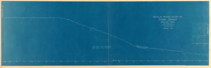
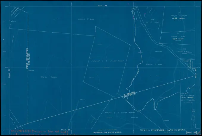
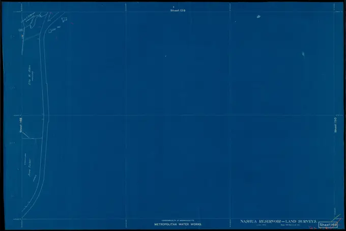
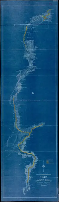
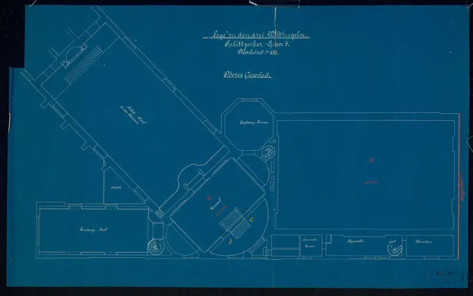
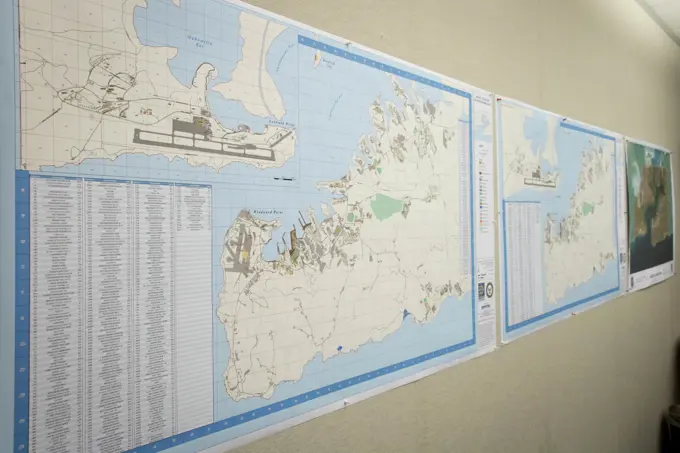
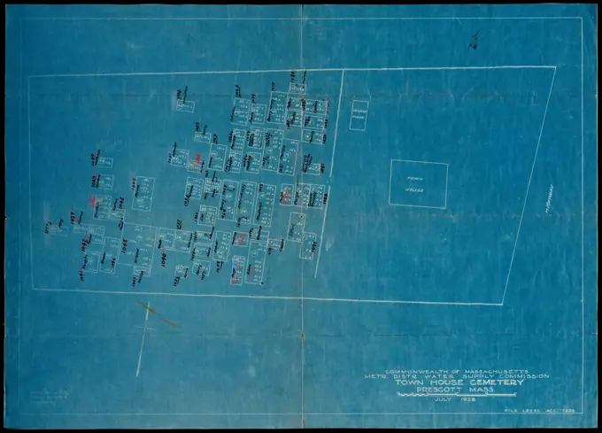
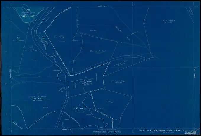
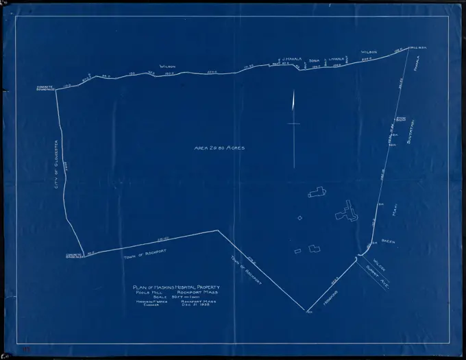
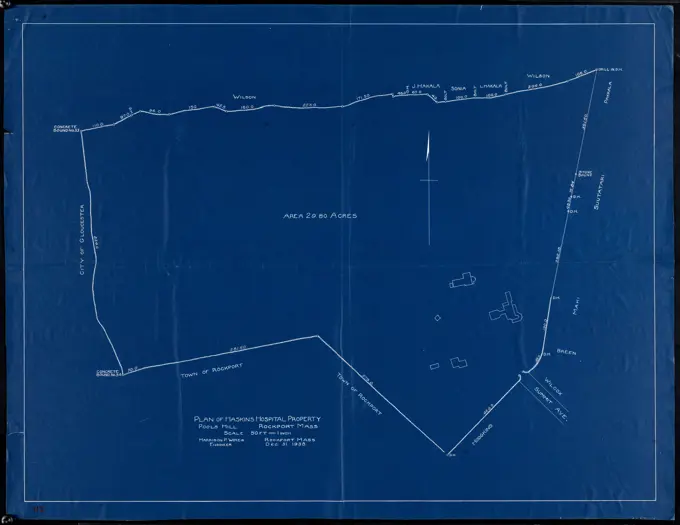
Blueprints of land surveys for the Wachusett Reservoir, featuring detailed maps and drawings dating from the late 1800s, predominantly in blue tones.

Metropolitan Water Works, Wachusett Reservoir, land surveys, sheet 109, index plan to photographs of real estate, Boylston, Mass., May 1896 , waterworks, real estate, land surveys, blueprints reprographic copies. Massachusetts Metropolitan Water Works

Assets in this Story

6145-50562700
Metropolitan Water Works, Wachusett Reservoir, land surveys, sheet 107, index plan to photographs of real estate, Boylston, Mass., ca. 1896-1898 , waterworks, real estate, land surveys, blueprints reprographic copies. Massachusetts Metropolitan Water Works
6145-51395517
Metropolitan Water Works, Wachusett Reservoir, land surveys, sheet 108, index plan to photographs of real estate, Boylston, Mass., June 1896 , waterworks, real estate, land surveys, blueprints reprographic copies. Massachusetts Metropolitan Water Works
6145-51395523
Metropolitan Water Works, Wachusett Reservoir, land surveys, sheet 109, index plan to photographs of real estate, Boylston, Mass., May 1896 , waterworks, real estate, land surveys, blueprints reprographic copies. Massachusetts Metropolitan Water Works
6145-51395579
Metropolitan Water Works, Wachusett Reservoir, land surveys, sheet 91, index plan to photographs of real estate, Boylston, Mass., April 1896 , waterworks, real estate, land surveys, blueprints reprographic copies. Massachusetts Metropolitan Water Works
6145-51395559
Metropolitan Water Works, Wachusett Reservoir, land surveys, sheet 31, index plan to photographs of real estate, Clinton, Mass., March 1896 , waterworks, real estate, land surveys, blueprints reprographic copies. Massachusetts Metropolitan Water Works
6145-55913034
Charles River, Boston Harbor, and the proposed Charles River basin : prepared to accompany report made to Henry L. Higginson, Augustus Hemenway, James J. Storrow and others. Boston Public Library copy imperfect: Missing left-most panels. In Report of the Committee on Charles River Dam appointed under resolves of 1901, chapter 105, to consider the advisability and feasibility of building a dam across the Charles River at or near Craigie bridge. Includes illustration of tidal cross-sections... , Massachusetts  , Charles  ,river
6145-54524676
Cartographic, Maps. 1905. Lionel Pincus and Princess Firyal Map Division. Bronx (New York, N.Y.) Sheet 40: Grid #32000E - 36000E, #5000S - 9000S. Includes East River, Morris Lane, New Pennfield Road, Fort Schuyler Road and Schuyler Road. Planning Grid of the Office of the Topographical Bureau of Bronx.
6145-51387920
South Station development study : estimated track retirement , Boston Mass., Maps, Railroad tracks, Massachusetts, Boston, Maps, City planning, Massachusetts, Boston, Maps, South Station Boston, Mass., Maps, Urban renewal, Massachusetts, Boston, Maps
6145-51386460
Plan showing street bounds, lots at Long Beach, Rockport, Mass. , Streets
6145-55928255
Cartographic, Maps. 1905. Lionel Pincus and Princess Firyal Map Division. Bronx (New York, N.Y.) Sheet 22: Grid #20000E - 24000E, #9000S - 13000S. Includes Clason's Point Road (Soundview Avenue),(Harding Park) Randall Avenue, (White Plains Road) and Lafayette Avenue. Planning Grid of the Office of the Topographical Bureau of Bronx.
6145-50562772
Pine Grove Cemetery, North Dana, Mass., June 20, 1927 , waterworks, reservoirs water distribution structures, real estate, cemeteries
6145-51395554
Metropolitan Water Works, Wachusett Reservoir, land surveys, sheet 45, index plan to photographs of real estate, West Boylston, Mass., September 1897 , waterworks, real estate, land surveys, blueprints reprographic copies. Massachusetts Metropolitan Water Works
1788-36674
Cartography, Italy, 18th-century. New geographical map of the Papal States created by Ruggero Boscovich and Cristoforo Maire, 1755. Engraving.
6145-50562729
Metropolitan Water Works, Wachusett Reservoir, land surveys, sheet 127, index plan to photographs of real estate, Boylston, Mass., August 1896 , waterworks, real estate, land surveys, blueprints reprographic copies. Massachusetts Metropolitan Water Works
6145-51395542
Metropolitan Water Works, Wachusett Reservoir, land surveys, sheet 203, index plan to photographs of real estate, Holden and West Boylston, Mass., June 1898 , waterworks, real estate, land surveys, blueprints reprographic copies. Massachusetts Metropolitan Water Works
6145-50572398
Plan of Haskins Hospital Property, Pools Hill, Rockport, Mass. ,
6145-50562727
Metropolitan Water Works, Wachusett Reservoir, land surveys, sheet 125, index plan to photographs of real estate, West Boylston, Mass., April 1896 , waterworks, real estate, land surveys, blueprints reprographic copies. Massachusetts Metropolitan Water Works
6145-51395550
Metropolitan Water Works, Wachusett Reservoir, land surveys, sheet 32, index plan to photographs of real estate, Clinton, Mass., ca. 1896-1898 , waterworks, real estate, land surveys, blueprints reprographic copies. Massachusetts Metropolitan Water Works
6145-51386073
Plan of Haskins Hospital Property, Pools Hill, Rockport, Mass. ,
6145-52832387
Situation plan and design of the Mariahilf axis and Schönbrunner Allee at Schönbrunn Castle, Vienna, drawn in graphite and pen with red, gray, and black details, colored and lavated on paper.
6145-51395570
Metropolitan Water Works, Wachusett Reservoir, land surveys, sheet 90, index plan to photographs of real estate, Boylston, Mass., April 1896 , waterworks, real estate, land surveys, blueprints reprographic copies. Massachusetts Metropolitan Water Works
6145-50562731
Metropolitan Water Works, Wachusett Reservoir, land surveys, sheet 129, index plan to photographs of real estate, Boylston, Mass., May 1896 , waterworks, real estate, land surveys, blueprints reprographic copies. Massachusetts Metropolitan Water Works
6145-50567486
Brighton and Allston urban design strategy , City planning, Massachusetts, Boston, Maps, Allston Boston, Mass., Maps, Brighton Boston, Mass., Maps Norman B. Leventhal Map Center Collection
6145-51386772
Proposed development of Front Beach, Rockport, Mass. : Recommended by special committee , Beaches
6145-51395520
Metropolitan Water Works, Wachusett Reservoir, land surveys, sheet 125, index plan to photographs of real estate, West Boylston, Mass., April 1896 , waterworks, real estate, land surveys, blueprints reprographic copies. Massachusetts Metropolitan Water Works
6145-54549395
Situationsplan der Pyramiden-Felder bei Abu-Roasch Abû Rawwâsh Site. 1849 - 1856. Lepsius, Richard, 1810-1884. Cartographic. Prints. General Research Division. Egypt , Antiquities, Abu Rawwash Site (Egypt)
6145-50562750
Metropolitan Water Works, Wachusett Reservoir, land surveys, sheet 225, index plan to photographs of real estate, West Boylston, Mass., October 18, 1898 , waterworks, real estate, land surveys, blueprints reprographic copies. Massachusetts Metropolitan Water Works
6145-48663981
Historical map of the Emerald Necklace , Emerald Necklace Boston, Mass., Maps, Emerald Necklace Boston, Mass., History, Boston Mass., Maps, Local transit, Massachusetts, Boston, Maps Norman B. Leventhal Map Center Collection
4443-75463013
Map of Staten Island (Motanucke, Monocknong, Aquehonga, Eghqueous, Staten Eylant) by Charles W. Leng, with ye olde names & nicknames by William T. Davis., 1896
6145-51391749
Campus High School urban renewal area, Mass. r- : land disposition map , Roxbury Boston, Mass., Maps, City planning, Massachusetts, Boston, Maps, Urban renewal, Massachusetts, Boston, Maps
6145-51395512
Metropolitan Water Works, Wachusett Reservoir, land surveys, sheet 103, index plan to photographs of real estate, West Boylston, Mass., March 1898 , waterworks, real estate, land surveys, blueprints reprographic copies. Massachusetts Metropolitan Water Works
6145-51395538
Metropolitan Water Works, Wachusett Reservoir, land surveys, sheet 126, index plan to photographs of real estate, Boylston and West Boylston, Mass., ca. 1896-1898 , waterworks, real estate, land surveys, blueprints reprographic copies. Massachusetts Metropolitan Water Works
6145-50562728
Metropolitan Water Works, Wachusett Reservoir, land surveys, sheet 126, index plan to photographs of real estate, Boylston and West Boylston, Mass., ca. 1896-1898 , waterworks, real estate, land surveys, blueprints reprographic copies. Massachusetts Metropolitan Water Works
6145-55167782
West Indies, harbors of Jamaica : from British surveys to 1879, corrected to 1881. Relief shown by hachures and spot heights. Depths shown by soundings and isolines. Includes 4 coastal views.... , Jamaica  , Cornwall  ,county   , Falmouth Jamaica  , Middlesex  ,county   , Annotto Bay Jamaica  , Middlesex  ,county   , Saint Ann's Bay Jamaica  , Portland  ,county   , Port Antonio Jamaica  , Cornwall  ,county   , Savanna-la-Mar Jamaica  , Cornwall  ,county   , Black River Bay
4409-17276404
AUDIENCIA Y CASAS REALES DE PANAMA- 1609 -. Location: Archivo General de Indias. Sevilla. Seville. SPAIN.
6145-51395530
Metropolitan Water Works, Wachusett Reservoir, land surveys, sheet 168, index plan to photographs of real estate, Boylston, Mass., June 1896 , waterworks, real estate, land surveys, blueprints reprographic copies. Massachusetts Metropolitan Water Works
6145-50562726
Metropolitan Water Works, Wachusett Reservoir, land surveys, sheet 124, index plan to photographs of real estate, West Boylston, Mass., May 1898 , waterworks, real estate, land surveys, blueprints reprographic copies. Massachusetts Metropolitan Water Works
6145-50570570
Plan of lots in Kendall Square, Cambridge, between Massachusetts Ave., Vassar St. and Claflin St. , Real property, Massachusetts, Cambridge, Maps, Cambridge Mass., Maps, Kendall Square Cambridge, Mass., Maps Norman B. Leventhal Map Center Collection
6145-48732741
Map of Gloucester, Cape Ann : Showing the roads, harbours, rivers, coves, islands & ledges, surrounding that important cape, with directions for entering the harbours ,
6145-50568476
Oil and gas fields of the state of Kentucky , Kentucky, Maps, Oil fields, Kentucky, Maps, Gas fields, Kentucky, Maps, Petroleum pipelines, Kentucky, Maps Norman B. Leventhal Map Center Collection
6145-50567413
Storrow Memorial Embankment : plan of additions and changes under the requirements of Chapter 262, Acts of 1949 , Charles River Esplanade Boston, Mass., Planning, Maps, City planning, Massachusetts, Boston, Maps Norman B. Leventhal Map Center Collection
6145-48719970
Dominion of Canada, Nova Scotia, Whitehaven : from a British survey in 1855 , Whitehead Harbour N.S., Maps, Coasts, Nova Scotia, Maps, Navigation, Nova Scotia, Whitehead Harbour Norman B. Leventhal Map Center Collection
6145-54267704
Jamaica Plain urban renewal area r-49 : existing and proposed community facilities. Shows schools; fire station; police station; library, indoor recreation, health unit; park or playground; and to be abandoned Inset: Location map.. Part of an urban renewal plan for Boston's Jamaica Plain neighborhood... , Massachusetts  , Suffolk  ,county   , Boston  , Jamaica Plain
6145-55924717
New York (N.Y.). Bureau of Engineering. Cartographic, Maps. 1924. Lionel Pincus and Princess Firyal Map Division. New York (N.Y.) 4B - N.Y. City (Aerial Set).
6145-55175493
New York (N.Y.). Bureau of Engineering. Cartographic, Maps. 1924. Lionel Pincus and Princess Firyal Map Division. New York (N.Y.) 21C - N.Y. City (Aerial Set).
6145-50562704
Metropolitan Water Works, Wachusett Reservoir, land surveys, sheet 52, index plan to photographs of real estate, Clinton, Mass., ca. 1896-1898 , waterworks, real estate, land surveys, blueprints reprographic copies. Massachusetts Metropolitan Water Works
6145-52834521
A black ink and watercolor drawing by Carl von Hasenauer of the 3rd gallery wardrobe, plafond decoration, and doorstep of the Burgtheater in Vienna I, including recovery and profile details, dated September 1, 1886.
6145-55176054
New York (N.Y.). Department of Parks. Topographical Division. Cartographic, Maps. 1873. Lionel Pincus and Princess Firyal Map Division. Westchester County (N.Y.), New York (N.Y.) Bronx, Topographical Map Sheet 15; Map bounded by 151 St., Southern Blvd., 149th St., Whitlock Ave., Wetmore Ave.; Including Edgewater Road, Cypress Ave., Powers Ave., Robbins Ave.
6145-55913989
Index to planning districts. Shows planning districts, model cities area, code enforcement areas, urban renewal projects and little city halls.... , Massachusetts  , Suffolk  ,county   , Boston Downtown Boston
6145-51389093
Waterfront land inventory South Boston : CRP port study , Boston Mass., Maps, City planning, Massachusetts, Boston, Maps, Urban renewal, Massachusetts, Boston, Maps, Central business districts, Massachusetts, Boston, Maps, Waterfronts, Massachusetts, Boston, Maps, Buildings, Massachusetts, Boston, Maps, Real property, Massachusetts, Boston, Maps
6145-54522217
New York (N.Y.). Bureau of Engineering. Cartographic, Maps. 1924. Lionel Pincus and Princess Firyal Map Division. New York (N.Y.) 32B - N.Y. City (Aerial Set).
6145-51398192
Pine Grove Cemetery, Prescott, Mass., Nov. 1932 , waterworks, reservoirs water distribution structures, real estate, cemeteries
6145-54522212
New York (N.Y.). Bureau of Engineering. Cartographic, Maps. 1924. Lionel Pincus and Princess Firyal Map Division. New York (N.Y.) 26B - N.Y. City (Aerial Set).
6145-54562826
Plan de Karak.. Mauss, Ch. Imprimerie Monrocq. Illustrations, Prints, Plans. 1874. Dorot Jewish Division. Karak (Jordan)
6145-50646305
St. Alfonsus -Retraitenhuis - Amersfoort Retraitantenkamer. verso
6145-55924740
New York (N.Y.). Bureau of Engineering. Cartographic, Maps. 1924. Lionel Pincus and Princess Firyal Map Division. New York (N.Y.) 23B - N.Y. City (Aerial Set).
4409-49384
Temple of Ramses III. Relief depicting Ramses III capturing his enemies in the presence of Amun. First pylon of the temple. New Kingdom. (1550-1069 b.C). Twentieth dynasty. Thebes. Medinet-Habou. Egypt.
6145-54293554
Aerial Photo WCC-1-123. Central Plains Region (Kansas City, MO). Negative. Department of the Interior. Bureau of Indian Affairs. Red Lake Agency. 1964-. Photographs
6145-55924749
New York (N.Y.). Bureau of Engineering. Cartographic, Maps. 1924. Lionel Pincus and Princess Firyal Map Division. New York (N.Y.) 25A - N.Y. City (Aerial Set).
6145-48685015
Inner belt, Southwest Expressway , City planning, Massachusetts, Boston, Maps, Express highways, Massachusetts, Boston, Maps, Boston Mass., Maps, Southwest Corridor Boston, Mass., Maps
6145-50562562
Map showing the advantages of Lawrence as a location for State Normal School , Teachers colleges, Transportation, Census. Lawrence Public Library Map Collection
6145-55924748
New York (N.Y.). Bureau of Engineering. Cartographic, Maps. 1924. Lionel Pincus and Princess Firyal Map Division. New York (N.Y.) 25C - N.Y. City (Aerial Set).
6145-52946656
Map of Yard. Glass Plate Negatives of the Construction and Repair of Buildings, Facilities, and Vessels at the New York Navy Yard.
4409-169574
CARTEL EXPLICATIVO DE LA ÑORICA - NORIA DE AGUA SITUADA EN EL VALLE DE RICOTE. Location: EXTERIOR, ABARÁN, MURCIA, SPAIN.
4409-17285010
CARTEL EXPLICATIVO DE LA ÑORICA - NORIA DE AGUA SITUADA EN EL VALLE DE RICOTE. Location: EXTERIOR. Abarán. MURCIA. SPAIN.
6145-55927109
New York (N.Y.). Board of Estimate and Apportionment. Cartographic, Maps. 1916. Lionel Pincus and Princess Firyal Map Division. Zoning , New York (State) , New York, Maps Height District Map Section No. 18
6145-50562708
Metropolitan Water Works, Wachusett Reservoir, land surveys, sheet 65, index plan to photographs of real estate, West Boylston, Mass., September 1897 , waterworks, real estate, land surveys, blueprints reprographic copies. Massachusetts Metropolitan Water Works
6145-48732662
Profile on proposed center line, Story Street, Rockport, Mass. , Streets
6145-51394218
Landscaping plan of City Hall Plaza, Boston , City planning, Massachusetts, Boston, Maps, Landscape gardening, Massachusetts, Boston, Maps, Buildings, Massachusetts, Boston, Maps, Urban renewal, Massachusetts, Boston, Maps, Government Center Boston, Mass., Maps Norman B. Leventhal Map Center Collection
6145-48559328
Plan of Concord & Sudbury Rivers with the meadows adjoining , Flood control, Law & legal affairs, Alvord, D.W., 1817-1871. Wayland Historical Maps and Plans
1746-30004631
The Ptolemy world map is a map of the world known to Hellenistic society in the 2nd century. It is based on the description contained in Ptolemy's book Geography, written c. 150. Based on an inscription in several of the earliest surviving manuscripts, it is traditionally credited to Agathodaemon of Alexandria.
6145-51395568
Metropolitan Water Works, Wachusett Reservoir, land surveys, sheet 68, index plan to photographs of real estate, Boylston and Sterling, Mass., ca. 1896-1898 , waterworks, real estate, land surveys, blueprints reprographic copies. Massachusetts Metropolitan Water Works
6145-54522220
New York (N.Y.). Bureau of Engineering. Cartographic, Maps. 1924. Lionel Pincus and Princess Firyal Map Division. New York (N.Y.) 5B - N.Y. City (Aerial Set).
6145-50562711
Metropolitan Water Works, Wachusett Reservoir, land surveys, sheet 68, index plan to photographs of real estate, Boylston and Sterling, Mass., ca. 1896-1898 , waterworks, real estate, land surveys, blueprints reprographic copies. Massachusetts Metropolitan Water Works
6145-54303057
Atlanta North-South Expressway. Original caption: Atlanta North-South Expressway. Credit: State Highway Department of Georgia. Photo August 26, 1951. State: Georgia.
6145-51395293
Map showing the advantages of Lawrence as a location for State Normal School , Teachers colleges, Transportation, Census. Lawrence Public Library Map Collection
6210-62158301
Detailed map of Gilli Trawangan Island, Lesser Sunda Islands, Indonesia, Asia
6145-48718279
West Indies, harbors of Jamaica : from British surveys to 1879, corrected to 1881 , Falmouth Harbour Jamaica, Maps, Annotto Bay Jamaica, Maps, Saint Ann's Bay Jamaica, Maps, Port Antonio Jamaica, Maps, Savanna-la-Mar Jamaica, Maps, Black River Bay Jamaica, Maps, Coasts, Jamaica, Maps, Navigation, Jamaica, Falmouth Harbour, Navigation, Jamaica, Annotto Bay, Navigation, Jamaica, Saint Ann's Bay, Navigation, Jamaica, Black River Bay Norman B. Leventhal Map Center Collection
6145-51387211
Roxbury-N. Dorchester G.N.R.P. r-50 : existing & proposed community facilities , Roxbury Boston, Mass., Maps, City planning, Massachusetts, Boston, Maps, Urban renewal, Massachusetts, Boston, Maps, School buildings, Massachusetts, Boston, Maps, Police stations, Massachusetts, Boston, Maps, Fire stations, Massachusetts, Boston, Maps, Library buildings, Massachusetts, Boston, Maps, Parks, Massachusetts, Boston, Maps, Playgrounds, Massachusetts, Boston, Maps, Recreation centers, Massachusetts, Boston, Maps
6145-59285232
View of the Oudezijds Achterburgwal in Amsterdam, near the Oudezijds Kolk, c. 1897  Page 26 from a sketchbook with 17 sheets. Amsterdam paper. chalk  canals, waters (in city). civic architecture; edifices; dwellings The Oudezijds Achterburgwal. Oudezijds Kolk
6145-54522223
New York (N.Y.). Bureau of Engineering. Cartographic, Maps. 1924. Lionel Pincus and Princess Firyal Map Division. New York (N.Y.) 6D - N.Y. City (Aerial Set).
6145-54550518
Sheet 13. 1: 250,000. Cartographic. Maps. 1890 - 1892. Lionel Pincus and Princess Firyal Map Division. Turkey, Turkey
6145-50513331
Profile on proposed center line, Story Street, Rockport, Mass. , Streets
6145-51396923
Aerial photograph of South Boston , South Boston Boston, Mass., Aerial views Norman B. Leventhal Map Center Collection
4409-17339305
Napoleonic map. European Russia. Territory in the vicinity of Moscow. Atlas de l'Histoire du Consulat et de l'Empire. History of the Consulate and the Empire of France under Napoleon by Marie Joseph Louis Adolphe Thiers (1797-1877). Drawings by Dufour, engravings by Dyonnet. Edited in Paris, 1864.
6145-55924745
New York (N.Y.). Bureau of Engineering. Cartographic, Maps. 1924. Lionel Pincus and Princess Firyal Map Division. New York (N.Y.) 24B - N.Y. City (Aerial Set).
6145-54601973
Geological map Allegheny River Valley accompanying report of Allegheny River survey Nov. 25, 1898
4443-75467452
A hand-colored map titled 'G. Woolworth Colton's new guide map of the United States & Canada' illustrating railroads, counties, and administrative divisions. The map was published in 1861 in New York by Colton and in Chicago by Rufus Blanchard. It measures 75 x 91 cm on a sheet of 84 x 103 cm
6145-55175470
New York (N.Y.). Bureau of Engineering. Cartographic, Maps. 1924. Lionel Pincus and Princess Firyal Map Division. New York (N.Y.) 10A - N.Y. City (Aerial Set).
6145-50562736
Metropolitan Water Works, Wachusett Reservoir, land surveys, sheet 149, index plan to photographs of real estate, Boylston, Mass., June 1896 , waterworks, real estate, land surveys, blueprints reprographic copies. Massachusetts Metropolitan Water Works
6145-50572426
Map of Land's End, Rockport ,
6145-29860928
Helen Miller, Watts Estate and Garden, c 1936 Watts Estate and Garden
463-5680
Central and Eastern Europe 1802 Maps Postal Museum, Berlin
1848-19261134
Stadtplan, 1892: Danzig, now Gdansk, Poland, Polen, digital restaurierte Reproduktion einer Originalvorlage aus dem 19. Jahrhundert, Europe
4449-40629
plan of underground mine, Sigmundshall, near Bokeloh, Lower Saxony, northern Germany
6145-51395526
Metropolitan Water Works, Wachusett Reservoir, land surveys, sheet 149, index plan to photographs of real estate, Boylston, Mass., June 1896 , waterworks, real estate, land surveys, blueprints reprographic copies. Massachusetts Metropolitan Water Works
6145-51395272
Map railway route, Seward to Fairbanks : (including Matanuska - branch) , Railroads, Alaska, Maps, Alaska, Maps Norman B. Leventhal Map Center Collection
1525-25063221
Scraps of pasted newspaper on wall
1788-17588
Plan of the Latin colonia of Cosa, 3rd century BC, drawing
1525-27945151
Architectural background with technical drawings. Blueprints series. Site plan texture. House blueprint, drawing, part of architectural project.. Architectural background with technical drawings. Blueprints plan texture. Drawing part of architectural project.
4443-75460784
The Tenement-House Committee maps, 1895, Publisher, Harper & Brothers, Manhattan (New York, N.Y.), New York (N.Y.), Population, Sanitary districts, New York (State), New York, 2 maps on 1 sheet; 14 x 48 cm and 17 x 48 cm
6145-54311165
South Ferry, N.Y., Dec. 11, 2012   The dark line on map of Manhattan between Canal Street and Chambers street, shows the high water mark at the South Ferry Terminal stairway to the 1 and R subways. Andre R. Aragon/FEMA. South Ferry, Manhattan N.Y., Dec. 11, 2012 -- The dark line on map of Manhattan between Canal Street and Chambers street, shows the high water mark at the South Ferry Terminal stairway to the 1 and R subways. Andre R. Aragon/FEMA. Photographs Relating to Disasters and Emergency Management Programs, Activities, and Officials
6145-55916357
The Boston Public Libraries.... , Massachusetts  , Suffolk  ,county   , Boston
6145-51396252
The Literary Digest liberty map of the Western Front of the Great World War showing the battle line of liberty as it stood September 5th, 1918 : also showing the lines of farthest advance of the German and the Allied offensives with complete index , Coal, Europe, Maps, Iron, Europe, Maps, World War, 1914-1918, Maps, Europe, Maps Norman B. Leventhal Map Center Collection
6145-29590508
Elsevier photo collection. Report forest heather fires. central item, degree direction observation items easily placed map intersection rulers indicates correct fire. circle map observation district, observation tower middle Photo VIII. 1936. Gelderland, Veluwe
6145-52066442
Salvage Engineering Response Team - New Orleans - Early October - 26-HK-350-137. Hurricane Katrina
1899-48213865
Plaque showing battle history of the USS Alabama museum battleship at the Battleship Memorial Park in Mobile, Alabama.
6145-29673296
Photo collection Government information service. Social work, blind care. undated
6145-51394542
Map of Boston Harbor , Boston Harbor Mass., Maps, Boston Mass., Maps, Massachusetts, Maps Norman B. Leventhal Map Center Collection
6145-48502242
test111
6145-52411246
Bellows Falls. American views, Bellows Falls and vicinity. 1850 - 1930. still image. Stereographs, Photographs. The Miriam and Ira D. Wallach Division of Art, Prints and Photographs: Photography Collection. Vermont, Bellows Falls (Vt.)
6145-55916351
Boston proper. "9-65." "5520." "34-355."... , Massachusetts  , Suffolk  ,county   , Boston
1801-62861438
Bath City Information System, Bath, United Kingdom. Architect: Pearson Lloyd, 2011. Partial view of new map directory.
6145-52271839
Jemez Mountain Trail - Jemez Mountain Trail Wall Map. A map and relief model show the terrain of the Byway inside the Walatowa Visitor Center. New Mexico (35.644° N 106.726° W)
6145-52927886
U.S..-Mexico Binational Commission (BNC) agreement signing event at Main Interior for the Joint Declaration of Sister Park Partnerships, with Deputy Secretary P. Lynn Scarlett and Mexican counterpart, Undersecretary Felipe Adrian Vasquez of the Ministry of Environment and Natural Resources, officially designating seven parks for cooperative efforts on natural resource management
6145-48904520
JACKSONVILLE, Fla. (Oct. 3, 2016) Maps of Naval Station Guantanamo Bay, Cuba, line the walls of the recently stood up Emergency Operations Center (EOC) at Naval Facilities Engineering Command (NAVFAC) Southeast at Naval Air Station Jacksonville, Fla. The EOC was activated to assist in preparing Guantanamo Bay for the impending arrival of Hurricane Matthew.
6145-48703197
Town House Cemetery, Prescott, Mass., July 1928 , waterworks, reservoirs water distribution structures, real estate, cemeteries
6145-48752117
Precinct map, Wellesley, Massachusetts ,. Wellesley Local Historical Map Collection
4385-185
Plotting Ship's Position
6177-V63593191
6145-51396235
Cape Cod and the islands , Cape Cod Mass., Aerial views, Nantucket Island Mass., Aerial views, Martha's Vineyard Mass., Aerial views Norman B. Leventhal Map Center Collection
4409-50088801
Madrid, 1954. Plan of the 18-hole golf course of the Real Sociedad Hípica Española Club de Campo.
6145-51380294
Sidewall (USA); machine-printed paper; 43 x 24 cm (16 15/16 x 9 7/16 in.)
6145-53168003
World Exhibition 1929
4409-73098939
pins marking possible travel points on a Europe map, Republic of Malta, Europe.
4409-28511960
DIAGRAMA FUNCIONAL DE LAS INSTALACIONES DE AGUA. Location: CANAL DE ISABEL II. MADRID. SPAIN.
4220-20416658
Aberdeen on a flag day... and on a house-to-house collection day! Satire on the more frugal nature of the Scottish psyche.  circa 1930s
5514-68351660
Iraq War Media Coverage