A hand-colored map titled 'G. Woolworth Colton's new guide map of the United States & Canada' illustrating railroads, counties, and administrative divisions. The map was published in 1861 in New York by Colton and in Chicago by Rufus Blanchard. It measures 75 x 91 cm on a sheet of 84 x 103 cm
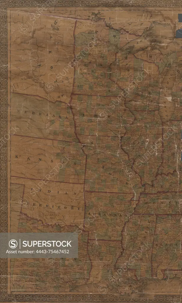
SuperStock offers millions of photos, videos, and stock assets to creatives around the world. This image of A hand-colored map titled 'G. Woolworth Colton's new guide map of the United States & Canada' illustrating railroads, counties, and administrative divisions. The map was published in 1861 in New York by Colton and in Chicago by Rufus Blanchard. It measures 75 x 91 cm on a sheet of 84 x 103 cm by Artokoloro is available for licensing today.
Looking for a license?
Click here, and we'll help you find it! Questions? Just ask!
Click here, and we'll help you find it! Questions? Just ask!
DETAILS
Image Number: 4443-75467452Rights ManagedCredit Line:Artokoloro/SuperStockCollection:Artokoloro Model Release:NoProperty Release:NoResolution:3433×5700