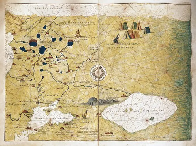
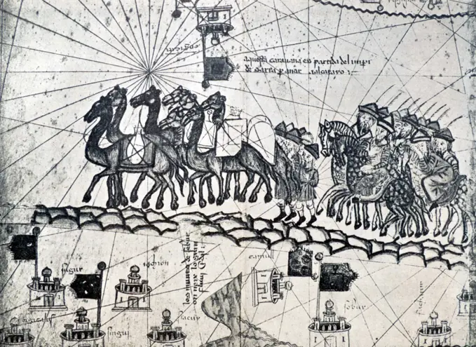
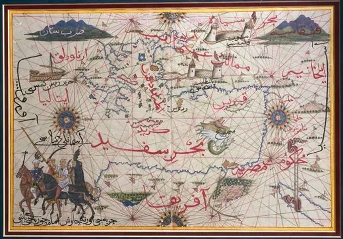
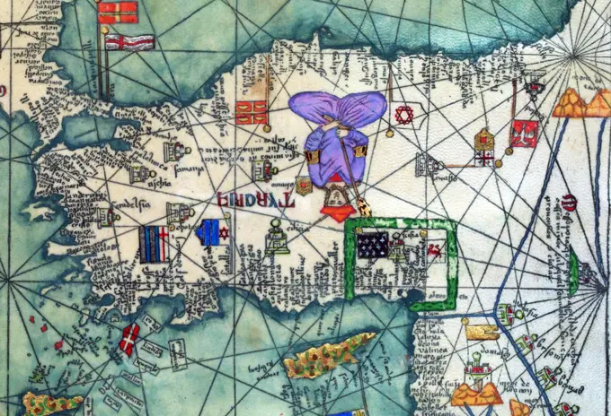
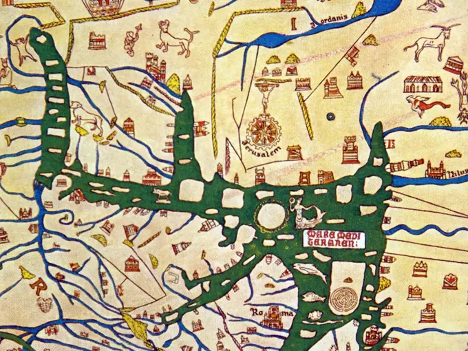
Ancient Cartography

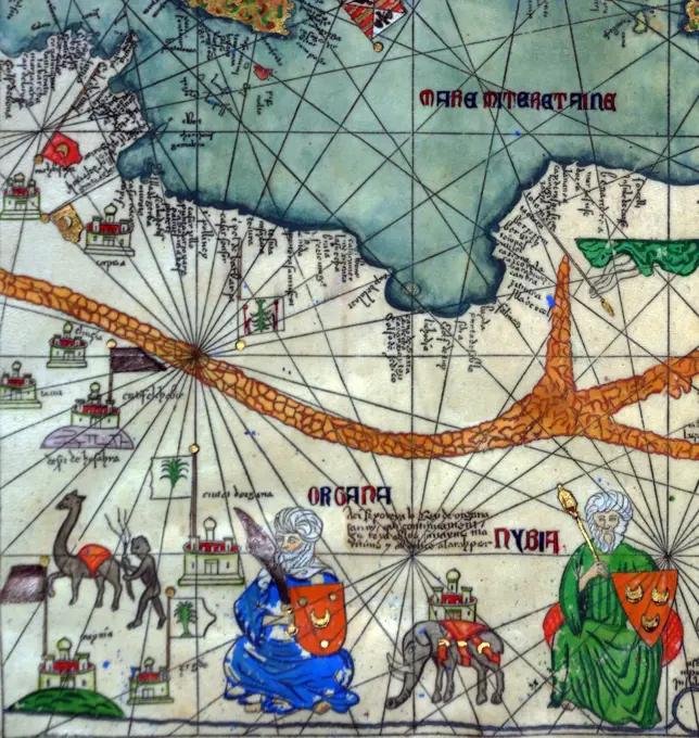
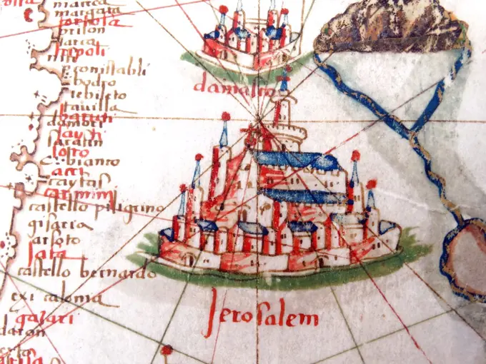
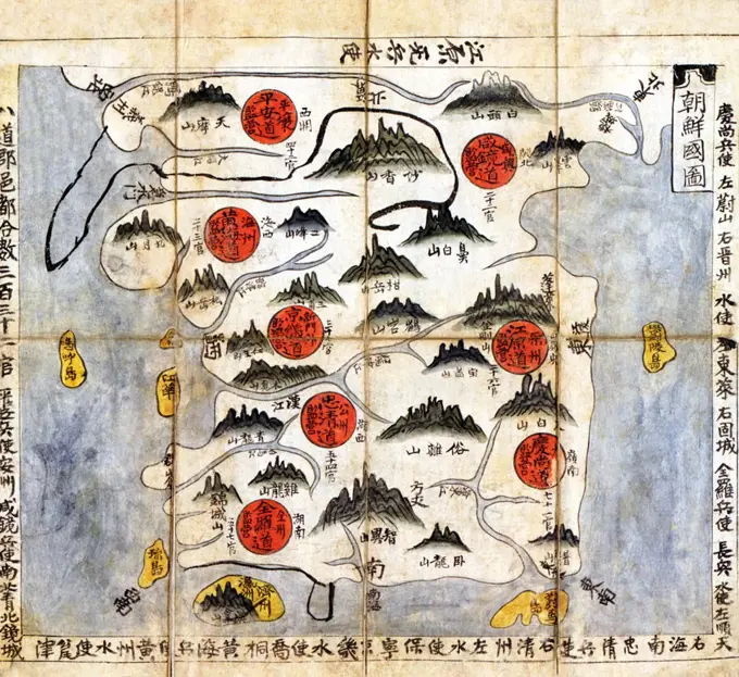
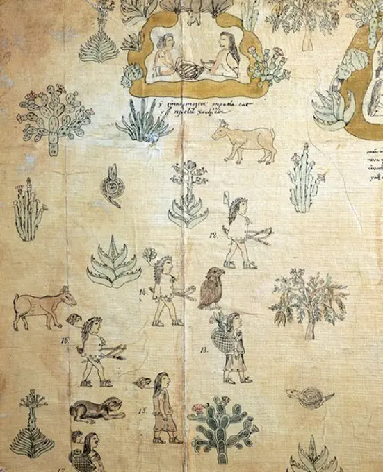
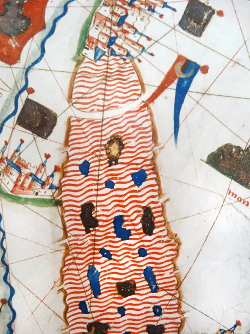
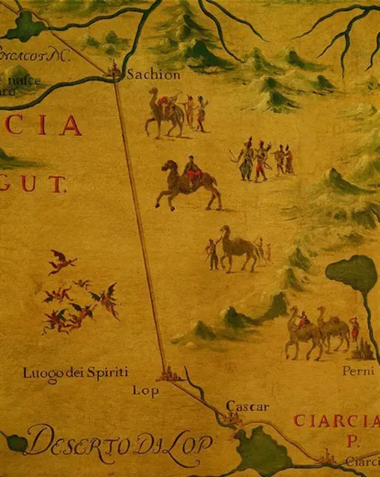
Detailed ancient maps depicting regions in Europe and Africa, highlighting geographical features and intricate artistic elements.

Moschoviae Tabula. Map of Russia and of the Indo-European villages on the shores of the Volga River, 1525. Made by Battista Agnese from descriptions by Paolo Giovio. It is believed to be the oldest map of Russia. Miniature Painting. ITALY. VENETO. Venice. Biblioteca nazionale marciana (St. Mark's Library).
A map of Concord, the old Musketaquid Plantation. Inset: The original bounds of the "Plantacon att Musketequed" in 1635 & Blood's Farms. Includes illustrations of famous homes in left and right borders.... , Massachusetts  , Middlesex  ,county   , ConcordDetail from the Catalan Atlas showing Marco Polo on his expedition. The Catalan Atlas is the most important map of the medieval period in the Catalan language (drawn and written in 1375).CIVITATES ORBIS TERRARUM - CALCUTA ORMUZ CANONOR Y SAN JORGE DE LA MINA - GRABADO - SIGLO XVI. Author: GEORG BRAUN 1541-1622 / FRANS HOGENBERG. Location: BIBLIOTECA NACIONAL-COLECCION. MADRID. SPAIN.Cartography, 16th century. Northern Europe, from Atlas of the World in thirty-three Maps, by Battista Agnese, 1553Catholic America : a pictorial map portraying the contribution of Catholics in the development of the United States of America 1492 to 1946 , Catholic Church, History, Maps, Catholic Church, United States, History, Maps, Catholics, United States, History, Maps, Catholics, United States, Statistics, Maps, United States, Maps Norman B. Leventhal Map Center CollectionEnd of 5th century AD. Deatail from a freize showing the Battle of Kadesh (Qadesh) between the Egyptian Empire under Ramesses II and the Hittite Empire under Muwatalli II at the city of Kadesh on the Orontes River, near the modern Syrian-Lebanese border dated to 1274 BC. It was the largest chariot battle ever fought, involving perhaps 5,000ñ6,000 chariotsMilitaria, Italy, 20th century. Handkerchief given to the recruits, 1912.Cartography, late 16th century. The Maghreb and the Middle East. Ottoman miniature.Yojido, map of Korea, 1800.Map of Michoacan bishopric (Mexico). Madrid, History Academy. Location: ACADEMIA DE LA HISTORIA-COLECCION. MADRID. SPANIEN.Mamaevo poboishche.. Rovinski, D. A. (Dmitri Aleksandrovich), 1824-1895. Prints. 1881. Rare Book Division. Folk art , Russia (Federation), Russia , Social life and customs, Engraving, RussianCartography, 15th century. World map by Camaldolese monk Fra Mauro, 1449. Detail: ItalyBuddhist map of the world. Date/Period: 17th-18th century. Painting. Hanging scroll, ink and colours on paper. Height: 171 mm (6.73 in); Width: 167 mm (6.57 in). Author: UNKNOWN.Spain/Catalonia: Egypt, Turkey, Cyprus and the eastern Mediterranean, as represented in the Catalan Atlas, by the Jewish illustrator Cresques Abraham, 1375Edo (, literally 'bay-entrance' or 'estuary'), also romanized as Yedo or Yeddo, is the former name of the Japanese capital Tokyo, and was the seat of power for the Tokugawa shogunate which ruled Japan from 1603 to 1868. During this period it grew to become one of the largest cities in the world and the site of a vibrant urban culture centered on notions of the 'floating world'. The northeastern corner of the city, regarded as a dangerous direction in traditional onmyodo (cosmology/geomancy), is guarded from evil spirits by a series of temples, including Senso-ji and Kan'ei-ji. Just beyond these lay the districts of the eta or outcastes, who engaged in unclean vocations and were thus separated from the main sections of commoner residences. A long dirt path extended west from the riverbank, a short distance north of these eta districts, leading along the northern edge of the city to the Yoshiwara pleasure districts. Previously located within the city proper, close to Asakusa, the distrEarly chronology of the  Aztecs.         Date: pre-ConquestA sight-seers map of Manhattan. Savitt, Paul. Cartographic. Maps. 1946. Lionel Pincus and Princess Firyal Map Division. Manhattan (New York, N.Y.)Jordan the Byzantine Madaba MapA detailed medieval map of the world as it was known. Dated 14th Century Spain/Catalonia: Tunisia, Libya and the central Mediterranean as represented in the Catalan Atlas, by the Jewish illustrator Cresques Abraham, 1375Map of Korea. Korea, Korean, 1784, copy after a map dated 1628. Drawings. Ink and color on paper, mounted as a panelmosaic replica of antique Madaba map of Holy Land A descriptive map of the region within one hundred miles of the capital of the United States : portraying the principal events and places of major interest in the nation's political, cultural, and religious history : commemorating the two hundredth anniversary of the birth of George Washington , Historic sites, Middle Atlantic States, Maps, Historic sites, Washington Region, Maps, Middle Atlantic States, History, Maps, Middle Atlantic States, Maps, Washington Region, History, Maps, Washington Region, Maps, Pictorial maps Norman B. Leventhal Map Center CollectionA descriptive map of the region within one hundred miles of the capital of the United States : portraying the principal events and places of major interest in the nation's political, cultural, and religious history : commemorating the two hundredth anniversary of the birth of George Washington. Conservation of this piece was funded by Matt McCormack in honor of George F. McCormack, Jr. Includes text, historical notes, color illustrations, and coats of arms.... , Middle Atlantic  ,areaThe Honil Gangni Yeokdae Gukdo Ji Do ('Map of Integrated Lands and Regions of Historical Countries and Capitals'), often abbreviated as Kangnido, is a world map created in Korea (ca. 1470), produced by Yi Hoe and Kwon Kun, premised about a similar map that was introduced to Korea from Japan in 1402. The Kangnido is one of the oldest surviving world maps from East Asia, along with the Chinese Da Ming Hun Yi Tu (ca. 1398). It is one of the most important materials for reconstructing the lost 14th-century original by the Chinese. As a world map, it reflects the geographic knowledge of China during the Mongol Empire when geographical information about Western countries became available via Islamic geographers. It depicts the general form of the Old World, from Africa and Europe in the west to Japan in the east. Although, overall, it is less geographically accurate than its Chinese cousin, most obviously in the depiction of rivers and small islands, it does feature some improvements (particCartography, 16th century. Map of Puerto Rico and the Antilles.detail showing Jerusalem as the centre of the world on the Hereford Mappa Mundi of 1280.Japanese print shows Perry's steamship in bottom right panel. A map of the coast of Soshu in left panel andvarious Japanese coats of arms in upper half of both panels. Dated late 18 Century.Renaissance map of Europe, Jacopo Russo, 1528, detail, showing Jerusalem and DamascusA descriptive map of the region within one hundred miles of the capital of the United States : portraying the principal events and places of major interest in the nation's political, cultural, and religious history : commemorating the two hundredth anniversary of the birth of George Washington , Historic sites, Middle Atlantic States, Maps, Historic sites, Washington Region, Maps, Middle Atlantic States, History, Maps, Middle Atlantic States, Maps, Washington Region, History, Maps, Washington Region, Maps, Pictorial maps Norman B. Leventhal Map Center CollectionA map of Treasure Island.          Date: First published: 1883Korea: Political map of Korea from the Ch'onha Chido Atlas showing the 8 administrative regions or provinces (indicated by red circles), pen and ink on rice paper, Joseon Dynasty, c. 1800The Mapa Tlotzin, that is the genealogy of the governors of Acolhuacan, drawing of the hunting of indigenous peoples. Mexico, 16th Century.LA PATAGONIA, ESTRECHO MAGALLANES Y TIERRA DE FUEGO- MAPA DEL SIGLO XVII. Location: SERVICIO GEOGRAFICO DEL EJERCITO. MADRID. SPAIN.Michael of Rhodes, a Venetian galley commander, wrote a manuscript describing his knowledge of mathematics, ships and shipbuilding, navigation, and time reckoning. It contains some of the earliest surviving portolan aids to navigation and is the world's first known treatise on shipbuilding.Renaissance map of Europe, Jacopo Russo, 1528, detail showing the River Nile (left) and the Red SeaMap of Block Island -- scene of the Larchmont sinking, first settler bringing ashore a cow, daily trips from Providence, the fishing fleet , Tichnor Brothers Collection, postcards of the United StatesMAPA DEL REINO DE VALENCIA - DETALLE DE UN GALEON - SIGLO XVI - Detalle de la n 6438. Author: Abraham Ortelius (1527-1598). Location: SERVICIO GEOGRAFICO DEL EJERCITO, MADRID, SPAIN.Map of Block Island -- scene of the Larchmont sinking, first settler bringing ashore a cow, daily trips from Providence, the fishing fleet , Tichnor Brothers Collection, postcards of the United StatesEmbroidered map sampler late 18th-early 19th century British Working an embroidered maps such as this sampler became part of a young girls education, starting in the 1770s, and continuing until about the 1840s. The map of England and Wales was so popular that printed versions were available to be stitched, which slightly reduces the potential for learning geography, while retaining the importance of practicing neat embroidery. The additional flourish of the floral garland is a charming feature. Other embroidered maps of geographical features were produced, from individual towns and counties, to the entire world in two hemispheres.. Embroidered map sampler 228716Plan de Paris , Paris France, Maps Norman B. Leventhal Map Center CollectionMapas: Mapa del Mediteraneo - sobre piel del carnero/hacia 1550. Museum: BIBLIOTECA NACIONAL DE RUSIA SAN PETERS RUSIA.The desert of Lop and the home of spirits and ghosts as crossed by Marco Polo, by Giovanni Battista Ramusio (1485-1557). Hall of Maps, The Doge's Palace (Palazzo Ducale), Venice, 16th century. Canvas.The Atlas Maior is the final version of Joan Blaeu's atlas, published in Amsterdam between 1662 and 1672, in Latin (11 volumes), French (12 volumes), Dutch (9 volumes), German (10 volumes) and Spanish (10 volumes), containing 594 maps and around 3000 pages of text. It was the largest and most expensive book published in the seventeenth century. Earlier, much smaller versions, titled Theatrum Orbis Terrarum, sive, Atlas Novus, were published from 1634 onwards.