Korea: Political map of Korea from the Ch'onha Chido Atlas showing the 8 administrative regions or provinces (indicated by red circles), pen and ink on rice paper, Joseon Dynasty, c. 1800
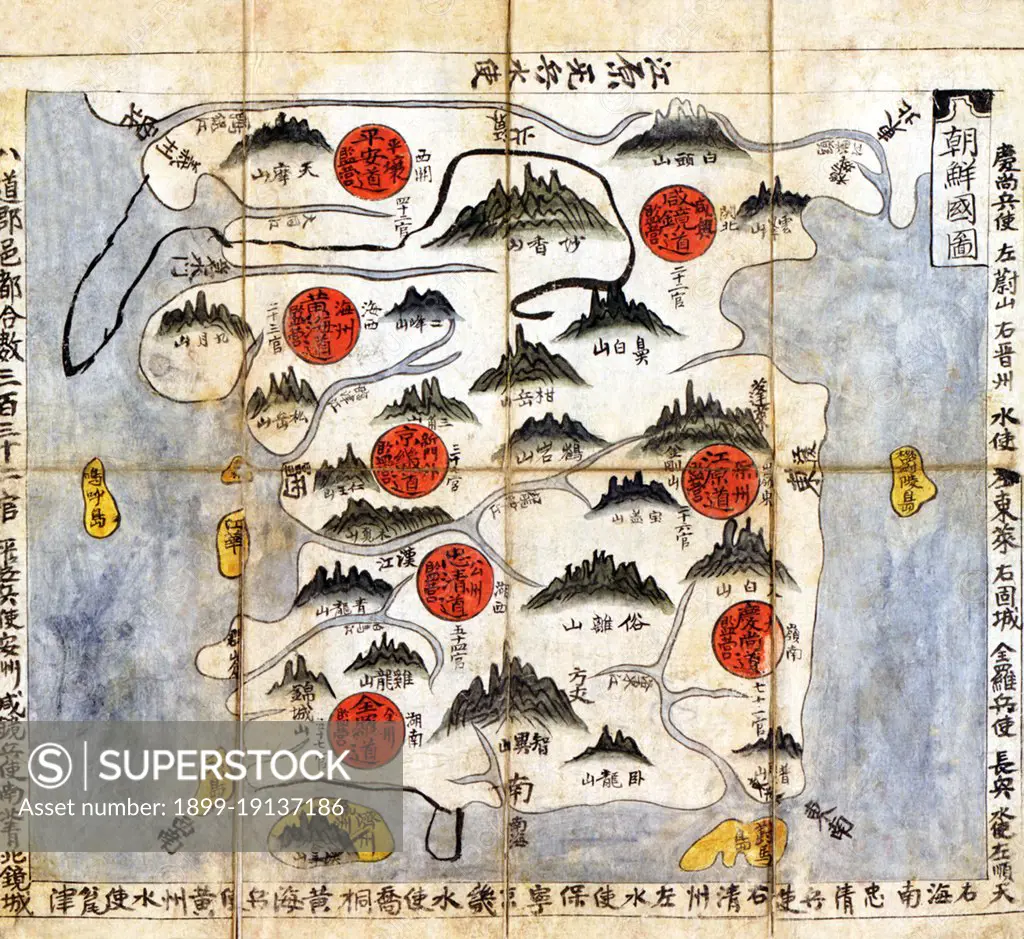
SuperStock offers millions of photos, videos, and stock assets to creatives around the world. This image of Korea: Political map of Korea from the Ch'onha Chido Atlas showing the 8 administrative regions or provinces (indicated by red circles), pen and ink on rice paper, Joseon Dynasty, c. 1800 by Pictures from History/Universal Images is available for licensing today.
Looking for a license?
Click here, and we'll help you find it! Questions? Just ask!
Click here, and we'll help you find it! Questions? Just ask!
DETAILS
Image Number: 1899-19137186Rights ManagedCredit Line:Pictures from History/Universal Images/SuperStockCollection: