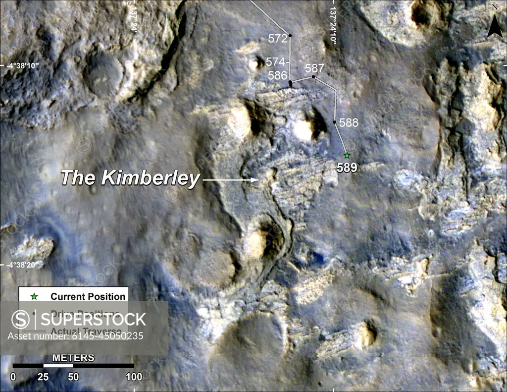
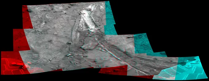
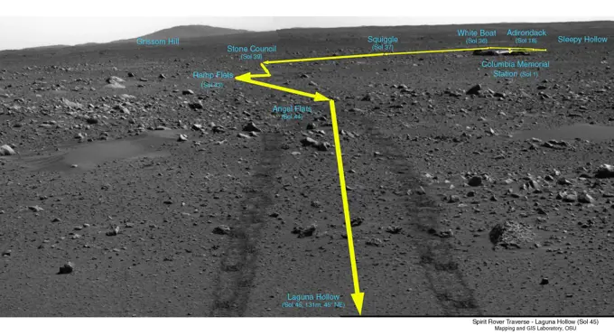
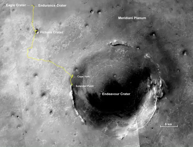
This map shows the route driven by NASA's Curiosity Mars in its approach to and April 1, 2014, arrival at a waypoint called 'the Kimberley,' which rover team scientists chose in 2013 as the location for the mission's next major investigations.
SuperStock offers millions of photos, videos, and stock assets to creatives around the world. This image of This map shows the route driven by NASA's Curiosity Mars in its approach to and April 1, 2014, arrival at a waypoint called 'the Kimberley,' which rover team scientists chose in 2013 as the location for the mission's next major investigations. by Piemags/PL Photography Limited is available for licensing today.
Visually Similar More from Mars and Vesta Geological Features story

Looking for a license?
Click here, and we'll help you find it! Questions? Just ask!
Click here, and we'll help you find it! Questions? Just ask!
DETAILS
Image Number: 6145-45050235Royalty FreeCredit Line:Piemags/PL Photography Limited/SuperStockCollection:PL Photography Limited Story:Mars and Vesta Geological FeaturesContributor:Piemags Model Release:NoProperty Release:NoResolution:3300×2550