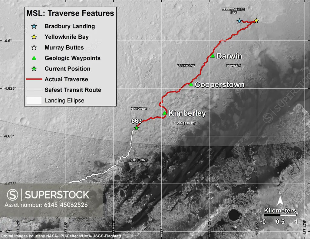
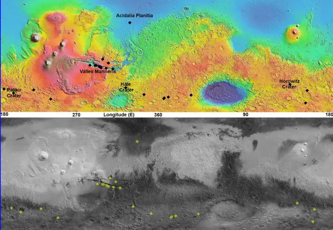
This map shows in red the route driven by NASA's Curiosity Mars rover from its landing site at 'Bradbury Landing.' The white line shows the planned route to reach destinations on Mount Sharp. Sol 669 will complete one Martian year.
SuperStock offers millions of photos, videos, and stock assets to creatives around the world. This image of This map shows in red the route driven by NASA's Curiosity Mars rover from its landing site at 'Bradbury Landing.' The white line shows the planned route to reach destinations on Mount Sharp. Sol 669 will complete one Martian year. by Piemags/PL Photography Limited is available for licensing today.
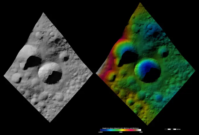
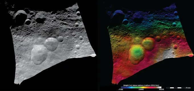
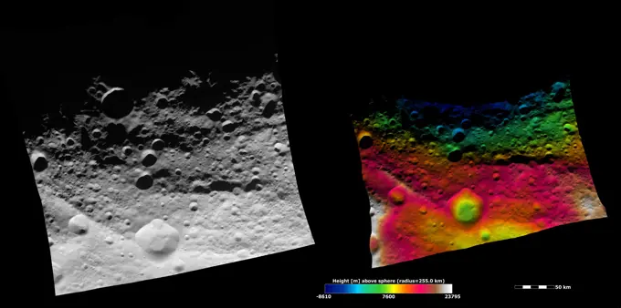
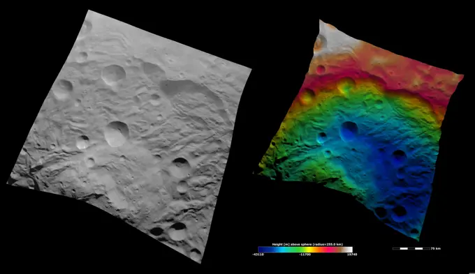
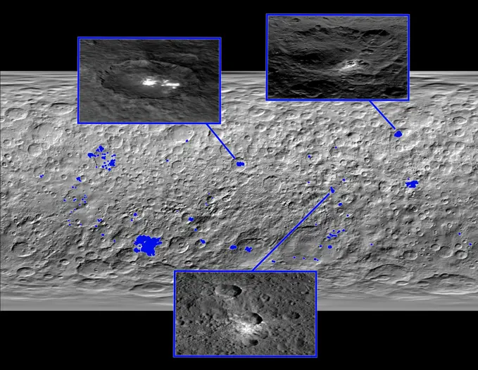
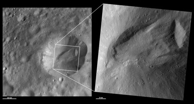
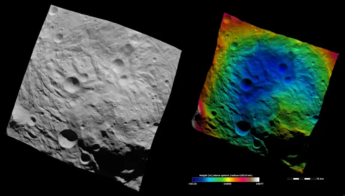
Visually Similar More from Asteroid Surfaces and Craters story


Looking for a license?
Click here, and we'll help you find it! Questions? Just ask!
Click here, and we'll help you find it! Questions? Just ask!
DETAILS
Image Number: 6145-45062526Royalty FreeCredit Line:Piemags/PL Photography Limited/SuperStockCollection:PL Photography Limited Story:Asteroid Surfaces and CratersContributor:Piemags Model Release:NoProperty Release:NoResolution:3300×2550