This is a map of lower Mount Sharp on Mars, showing the major geologic units identified from orbit. The rocks of the 'Murray Formation,' mapped in green, likely represent the oldest layers of Mount Sharp that NASA's Curiosity rover will explore.
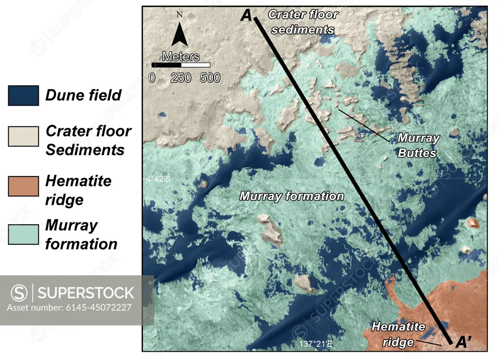
SuperStock offers millions of photos, videos, and stock assets to creatives around the world. This image of This is a map of lower Mount Sharp on Mars, showing the major geologic units identified from orbit. The rocks of the 'Murray Formation,' mapped in green, likely represent the oldest layers of Mount Sharp that NASA's Curiosity rover will explore. by Piemags/PL Photography Limited is available for licensing today.
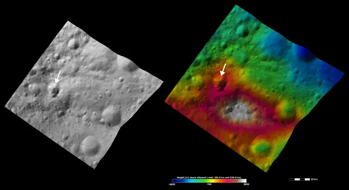
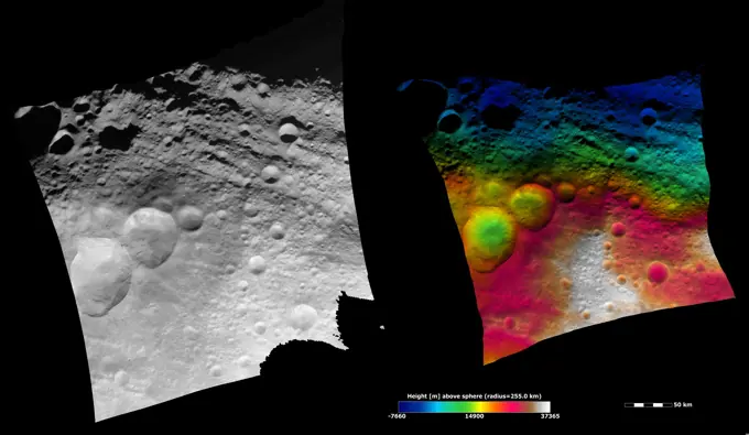
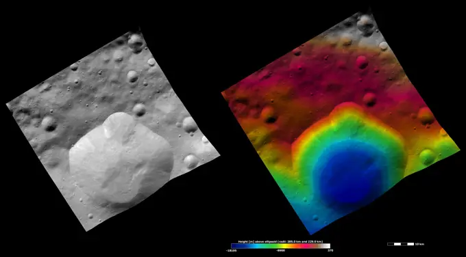
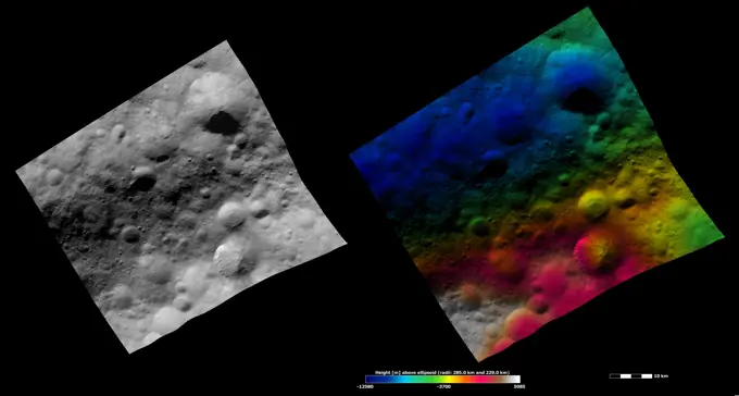
Visually Similar More from Asteroid Vesta Imagery story


Looking for a license?
Click here, and we'll help you find it! Questions? Just ask!
Click here, and we'll help you find it! Questions? Just ask!
DETAILS
Image Number: 6145-45072227Royalty FreeCredit Line:Piemags/PL Photography Limited/SuperStockCollection:PL Photography Limited Story:Asteroid Vesta ImageryContributor:Piemags Model Release:NoProperty Release:NoResolution:4173×3008