Map of Java, during the Java War 1825-1830 (right part), Alfred Bayly, After de Stuers, 1830 print Map of a part of the south side of the island of Java around Yogyakarta, during the Java War 1825-1830, prepared by Major De Stuers in the headquarters in Magelang, 31 January 1830. Large map consisting of two parts of which this is the right part. Leiden paper maps of separate countries or regions Java
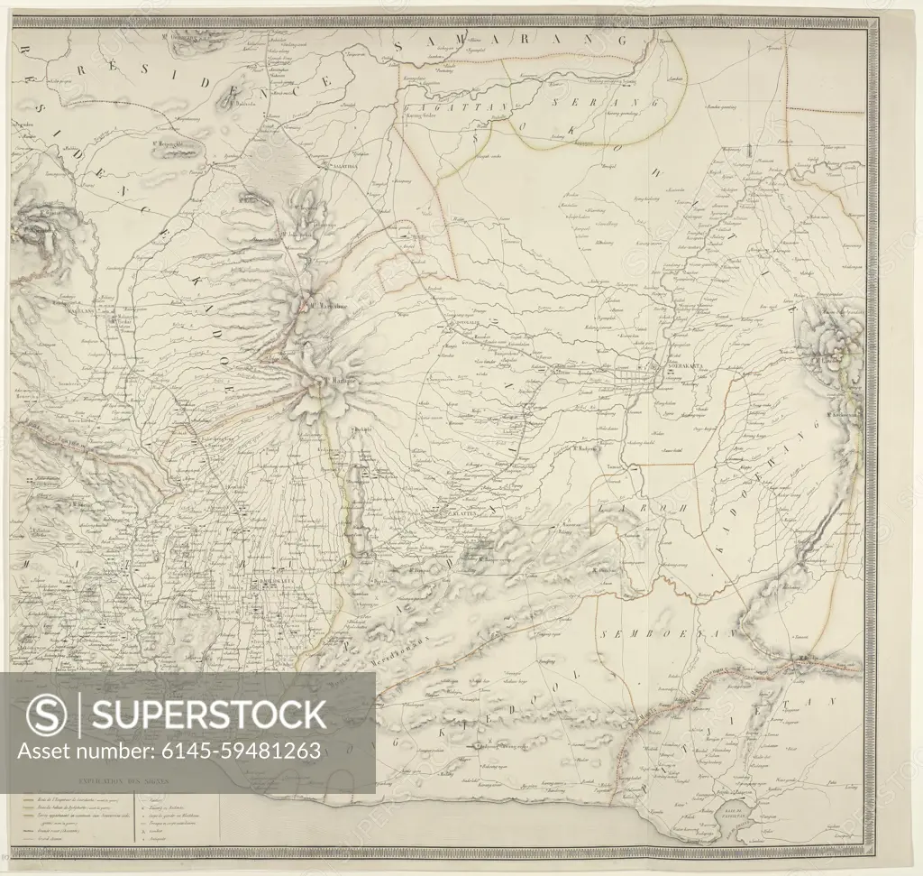
SuperStock offers millions of photos, videos, and stock assets to creatives around the world. This image of Map of Java, during the Java War 1825-1830 (right part), Alfred Bayly, After de Stuers, 1830 print Map of a part of the south side of the island of Java around Yogyakarta, during the Java War 1825-1830, prepared by Major De Stuers in the headquarters in Magelang, 31 January 1830. Large map consisting of two parts of which this is the right part. Leiden paper maps of separate countries or regions Java by Piemags/PL Photography Limited is available for licensing today.
Visually Similar More from Historical U.S. State Maps story


Looking for a license?
Click here, and we'll help you find it! Questions? Just ask!
Click here, and we'll help you find it! Questions? Just ask!
DETAILS
Image Number: 6145-59481263Royalty FreeCredit Line:Piemags/PL Photography Limited/SuperStockCollection:PL Photography Limited Story:Historical U.S. State MapsContributor:Piemags Model Release:NoProperty Release:NoResolution:5058×4798