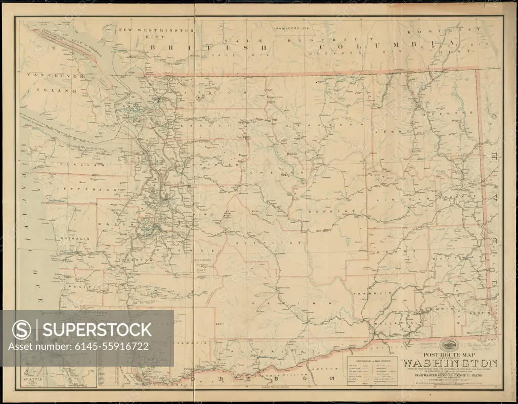
Post route map of the state of Washington showing post offices with the intermediate distances and mail routes in operation on the 1st of December, 1903. Also shows railroads and counties. Relief shown by hachures and spot heights. Inset: Seattle and vicinity. Includes lists of counties showing relative position.... , Washington
SuperStock offers millions of photos, videos, and stock assets to creatives around the world. This image of Post route map of the state of Washington showing post offices with the intermediate distances and mail routes in operation on the 1st of December, 1903. Also shows railroads and counties. Relief shown by hachures and spot heights. Inset: Seattle and vicinity. Includes lists of counties showing relative position.... , Washington by Piemags/PL Photography Limited is available for licensing today.
Looking for a license?
Click here, and we'll help you find it! Questions? Just ask!
Click here, and we'll help you find it! Questions? Just ask!
DETAILS
Image Number: 6145-55916722Royalty FreeCredit Line:Piemags/PL Photography Limited/SuperStockCollection:PL Photography Limited Story:Historical U.S. State MapsContributor:Piemags Model Release:NoProperty Release:NoResolution:12404×9700