Map of Butler County, Ohio. This map was drawn from the original surveys of the range and township lines and from recent surveys of the subdivision fo the several sections in each township and published by John Crane. BPL copy assembled, sectioned in 4 pieces and mounted on cloth. Includes statistical table, list of church properties, list of county officers, population list, illustration of the Indianapolis and Cincinnati Junction Railway bridge and viaduct and 10 views of public and commercial properties.... , Ohio , Butler ,county
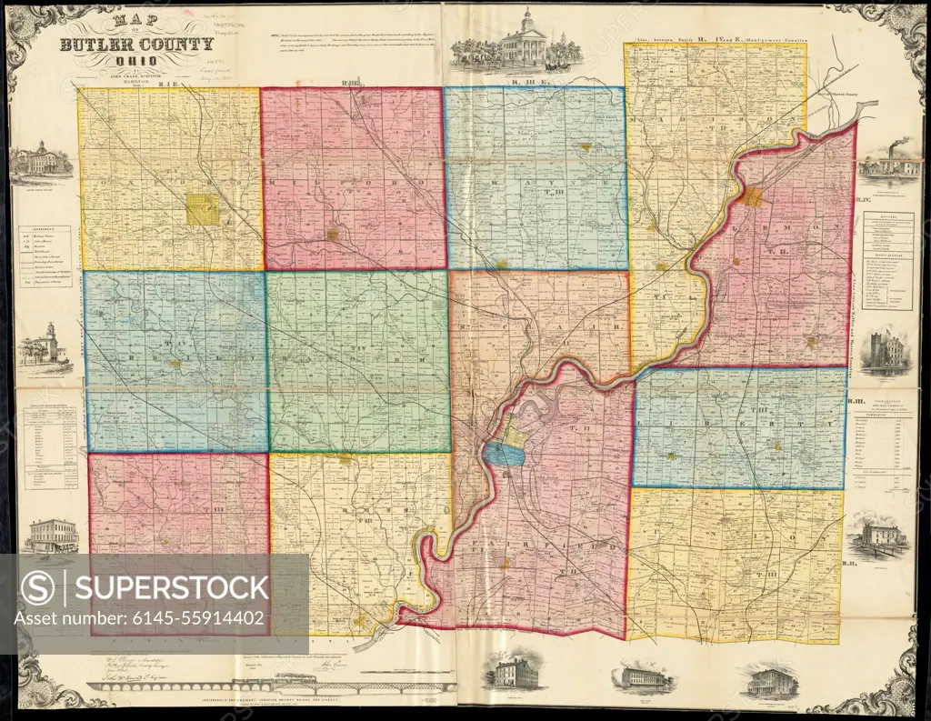
SuperStock offers millions of photos, videos, and stock assets to creatives around the world. This image of Map of Butler County, Ohio. This map was drawn from the original surveys of the range and township lines and from recent surveys of the subdivision fo the several sections in each township and published by John Crane. BPL copy assembled, sectioned in 4 pieces and mounted on cloth. Includes statistical table, list of church properties, list of county officers, population list, illustration of the Indianapolis and Cincinnati Junction Railway bridge and viaduct and 10 views of public and commercial properties.... , Ohio , Butler ,county by Piemags/PL Photography Limited is available for licensing today.
Looking for a license?
Click here, and we'll help you find it! Questions? Just ask!
Click here, and we'll help you find it! Questions? Just ask!
DETAILS
Image Number: 6145-55914402Royalty FreeCredit Line:Piemags/PL Photography Limited/SuperStockCollection:PL Photography Limited Story:Topographical and Postal MapsContributor:Piemags Model Release:NoProperty Release:NoResolution:12710×9844