This image shows a UAVSAR interferogram swath overlaid atop a Google Earth image. New NASA airborne radar images show the continuing deformation in Earth's surface resulting from the magnitude 7.2 temblor in Baja California on April 4, 2010.

SuperStock offers millions of photos, videos, and stock assets to creatives around the world. This image of This image shows a UAVSAR interferogram swath overlaid atop a Google Earth image. New NASA airborne radar images show the continuing deformation in Earth's surface resulting from the magnitude 7.2 temblor in Baja California on April 4, 2010. by Piemags/PL Photography Limited is available for licensing today.
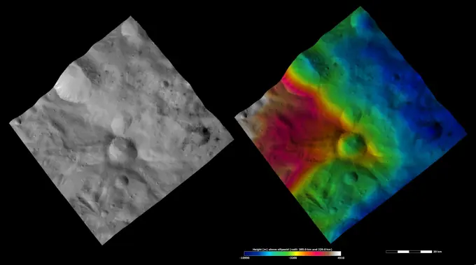
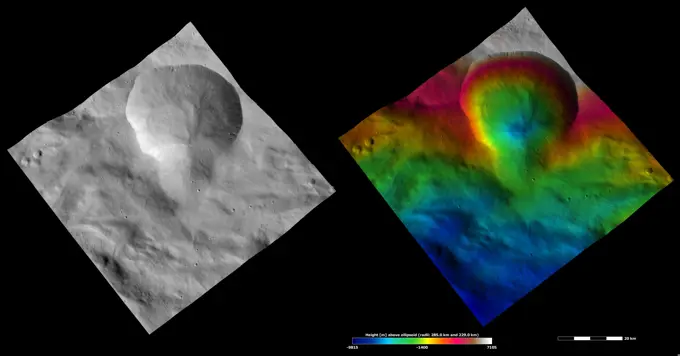
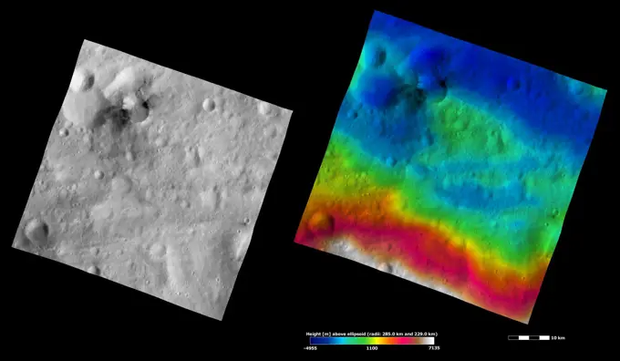
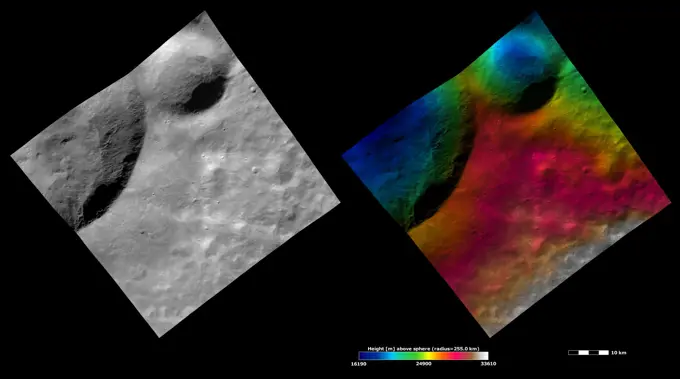
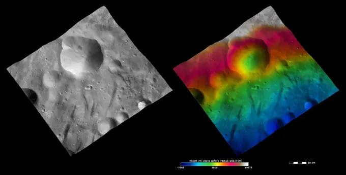
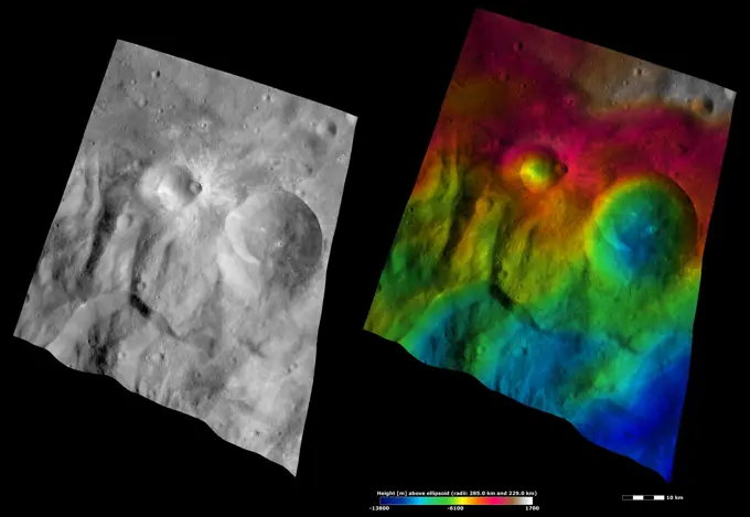
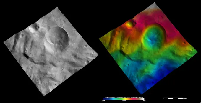
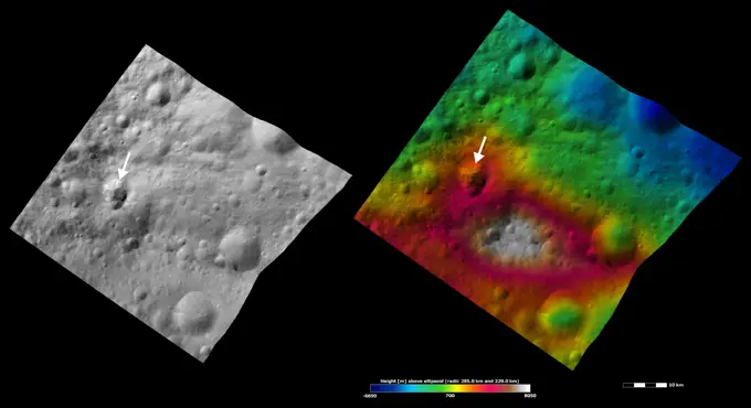
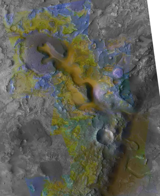
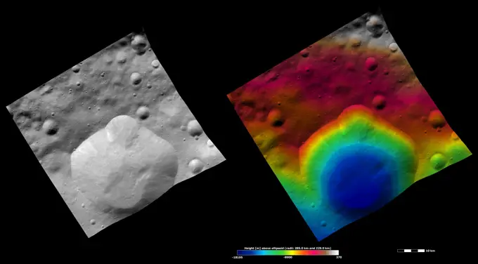
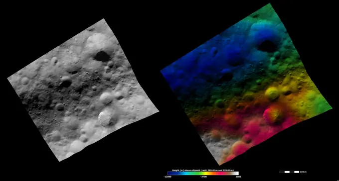
Visually Similar More from Asteroid Vesta Imagery story


Looking for a license?
Click here, and we'll help you find it! Questions? Just ask!
Click here, and we'll help you find it! Questions? Just ask!
DETAILS
Image Number: 6145-44826277Royalty FreeCredit Line:Piemags/PL Photography Limited/SuperStockCollection:PL Photography Limited Story:Asteroid Vesta ImageryContributor:Piemags Model Release:NoProperty Release:NoResolution:2256×1464