1803 Lewis and Clark map, with annotations in brown ink by Meriwether Lewis, tracing the Mississippi and Missouri Rivers, Lakes Michigan, Superior, and Winnipeg, and the country onwards to the Pacific. Manuscript map by Nicholas King, ca. 1803
This image has restrictions and cannot be purchased online. Get in touch for more details.
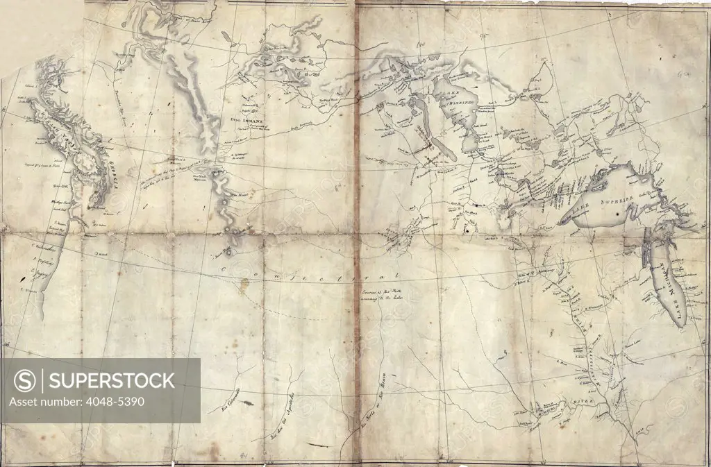
SuperStock offers millions of photos, videos, and stock assets to creatives around the world. This image of 1803 Lewis and Clark map, with annotations in brown ink by Meriwether Lewis, tracing the Mississippi and Missouri Rivers, Lakes Michigan, Superior, and Winnipeg, and the country onwards to the Pacific. Manuscript map by Nicholas King, ca. 1803 by Everett Collection is available for licensing today.
DETAILS
Image Number: 4048-5390Rights ManagedCredit Line:SuperStock / Everett CollectionCollection: Everett Collection Model Release:NoProperty Release:NoResolution:2550×1676
Free Research
Can't find the usage you need?
We're here to help!
Phone: +1 866 236 0087
Email: help@superstock.com
Research / License Request Form
Can't find the usage you need?
We're here to help!
Phone: +1 866 236 0087
Email: help@superstock.com
Research / License Request Form
Retouching Services
Our MediaMagnet division offers comprehensive retouching services at great rates. For a free quote, please send us an e-mail and we'll get back to you promptly.
Email: Retouching Service
Our MediaMagnet division offers comprehensive retouching services at great rates. For a free quote, please send us an e-mail and we'll get back to you promptly.
Email: Retouching Service