1771 Zannoni Map of the British Isles (England, Scotland, Ireland)
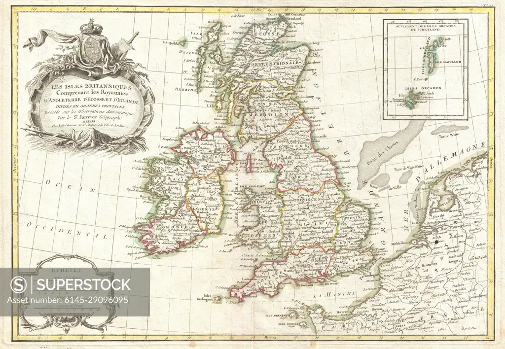
SuperStock offers millions of photos, videos, and stock assets to creatives around the world. This image of Explore the Historic 18th Century Map of the British Isles – A Detailed Geographical Illustration of England, Scotland, and Ireland. Perfect for History Enthusiasts and Cartography Lovers. by Piemags/PL Photography Limited is available for licensing today.
Looking for a license?
Click here, and we'll help you find it! Questions? Just ask!
Click here, and we'll help you find it! Questions? Just ask!
DETAILS
Image Number: 6145-29096095Royalty FreeCredit Line:Piemags/PL Photography Limited/SuperStockCollection: