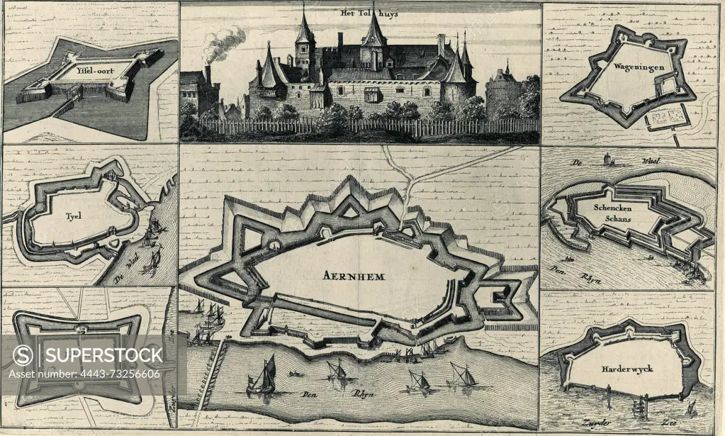
Yssel-Oort, Tyel, Elburg, Het Tolhuys, Aernhem, Wageningen, Schenckenschans, Harderwyck, Seven fortification plans and a view of Het Tolhuis near Lobit, Seven plans of fortifications captured by the French in 1672 and a view of Het Tollhouse, burned down by the French in 1672. On the left the maps of IJseloord, Tiel and Elburg. In the middle a view of the Tollhouse, near Lobith, and a fortress plan of Arnhem. On the right the maps of Wageningen, Schenkenschans and Harderwijk., print, prent, map, historical print, prints, Frederik Muller Historieplaten, height 209 mm, width 314 mm, print maker, printmaker, 1675 - 1675, paper, papier, etching, etsen
SuperStock offers millions of photos, videos, and stock assets to creatives around the world. This image of Yssel-Oort, Tyel, Elburg, Het Tolhuys, Aernhem, Wageningen, Schenckenschans, Harderwyck, Seven fortification plans and a view of Het Tolhuis near Lobit, Seven plans of fortifications captured by the French in 1672 and a view of Het Tollhouse, burned down by the French in 1672. On the left the maps of IJseloord, Tiel and Elburg. In the middle a view of the Tollhouse, near Lobith, and a fortress plan of Arnhem. On the right the maps of Wageningen, Schenkenschans and Harderwijk., print, prent, map, historical print, prints, Frederik Muller Historieplaten, height 209 mm, width 314 mm, print maker, printmaker, 1675 - 1675, paper, papier, etching, etsen by Artokoloro is available for licensing today.
Looking for a license?
Click here, and we'll help you find it! Questions? Just ask!
Click here, and we'll help you find it! Questions? Just ask!
DETAILS
Image Number: 4443-73256606Rights ManagedCredit Line:Artokoloro/SuperStockCollection:Artokoloro Model Release:NoProperty Release:NoResolution:3520×2116