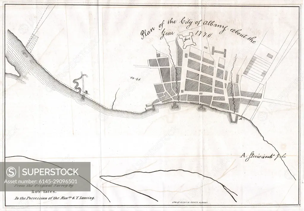
1820 Yates Map of Albany circa 1770
SuperStock offers millions of photos, videos, and stock assets to creatives around the world. This image of Explore Historic Albany: 1770 City Map Reveals Architectural Heritage and Urban Layout by Piemags/PL Photography Limited is available for licensing today.
DETAILS
Image Number: 6145-29096501Royalty FreeCredit Line:Piemags/PL Photography Limited/SuperStockCollection: