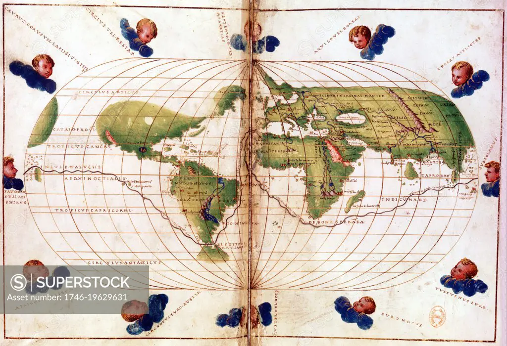
World map of route taken by Ferdinand Magellan (c1480-1521) when he led first circumnavigation of the globe 1519-1521. Mercator projection. Bibliotheque Nationale
SuperStock offers millions of photos, videos, and stock assets to creatives around the world. This image of World map of route taken by Ferdinand Magellan (c1480-1521) when he led first circumnavigation of the globe 1519-1521. Mercator projection. Bibliotheque Nationale by World History Archive/Image Asset Management is available for licensing today.
Looking for a license?
Click here, and we'll help you find it! Questions? Just ask!
Click here, and we'll help you find it! Questions? Just ask!
DETAILS
Image Number: 1746-19629631Rights ManagedCredit Line:World History Archive/Image Asset Management/SuperStockCollection:Image Asset Management Contributor:World History Archive Model Release:NoProperty Release:NoResolution:4500×3079