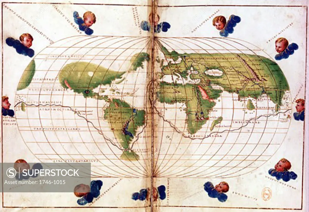
World map of route taken by Ferdinand Magellan (c1480-1521) when he led first circumnavigation of the globe 1519-21. Mercator projection. Bibliotheque Nationale
SuperStock offers millions of photos, videos, and stock assets to creatives around the world. This image of World map of route taken by Ferdinand Magellan (c1480-1521) when he led first circumnavigation of the globe 1519-21. Mercator projection. Bibliotheque Nationale by Image Asset Management/World History Archive is available for licensing today.
DETAILS
Image Number: 1746-1015Rights ManagedCredit Line:Image Asset Management/World History Archive/SuperStockCollection: