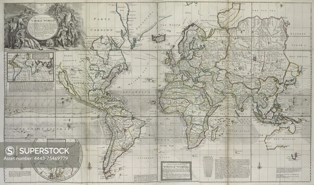
A world map from 1736, showcasing the locations of its principal parts based on the latest and most accurate observations. The map is hand-colored and measures 74 x 123 cm, folded to 59.5 x 28 cm. It was published in London by Tho. Bowles, a print and map-seller in St. Paul's Churchyard
SuperStock offers millions of photos, videos, and stock assets to creatives around the world. This image of A world map from 1736, showcasing the locations of its principal parts based on the latest and most accurate observations. The map is hand-colored and measures 74 x 123 cm, folded to 59.5 x 28 cm. It was published in London by Tho. Bowles, a print and map-seller in St. Paul's Churchyard by Artokoloro is available for licensing today.
Looking for a license?
Click here, and we'll help you find it! Questions? Just ask!
Click here, and we'll help you find it! Questions? Just ask!
DETAILS
Image Number: 4443-75469779Rights ManagedCredit Line:Artokoloro/SuperStockCollection:Artokoloro Model Release:NoProperty Release:NoResolution:5700×3362