Woods' new map of Pittsburgh, Allegheny, and surroundings, issued in 1867. The map measures 25 x 35 cm and was published by A. Hani in Pittsburgh, Pennsylvania. The NYPL Map Division copy has had its margins trimmed off
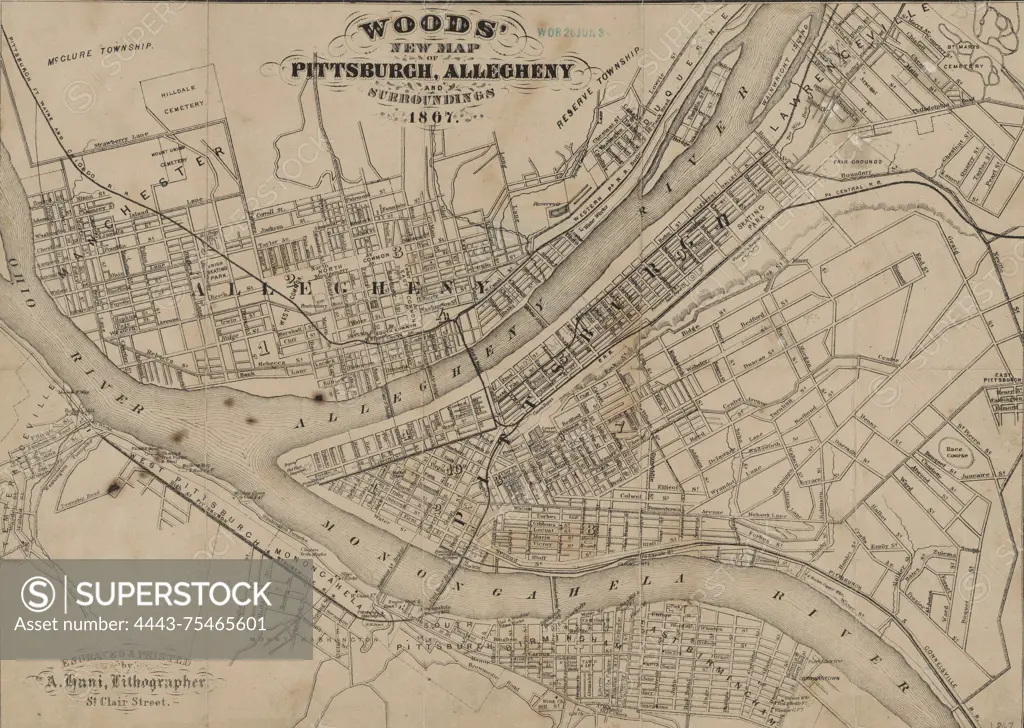
SuperStock offers millions of photos, videos, and stock assets to creatives around the world. This image of Woods' new map of Pittsburgh, Allegheny, and surroundings, issued in 1867. The map measures 25 x 35 cm and was published by A. Hani in Pittsburgh, Pennsylvania. The NYPL Map Division copy has had its margins trimmed off by Artokoloro is available for licensing today.
Looking for a license?
Click here, and we'll help you find it! Questions? Just ask!
Click here, and we'll help you find it! Questions? Just ask!
DETAILS
Image Number: 4443-75465601Rights ManagedCredit Line:Artokoloro/SuperStockCollection:Artokoloro Model Release:NoProperty Release:NoResolution:5700×4056