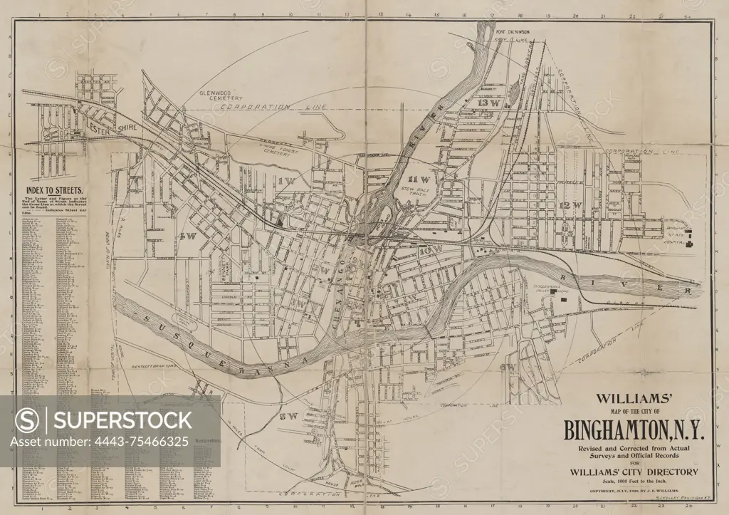
Williams' map of the City of Binghamton, N.Y. revised and corrected from actual surveys and official records for Williams' city directory, 1899. Additional, Map of the City of Binghamton, N.Y., 1899., Binghamton, N.Y. Publisher, J.E. Williams. Real property, New York (State), Binghamton, Binghamton (N.Y.), Broome County (N.Y.)., 1 map; 48 x 69 cm, on sheet 61 x 83 cm., A historical map of the City of Binghamton, New York, published in 1899 by J.E. Williams. The map is based on actual surveys and official records, depicting the layout of the city and its real properties. The map measures 48 x 69 cm and is presented on a larger sheet measuring 61 x 83 cm
SuperStock offers millions of photos, videos, and stock assets to creatives around the world. This image of Williams' map of the City of Binghamton, N.Y. revised and corrected from actual surveys and official records for Williams' city directory, 1899. Additional, Map of the City of Binghamton, N.Y., 1899., Binghamton, N.Y. Publisher, J.E. Williams. Real property, New York (State), Binghamton, Binghamton (N.Y.), Broome County (N.Y.)., 1 map; 48 x 69 cm, on sheet 61 x 83 cm., A historical map of the City of Binghamton, New York, published in 1899 by J.E. Williams. The map is based on actual surveys and official records, depicting the layout of the city and its real properties. The map measures 48 x 69 cm and is presented on a larger sheet measuring 61 x 83 cm by Artokoloro is available for licensing today.
Looking for a license?
Click here, and we'll help you find it! Questions? Just ask!
Click here, and we'll help you find it! Questions? Just ask!
DETAILS
Image Number: 4443-75466325Rights ManagedCredit Line:Artokoloro/SuperStockCollection:Artokoloro Model Release:NoProperty Release:NoResolution:5700×4029