Westchester, Double Page Plate No. 6 Map bounded by Morris St., Hudson River, Well Ave., Cromwell Pl., Palisade Ave., Elm St., 1893., 1893., New York. Publisher, Bien, Joseph R. Westchester County (N.Y.)
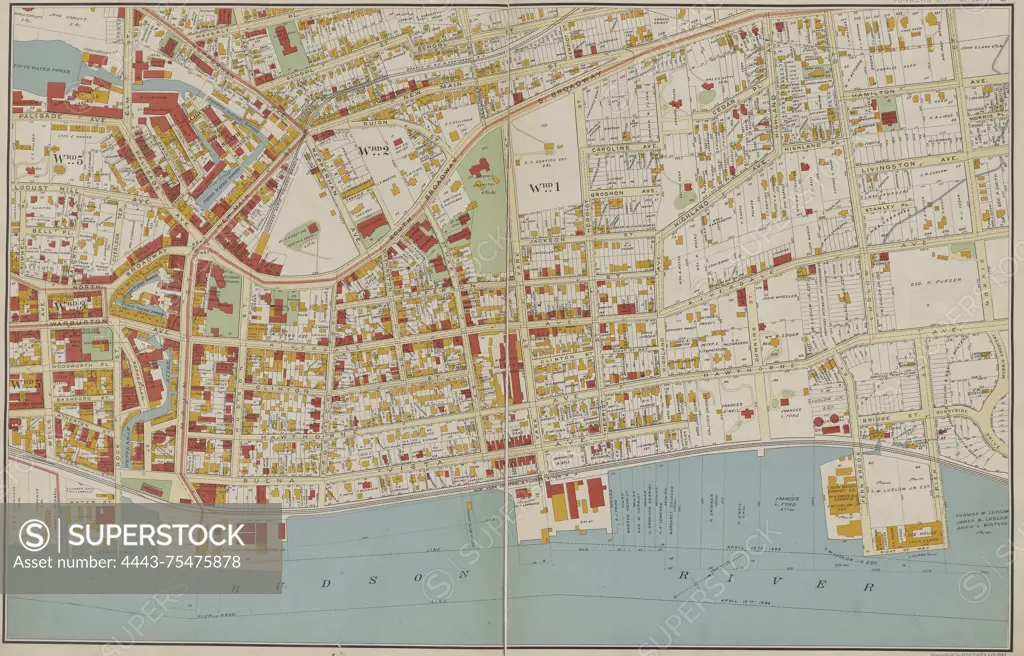
SuperStock offers millions of photos, videos, and stock assets to creatives around the world. This image of Westchester, Double Page Plate No. 6 Map bounded by Morris St., Hudson River, Well Ave., Cromwell Pl., Palisade Ave., Elm St., 1893., 1893., New York. Publisher, Bien, Joseph R. Westchester County (N.Y.) by Artokoloro is available for licensing today.
Looking for a license?
Click here, and we'll help you find it! Questions? Just ask!
Click here, and we'll help you find it! Questions? Just ask!
DETAILS
Image Number: 4443-75475878Rights ManagedCredit Line:Artokoloro/SuperStockCollection:Artokoloro Model Release:NoProperty Release:NoResolution:5464×3502