We can measure how fast tectonic plates are moving today with the Global Positioning System (GPS) method. The three most commonly used space-geodetic techniques. very long baseline interferometry (VLBI), satellite laser ranging (SLR), and the Global Positioning System (GPS)are based on technologies developed for military and aerospace research, notably radio astronomy and satellite tracking.
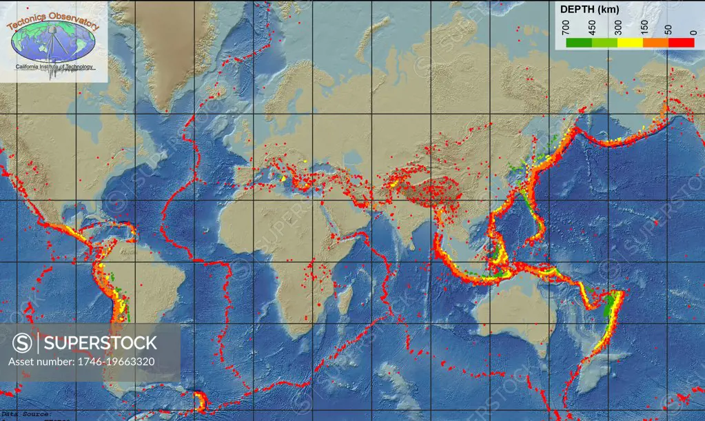
SuperStock offers millions of photos, videos, and stock assets to creatives around the world. This image of We can measure how fast tectonic plates are moving today with the Global Positioning System (GPS) method. The three most commonly used space-geodetic techniques. very long baseline interferometry (VLBI), satellite laser ranging (SLR), and the Global Positioning System (GPS)are based on technologies developed for military and aerospace research, notably radio astronomy and satellite tracking. by World History Archive/Image Asset Management is available for licensing today.
Looking for a license?
Click here, and we'll help you find it! Questions? Just ask!
Click here, and we'll help you find it! Questions? Just ask!
DETAILS
Image Number: 1746-19663320Rights ManagedCredit Line:World History Archive/Image Asset Management/SuperStockCollection:Image Asset Management Contributor:World History Archive Model Release:NoProperty Release:NoResolution:5500×3282