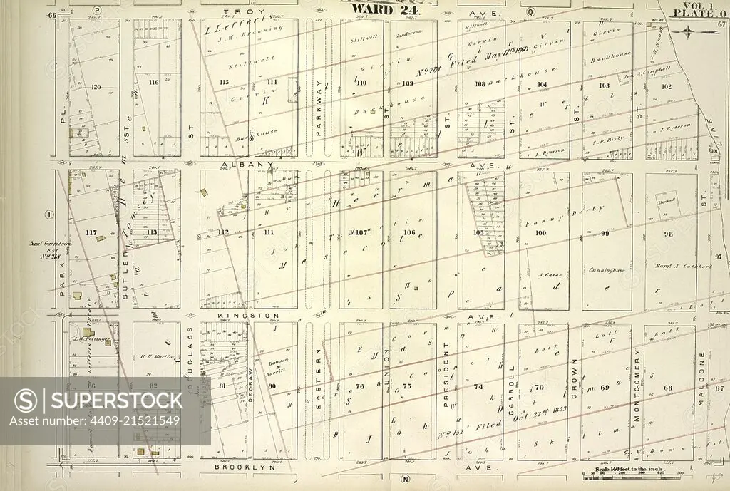
Vol. 1. Plate, O. Map bound by Troy Ave., City Line, Brooklyn Ave., Park PL; Including Albany Ave., Kingston Ave., Butler St., Douglass St., Degraw St., Eastern Parkway, Union St., President St., Carroll St., Crown St., Montgomery St., Marion St.
SuperStock offers millions of photos, videos, and stock assets to creatives around the world. This image of Explore Historical Urban Planning with This Vintage City Map: Uncover the Layout and Architecture of Early 20th Century Urban Development. by quintlox/Album Archivo/Album is available for licensing today.
Looking for a license?
Click here, and we'll help you find it! Questions? Just ask!
Click here, and we'll help you find it! Questions? Just ask!
DETAILS
Image Number: 4409-21521549Rights ManagedCredit Line:quintlox/Album Archivo/Album/SuperStockCollection:Album Archivo Contributor:quintlox Model Release:NoProperty Release:NoResolution:6520×4387