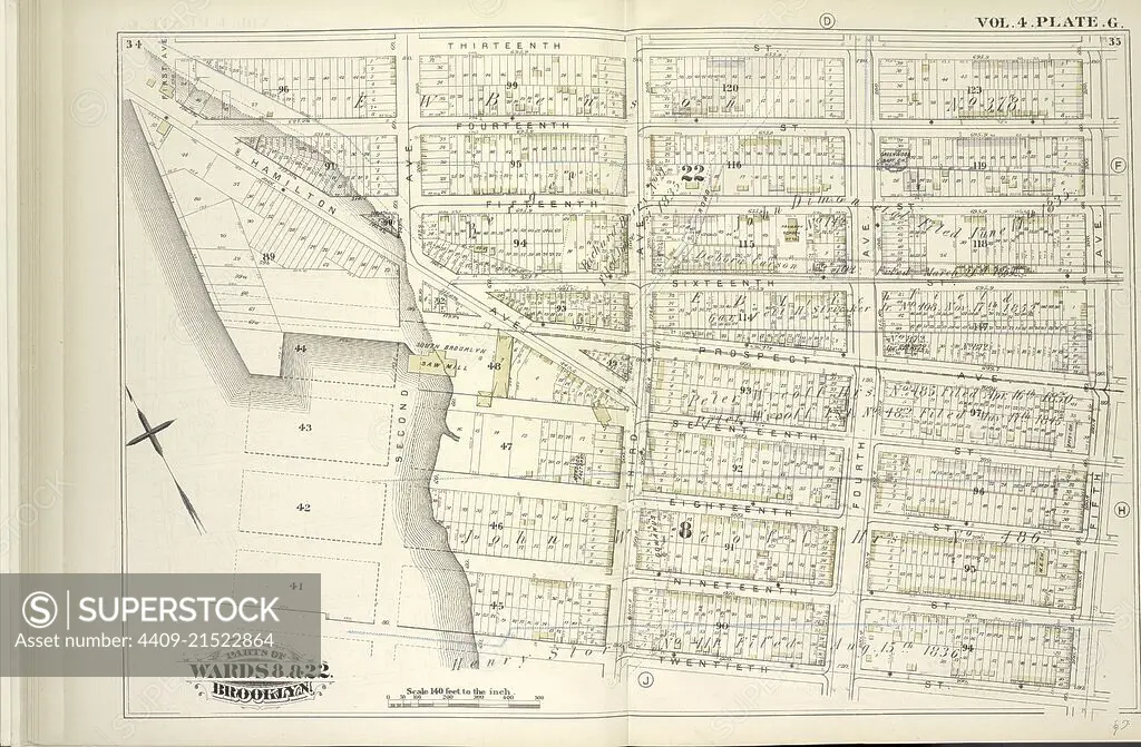
Vol. 4. Plate, G. Map bound by Thirteenth St., Fifth Ave., Twentieth St., Gowanus Bay; Including Fourteenth St., Fifteenth St., Fifteenth St., Sixteenth St., Prospect Ave., Seventeenth St., Eighteenth St., Nineteenth St., Hamilton Ave., First Ave., Seco.
SuperStock offers millions of photos, videos, and stock assets to creatives around the world. This image of Explore Historic 19th Century Brooklyn Maps: Detailed Urban Planning and Architecture in Wards 8 & 22 by quintlox/Album Archivo/Album is available for licensing today.
Looking for a license?
Click here, and we'll help you find it! Questions? Just ask!
Click here, and we'll help you find it! Questions? Just ask!
DETAILS
Image Number: 4409-21522864Rights ManagedCredit Line:quintlox/Album Archivo/Album/SuperStockCollection:Album Archivo Contributor:quintlox Model Release:NoProperty Release:NoResolution:6520×4273