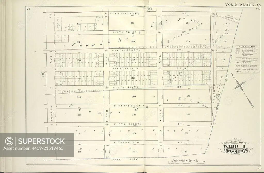
Vol. 4. Plate, Q. Map bound by Fifty-Second St., City Line, Fourth Ave.; Including Fifty-Third St., Fifty-Fourth St., Fifty-Fifth St., Fifty-Sixth St., Fifty-Seventh St., Fifty-Eighth St., Fifty-Ninth St., Fifth Ave., Sixth Ave., Seventh Ave.
SuperStock offers millions of photos, videos, and stock assets to creatives around the world. This image of Explore Historical Urban Planning with this Vintage City Map – Discover the Architectural Layout and Boundaries of Ward 8 in 19th Century Brooklyn. by quintlox/Album Archivo/Album is available for licensing today.
Looking for a license?
Click here, and we'll help you find it! Questions? Just ask!
Click here, and we'll help you find it! Questions? Just ask!
DETAILS
Image Number: 4409-21519465Rights ManagedCredit Line:quintlox/Album Archivo/Album/SuperStockCollection:Album Archivo Contributor:quintlox Model Release:NoProperty Release:NoResolution:6520×4273