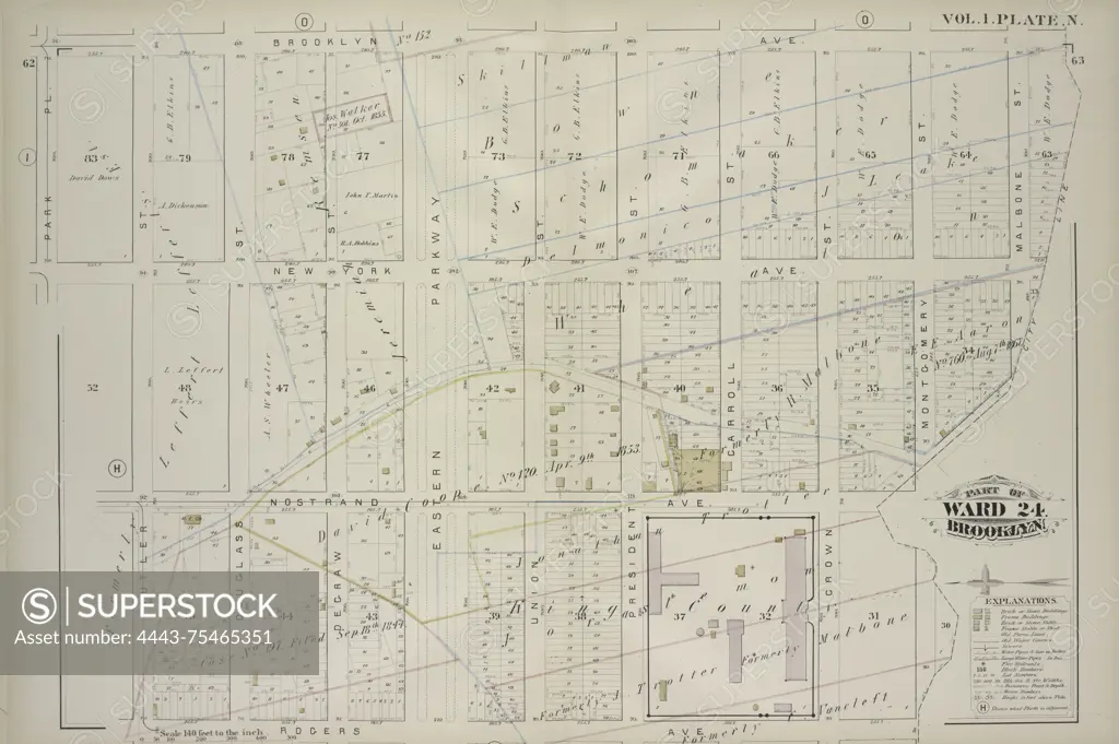
Vol. 1. Plate N. Map bound by Brooklyn Ave., City Line, Rogers Ave., Butler St., Park PL; including New York Ave., Nostrand Ave., Douglass St., Degraw St., Eastern Parkway, Union St., President St., Carroll St., Crown St., Montgomery St., Malbone St., 1880., Philadelphia. Publisher, G.M. Hopkins & Co. Real property, New York (State), New York
SuperStock offers millions of photos, videos, and stock assets to creatives around the world. This image of Vol. 1. Plate N. Map bound by Brooklyn Ave., City Line, Rogers Ave., Butler St., Park PL; including New York Ave., Nostrand Ave., Douglass St., Degraw St., Eastern Parkway, Union St., President St., Carroll St., Crown St., Montgomery St., Malbone St., 1880., Philadelphia. Publisher, G.M. Hopkins & Co. Real property, New York (State), New York by Artokoloro is available for licensing today.
Looking for a license?
Click here, and we'll help you find it! Questions? Just ask!
Click here, and we'll help you find it! Questions? Just ask!
DETAILS
Image Number: 4443-75465351Rights ManagedCredit Line:Artokoloro/SuperStockCollection:Artokoloro Model Release:NoProperty Release:NoResolution:6609×4401