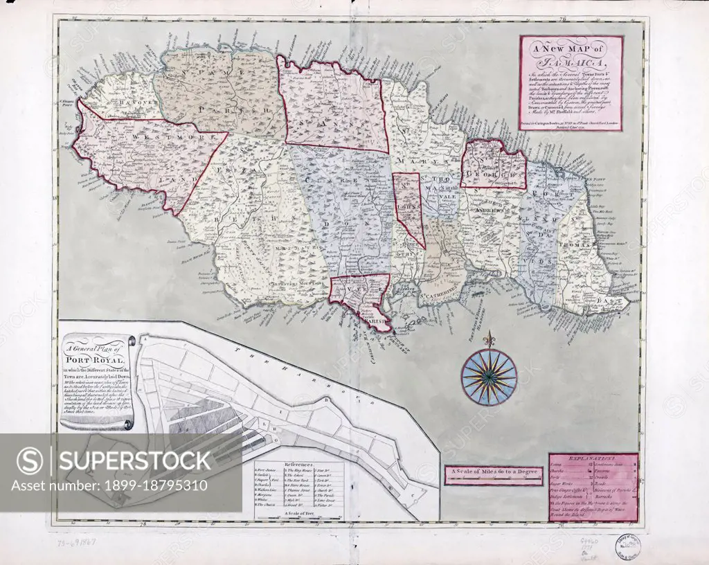
Vintage Maps / Antique Maps - A new map of Jamaica; in which the several towns, forts, & settlements are accurately laid down, as well as the situations & depths of the most noted harbours and anchoring places ca. 1771.
SuperStock offers millions of photos, videos, and stock assets to creatives around the world. This image of Vintage Maps / Antique Maps - A new map of Jamaica; in which the several towns, forts, & settlements are accurately laid down, as well as the situations & depths of the most noted harbours and anchoring places ca. 1771. by HUM Images/Universal Images is available for licensing today.
Looking for a license?
Click here, and we'll help you find it! Questions? Just ask!
Click here, and we'll help you find it! Questions? Just ask!
DETAILS
Image Number: 1899-18795310Rights ManagedCredit Line:HUM Images/Universal Images/SuperStockCollection: