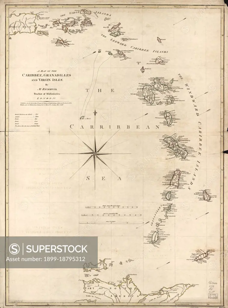
Vintage Maps / Antique Maps - A map of the Caribbean, Granadilles and Virgin Islands ca. 1779.
SuperStock offers millions of photos, videos, and stock assets to creatives around the world. This image of Vintage Maps / Antique Maps - A map of the Caribbean, Granadilles and Virgin Islands ca. 1779. by HUM Images/Universal Images is available for licensing today.
Looking for a license?
Click here, and we'll help you find it! Questions? Just ask!
Click here, and we'll help you find it! Questions? Just ask!
DETAILS
Image Number: 1899-18795312Rights ManagedCredit Line:HUM Images/Universal Images/SuperStockCollection: