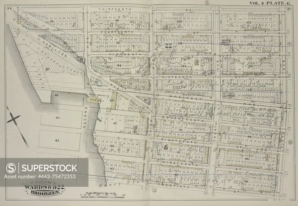
A vintage map from volume 4, created by G.M. Hopkins & Co. in 1880. The map is bounded by Thirteenth Street, Fifth Avenue, Twentieth Street, and Gowanus Bay, and includes various streets such as Fourteenth Street, Fifteenth Street, Sixteenth Street, Prospect Avenue, Seventeenth Street, Eighteenth Street, Nineteenth Street, Hamilton Avenue, and First through Fourth Avenues. The map is representative of real property in Brooklyn, New York
SuperStock offers millions of photos, videos, and stock assets to creatives around the world. This image of A vintage map from volume 4, created by G.M. Hopkins & Co. in 1880. The map is bounded by Thirteenth Street, Fifth Avenue, Twentieth Street, and Gowanus Bay, and includes various streets such as Fourteenth Street, Fifteenth Street, Sixteenth Street, Prospect Avenue, Seventeenth Street, Eighteenth Street, Nineteenth Street, Hamilton Avenue, and First through Fourth Avenues. The map is representative of real property in Brooklyn, New York by Artokoloro is available for licensing today.
Looking for a license?
Click here, and we'll help you find it! Questions? Just ask!
Click here, and we'll help you find it! Questions? Just ask!
DETAILS
Image Number: 4443-75472353Rights ManagedCredit Line:Artokoloro/SuperStockCollection:Artokoloro Model Release:NoProperty Release:NoResolution:5976×4135