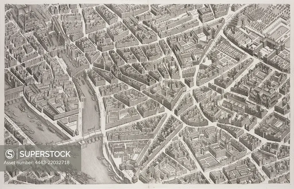
View of the Pont Neuf and Left Bank, 1739, Plan de Paris: commencé l'année 1734, dessiné et gravé sous les ordres de messire Michel Etienne Turgot, Marquis de Sousmons, et al.: achevé de graver en 1739, Bretez, Louis, d. 1738, Lucas, Claude, 18th cent., Engraving, 1740. Plate 11 in a group of 20 numbered sectional plans of Paris, each section measuring 52 x 82 cm. The plate size of this section spans two leaves of the book; the entire map of the city (all sections assembled together) measures 242 x 310 cm.
SuperStock offers millions of photos, videos, and stock assets to creatives around the world. This image of View of the Pont Neuf and Left Bank, 1739, Plan de Paris: commencé l'année 1734, dessiné et gravé sous les ordres de messire Michel Etienne Turgot, Marquis de Sousmons, et al.: achevé de graver en 1739, Bretez, Louis, d. 1738, Lucas, Claude, 18th cent., Engraving, 1740. Plate 11 in a group of 20 numbered sectional plans of Paris, each section measuring 52 x 82 cm. The plate size of this section spans two leaves of the book; the entire map of the city (all sections assembled together) measures 242 x 310 cm. by Artokoloro is available for licensing today.
Looking for a license?
Click here, and we'll help you find it! Questions? Just ask!
Click here, and we'll help you find it! Questions? Just ask!
DETAILS
Image Number: 4443-22032718Rights ManagedCredit Line:Artokoloro/SuperStockCollection:Artokoloro Model Release:NoProperty Release:NoResolution:5303×3416