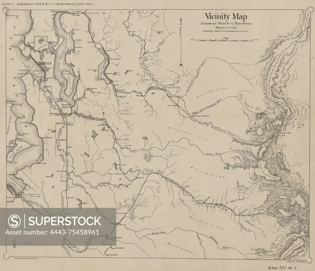
Vicinity map of the Duwamish River and its tributaries in Washington, 1898. Published by the U.S. House of Representatives, this map measures 35 x 42 cm on a sheet of 40 x 48 cm. It illustrates the Duwamish River Watershed and its surrounding watersheds, including the White River, Green River, Cedar River, and Snoqualmie River Watersheds
SuperStock offers millions of photos, videos, and stock assets to creatives around the world. This image of Vicinity map of the Duwamish River and its tributaries in Washington, 1898. Published by the U.S. House of Representatives, this map measures 35 x 42 cm on a sheet of 40 x 48 cm. It illustrates the Duwamish River Watershed and its surrounding watersheds, including the White River, Green River, Cedar River, and Snoqualmie River Watersheds by Artokoloro is available for licensing today.
Looking for a license?
Click here, and we'll help you find it! Questions? Just ask!
Click here, and we'll help you find it! Questions? Just ask!
DETAILS
Image Number: 4443-75458961Rights ManagedCredit Line:Artokoloro/SuperStockCollection:Artokoloro Model Release:NoProperty Release:NoResolution:5700×4901