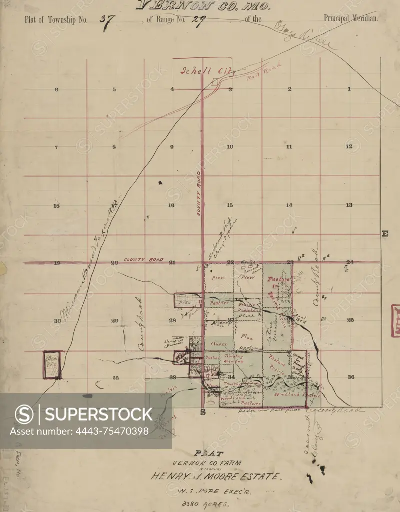
Vernon Co., Mo. plat of township no. 37, of range no. 29, of the principal meridian, 1870 - 1879. Additional, Plat Vernon Co. farm, Missouri Henry J. Moore estate., 1870 - 1879., Hannibal, Mo. Publisher, publisher not identified. Moore, Henry J, Estate, Vernon County (Mo.)., 1 map hand colored; on sheet 57 x 45 cm. NYPL Map Div. copy includes manuscript additions in ink and watercolor
SuperStock offers millions of photos, videos, and stock assets to creatives around the world. This image of Vernon Co., Mo. plat of township no. 37, of range no. 29, of the principal meridian, 1870 - 1879. Additional, Plat Vernon Co. farm, Missouri Henry J. Moore estate., 1870 - 1879., Hannibal, Mo. Publisher, publisher not identified. Moore, Henry J, Estate, Vernon County (Mo.)., 1 map hand colored; on sheet 57 x 45 cm. NYPL Map Div. copy includes manuscript additions in ink and watercolor by Artokoloro is available for licensing today.
Looking for a license?
Click here, and we'll help you find it! Questions? Just ask!
Click here, and we'll help you find it! Questions? Just ask!
DETAILS
Image Number: 4443-75470398Rights ManagedCredit Line:Artokoloro/SuperStockCollection:Artokoloro Model Release:NoProperty Release:NoResolution:4455×5700