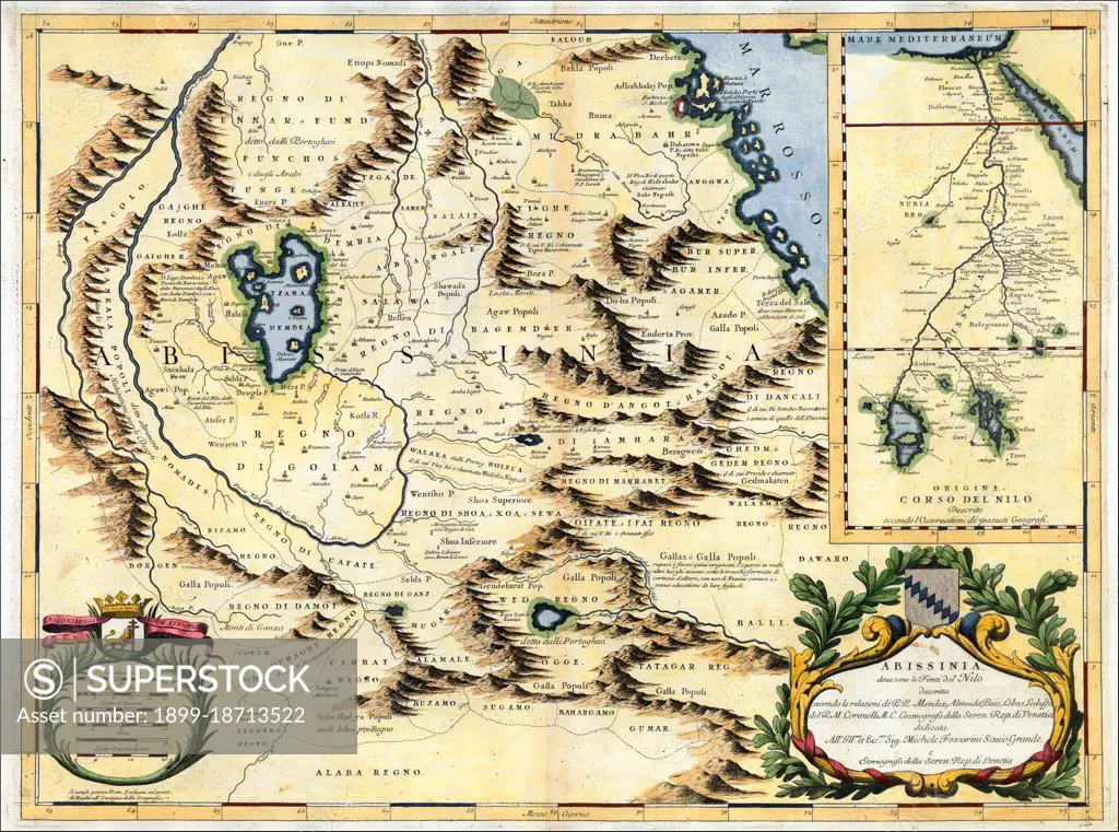
A Venetian cartographer, Coronelli (1650-1718) cites his sources for this Nile map, including the Portuguese Jesuits Pedro Páez and Jerónimo Lobo, and contrasts his work with an inset showing the original” (that is, outdated) course of the Nile as presented by past geographers, who followed the Ptolemaic tradition of two source lakes. Páez and Lobo had visited Ethiopia in the early 1600s, and both gave accounts of having seen the springs that natives believed to be the river’s source, though the Jesuits failed to distinguish between the two branches of the river. Coronelli’s Nile is the Blue Nile, and his geography is fairly accurate for that branch, identifying the significance of Lake Tsana and the clockwise unfolding of the river as it descends from there.
SuperStock offers millions of photos, videos, and stock assets to creatives around the world. This image of A Venetian cartographer, Coronelli (1650-1718) cites his sources for this Nile map, including the Portuguese Jesuits Pedro Páez and Jerónimo Lobo, and contrasts his work with an inset showing the original” (that is, outdated) course of the Nile as presented by past geographers, who followed the Ptolemaic tradition of two source lakes. Páez and Lobo had visited Ethiopia in the early 1600s, and both gave accounts of having seen the springs that natives believed to be the river’s source, though the Jesuits failed to distinguish between the two branches of the river. Coronelli’s Nile is the Blue Nile, and his geography is fairly accurate for that branch, identifying the significance of Lake Tsana and the clockwise unfolding of the river as it descends from there. by Pictures From History/Universal Images is available for licensing today.
Looking for a license?
Click here, and we'll help you find it! Questions? Just ask!
Click here, and we'll help you find it! Questions? Just ask!
DETAILS
Image Number: 1899-18713522Rights ManagedCredit Line:Pictures From History/Universal Images/SuperStockCollection: