1753 Vaugondy Map of Persia, Arabia and Turkey
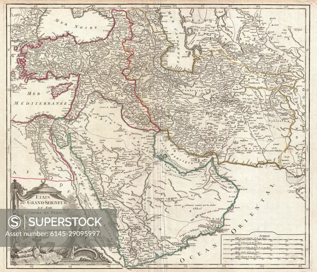
SuperStock offers millions of photos, videos, and stock assets to creatives around the world. This image of Explore the Historic Beauty of the 18th Century Middle Eastern Map - A Detailed Insight into Ancient Geopolitical Boundaries and Trade Routes. by Piemags/PL Photography Limited is available for licensing today.
DETAILS
Image Number: 6145-29095997Royalty FreeCredit Line:Piemags/PL Photography Limited/SuperStockCollection: