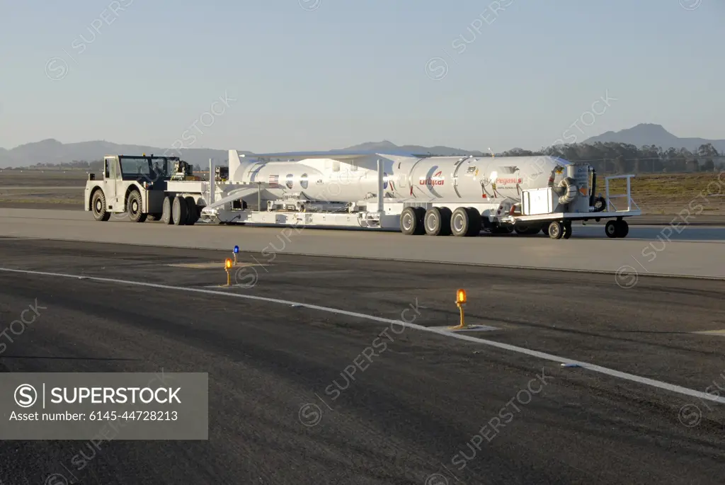
VANDENBERG AIR FORCE BASE, Fla. -- NASAs Interstellar Boundary Explorer, or IBEX, spacecraft and mated Pegasus XL rocket are transported to the ramp on Vandenberg Air Force Base in California. There, the rocket will be attached to Orbital Sciences L-1011 aircraft for launch. IBEX is targeted for launch from the Kwajalein Atoll, a part of the Marshall Islands in the Pacific Ocean, on Oct. 19. IBEX will be launched aboard the Pegasus rocket dropped from under the wing of the L-1011 aircraft flying over the Pacific Ocean. The Pegasus will carry the spacecraft approximately 130 miles above Earth and place it in orbit. The IBEX satellite will make the first map of the boundary between the Solar System and interstellar space.
SuperStock offers millions of photos, videos, and stock assets to creatives around the world. This image of VANDENBERG AIR FORCE BASE, Fla. -- NASAs Interstellar Boundary Explorer, or IBEX, spacecraft and mated Pegasus XL rocket are transported to the ramp on Vandenberg Air Force Base in California. There, the rocket will be attached to Orbital Sciences L-1011 aircraft for launch. IBEX is targeted for launch from the Kwajalein Atoll, a part of the Marshall Islands in the Pacific Ocean, on Oct. 19. IBEX will be launched aboard the Pegasus rocket dropped from under the wing of the L-1011 aircraft flying over the Pacific Ocean. The Pegasus will carry the spacecraft approximately 130 miles above Earth and place it in orbit. The IBEX satellite will make the first map of the boundary between the Solar System and interstellar space. by Piemags/PL Photography Limited is available for licensing today.
Looking for a license?
Click here, and we'll help you find it! Questions? Just ask!
Click here, and we'll help you find it! Questions? Just ask!
DETAILS
Image Number: 6145-44728213Royalty FreeCredit Line:Piemags/PL Photography Limited/SuperStockCollection:PL Photography Limited Story:Space Mission LogisticsContributor:Piemags Model Release:NoProperty Release:NoResolution:3000×2008