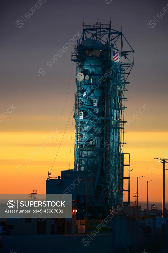
VANDENBERG AIR FORCE BASE, Calif. - The sun sets over the West Cost prior to the launch gantry being rolled back to reveal the United Launch Alliance Delta II rocket with the Soil Moisture Active Passive, or SMAP, satellite aboard, at the Space Launch Complex 2 at Vandenberg Air Force Base, California. SMAP is a remote sensing mission designed to measure and map the Earth's soil moisture distribution and freeze/thaw stat with unprecedented accuracy, resolution and coverage.SMAP will provide global measurements of soil moisture and its freeze/thaw state. These measurements will be used to enhance understanding of processes that link the water, energy and carbon cycles, and to extend the capabilities of weather and climate prediction models. SMAP data also will be used to quantify net carbon flux in boreal landscapes and to develop improved flood prediction and drought monitoring capabilities. Launch is scheduled for Jan. 29, 2015.
SuperStock offers millions of photos, videos, and stock assets to creatives around the world. This image of VANDENBERG AIR FORCE BASE, Calif. - The sun sets over the West Cost prior to the launch gantry being rolled back to reveal the United Launch Alliance Delta II rocket with the Soil Moisture Active Passive, or SMAP, satellite aboard, at the Space Launch Complex 2 at Vandenberg Air Force Base, California. SMAP is a remote sensing mission designed to measure and map the Earth's soil moisture distribution and freeze/thaw stat with unprecedented accuracy, resolution and coverage.SMAP will provide global measurements of soil moisture and its freeze/thaw state. These measurements will be used to enhance understanding of processes that link the water, energy and carbon cycles, and to extend the capabilities of weather and climate prediction models. SMAP data also will be used to quantify net carbon flux in boreal landscapes and to develop improved flood prediction and drought monitoring capabilities. Launch is scheduled for Jan. 29, 2015. by Piemags/PL Photography Limited is available for licensing today.
Looking for a license?
Click here, and we'll help you find it! Questions? Just ask!
Click here, and we'll help you find it! Questions? Just ask!
DETAILS
Image Number: 6145-45087031Royalty FreeCredit Line:Piemags/PL Photography Limited/SuperStockCollection:PL Photography Limited Contributor:Piemags Model Release:NoProperty Release:NoResolution:2002×3000