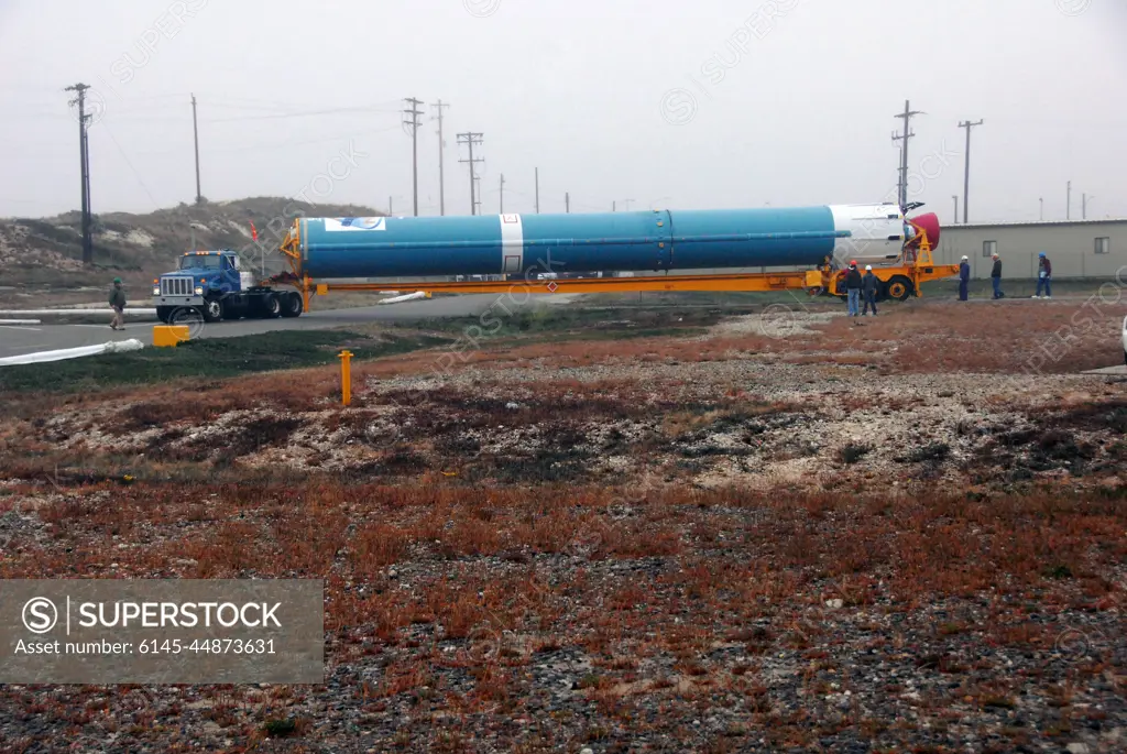
VANDENBERG AIR FORCE BASE, Calif. -- The first stage of a United Launch Alliance Delta II that will carry NASA's National Polar-orbiting Operational Environmental Satellite System Preparatory Project (NPP) satellite into space is on its way from NASA Hangar 836 to NASA's Space Launch Complex-2 at Vandenberg Air Force Base in California.NPP will be positioned 512 miles above the Earth's surface and will orbit about 16 times each day to observe nearly the entire globe. The NPP mission for NASA and the National Oceanic and Atmospheric Administration (NOAA) is to measure Earth's atmospheric and sea surface temperatures, humidity sounding, land and ocean biological activity, and cloud and aerosol properties.
SuperStock offers millions of photos, videos, and stock assets to creatives around the world. This image of VANDENBERG AIR FORCE BASE, Calif. -- The first stage of a United Launch Alliance Delta II that will carry NASA's National Polar-orbiting Operational Environmental Satellite System Preparatory Project (NPP) satellite into space is on its way from NASA Hangar 836 to NASA's Space Launch Complex-2 at Vandenberg Air Force Base in California.NPP will be positioned 512 miles above the Earth's surface and will orbit about 16 times each day to observe nearly the entire globe. The NPP mission for NASA and the National Oceanic and Atmospheric Administration (NOAA) is to measure Earth's atmospheric and sea surface temperatures, humidity sounding, land and ocean biological activity, and cloud and aerosol properties. by Piemags/PL Photography Limited is available for licensing today.
Looking for a license?
Click here, and we'll help you find it! Questions? Just ask!
Click here, and we'll help you find it! Questions? Just ask!
DETAILS
Image Number: 6145-44873631Royalty FreeCredit Line:Piemags/PL Photography Limited/SuperStockCollection:PL Photography Limited Contributor:Piemags Model Release:NoProperty Release:NoResolution:3000×2008