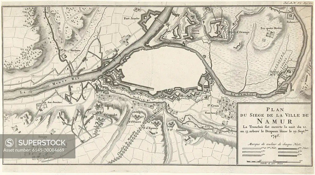
Van Het Plan Beleg van de stad Namen, 1746; Map of the siege of the city of Namur La Trouche was opened the night of the 12. to 13. sported the white flag on the 19th century 1746.plan of the reinforcements to the city Names, Besiestijd from 12-13 September and Taken by The French on September 19, 1746. Signature at the top right: Plan VI. PAG. 112.
SuperStock offers millions of photos, videos, and stock assets to creatives around the world. This image of Van Het Plan Beleg van de stad Namen, 1746; Map of the siege of the city of Namur La Trouche was opened the night of the 12. to 13. sported the white flag on the 19th century 1746.plan of the reinforcements to the city Names, Besiestijd from 12-13 September and Taken by The French on September 19, 1746. Signature at the top right: Plan VI. PAG. 112. by Piemags/PL Photography Limited is available for licensing today.
Looking for a license?
Click here, and we'll help you find it! Questions? Just ask!
Click here, and we'll help you find it! Questions? Just ask!
DETAILS
Image Number: 6145-30084669Royalty FreeCredit Line:Piemags/PL Photography Limited/SuperStockCollection:PL Photography Limited Contributor:Piemags Model Release:NoProperty Release:NoResolution:2500×1392