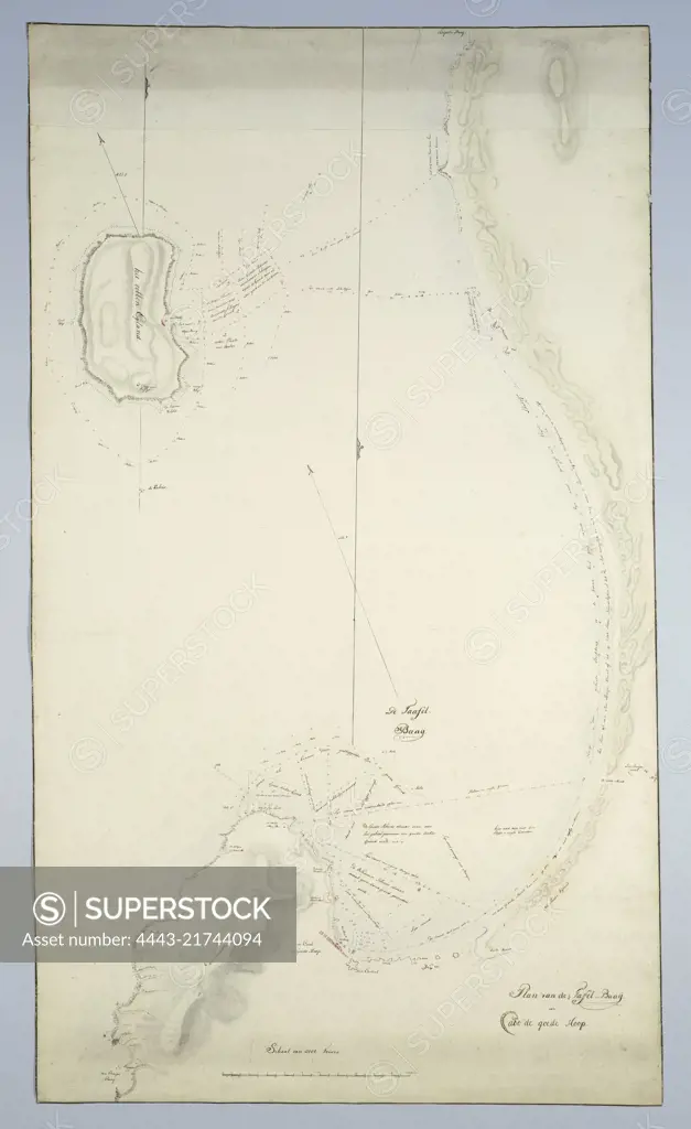
Unlocked by means of a guide map with demarcated areas, indicated by the letters A to G with indications of the type of sand, rocks and locations with their names, part F: Cape Town, also indicates the names of the buildings along Table Bay, Map of Table Bay and Robben Island., draughtsman: Robert Jacob Gordon, (attributed to), draughtsman: Johannes Schumacher, (possibly), draughtsman: J.C. Friderici, (attributed to), Kaapprovincie, c. 1788, paper, pen, brush, h 1135 mm × w 655 mm
SuperStock offers millions of photos, videos, and stock assets to creatives around the world. This image of Unlocked by means of a guide map with demarcated areas, indicated by the letters A to G with indications of the type of sand, rocks and locations with their names, part F: Cape Town, also indicates the names of the buildings along Table Bay, Map of Table Bay and Robben Island., draughtsman: Robert Jacob Gordon, (attributed to), draughtsman: Johannes Schumacher, (possibly), draughtsman: J.C. Friderici, (attributed to), Kaapprovincie, c. 1788, paper, pen, brush, h 1135 mm × w 655 mm by Artokoloro is available for licensing today.
Looking for a license?
Click here, and we'll help you find it! Questions? Just ask!
Click here, and we'll help you find it! Questions? Just ask!
DETAILS
Image Number: 4443-21744094Rights ManagedCredit Line:Artokoloro/SuperStockCollection:Artokoloro Model Release:NoProperty Release:NoResolution:2452×4000