A topographical plan of the ruins and surroundings of Medinet Habu in Thèbes, dated between 1809 and 1828. The map, published in Paris by Impr. impériale, measures 51 x 70 cm and provides a detailed representation of the ancient site in Egypt
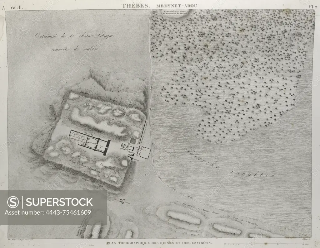
SuperStock offers millions of photos, videos, and stock assets to creatives around the world. This image of A topographical plan of the ruins and surroundings of Medinet Habu in Thèbes, dated between 1809 and 1828. The map, published in Paris by Impr. impériale, measures 51 x 70 cm and provides a detailed representation of the ancient site in Egypt by Artokoloro is available for licensing today.
Looking for a license?
Click here, and we'll help you find it! Questions? Just ask!
Click here, and we'll help you find it! Questions? Just ask!
DETAILS
Image Number: 4443-75461609Rights ManagedCredit Line:Artokoloro/SuperStockCollection:Artokoloro Model Release:NoProperty Release:NoResolution:5318×4137