A topographical map of the state of New Hampshire from 1878, issued in New York, N.Y. The map includes details related to land grants in New Hampshire. It measures 53 x 36 cm on a sheet that is 61 x 43 cm. The publisher is not identified
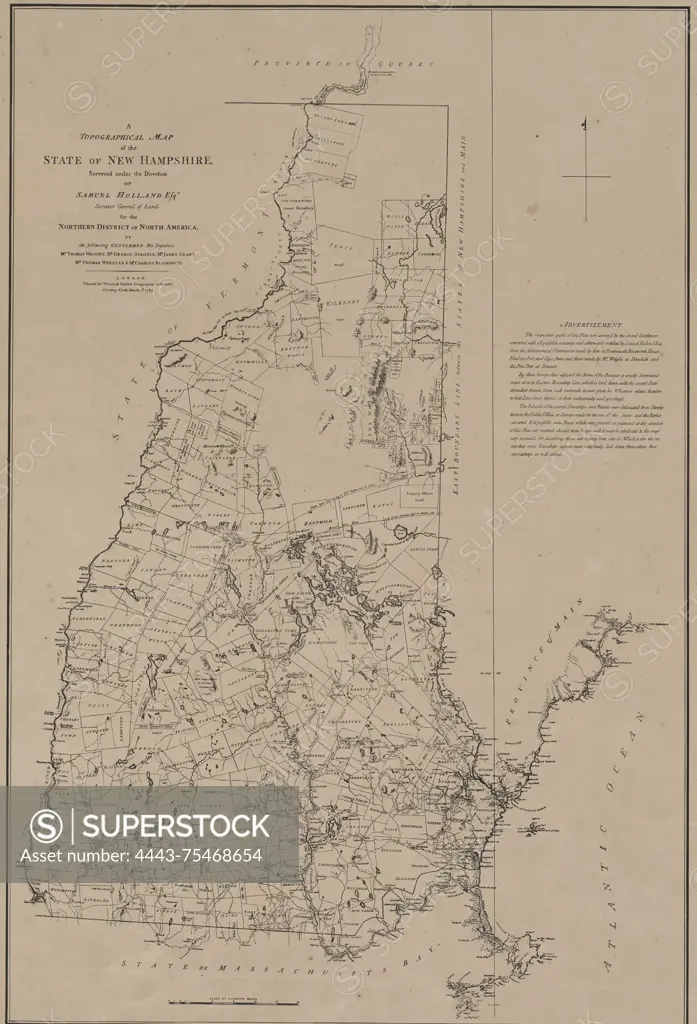
SuperStock offers millions of photos, videos, and stock assets to creatives around the world. This image of A topographical map of the state of New Hampshire from 1878, issued in New York, N.Y. The map includes details related to land grants in New Hampshire. It measures 53 x 36 cm on a sheet that is 61 x 43 cm. The publisher is not identified by Artokoloro is available for licensing today.
Looking for a license?
Click here, and we'll help you find it! Questions? Just ask!
Click here, and we'll help you find it! Questions? Just ask!
DETAILS
Image Number: 4443-75468654Rights ManagedCredit Line:Artokoloro/SuperStockCollection:Artokoloro Model Release:NoProperty Release:NoResolution:3885×5700