A topographical map of Lincoln County, Maine, created by Lee & Marsh in 1857. The map measures 143 x 141 cm and is hand-colored. It is dissected and incomplete, consisting of 2 southeast sheets out of a possible 6, with each sheet measuring 57 x 74 cm or smaller. The map features details on landowners, buildings, and administrative divisions within Lincoln County, Maine. Published in Philadelphia at 17, 19 & 21 Minor St
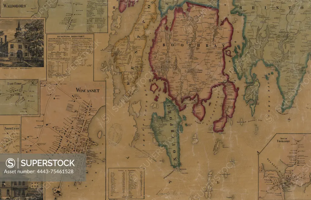
SuperStock offers millions of photos, videos, and stock assets to creatives around the world. This image of A topographical map of Lincoln County, Maine, created by Lee & Marsh in 1857. The map measures 143 x 141 cm and is hand-colored. It is dissected and incomplete, consisting of 2 southeast sheets out of a possible 6, with each sheet measuring 57 x 74 cm or smaller. The map features details on landowners, buildings, and administrative divisions within Lincoln County, Maine. Published in Philadelphia at 17, 19 & 21 Minor St by Artokoloro is available for licensing today.
Looking for a license?
Click here, and we'll help you find it! Questions? Just ask!
Click here, and we'll help you find it! Questions? Just ask!
DETAILS
Image Number: 4443-75461528Rights ManagedCredit Line:Artokoloro/SuperStockCollection:Artokoloro Model Release:NoProperty Release:NoResolution:5700×3670