A topographical map of Lewis County, New York, based on actual surveys from 1857, published by S. & R.S. Taintor Jr. & Co. The image features real property and railroad details of the area. The map measures 137 x 91 cm, with the overall sheet size being 141 x 127 cm
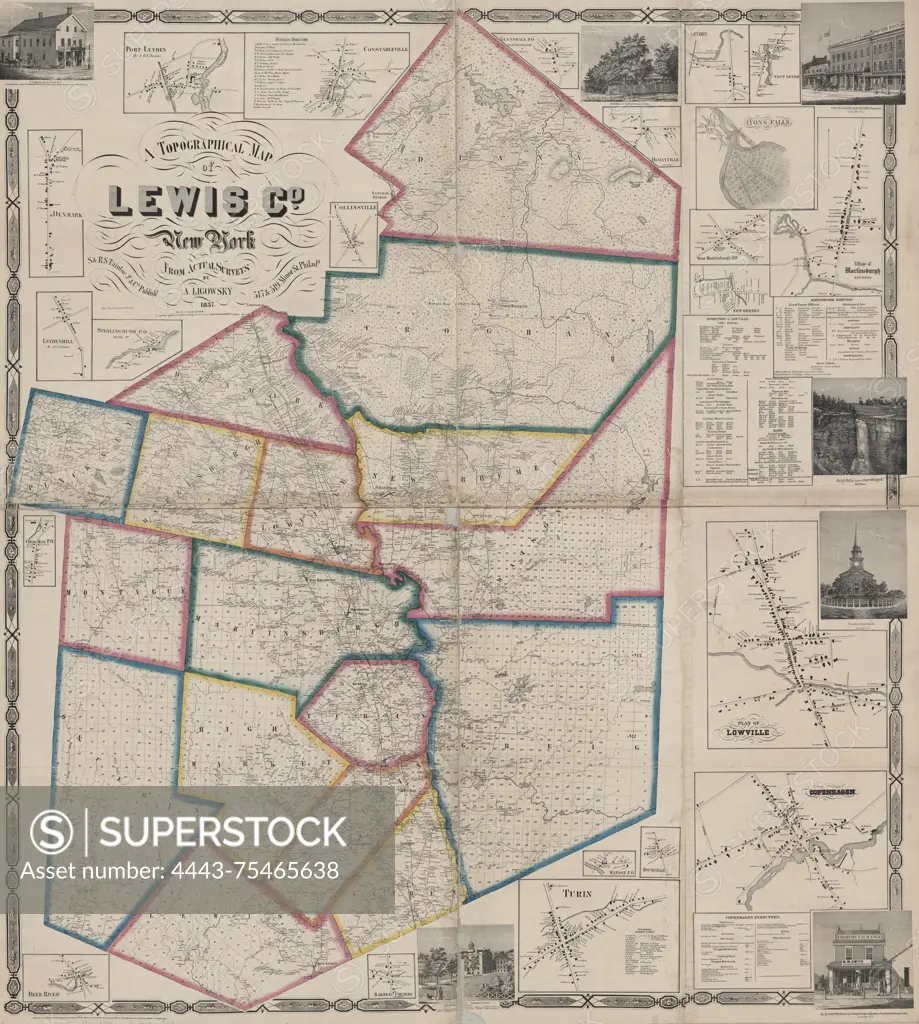
SuperStock offers millions of photos, videos, and stock assets to creatives around the world. This image of A topographical map of Lewis County, New York, based on actual surveys from 1857, published by S. & R.S. Taintor Jr. & Co. The image features real property and railroad details of the area. The map measures 137 x 91 cm, with the overall sheet size being 141 x 127 cm by Artokoloro is available for licensing today.
Looking for a license?
Click here, and we'll help you find it! Questions? Just ask!
Click here, and we'll help you find it! Questions? Just ask!
DETAILS
Image Number: 4443-75465638Rights ManagedCredit Line:Artokoloro/SuperStockCollection:Artokoloro Model Release:NoProperty Release:NoResolution:5118×5700