Topographical map of Hunterdon County, New Jersey, published by Beers, Comstock & Cline in 1872. The map is hand-colored and measures 38 x 57 cm, with the sheet size being 40 x 59 cm. It includes administrative and political divisions of Hunterdon and Somerset counties, featuring locations such as Bloomfield, Lambertville, and Dover. The map was issued in New York, N.Y
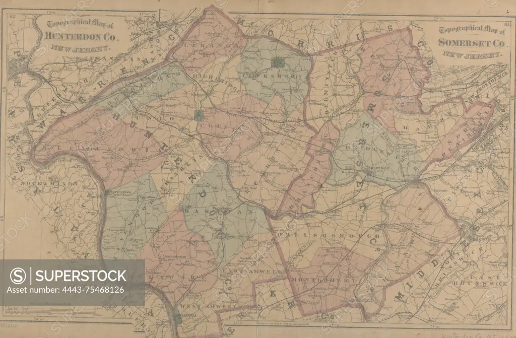
SuperStock offers millions of photos, videos, and stock assets to creatives around the world. This image of Topographical map of Hunterdon County, New Jersey, published by Beers, Comstock & Cline in 1872. The map is hand-colored and measures 38 x 57 cm, with the sheet size being 40 x 59 cm. It includes administrative and political divisions of Hunterdon and Somerset counties, featuring locations such as Bloomfield, Lambertville, and Dover. The map was issued in New York, N.Y by Artokoloro is available for licensing today.
Looking for a license?
Click here, and we'll help you find it! Questions? Just ask!
Click here, and we'll help you find it! Questions? Just ask!
DETAILS
Image Number: 4443-75468126Rights ManagedCredit Line:Artokoloro/SuperStockCollection:Artokoloro Model Release:NoProperty Release:NoResolution:5700×3739