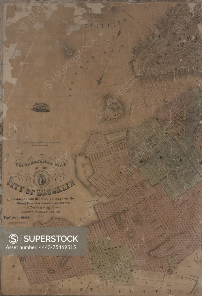
Topographical map of the city of Brooklyn, as reduced from the original maps on file, showing farm lines and modern improvements., 1855., New York. Publisher, M. Dripps, Brooklyn (New York, N.Y.)., 1 map on 2 sheets; dimensions 81 x 112 cm
SuperStock offers millions of photos, videos, and stock assets to creatives around the world. This image of Topographical map of the city of Brooklyn, as reduced from the original maps on file, showing farm lines and modern improvements., 1855., New York. Publisher, M. Dripps, Brooklyn (New York, N.Y.)., 1 map on 2 sheets; dimensions 81 x 112 cm by Artokoloro is available for licensing today.
Looking for a license?
Click here, and we'll help you find it! Questions? Just ask!
Click here, and we'll help you find it! Questions? Just ask!
DETAILS
Image Number: 4443-75469515Rights ManagedCredit Line:Artokoloro/SuperStockCollection:Artokoloro Model Release:NoProperty Release:NoResolution:3898×5700