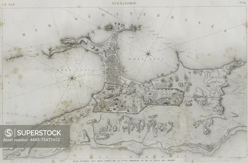
A topographic map titled 'Plan général des deux ports, de la ville moderne, et de la ville des arabes,' depicting the city of Alexandria and its ports. Issued in Paris by Impr. impériale in 1817, the map measures 70 x 94 cm and covers the region of Alexandria, Egypt. The date range of the map is 1809 - 1828
SuperStock offers millions of photos, videos, and stock assets to creatives around the world. This image of A topographic map titled 'Plan général des deux ports, de la ville moderne, et de la ville des arabes,' depicting the city of Alexandria and its ports. Issued in Paris by Impr. impériale in 1817, the map measures 70 x 94 cm and covers the region of Alexandria, Egypt. The date range of the map is 1809 - 1828 by Artokoloro is available for licensing today.
Looking for a license?
Click here, and we'll help you find it! Questions? Just ask!
Click here, and we'll help you find it! Questions? Just ask!
DETAILS
Image Number: 4443-75477452Rights ManagedCredit Line:Artokoloro/SuperStockCollection:Artokoloro Model Release:NoProperty Release:NoResolution:5837×3839