A topographic map titled 'Environs de Soueys Suez,' detailing the plan and leveling of the sources known as the Springs of Moses, along with a view of the springs and their surroundings. The map was issued between 1809 and 1828 and published in Paris by Impr. impériale. Its dimensions are 70 x 50 cm, and it focuses on the region of Egypt
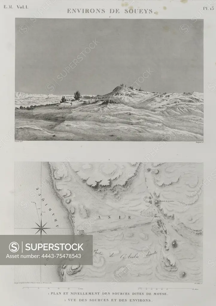
SuperStock offers millions of photos, videos, and stock assets to creatives around the world. This image of A topographic map titled 'Environs de Soueys Suez,' detailing the plan and leveling of the sources known as the Springs of Moses, along with a view of the springs and their surroundings. The map was issued between 1809 and 1828 and published in Paris by Impr. impériale. Its dimensions are 70 x 50 cm, and it focuses on the region of Egypt by Artokoloro is available for licensing today.
Looking for a license?
Click here, and we'll help you find it! Questions? Just ask!
Click here, and we'll help you find it! Questions? Just ask!
DETAILS
Image Number: 4443-75478543Rights ManagedCredit Line:Artokoloro/SuperStockCollection:Artokoloro Model Release:NoProperty Release:NoResolution:3600×5099