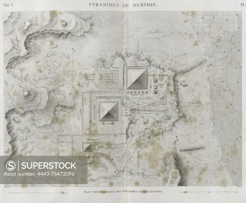
Topographic map of the Pyramids of Memphis and surrounding areas, published between 1809 and 1828 in Paris by Impr. impériale. The map measures 70 x 94 cm and depicts the Pyramids of Giza, situated in the extinct city of Memphis, Egypt
SuperStock offers millions of photos, videos, and stock assets to creatives around the world. This image of Topographic map of the Pyramids of Memphis and surrounding areas, published between 1809 and 1828 in Paris by Impr. impériale. The map measures 70 x 94 cm and depicts the Pyramids of Giza, situated in the extinct city of Memphis, Egypt by Artokoloro is available for licensing today.
Looking for a license?
Click here, and we'll help you find it! Questions? Just ask!
Click here, and we'll help you find it! Questions? Just ask!
DETAILS
Image Number: 4443-75472096Rights ManagedCredit Line:Artokoloro/SuperStockCollection:Artokoloro Model Release:NoProperty Release:NoResolution:3987×3298